


The Albion Road is the A193, connecting the A19 (and the Tyne Tunnel) with Tynemouth - heavily used by fast traffic.

|
|
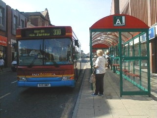
Looking up Bedford Street from the lower end (corner of Saville Street), showing stops for bus routes 301, 310, 317, 325, 442, 810, 812. Anyone alighting here has to walk up the incline if they want to access shops and services further up towards Albion Road. |
| Bedford Street is now one-way, allowing vehicles to pass parked buses. |
|
|
|
In the past there were bus stops in West Wellington Street, off Bedford Street further up the incline. These were removed because of congestion caused by buses stopping in the narrow road. Note, however, the open space behind the McDonalds, which is often used by buses to park during periods between timetabled services. |
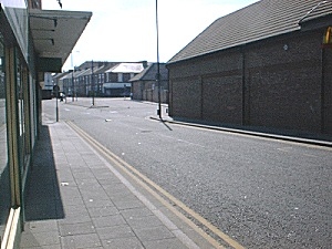
| A view from higher up Bedford Street looking downhill. |
|
|
|
Another view looking up Bedford Street. The length from Saville Street at the bottom to Albion Road at the top is about 400 metres - perhaps not far for a fit person, but with the incline this poses difficulty for anyone with limited mobility. |
| Nelson Health Centre, located at corner of West Percy Street and Cecil Street. Various doctors' practices and medical centres are located at the top end of the town centre. |
|
| Priory Medical Centre is on Albion Road, corner of Sydney Street
|
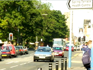
Across the road is Spring Terrace where there is another health centre, as indicated by the street sign
|
|
|
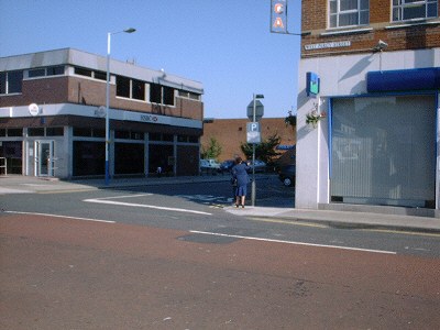
There are some bus services which travel along Albion Road. Surprisingly, however, the nearest bus stops to these three medical centres for buses travelling in the Tynemouth direction (eastward) are a fair distance away. In the picture shown, the bus stop is just beyond the traffic lights. The previous bus stop is a similar distance back from the point at which the picture was taken.
The Albion Road is the A193, connecting the A19 (and the Tyne Tunnel) with Tynemouth - heavily used by fast traffic. |
| A number of high street banks are located on West Percy Street. Government plans to changes the mode of distribution of state retirement pension and other social security benefits, ie to non-cash payment, will make the location of banks critical to those receiving them. The three banks shown (HSBC, Lloyds-TSB, and Barclays) are not close to any bus service. |
|
|
|
The central library - an essential service. But don't expect to find the bus service you need nearby. Northumberland Square is no longer a square, since the library was built on the street forming the bottom part of the Square. In the past, bus stops were located around the Square; some buses do stop, but most buses now go past the Square. |