
Source: "with Fur Traders in Colorado, 1839-40, The Journal of E. Williard Smith,"with an introduction and notes by LeRoy R. Hafen. Colorado Magazine, Vol.XXVII, No.3 (July, 1950).
"This romantic region gives rise to several large tributaries both of the Platte and Arkansas, and furnishes the main branches of the Kansas. Its geological classifications consist of sandstone, limestone, granite, and cretaceous rock. Large quantities of silex are also found together with many interesting specimens of petrifaction that principally consist of pine wood; these, in many cases, exhibit the tree in its perfect shape,with all the grains and pores that marked the growth.
"A ride of three hours took us past the heads of Bijou [West Kiowa] and Kuyawa [Kiowa], whose clear and swift current, confined to narrow beds, here presented a striking contrast to those remarked at their confluence with the Platte.
"Continuing on a few miles we reached Black Squirrel Creek, an affluent of the Arkansas ....”
Source: Rocky Mountain Life, by Rufus B. Sage. (Lincoln: Univ, of Nebraska Press, 1982).
“July 10. - Snow fell heavily on the mountains during the night, and Pike's peak this morning is luminous and grand, covered from the summit, as low down as we can see, with glittering white. Leaving the encampment at 6 o'clock, we continued our easterly course over a rolling country ....”
Source:
Marcy had spent narly a month waiting along the upper Fountain for reinforcements to help guard the train against an expected Mormon attack. On 28 April 1858 word had arrived from Colonel Loring that the reinforcements were marching up the Cherokee Trail, and that the supply train should prepare to join them.
The next morning Captain Marcy headed his supply train east across the hills to intersect the Cherokee Trail above Jimmy Camp. On reaching the rolling prairie, he could see Colonel Loring’s troops about ten miles ahead. Expecting that the troops would encamp on Black Squirrl Creek at the edge the pinery, the supply train pushed on through the mud and buffalo grass, reaching the creek about 1 P.M. Colonel Loring had not waited there, but had followed thez trail some seven miles north, and gone into czmp along West Kiowa Creek near a hill known as Point of Rocks.
Captain Marcy decided to put off linking up with Loring’s troops until morning, and instad pasture his large herds on the fresh grass along Black Squirrel Creek. A work detail was ordered to build a 250-foot circle of brush to hold the animals for the night. (This brush corral was located just east of present Meridian Road, at the edge the trees. In later years it became a prominent landmark along the Cherokee Trail. Even as late as the 1870’s it was still being used by area ranchers as a place to corral their stock.
“This pleasant state of things lasted until near sunset, when the wind suddenly changed into the north: it turned cold, and soon commenced snowing violently, and continued to increase until it became a frightful winter tempest, filling the atmosphere with a dense cloud of driving snow, against which it was utterly impossible to ride or walk.
“Soon after the storm set in one of our herds of three hundred horses and mules broke furiously away from the herdsmen who were guarding them, and, in spite of their utmost efforts, ran at full speed, directly with the wind, for forty miles before they stopped. Three of the herdsmen followed them as far as they were able, but soon became exhausted, bewuildered, and lost on the prairie.
“One of them succeeded in finding his way back to camp in a state of great prostration and suffering. One of the others was found frozen to death in the snow, and the third was discovered
crawling about upon his hands and knees, in a state of temporary delirium, after the tempest subsided.
“This terrific storm exceeded in violence and duration anything of the kind our eldest mountaineers had ever beheld. It continued with uninterrupted fury for sixty consecutive hours, and during this time it was impossible to move for any distance facing the wind and snow ....
“The instincts of all our animals, excepting the herds alluded to, led them to seek shelter in a grove of timber near camp, where they were somewhat protected from the fury of the gale. But several antelopes were found frozen upon the prairie after the storm.
“We had with us a flock of sheep, which scattered throughout the timber in every direction during the storm, and afterward were nearly as wild as deer; they, like the insane herdsman, seemed to have lost their senses ....”
Source: Thirty Years of Army Life on the Border, by Randolph B. Marcy. (New York: Harper & Brothers, 1866).
Source: "The Cherokee Expedition of 1858," by Philander Simmons. Pike's Peak Gold Rush Guidebooks of 1859, ed. by LeRoy H. Hafen. (Glendale, Calif.: The Arthur H. Clark Co., 1941).
This whiskey would be found four years later by a Colorado City resident named John Bott. Bott and several companions were hauling a wagonload of goods up the Cherokee Trail when they chanced upon eight barrels of fine Kentucky bourbon hidden in a clump of bushes near Point of Rocks. They loaded the whiskey barrels into their wagon, took some to Russellville, some to Auraria, and retailed all at twenty-five cents a drink. From the sale of what was once government-issue whiskey, the men were able to realize nearly $4,000 in profit.
Source: "Across the Plains in 1858,' by David Kellogg. The Trail. Vol.7, No.8 (January, 1913).
Source: Two Diaries. (Denver: Denver Public Library, 1962).
Source: "Diary of a Journey to the Pike's Peak Gold Mines in 1859," by Dr. George M. Willing. Edited by Ralph P. Bieber, The Mississippi Valley Historical Review, Vol.XIV (June 1927-March 1928).
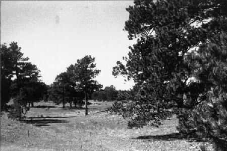
“June 12th. Today we are traveling through an extensive Pinery, twelve miles across. Five miles from the edge of the pine, there is a brancJi of clear, cold running water. On this creek are three graves, two of them made this spring; the other in '58...the land passed over today is very indifferent; fit only to grow pine and strawberries. There is an abundance of the vines, which are just in bloom; berries, not formed.”
Source: "Diary of A.M. Gass," Overland Routes to the Gold Fields, 1859, ed. by LeRoy H. Hafen. (Glendale, Calif.: The Arthur H. Clark Co., 1942).
Source: "Diary of Mrs. A.C. Hunt, 1859," ed. by LeRoy R. Hafen. Colorado Magazine, Vol.XXI, (September, 1944).
Randolph B. Marcy, 29 April – 2 May 1858.
Captain Marcy was traveling the Cherokee Trail north; under his command was a provision train of seventeen wagonloads of corn and 1,500 animals (horses, mules, oxen and sheep), all purchased as supplies for Colonel Johnston’s army then marching on Salt Lake City.
“On the 30th [29th] day of April, our re-enforcements having joined us, we gladly resumed our march for Utah, and at about one o'clock encamped upon the ridge that divides the Arkansas from the Platte River. The day was bright, cheerful, and pleasant, the atmosphere soft, balmy, and delightful, the fresh grass was about six inches high, the trees had put forth their new leaves, and all nature conspired in giving evidence that the sombre garb of winter had been cast aside for the more verdant and smiling attire of spring. Our large herds of animals were turned out to graze upon the tender and nutritious grass that everywhere abounded. Our men were enjoying their social jokes and pastimes after the fatigues of the days' march, and every thing indicated contentment and happiness.
Philander Simmons, 20 June 1858.
Simmons was a gold seeker of 1858. He was not totally unfamiliar with the pinery on the Platte-Arkansas divide. He had visitd the old Pueblo as early as 1842, then traveled the old trail north to Fort Laramie. In 1858 he returned west with the Cherokees of the Russell Party. He would later write that his Indian companions had an ulterior motive in joining the goldseeking expedition, namely to find an alternative location for the Cherokee Nation in the event they decided to sell their land holding in present-day Oklahoma.
“...reached the Squirrel creek pineries. There we found the remains of Captain Marcy's camp, who, in the month of May, had been caught in a severe snow-storm while on his way to Utah to join General Johnson in the Mormon war, during which several of his men were frozen and several hundred head of horses and mules were lost, until found and returned by young Autoba [Autobees]. A large number of dead sheep were lying in piles around the camp. In looking at the pinery, the Indians remarked what a pity it was that such a forest of pines should be so far away from any settlement, where they might be of some use, instead of furnishing shelter for Indians and wild beasts.”
David Kellogg, 29 October 1858.
The Kellogg Party of gold seekers had heard the story of the Marcy-Loring Expedition when they reached the old Puelbo on the Arkansas River. Living near the adobe ruins had been one George McDougal, his Mexican woman and several of her countrymen. McDougal himself had returned west in the spring of 1858 with the Cherokees of the Russell Party. Remembering the scenes of disaster on the divide, he had advised the gold seekers to hurry across so as to avoid encountering another killer snowstorm. He had also repeated a rumor involving a stash of whisked said to have been hidden somwhere in the forest by members of the Marcy-Loring Expedition.
“Nooned at Black Squirrel Creek. Near our camp are the graves of two men who perished here last May, soldiers of Gen. Marcy's command on their way to fight the Mormons at Salt Lake. Severe storms often visited this region and McDougal advised us to hurry across. Our thirsty boys have been searching for a cache of liquor said to have been left by Johnson's command.”
Calvin Perry Clark, 1 June 1859.
Clark was the first of the Fifty-Niner diarists to make mention of the gold sekers who froze to death in the pinery. Clark himself was a young man of twenty-three. He was enroute to the gold diggings with his father and several friends and relatives. While the older men goaded the oxen up the Cherokee Trail to the pinery, Calvin and a friend had made a short side trip to Pikes Peak. On their return the duo had been forced to spend the night huddled together over a small fire; “verry cold,’ Clark remembered it. The next morning they overtook their fellow Illini in the forest, where Clark once again found time to make an entry in his diary.
“...overtook the teams today in the Pinery at 1 O'clock P.m. cold wind but not uncomfortable with an over coat on...this region is called the Mountain Devide, between Cherry Creek and Pike's Peak. One man was frozen to deth here last Thursday May 25th 1859 in a snow storm 1/4 mile behind his teem. at this time thare was several men lost that has never been herd from since, supposed to be frozen to deth.”
George M. Willing, 10 June 1859.
Gold seeker from St. Louis.
“Heavy clouds about the mountains all day, but no rain in the valley, which is very parched. Camped at 6 P.M. on Squirrel Creek, 13 miles from Jim's Spring. Raining very hard. Here is an extensive forest of noble pine trees, that abounds with deer. The people of Auraria which is forty miles distant drew their supply of venison from this neighborhood last winter.”
A.M. Gass, 11-12 June 1859.
Gass had traveled all the way from Texas to join the Pikes Peak Gold Rush. The trip had been eventful, but without serious accident. On reaching Kiowa Creek – midway through the Pinery – Gass noticed three graves. Two were freshly dug, probably containing the bodies of frozen Fifty-Niners. The third was from 1858, and undoubtedly contained the charred remains of an unknown retainer traveling in the wake of the Marcy-Loring Expedition. A merchant train had discovered the body in early May of 1858. Loquacious bullwhackers had surmised that the man had built himself a large fire of logs during the great blizzard and, falling asleep, had burned to death.
“June 11th...Tonight, we are camped by a beautiful spring, beside a pinery, pine timber is the only kind in sight. It is from one to two and a half feet in diameter, twenty to forty feet without limbs. The grass here is good. This region, I think, is well adapted to the growth of corn.
Ellen Hunt, 25 June 1859.
Mrs Hunt was traveling to the gold diggings in company with her two small children and her husband, Alexander Cameron (later territorial governor). Her recent bout with an infectious disease known as erysipelas probably only enhanced the accuracy of the grave count she provided in her diary.
“Started at moon rise and traveled 15 miles before breakfast
to a pine forest - very beautiful but sad from the number of graves here - 8 are in view of persons who have frozen to death, one as late as June third, '59. The changes are so sudden even in the summer that from being very warm it will be so cold as to benumb the body before fire can be made to warm it. These changes generally occur after a rain, or storm of some kind. When the cattle were driven up to start again they were nearly frantic with the stings of a large horse fly, patches as large as both my hands were black with them and blood streamed from the biten part for an hour while passing through the pines. They almost ran and seemed wild with pain. We camped in a beautifully undulating valley. The mountains to the left and lofty pine-clad hllls on every side. A beautiful clear spring and abundance of grass for our accomodation.”
©2000 Richard Gehling
E-mail me.