The Cruise To Babelthaup
We left the Mekong River at the end of August 1969, had some liberty in Subic and Taiwan and were headed home. In the middle of the night a radio message was received which said "Divert from previous directed schedule and proceed to Guam where you will receive specific directions for mission to Babelthaup". My immediate reaction at 2AM was, never heard of the place, get a retransmission, the destination must be wrong. It came back the same way so we broke out a chart and sailing directions. Discovered that there really was a place named Babelthaup and was an island north of Koror in the Palau island chain.
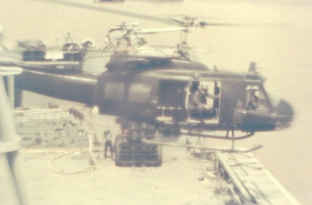
We arrived in Guam and met with the COMNAVMARIANAS staff who stated that there was a group of "electronic surveillance people on top of a mountain" on the island of Babelthaup and we were to embark a helo and evacuate them. A "by the way" was that there were some "supplies" that needed to be transported to the port of Koror and we could just stop in the port and drop them off.
The cargo started to arrive. A bunch of old explosives, an old 40 foot utility boat that I would not have used to go fishing in, and other "people to people" stuff not destined to make friends. My immediate reaction was this looked like a lot of "good old boy, favor" stuff and I asked the staff for a directive for a port visit and authorization for port services expenses. Reply was "don"t make a big thing over this. Just stop in, unload. LSTs go in there all the time(did not say they were WW2 sized LSTs)". I replied that we were not a pickup truck and would sail when the directive arived. This resulted in a 24 hour standoff. The crew wondered why we did not get underway. Finally the directive arrived and we departed Guam with an old CH34 helo and crew embarked.
When we got near Koror it became apparent that the "1934" chart had not been updated. We could not find the mouth of the channel so we launced the helo which found the channel and marked it with a smoke flare.
We started in and discovered nothing was accurate. Not the chart, not the sailing directions, not the harbor. Part way up the channel the First Lt called the bridge from the forecastle and said we were too long to negotiate the next curve in the channel. We worked out an agreement that the bow had prioity for damage since the prospect of screw damage 500 miles from the nearest tug was not acceptable. Some how we negotiated that sharp bend in the river and arrived in the harbor and instead of a 30 foot depth everywhere, there were coral heads showing. We arrived at the pier and no one would take our lines so we put a boat in the water with our line handlers and got moored.

The Tom Green World Series of Micronesia 1969
THERE WAS NOT A LOT TO DO ON THE SUNNY ISLE OF PALAU. We asked if there was a place where we could play baseball and have a beer party and were informed that the Seabees had built a ball field after WW2 that was perfect for us. You can see from the picture that the grass may not have been cut since 1946.
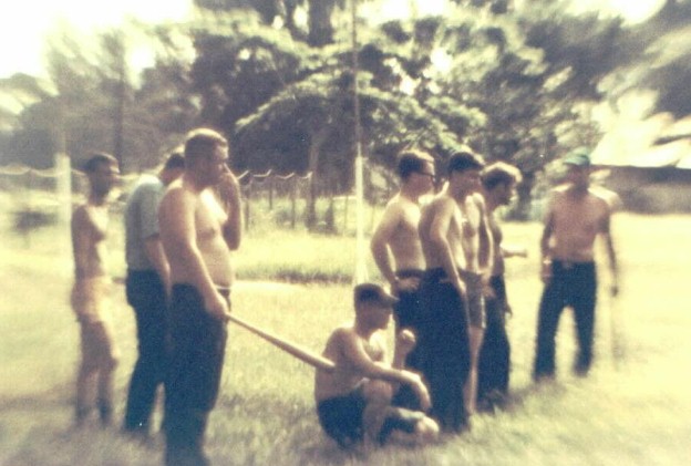
We held the game and drank a lot of beer. The ball game was somewhat different since the grass was 2 to 3 feet high. Many of the school children showed up to watch the game and probably think that looking for the ball in the tall grass was part of the game plan.
Our contribution to the natives was to show a movie, using the side of the ship as a screen, and the whole town showed up to watch. We sailed the next day and while within range of the island of YAP, launched the helo with 6 crew members per cycle so they could say they had seen that island. Somewhat later I wondered what we would have done if the helo had had a mechanical problem while on the ground on an island we were not authorized to visit.
This is the end of this little piece of Tom Green History. Click the back button to return to the main cruise.