As the wind died down below hurricane force, we walked up to see how far the storm surge had come in. It was really remarkable... Kevin's mom, who had lived in the area for 50 years, had never seen the water come up as far as it did. When we spoke with others later, the consensus was that Isabel caused the worst storm surge since a hurricane back in 1933. Kevin also estimated that the winds were sustained at 90 mph, with gusts over 100 mph. This seemed reasonable to me, especially since we were near the ocean (and thus there was less friction to slow down the wind).
The water started receding pretty quickly, causing Jeff and I to think we'd be able to leave for Havelock in a couple of hours. Kevin broke the bad news that it would likely take a couple of low tides (i.e., after 2 a.m.) to get all of the water off of US-70. There also would be a lot of junk (sea drift, wood, propane tanks, boats, etc.) on the road that would require the state plows to clear off. When I suggested that they'd probably be out pretty quickly, Kevin replied "Aww, buddy, buddy, buddy... you gotta realize, you're in 1970 out here. We've still got the Klan, and there's folks who aren't too happy about what black people do." Yikes!
Their biases aside, people were incredibly nice to us out-of-towners. Kevin and family made some "vegetable soup" for us -- I have that in quotes because there were big chunks of beef in it.
 |
Water beginning to recede as the tide falls away and the winds start to ease. We still had sustained tropical storm force winds at this point, but that was nothing compared to the eyewall. Kevin is coming down the street to offer us some "vegetable" soup and check out how his truck held up in the eyewall. |
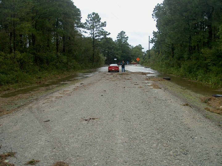 |
Jeff standing beside the car. We moved up to that point as the water receded, but couldn't go any further because there was still a good amount of water between us and Kevin's house (by the corner of East St. and US-70). |
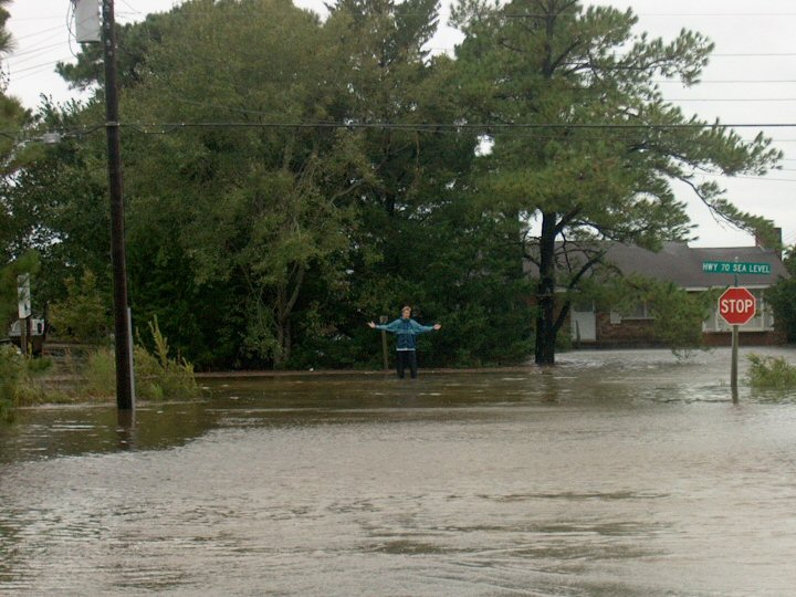 |
Me standing in the middle of what used to be Route 70 but what became part of the ocean. It's only knee deep at this point because the tide has been going out for two hours. |
 |
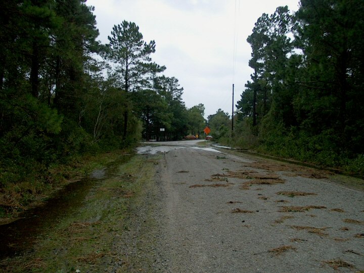
Looking out into what should have been asphalt and grass, but instead was oceanfront property. Most people prefer that their oceanfront property not be IN the ocean, however. |
 |
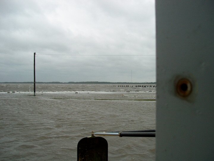
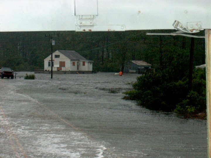
A picture from the point on East Street where the water reached its highest point at around 1:30, and then started receding. By now I was able to move my car up to near Kevin's house. US-70 is past my car and the red pickup.... that gives you an idea of how far the water came up. My guess is about a third of a mile inland. |
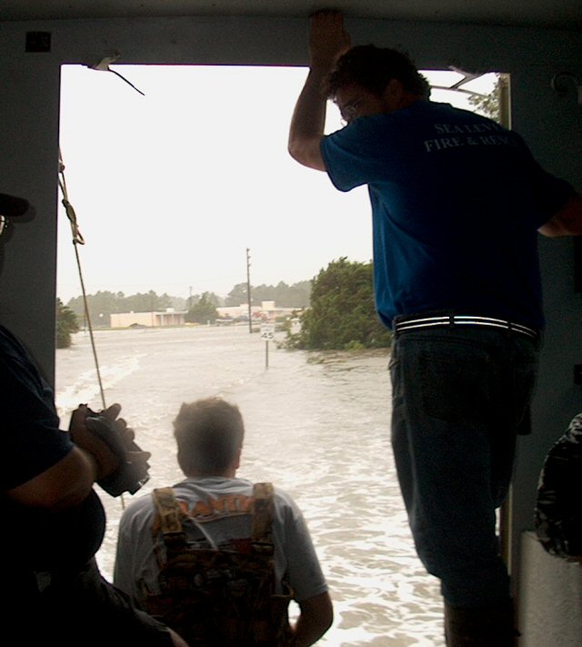
Around 4;30, a big army truck
came plowing through the water on Route 70 and offered us a ride to
spend the night at the shelter in Atlantic. I still wasn't
convinced that we couldn't make it out after the first low tide, but
even then I would've been driving at night with lots of stuff on the
road. It's more likely that we would have had to sleep in the
car,
which wasn't an appealing option. So we piled into the truck and
headed back toward Atlantic.
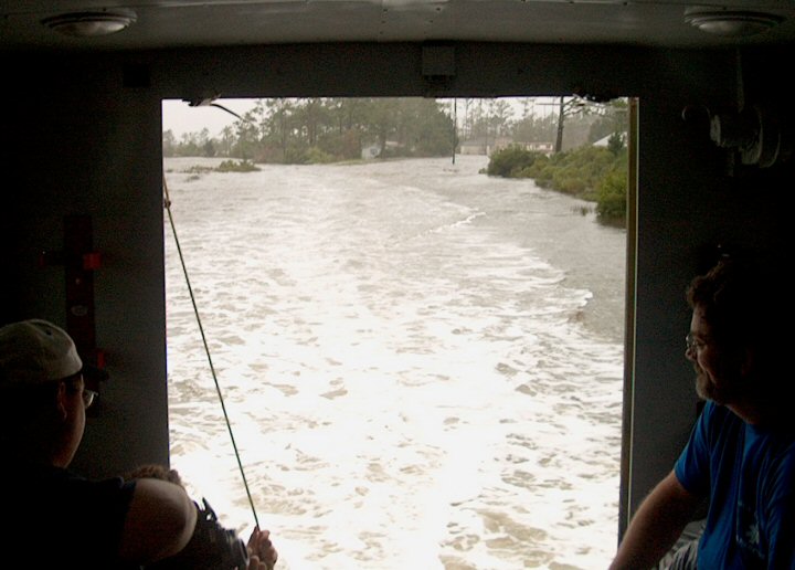
Saw some incredible sights along the way -- the firehouse waist deep in water, waves rolling gently across the highway, and too so many houses that, even midway between tides, were partly underwater. The volunteers on the truck seemed to know everyone in the area, and took inventory to make sure everyone was accounted for as we rode along.
Saw some incredible sights along the way -- the firehouse waist deep in water, waves rolling gently across the highway, and too so many houses that, even midway between tides, were partly underwater. The volunteers on the truck seemed to know everyone in the area, and took inventory to make sure everyone was accounted for as we rode along.
 |
Photo through the screen window of the army truck. Waves are crashing over the rocks near where we had been parked originally. The line heading out into the water is what is left of the long dock I took a picture of before the tide rolled in. As you can see, the gazebo didn't survive. |
 |
The Sea Level Inn, about the only thing in Sea Level that stayed relatively dry. In fact, the firehouse moved their ambulance and other vehicles over there when the station got flooded. In the middle of the photo, next to the telephone pole, is the top of the gazebo that was once on a pier 100 yards out into the bay. |
 |
Clearer picture of the bay that claimed much of Sea Level as new real estate, at least for the day. To the left of the telephone pole is where I was parked earlier. There is a small strip of grass showing near the water-covered road. |
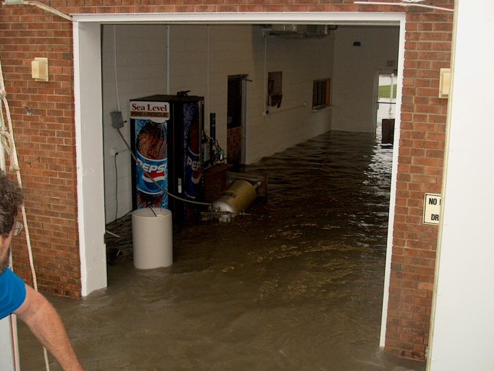 |
One of the volunteers looks at the waist-deep water that invaded the firehouse. I don't know what that metal thing is, but it was just floating around. A lot of linens, food, and a couple of small electronic items were put up high and kept safe in the office on the left. |
 |
This is where the car once sat... just in front of that lone white post in the bottom of the picture. Most of the fence was wiped out; the part that remained was mangled pretty badly. |
 |
The fire chief (middle) and other volunteers look on as we go truckin' on down US-70. The Sea Level Inn is in the background. I don't think anybody was able to go the speed limit this afternoon... |
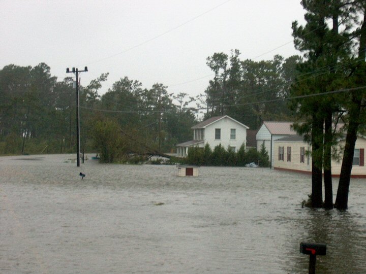 |
A tree felled by the strong winds, and more homes underwater. One mailbox barely sticks above the water. The tree is blown down toward the southwest, meaning that it fell before the eye reached land. |
 |
These trees also fell before the eye made landfall. I'm sure the saturated soil (or the ocean if you prefer) didn't help matters. |
 |
More waves lapping over the highway. |
 |
Somebody, I'm not sure who, got out and was checking on their house. You can see him out there in the orange jacket, trudging through the waist deep water. He actually was on the side of the road AWAY from the bay side. Here the road was more raised, so you actually could see the yellow and white lines. |
 |
Unfortunately the camera flash against the window blinded this picture. There are two buildings here... both part of a small clam hatchery. The one in the middle is just very beat up; the one on the right completely collapsed. |
