![]()
QUEENSLAND |
|
74 Kallista
Rd |
email qldbwc@yahoo.com |
![]()
|
|
|
|
|
Best Of All to Kennedy Lookout
17 May 2008
A couple of years ago I tried this walk but a very large starting number meant that we made very slow progress. We eventually aborted the walk and exited via a ridge about 1.5 kilometres short of Kennedy Lookout. A couple of other times I did not get the numbers to do the walk, but this time everything went to plan.
After driving up to Springbrook and parking at the Best of All Lookout car park, we ducked around the back of the repeater station fence into the rainforest. We quickly picked up the pink tags to follow in and out of gullies down the ridge to the top of the falls on the cliffs above Numinbah Gap.
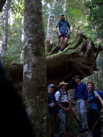
This is a very picturesque area with some very large trees a few of which have been snapped off at the base and blown over in some relatively recent storms.
From here we started the contour around to Kennedy Lookout, at first following the pink tags to where they continued down the cliff break to the bottom of the previously mentioned falls. As we were contouring at a lower level than my previous attempt, we managed to avoid a lot of the wait-a-while that was encountered before.
Morning tea break was taken at the first substantial creek crossing and from there we continued around to a prominent knoll which is near the “big rock” feature that is marked on my 1960’s army map of the area.
From here we travelled on a compass bearing, dropping a little altitude to the top of another waterfall and some good views over the Numinbah valley.
Staying close to the top the escarpment and following more pink tags we crossed a couple more creeks and arrived at Kennedy Lookout for a welcome lunch break. This lookout is a hundred metres or so north of where the rough track comes up through a cliff break from Natural Arch.
After lunch we followed an old snig track from just above the lookout to a road that runs between a couple of houses before leading back to the main road which we followed back to the car park. 20 years ago this snig track ended at a house and plant nursery but this no longer exists and the track that National Parks marked to avoid this no longer seems to be in use.
As we were walking back to the car the weather, which had been fine all day, started to deteriorate and there was thick fog by the time we reached the cars. We drove down for refreshments at a cafe on the Numinbah Gap road and could look back to see a storm building where we had just been walking. Luckily we had a fairly early finish.
Thanks to the small group of walkers who made the day a success. David Kenrick
Notify any errors to qldbwc@yahoo.com