Rail Attractions North of Toronto

Rail Attractions North of Toronto Canada
CN
York Subdivision
This line was
built between 1959 and 1965 to connect the new MacMillan Yard with
existing lines running east of Toronto. The York Subdivision is a
busy line, especially west of Doncaster, where traffic for western
Canada mixes with Toronto-Montreal tonnage.
|
CN YORK
SUBDIVISION |
|
0.0 |
Pickering Jct |
|
1.4 |
Liverpool |
|
5.0 |
Beare East |
|
6.5 |
Beare |
|
12.2 |
McCowans |
|
14.0 |
Hagerman |
|
18.4 |
Doncaster |
|
23.6 |
Snider |
|
25.0 |
MacMillan Yard |
The
York Subdivision
connects with the CN Newmarket Subdivision at Snider, with the CN
Bala Subdivision at Doncaster, and with the CN Uxbridge Subdivision
at Hagerman. There are diamonds with connecting wye tracks at each of
these locations.
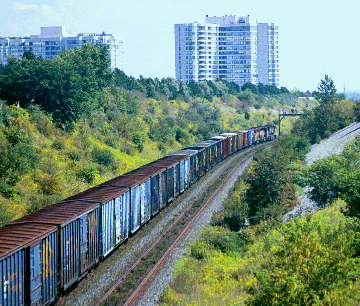
Like the Halton
Sub, this line was built in wide-open countryside with wide
rights-of-way. The line is now surrounded by urban terrain, with
generally impenetrable fencing. There are a number of cuts and open
areas which make for good photographs. The line runs just north of
Steeles Ave to Yonge Street, then slips northeast to parallel John
Street (Bayview to Woodbine), Esna Park Road/Alden Road (Woodbine to
Warden) and 14th Avenue (Warden to Markham Road)
DONCASTER -
From Bathurst Street east to Yonge, the line runs in a deep cut.
There are good overhead bridges at Hilda Avenue (runs north off
Steeles) and Yonge Street. There is a steep grade climbing to the
west at this point. The eastward approach signals visible from Hilda
Ave are notable because they have lighted arrows that show the
routing at Doncaster.
Number 451
eastbound at Hilda Street 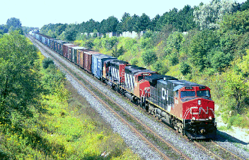
 Looking
downhill (east) to Yonge Street
Looking
downhill (east) to Yonge Street
East of Yonge
the line climbs to run on an embankment.The junction at Doncaster is
best accessed off John Street, west from Bayview Ave. There are
connecting tracks on three sides of the diamond: west to south
(freights to/from downtown Toronto), west to north (transcontinental
freights to/from the Bala Subdivision, and the westbound Canadian),
and south to east (transcontinental traffic to/from Montreal,
bypassing MacMillan Yard). John Street has a new overpass over the
Bala Sub north of the junction,
there are wide
shoulders and it gives a good view for southbounds from the north
side. Unfortunately, the junction is otherwise not easy to access.
Another option is to try the school property on the northeast
quadrants, or the parks on the two south quadrants.
East from
Doncaster, the line can be accessed from behind various industries.
The main north-south roads cross on overpasses. There are views of
the line from the parallel Highway 407 toll highway.
HAGERMAN
- One level crossing remains on 14th Ave. This area is under
development and the right of way is disappearing behind new
industrial properties.
McCOWANS
- The York Subdivision crosses the CP Havelock Subdivision north of
Steeles Avenue at the 9th Line. There is a nice trestle just west of
the ninth line.
BEARE -
The York Subdivision crosses over the CP Belleville Sub at Beare.
This spot is at the upper end of Meadowvale Road, northeast of the
Metro Toronto Zoo. Take Meadowvale north to its end at Plug Hat Road,
then go east on Plug Hat Road, then go south on Beare Road to the CP
tracks. There is room to park on the side of the road. The bridge is
a short walk from the road. This area is not patrolled frequently,
but stay back from the tracks in any event.
CN
Uxbridge Subdivision - North of Hagerman
|
CN UXBRIDGE
SUBDIVISION |
|
33.6 |
Uxbridge(Out of Service) |
|
40.6 |
Stouffville |
|
46.9 |
Markham |
|
50.7 |
Unionville |
|
51.1 |
Hagerman |
Once a through
line to Lindsay and Bancroft, the Uxbridge Sub now ends officially in
Stouffville. Track remains in place to Uxbridge; the
Stouffville-Uxbridge section is now owned by the Province of Ontario
and is leased to the York Durham Historical Railroad, an operating
rail museum.
The Uxbridge
Subdivision begins at Scarborough Junction, where it connects with
the CN's Kingston Subdivision. It crosses the York Subdivision at Hagerman.
The Uxbridge
Sub has GO Trains service at rush hour, Moday to Friday, plus the
occasional industrial switching movement.
CN Uxbridge
Subdivision - South of Hagerman
CN
Bala Subdivision - North of Doncaster
|
CN BALA
SUBDIVISION |
|
21.0 |
Richmond Hill |
|
18.3 |
Langstaff |
|
16.1 |
Doncaster |
The
Bala Subdivision starts at Cherry Street just east of Union Station,
winds its way northwards up the Don Valley, and reaches the York Sub
at Doncaster. It continues northwards, passing east of Lake Simcoe,
and then northwest from Washago to Capreol.
The Bala Sub is
CN's main transcontinental route, and carries fairly heavy traffic.
The Bala Sub also carries traffic bound for North Bay. Trains to
eastern Canada now bypass MacMillan Yard, using a new south-to-east
leg of the wye at Doncaster.
Both VIA's
Canadian and ONR's Northlander use the Bala Sub north of
Doncaster.There is weekday rush hour GO service between Union and
Richmond Hill.
CN Bala Subdivision
south of Doncaster
CN
Newmarket Subdivision
The Newmarket
Sub was the first railway line in Toronto; the first train to Aurora
ran on May 16, 1853. The Newmarket Sub eventually ran north through
Washago to North Bay, and then on to Capreol. In 1996 CN abandoned
the Barrie-Washago and North Bay-Capreol sections of the line. This
meant the end of all through service on this route. The
Barrie-Bradford section was also removed from service, but is being
relaid for future GO expansion.
|
CN NEWMARKET
SUBDIVISION |
|
63.0 |
Barrie |
|
62.5 |
Allandale |
|
41.5 |
Bradford |
|
34.2 |
Newmarket |
|
29.9 |
Aurora |
|
22.7 |
King City |
|
18.3 |
Maple |
|
15.5 |
Concord |
|
14.0 |
Snider North |
|
12.9 |
Snider |
The
Newmarket Subdivision begins at Parkdale where it diverges from the
CN Weston Subdivision. It runs straight north and crosses the York
Subdivision at Snider, just east of Toronto Yard.
The Newmarket
Sub still sees GO service on the Toronto-Bradford section of the line.
CN Newmarket
Subdivision south of Snider
CN
MacMillan Yard
MacMillan Yard
is CN's huge hump yard and locomotive maintenance facility for the
Toronto area. Opened in 1965, it was first called Toronto Yard.
Mac Yard is
located north of Highway 7 between Keele and Jane Streets. The
locomotive facility is on the west side of the yard off Jane Street.
Until recently it was a fairly hospitable facility, but this has
changed. It may be wise to stay in your car in the parking lot.
Old Highway 7
crosses over the south end of the yard, with good wide shoulders.
This overpass gives a good view of the yard, but is noisy and not
that pleasant for long periods.
The approach to
"Mac Yard" is a large, open wye south of Highway 7 and
north of Steeles Avenue, featuring over-and-under routes for
incoming/outgoing trains. It can be seen well from the new Highway
407 (but keep your eyes on the road anyways!). For a closer look,
head behind the industrial buildings on Snidercroft Road, which runs
west off Keele Street between Steeles and Old Highway 7. An overpass
on Keele street gives a decent view of the east end of the wye, and a
nice eastward view of the York Sub and the Snider diamond. This
bridge has narrow shoulders....and bounces with the passing traffic,
but it's bearable for short periods.
Many through
trains bypass the yard on a connecting track to the south. Crews
normally change off at Jane Street, just north of Steeles Avenue.
CN
Halton Subdivision - Toronto Yard to Halwest
The Halton
Subdivision is CN's main route from MacMillan Yard west to Sarnia,
Detroit, and Niagara.
|
CN HALTON
SUBDIVISION |
|
0.0 |
Jct with York Sub |
|
0.2 |
Jane Street |
|
4.3 |
Humber |
|
8.8 |
Goreway |
|
8.9/9.5 |
Brampton Intermodal (BIT) |
|
9.7 |
Malport |
|
10.5 |
Torbram |
|
11.1 |
Halwest |
The
section between Toronto Yard and Halwest was built between 1959 and
1965, to connect the new MacMillan Yard with CN's western routes.
From Halwest, it continues west through Halton and Peel Regions to
Silver (Georgetown), then southwest to Burlington. The Halwest-Silver
portion was part of the original Grand Trunk line dating from the
1850's. In CN days it was part of the Brampton Subdivision. The
Silver-Burlington leg was originally part of the Beeton Subdivision,
a secondary line which once ran from Hamilton to Barrie.
The Halton-York
Subdivisions originally provided a freight bypass around the Toronto
area. In recent years urban sprawl has caught up with this
foresighted plan, and now the Halton is surrounded by suburban and
industrial areas. The new Highway 407 recently opened in the same
corridor; the 407 gives a good view of the line around Humber.
This is a very
heavy line which is seldom quiet for long. It handles most of CN's
east-west freight traffic (some Montreal-Oakville-Hamilton trains
bypass Mac Yard via the Oakville Sub). There are GO Trains west of
Halwest on weekdays. There are many wide line allotments, several
high trestles, many embankments and deep cuts. North of the city it
is being surrounded by industrial developments.
JANE STREET
- The Halton Subdivision begins at the Toronto Yard throat, north of
Steeles Avenue between Keele and Jane Streets. The southern leg of
the wye is a used by run-through trains; crews change off at Jane
Street. The line parallels Steeles Avenue from Jane Street west to
Highway 427. Most of this area is a-building with new industrial and
commercial developments; it's possible to park behind some of these
to access the tracks.
Jane-Steeles
to Highway 27-Steeles is one of the few parts of the city where the
author does not recommend lingering after dark, particularly if you
are alone.
HUMBER
- Good photo points can be found in the Islington-Martin Grove Road
area, with good sweeping curve shots. A telephoto lens is helpful.
The Halton Sub crosses the CP Mactier Sub at Humber (Islington
Avenue). West of Highway 27, the line cuts through the Claireville
Conservation Area, a large park with reservoir, beach, water slides,
picnic and play areas. It's a good place to amuse the family while
keeping an eye on the tracks.
An excellent
vantage point can be found on the old Indian Line roadway, which runs
south off Albion Ave just south of the Albion-Steeles intersection.
Ignore the 'do not enter' sign and drive through the gap in the
guardrails...you can park right on top of the bridge over the tracks.
A little further down the roadway, there is a footpath leading to the
shoreline, great for shooting trains as they cross the reservoir.
 Claireville
Reservoir
Claireville
Reservoir
The Indian
Line Campground, on Finch Ave north of Derry Road, is a popular
campground in the area, and abuts the tracks.
GOREWAY
- The level crossing on Goreway Road is a good place to set up and
wait for trains. There is a laneway on the southwest side of the
crossing. Throught freights sometimes change crews at Goreway.
BIT TERMINAL
- Just west of the 427, the BIT terminal wye runs north, passing
under Highway 7.
AIRPORT ROAD
- The overpass over the tracks gives a good vantage point, although
it's exposed and a bit close to traffic. The wye to the BIT terminal
is immediately to the east. Malport Yard is immediately to the west.
Westbounds sometimes are held just east of the bridge while trains
enter or leave BIT,which makes for a nice passing shot. Torbram Road
is another good level crossing just west of BIT.
HALWEST
- The Weston Subdivision, which originates at Bathurst Street, west
of Union Station, joins the Halton at Halwest.
CN Halton Subdivision
west of Halwest
CN
Brampton Intermodal Terminal
The Brampton
Intermodal Terminal (referred to as "BIT") is CN's main
intermodal terminal in the Toronto region. It's located north of the
Halton Sub, east of Airport Road. The BIT terminal is the terminus
for the hot '100' series intermodal freights. Power for these trains
often runs light to and from Mac Yard.
The BIT
terminal can be observed from the bridge on Highway 7. Security is
tight. The east and west leads can be observed easily from Torbram
Road and Goreway Road.
CN
Malport Yard
Malport Yard is
a local industrial yard between Airport Road and Goreway Road.
Numerous local switchers and transfers use this yard. CN's
Roadrailers use this terminal.
CP
Mactier Subdivision - North of Sheppard
|
CP MACTIER
SUBDIVISION |
|
21.6 |
Bolton |
|
17.0 |
Kleinburg |
|
15.3 |
Vaughan Intermodal |
|
14.8 |
Elder |
|
12.2 |
Woodbridge |
|
9.2 |
Emery |
|
6.5 |
Sheppard |
The
Mactier Subdivision is CP's mainline to Western Canada.
Continuing
north from Sheppard, the line crosses under the CN Halton Sub at
Humber (Islington Avenue north of Steeles) and runs through open
countryside (with suburbs a-building, unfortunately) north to Bolton
and beyond. There are a number of scenic bridges and curves in this area.
ELDER -
The south siding switch of the old Elder siding, now the south entry
point to Vaughan Terminal, is at Rutherford Road.
KLEINBURG
- Decent level crossing on Nashville Road. The Conservation area at
Albion Hills (Highway 50 north of Bolton) is a good picnic area in
summer and features cross-county skiing in winter, all adjacent to trackside.
TOTTENHAM
- The South Simcoe Railroad, an operating steam museum railroad, is
located here. The CP line crosses over the SSR; if you are very lucky
you can get the SSR train and the CP in the same photo here.
The Mactier
Subdivision sees moderate traffic. North of Vaughan, trains are long,
heavy, and heavily powered. The hottest westbounds are ordered out of
Vaughan before dawn, but may not hit the road until sunrise. Count on
one-two westbounds between dawn and noon, and another late in the
day. A couple of eastbounds come down late in the day. Local trains -
the "Spence turn" and the occasional "extra Honda"
- rush auto racks to and from the Honda plant in Alliston
CP broadcasts a
lineup for the Mactier Subdivision on the MOW channel - 161.175 -
shortly after 7AM Monday-Friday, and often on Saturday/Sunday also.
Map of the CP
Spence Facility - by Tony Borek
CP Mactier
Subdivision - South of Sheppard
CP
Vaughan Intermodal Terminal
CP's newer
intermodal terminal, servicing mostly Canadian transcontinental
traffic (Obico yard handles the Chicago/US traffic) is found on the
Mactier Sub in the City of Vaughan. Road access is Highway 50 south
of Bolton. This is a lift/setoff yard for many Mactier Sub trains.
Light-engine moves between Vaughan and Toronto Yard in Agincourt are
common. Transfers run in and out of Toronto regularly. The yard is
switched by a contractor using a variety of non-CP locomotives.
The yard can be
observed quite well from Highway 50; like most intermodal yards
visitors are NOT welcome. There really isn't anything worth venturing
inside to see. The yard is connected to the Mactier Sub by a long
wye, which is easily accessed from the back roads running east off
Highway 50.
The
Credit Valley Connection
At one time,
before the line south to Streetsville was constructed, CP's Owen
Sound line reached Toronto via a route that ran east from Melville
(just south of Orangeville) to Bolton. In 1907 a disastrous
derailment ocurred at Horseshoe Curve, southeast of Caledon. The
right of way is still visible in many places, particularly around the
crossroads of Caledon and Mono Station.
CP Owen Sound Subdivision
East Toronto Lines
West Toronto Lines
Central Toronto Lines
Halton Peel Lines

Back to homepage
Webmaster: Paul Cordingley
Toronto Ontario Canada
Our e-mail address: crs1026"insert the @"ca.inter.net
Copyright © 1996, Paul Cordingley
Revised - February 27, 2005
url:http://ca.oocities.com/railsintoronto@rogers.com/nortor.html