![]()
Back
NORTH WEST FRONTIER PROVINCE
Historically, the North-West Frontier Province (N.W.F.P.) has always been an important area due to its strategic locale. The Afghan and the British Governments agreed in 1893 on delineating the Durand Line which has served, since then, as border between Pakistan and Afghanistan.
The N.W.F.P.'s borders touched or are close to those of China, the Tajikistan and the disputed territory of the state of Jammu and Kashmir in the north and Afghanistan to the west all along the mountains and highlands from the Pamirs to the rugged terrain of South Waziristan. The area comprising the province has a rich past. Its barren hills and passes have seen many famous conquerors and adventurers, like Mahmood of Ghazni, Alexander the Great, Taimur, Emperor Babar, Nadir Shah and Ahmed Shah Abdali.
Its snow-capped peaks and lush green valleys of unusual beauty attract tourists and mountaineers from far and wide while its art and architecture is not less known than the historic Khyber Pass. Its climate varies from very cold (Chitral in the north) to very hot in places like D.I. Khan.
It covers an area of 74,521 sq. km. According to the 1998 census, the total population of N.W.F.P. was approximately 14 million out of whom 52% are males and 48% females. The density of population is 187 per sq. km and the intercensal change of population is of about 30 percent.
N.W.F.P. shares various common characteristics with other areas and provinces of the country, but the consciousness for freedom, patriotism, courage and respect for Islamic values of its people make NWFP a distinct socio-physiographic region which could be divided into two zones: the northern one extending from the ranges of the Hindukush to the borders of Peshawar basin; and the southern one extending from Peshawar to the Derajat basin. The northern zone is cold and snowy in winters with heavy rainfall and pleasant summers with the exception of Peshawar basin which is hot in summer and cold in winter. It has moderate rainfall. The southern zone is raid with hot summers and relatively cold winters and scantly rainfall.
NWFP with its capital at Peshawar, comprises five administrative divisions, namely, Peshawar, Kohat, Hazara, Dera Ismail Khan and Malakand. Peshawar Division consists of the districts of Peshawar and Mardan: Kohat Division comprises the districts of Kohat and Karak; Hazara, those of Abbottabad, Mansehra and Kohistan: Dera Ismail Khan, the districts of D.I. Khan and Bannu; and Malakand, the districts of Swat, Dir and Chitral and the Malakand Agency.
ECONOMY:
The economy of the province is based on its agriculture, industry and mineral resources. In all these sectors, the resources are limited, but efforts are being made to boost its economy by tapping the available resources to the maximum extent.
PLACES OF HISTORICAL AND TOURIST
INTEREST:
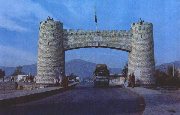
1. KHYBER PASS
The biggest tourist attraction is the historic Khyber Pass which is 17.7 km from Peshawar City and extends to Afghan territory and now forms part of the main Asian Highway. This legendary gateway to the South-Asian subcontinent is more than 35 km long.
2. SWAT
In this picturesque valley, located near the headquarters city of Saidu Sharif, excavations at Udigram and Mingora depict the life and teachings of Buddha. The Udigram finds have also some traces of earlier periods around the time of Alexander's invasion. At Saidu Sharif, there is a small museum mostly dispalying relics of Gandhara art.
3. CHARSADDA:
Some 30 km north of Peshawar is the modern urban settlement of Charsadda near which lie the ruins of the historic city of Pushkalavati, the pre-Kushan capital of Gandhara, which was captured by Alexander in 324 BC.
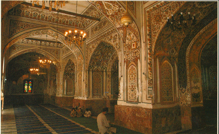
Located in Peshawar city, it is a magnificent mosque built by Mohabbat Khan, a Mughal Governor of Kabul in 1570 AD.
5. KAGHAN VALLEY:
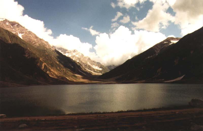
It is the valley of honey-mooners, of romance, of natural beauty and legend, which combine to endow Kaghan in Mansehra district with a charm unmatched throughout the world. High mountains with their lofty peaks and lakes, including the famous Saif-ul-Maluke lake, make the valley tourist's paradise. The valley has many suitable sites for hiking and hand-gliding.
6. MARGHUZAR
At a height of 1,281 meters about 13 km south of Saidu Sharif in Swat, Marghuzar is a beauty spot featured prominently by the White Palace of Swat rulers. On the 2,745 meters high plateau behind lies the temple of Ram Takht believed by Hindus to be the throne of Ramachandra. According to the legend, Buddha also sat on one of the rocks in the temple and the second Buddha was born here.
7. MADYAN
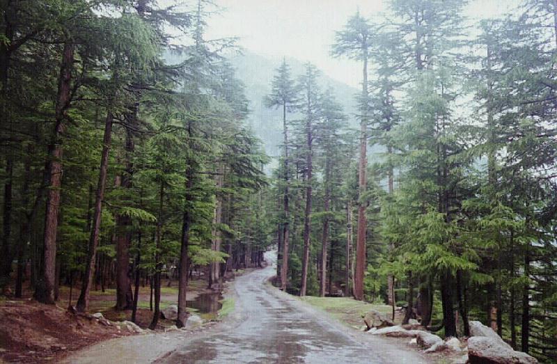
Situated at the height of 1,328 meters, 56 km north-east of Saidu Sharif on the Kalam Road on the bank of river Swat, Maydan offers a superb view of the countryside and has excellent hiking and camping sites. About 10 km north of Maydan is Bahrain which offers a wonderful view of natural waterfalls and a lovely view of snow-clad mountains. About 60 km north of Bahrain and at an altitude of 2,074 meters is Kalam where Ushu and Utrat rivers meet to form the Swat river. Snow-covered peaks, dense forests, wild flowers and green meadows surround Kalam, while the surroundings abound in wildlife including mountain goats, fowls, pheasants and partridges. Not far from Kalam are the valleys of Utrot and Gabral which offer breath-taking natural beauty.
8. MALAM JABBA:
A few kilometers from Saidu Sharif, Malam Jabba is the place where the first skiing resort of the country is being developed with the help of the Australian Government.
9. AYUBIA AND THE GALLIS:
Situated at an average height of 2,135 meters, Ayubia has a chair-lift at Ghora Dhaka which attracts visitors to enjoy scenic beauty of pine hills. The nearby hill station of Nathiagali, Changlagali, Khanspur, Khairagali, Thandiani, Abbotabad, Parachanar and Kala Bagh present an unpolluted environment and scenic beauty.
10. KALASH VALLEY:
Located in Chitral, Kalash Valley, the homeland of Kalash tribe, consists of three smaller valleys of Bombaret, Barrir and Rumbur. The Kalash are fascinating people with their pagan rituals and taboos.
11. GARAM CHASMA:
To the south of Chitral is Garam Chashma, the headquarters of Latkoh tehsil, famous for a large number of boiling sulphur springs which have a healing effect on skin diseases.
|
Back |
|
Home |