
Tuesday, May 15, 2001, 7:00 a.m. - Mile 3437.6 - Great Falls, MT
It looks like a good day today. The top is down, I have a jacket on because it's still a bit cold, and I'm ready to go. I buy gas but I don't get breakfast in Great Falls for some reason and this turns out to be a mistake. There really aren't many towns on Highway 89 northwest of Great Falls. I survive on granola bars and bottled water that I have with me. This seems to be a good enough reason to break my resolution not to eat in the car.

Heading west, it looks like rain clouds to the east but partly cloudy to the west. Maybe I'll be able to keep the top down today.Mile 3450.5 - Turnoff to Choteau
I hit more road construction and it's off and on between pavement and dirt for the next eight miles. At mile 3458.6 the construction ends and there's a turnoff to the right.As for scenery, Northern Montana might as well be in Missouri or Indiana except for the mountains in the distance. It's relatively flat with rolling hills.
Mile 3481.1 - Raining bugs

I pass a small lake or maybe swampy area and run into clouds of mosquitos. It's like it's raining bugs for a little while with the windshield getting covered with dark bug streaks. I would really hate to ride a motorcycle through here.

Mile 3491.8 - Choteau
You have to keep right in Choteau to stay on Highway 89. I stop where I see a hose in a field to wash the bugs off. These are beyond the capability of the built in washers on the car. I turn the wipers on and keep spraying water on the windshield until the bugs come off, at least on the part that the wipers touch. I can now see again.Mile 3512 - Interesting road
The road gets interesting for a while as we go through rolling hills. It's no longer so straight and is a bit more fun to drive on.
Mile 3560.1 - Windy and cold.
For some reason the temperature gets colder. I'm beginning to wonder if I'll reach the point where it's cold enough that I'll want to put the top up. That shouldn't happen, just like it not getting hot enough to put the top up. I'll just wear a hat and zip my coat up.Mile 562.3 - Junction of Highway 2
As I pass the junction of Highway 2 and Highway 89, a fine, light rain is falling. Not enough rain to raise the top, though. I intend to drive through Glacier National Park rather than the section of Highway 2 south of the park.9:20 a.m. - Mile 3565.3 - Browning, Montana
The rain keeps up and I eventually have to put the top up again. At mile 3578.8 there is a junction with one road going towards "East Glacier". I have to back up for about a hundred feet as I determine that this is not the road that goes to the entrance at St. Mary.Mile 3598.5 - St. Mary
This is where the turnoff is to Glacier National Park. I stop to buy some post cards and find out that the park is not open all the way through yet. That means that I'll get to drive on that section of Highway 2 south of the park anyway.Mile 3599.5 - Entrance to Glacier National Park

There is nobody at the visitor's center or the gate. They have brochures in a plastic case, though, and instructions on how to pay if you don't have a park pass. Since I bought my park pass a week ago, I just take a brochure. I want to make sure that I get one from every national park.
As I drive into the park, the view is dominated by the beautiful tall rugged mountains. This would be great with the top down, but it's raining and even snowing at higher altitudes. The scenery in this park is magnificent.


11:25 a.m. - Mile 3626.4 - Back to the entrance
As I get back to St. Mary I decide I need gas. There are five 2-sided pumps, but we all have to use an old one by the market. There are at least four cars that want gas from the two nozzles, but I'm the only one that needs Premium, so I'm not holding anybody up. Apparently this place doesn't really open until June.Mile 3646.6 - Right on 49
I finally take the exit to East Glacier, which will take me to Highway 2 and around to the other side of the park.Mile 3654.3 - Turnoff to Two Medicine
There is another road that goes a little ways into the park at Two Medicine, but I decide to skip that one. It looks like there are two intersting lakes to see there, and I'm sure there are other beautiful mountains. Instead, I continue on around the park to the other side. I am using the National Park map for these roads, since it is much more detailed than my AAA map.


There are range cattle along the road south of the park. Basically, this means cattle that are not kept off of the highway by fences. I pass several cattle on the left of the road and don't bother to slow down as I usually do when there is any animal near the road. I only see the calf on the right in the bushes as I pass it. I've got to slow down no matter what when I see animals that could cross the road. Even a calf could do serious damage to a car at speeds as low as 35 mph.12:15 p.m. - Mile 3715.8 - West Glacier Park

I stop for lunch at the small town of West Glacier Park. About half an hour later, I'm headed into the west entrance to see where I would have come out if the road in the middle of the park were not closed. It has stopped raining, so I put the top down, even though the roads are still wet. I can see the mountains better this way.
2:35 p.m. - Mile 3739.6 - Raining again
Eventually it starts raining enough that I have to put the top back up. I enjoyed the little bit of dry that let me have the top down for a few minutes.
There is a river alongside the road with some very serious rapids. I'm wondering if a person could make it through the big one in a kayak. It looks pretty dangerous, since the left side goes under some overhanging rocks, there's a large tree stuck in the right side, and if you don't hit the middle just right you'll likely be stuck there for a while. The few kayak fanatics I've met seem to just love stuff like that.


2:45 p.m. - Mile 3744.6 - Back to west entrance
It is now raining hard. I find Highway 2 and head west. This road should take me all the way to the Idaho border.Mile 3760.5 - Right on 2 towards Kalispell
3:07 p.m. - Mile 3765.0 - Left on 2 towards Kalispell
I'm noting the turns I have to make, in case it can help others who want to follow any of these routes to keep from making wrong turns. I've managed a few wrong turns myself on this trip. The worst was in Southern California when I completely missed one section of Highway 1. Someday I'm going back there just to figure out why I have such a hard time getting through there.The rain has stopped and I stop to put the top down again.
Mile 3776.3 - Right on 2
Mile 3777.7 - Entering Kalispell
Highway 2 is a nice high speed road through the mountains and forest. The speed limit is 70 mph. I set the cruise control on 78 and I'm not bored here. A Montana Highway Patrol car goes by with his radar on and he doesn't even notice me. I'm curious how fast you would have to go to attract their attention. I don't want to find out first hand, however.4:55 p.m. - Mile 3865.6 - Libby, Montana
I get gas in Libby, since it looks like the last place with real gas stations before I get to Canada and I want to buy gas as few times as possible in the land of Liters (I mean litres), Kilometers, and a dollar that you can buy three for $2.00 U.S.As I'm leaving Montana, the sun is out and it's a nice mountain road that I enjoy driving on.
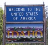
5:33 p.m. - 3902.4 - Entering Idaho
I'm back in the Pacific time zone, so it's only 4:33 p.m. now. Once again the watch I keep in the drink holder slot has the right time. I didn't see any point in changing it for just a few days.
I notice that the speed limit drops from 70 to 60 when you get to Idaho. That's too bad, because I enjoyed moving along a bit faster on the Montana roads.
4:52 p.m. - Mile 3918.8 - 95 North towards Canada
Mile 3931.6 - Junction of 1 and 95
I take Highway 1 to the left to remain in a westbound direction. It would be fairly easy to get on the wrong road, since there is little warning of what is ahead.5:25 p.m. - Mile 3944.1 - Canada

I cross into Canada at Porthill. I had expected a small town here, but I don't see one from the highway. Nobody checks anything as you leave the U.S.A. The woman at the booth in Canada asks where I'm from and asks if I have any guns. I explain that I don't own any guns and don't like them. She then asks if I have any handguns, rifles, shotguns, and so on. I quickly answer the question the way she wants and say that no, I don't have any guns. She didn't ask to look at any identification and didn't even check the car. I don't have a front license plate on my car and she doesn't bother to look at the one on the back. I ask her if she could stamp my passport for me, since I only have one other stamp in it. He is happy to do that for me.

The speed limit in Canada is 80 kph, which translates to about 50 mph. And I thought Idaho was slow. The yellow warning signs on the curves are marked at 60 kph. They seem to be very conservative about speeds here. I try to drive conservatively as well.

I even switch the speedometer to read in kph instead of mph to make it easier. Now I wonder if the usual 10 mph grace you get in the U.S. translates to 10 kph, or 16 kph. I'm bothered the whole time I'm in Canada trying to translate kilometers, liters, and dollars to what I'm familiar with.Mile 3952.8 - Left on 3 west
I finally get onto Highway 3, which I'll follow most of the way west towards Vancouver. I keep a conservative speed and get passed by several cars. My radar detector goes off as a police car approaches. Apparently they use instant-on Ka-band radar in their cars. It's a good thing I'm not going as fast as those cars that just passed me. I really shouldn't need a radar detector at the speeds I'm driving in Canada, but I keep it on just to learn how much it is used here.
I notice that the rest stops are a bit simpler than most of those that I've visited in the U.S.

Mile 4003.5 - Salmo, BC
I stop for dinner at a Subway sandwich shop. This is the most common familiar fast food place in Britsh Columbia. The meal cost $5.20 Canadian. The people working there indicate that $5.40 is $4.00 U.S. and it takes a while to get my change back. I tell them they can keep the extra change if they want, but they insist on getting it right. Most places keep a calculator around for figuring such things. I suppose I could have made an exchange for Canadian money, but that could be more of a hassle. I decide to use Credit cards as much as possible from here on.Mile 4053.0 - Top up again
It's raining again and I put the top up for the rest of the evening. I'm confused about which road I'm on and concerned that I might actually be headed east bound. It turns out I was on 3B, which is a little longer than the main Highway 3 would have been. When I get to a junction of 3 East and 3 West I know I'm headed in the right direction.I notice quite a few bicyclists on the road. It seems to be a more popular mode of transportation here than in the U.S. I also notice that I must be at a lower altitude, because the car definitely has more power than it has for nearly a week now. I try to figure out how high 1500 meters is, but decide it's not worth figuring out exactly. About 4500 feet is close enough.
8:30 p.m. - Mile 4083.8 - Christina Lake
As it starts to get dark, I finally spot a motel that looks good enough to stay at. It costs $46.00 CDN, which is much cheaper than any other I've stayed in. This town is small enough that it doesn't even show up on the map I'm using of the Western States. The motel has no phones in the room, so I have to use a cordless phone from the manager's office to call my wife and check where she's meeting me in Vancouver tomorrow.I've only been in Canada two other times. Once I stayed in Windor, which is south of Detroit, and the other was a quick trip to Toronto. Canada just feels different than the United States. The towns are organized differently, with houses up the hill sides, and the people are just a little bit more polite. If it didn't get so cold here, it might be a nice place to live.
Previous Next Home Site Map
Copyright (c), 2001 by Scott R. Nelson
Page last updated July 9, 2001
ScottRNelson@HotMail.com