
Places of interest on Mike's world tour.
Mount Kenya
Mount Kilimanjaro
Ngorongoro Crater
Dar es Salaam
Zanzibar
Harare
Lake Kariba
Great Zimbabwe
Gweru
Bulawayo
Victoria Falls
Chobe National Park
Okavango
Etosha Pan
Swakopmund
Cape Town
Cape of Good Hope
Mossel Bay
Johannesburg
Mount Kenya
Mount Kenya is a gigantic extinct volcano lying south of the Equator in central
Kenya (the country is named after the mountain). It reaches a height of 5,199 m
(17,058 feet) and is Africa's second highest mountain. Its slopes reveal evidence
of numerous explosive episodes, and the central core is eroded to form several
snow-capped, rocky peaks. Numerous glaciers emerge from cirques on the upper
slopes, which are covered with glacial debris. Tropical forests on the lower
slopes, the home of much wildlife, are threatened by the advance of agriculture.
Mount Kilimanjaro
Kilimanjaro, in north-east Tanzania, Africa's highest mountain. An extinct
volcano, it rises at Mawenzi Peak to 5,149 m (16,896 feet) and at Kibo Peak
to 5,895 m (19,340 feet). The two peaks are snow-capped and joined by a broad
col. The mountain is drained by a number of streams that form a radial pattern,
some feeding the Galana and Pangani rivers, while others peter out on the plains
below. The lower slopes are intensively cultivated, but there are forests and
grassland above.

Mount Kilimanjaro
Ngorongoro Crater
Ngorongoro Crater is a huge extinct volcanic crater in the Great Rift Valley,
north-east Tanzania, 326 sq. km. (126 sq. miles) in area. It is the centre of
a wildlife conservation area, established in 1959, which includes the Olduvai
Gorge.

The Great Rift Valley
(with Mount Kenya in the background)
Dar es Salaam
Dar es Salaam is the former capital (until 1974) and chief port of Tanzania,
founded in 1866 by the Sultan of Zanzibar, who built his summer palace there;
pop. (1988) 1,360,850. In Arabic its name means 'haven of peace'. It handles
most of Zambia's trade since the building of the Tanzam railway, as well as
Tanzania's, and has oil-refining, textile, pharmaceutical, and food industries.
Zanzibar
Zanzibar, one of two smallish islands (the other being Pemba) belonging to
Tanzania, lies on a coral reef some 32 km (20 miles) off the East African coast.
History Little of Zanzibar is known in early times: c.1100 it was
importing pottery from the Persian Gulf and became a base for Arab traders.
In 1506, when the Portuguese demanded tribute, it was poor and thinly populated.
The Portuguese established a trading post and a Catholic mission, but were
displaced by the sultanate of Oman who took it in 1698. It began to prosper
c.1770 as an entrepot for Arab and French slave traders. Following its
development by Said ibn Sultan, his son Majid became ruler of Zanzibar strongly
guided by the British consul Sir John Kirk (1866-87). German trading interests
were developing in these years, but Britain and Germany divided Zanzibar's
mainland territories between them and, by the Treaty of Zanzibar (1890),
Germany conceded British autonomy in exchange for control of the North Sea
island of Heligoland. Zanzibar became a British protectorate. In December
1963 it became an independent member of the Commonwealth, but in January 1964
the last sultan was deposed and a republic proclaimed. Union with Tanganyika,
to form the United Republic of Tanzania, followed in April. Zanzibar retained
its own administration and a certain degree of autonomy, and, after the
assassination of Sheikh Karume in 1972, Aboud Jumbe and the ruling Afro-Shirazi
Party ruthlessly put down all forms of political opposition until growing
resentment forced Jumbe's resignation in 1984, Ali Hassan Mwinyi succeeding
him. When the latter became President of Tanzania in 1985, there was a new
constitution, and Idris Abdul Wakil was appointed President, succeeded in
1990 by Salmin Amour. A banned Islamic fundamentalist movement, Bismillahi,
has steadily gained support on the island. The Tanzanian government, fearing
a threat to national unity, revoked the island's membership of the
Organization of the Islamic Conference (OIC) in 1993. In presidential elections,
held in October 1995, Amour narrowly defeated a challenge from the Civic United
Front, which advocated greater autonomy for Zanzibar within Tanzania.
Harare
Harare (formerly Salisbury) the capital, largest city, and marketing centre
of Zimbabwe, at an altitude of 1,470 m. (4,825 ft.) in the province of
Mashonaland East; pop. (est. 1987) 863,100. Originally named Fort Salisbury
in honour of the British prime minister Lord Salisbury, the city was first
settled by Europeans in 1890. It was designated capital of Southern Rhodesia
in 1902. It is a modern city with the world's largest tobacco market and
produces a wide range of food-stuffs, building materials, and consumer goods.
Lake Kariba
Kariba is a town in the district of Mashonaland West, northern Zimbabwe,
on the north-eastern shore of Lake Kariba. It was originally built in the
mid-1950s to house the 10,000 workers involved in building the Kariba Dam.
Now a major tourist resort, many of its people work in the Kariba
hydroelectric power plant which supplies Zimbabwe with most of its
electricity.
Lake Kariba is a man-made lake, created by the damming of the Zambezi River
between 1955 and 1959. Before flooding took place the settlements of the
Tonga people were relocated and wild animals were moved to higher ground,
rescued from drowning by Operation Noah. Drawing water from a catchment
area of 663,000 sq. km. (256,083 sq. miles), it forms a reservoir with a
capacity of 180,600 million cubic metres at maximum operating level. It
also forms the Lake Kariba Recreational Park with an area of 5,200 sq. km.
(2,008 sq. miles).
The Kariba Dam, which lies 385 km. downstream from
the Victoria Falls at the upper end of the Kariba Gorge, came into operation
in 1959, providing hydroelectric power for both Zimbabwe and Zambia. Its
construction entailed the excavation of nearly one million cubic metres of
rock and the laying down of 975,000 cubic metres of concrete.
Great Zimbabwe
Great Zimbabwe is the massive ruins of a city in Zimbabwe, 28 km. (17 miles)
south-east of Masvingo, dating from the 13th-15th c. when it prospered in
connection with the Arab gold trade.

Great Zimbabwe National Monument
Gweru
Gweru is the third-largest city in Zimbabwe and administrative capital of the
Midlands province; pop. (1982) 78,920. Established in the 1890s as a coaching
station on the Harare-Bulawayo route, Gweru developed in association with the
nearby gold mines. The Dabuka rail marshalling yard is the biggest
container-handling facility in the country. It changed its name from Gwelo
to Gweru in 1982.
Bulawayo
Bulawayo is an industrial city and transportation centre in western Zimbabwe,
the administrative and commercial capital of Matabeleland North and South;
pop. (1992) 620,940. Formerly the capital of the Matabele chiefs and
originally known as GuBulawayo (= place of slaughter), the city developed
into the country's second-largest city after 1893 when it was occupied by
the British South Africa Company as a mining settlement. It has varied
industries including motor vehicles, metals, machinery, textiles, tyres,
building materials, and food processing.
Victoria Falls
Victoria Falls, in southern Africa,
is one of the world's greatest natural wonders, and lies on the Zambezi River
where it flows between Zambia and Zimbabwe. The waterfalls are over 1.6 km
(1 mile) wide and drop a maximum of 108 m (355 feet). The water plunges
into a deep chasm 120 m (400 feet) wide--which itself is a fracture in
the Earth's crust--and leaves it through a winding gorge 80 km (50 miles)
long. The thick mist can be seen and the roar of the water can be heard as
far as 40 km (25 miles) away.

Victoria Falls
Chobe National Park, Botswana
Chobe district lies in northern Botswana adjacent to the lower course of
the Cuando River which flows into the Zambezi 80 km. (50 miles) west of the
Victoria Falls. The 1,087,800-hectare (2,685,926-acre) Chobe National Park,
designated in 1967, encompasses the Nogatosau floodplains and the sandy
Mababe Depression.
Okavango
The Okavango (Angolan Cubango) is a river of south-west Africa which
rises in central Angola, as the Cubango, and flows c.1,600 km. (1,000
miles) south-eastwards to Namibia, where it turns eastwards to form part
of the border between Angola and Namibia before entering Botswana, where
it drains into the extensive Okavango marshes of Ngamiland.
Etosha Pan, Namibia
Etosha Pan is a depression of the great African plateau, filled with
salt water and having no outlets, extending over an area of 4,800 sq.
km. (1,854 sq. miles) in northern Namibia. Supporting a large variety
of animals and waterfowl, Etosha was established as a game reserve in
1907 and declared a national park in 1958. The wetlands of Etosha are
home to the world's largest breeding population of greater flamingo.
Swakopmund, Namibia
Swakopmund is a port and resort town on the Atlantic coast of Namibia,
at the mouth of the Swakop River to the north of Walvis Bay. It was
formerly a leading port of German Southwest Africa.
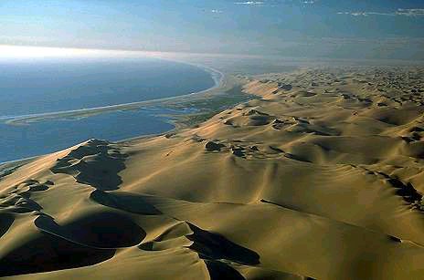
Namibian sand dunes
Cape Town, South Africa
Cape Town (Afrikaans Kaapstad) the legislative capital of the Republic
of South Africa and administrative capital of the Western Cape Province,
situated on Table Bay at the foot of Table Mountain (1,080 m.,
3,543 ft.); pop. (1985) 776,600. Founded as a victualling station by
the Dutch East India Company in 1652, Cape Town was eventually occupied
by the British in 1795. Capital of the Western Cape since 1994, it was
capital of the former Cape Province. Its castle (1666) is South Africa's
oldest building; the Dutch Reformed church dates from 1699. Groote
Schuur, the former estate of Cecil Rhodes, contains the University of
Cape Town, the Rhodes Memorial, a hospital, and museum. The National
Botanic Gardens (1913) contain a famous collection of South African
flora. Cape Town is the chief port, commercial, and industrial centre
for the surrounding region. Its industries include food processing,
wine making, clothing, printing, and tourism.

The precipitous cliffs of Table Mountain overlooking Cape Town, South Africa. The sandstone strata, of which the mountain is largely made, lie almost horizontal to give it its characteristic shape: a peak that is not quite flat but which undulates and contains several shallow valleys.
Cape of Good Hope, South Africa
The Cape of Good Hope (Afrikaans Kaap die Goeie Hoop) is a mountainous
promontory, rising to 256 m (840 feet), near the southern extremity of
Africa, south of Cape Town. It is a southern spur of Table Mountain and
shelters False Bay on the western side from the Atlantic. It was sighted
towards the end of the 15th c. by the Portuguese explorer Dias and named
Cape of Storms, and was rounded for the first time by Vasco da Gama in
1497. It was renamed by Henry the Navigator because its discovery promised
a sea route to the east.
Mossel Bay, South Africa
Mossel Bay - a seaport and resort in Western Cape, South Africa,
noted for the mussels from which it derives its name.
Johannesburg, South Africa
Johannesburg pop. (1991) 1,916,000, the largest city in South Africa,
is the centre of its gold-mining industry, and the financial and
commercial capital of Gauteng. Founded in 1886 and probably named
after Johannes Meyer, the first mining commissioner, it lies at the
centre of a large conurbation of municipalities and townships
including the township of Soweto, at an altitude of 1,754 m.
(5,750 ft.). It was made capital of the province of
Pretoria-Witwatersrand-Vereeniging in 1994. It has chemical,
pharmaceutical, metal, machinery, and textile industries. It is
also a diamond-cutting centre.
 Back to Mike's travel page
Info excerpted from The Oxford Interactive Encyclopedia
Developed by The Learning Company, Inc. Copyright © 1997 TLC Properties Inc. All rights reserved.