 |
| Optimizing Steamflood Performance Using 3D/4D Seismic Imaging E.L. von Dohlen, W.C. Kempner, L.F. Klonsky, J.A. Beery AAPG Pacific Section Converntion 1999 Chevron Reservoir Characterization Forum 1999 Stanford Unversity Petroleum Engineering Seminar March, 1999 |
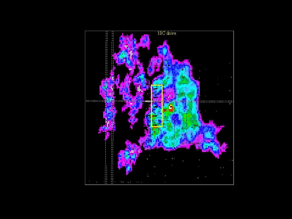
| Interpretation of Seismic data over the West Coalinga field identifies thermal processing trends in the Miocene shallow marine Temblor sands. Three phases of seismic acquisition, over a three year period, has completed full seismic coverage (>12 square miles) of the Chevron's thermal processing area. Some survey overlap yields 4D interpretation opportunity. Properties in the field have been steamdriven dating from the 1980s. Significant variability of production response to injection has been problematic in building program across this significant reserve base. Integration of seimic horizon amplitude with stratigraphic and production data allows definition of flow unit "bodies". Understanding the trend and volume of the "bodies" assists in the efficient management of the steam injection and expansion design. Interpretation of the seismic cube is sped by the application of Voxelgeo for 3 dimensional display of the spatial elements. Seed picking in Voxelgeo based on horizon amplitude limits defines continuity and stratigraphic form of the reservoir unit and their spatial interrelationship. The results of the integration of seismic is encouraging. Observed seismic amplitude anomalies centered on steam injector locations indicate a string stratigraphic control on the syeam distribution that can be used to explain the production response in the drive areas. A clearer understanding of the complex stratigraphy from seismic is being applied to improve efficiencies in heat placement. Integration of seismic in management of a thermal drive project shows promise for immediate impact with improved understanding of the reservoir flow unit. |
|
 |
 |
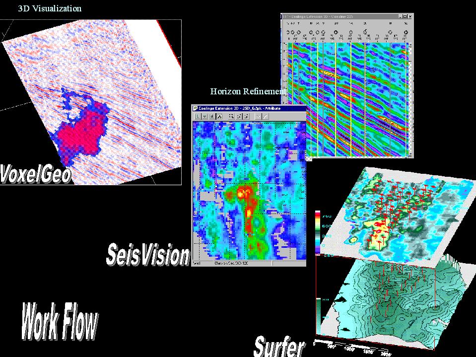
| Strengths of various programs were leveraged to accelerate intepretation. VoxelGeo with it's 3D visualization capability and seis geoforms, SeisVision with its data clean-up and export capability and Surfer to serve as a platform for graphic display of geologic and engineering data serves as a very effective integration. |
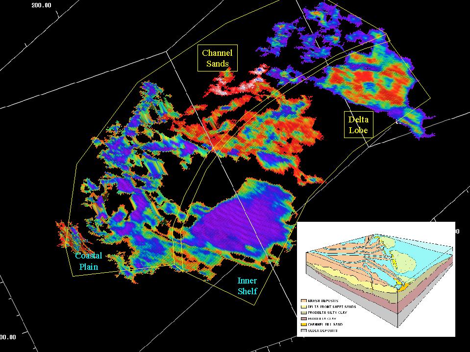
| Seed picking of the amplitude attribute in VoxelGeo allows rapid definition of seis geobodies. Straigraphic form of channels and deltas is evident. This assists in definition of stratigaphic facies for the sand units. Amplitude data painted onto the geoforms assists in the lithologic and processing evaluation. |
| Reshoot of seismic across the same area with the same acquisition parameters allows the opportunity to view seismic amplitude difference related to thermal processing. Relationship to sand stratigraphy and thermal processing fronts are evident. Parameters as temperature can be modeled based on amplitude difference. |
 |