![]()

PAKISTAN ' S NORTHERN AREAS
![]()
![]()
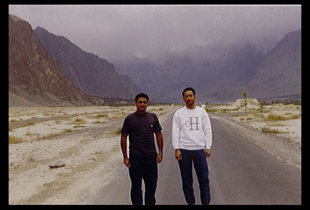
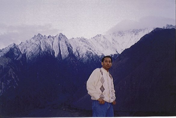
MY TOUR WITH FRIEND
 |
 |
 |
 |
Karakoram Highway |
The Karakoram Highway, or KKH, is the greatest wonder of modern . Connecting Pakistan to China, it twists through three great mountain ranges - the Himalaya, Karakoram and Pamir along the valleys of the Indus, Gilgit and Hunza rivers to the Chinese border at the Khunjerab Pass. (see bottom for details) |
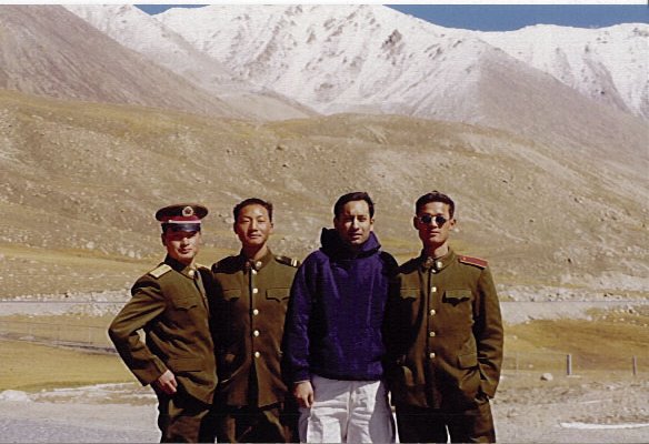 With Chinese militry at Khunjrab Pak-China boder |
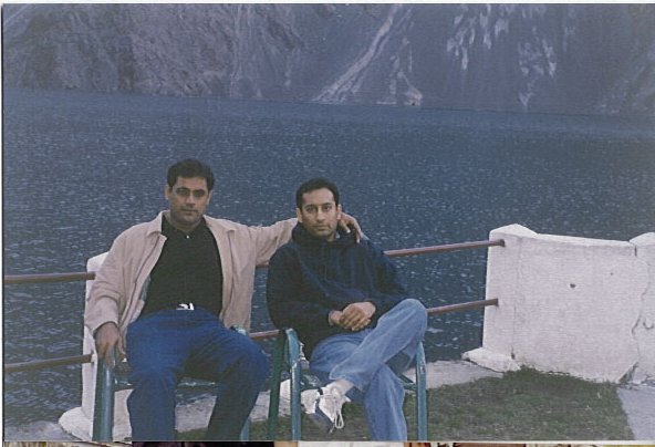
 At Khunjrab border with new friends |
 500 Feet above in middle of the mountain.... no wonder this art hasn't made by human |
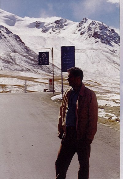 Khunjrab's edge , 0 miles to China |
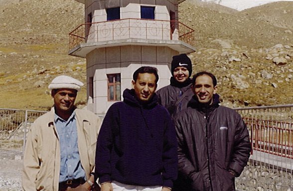
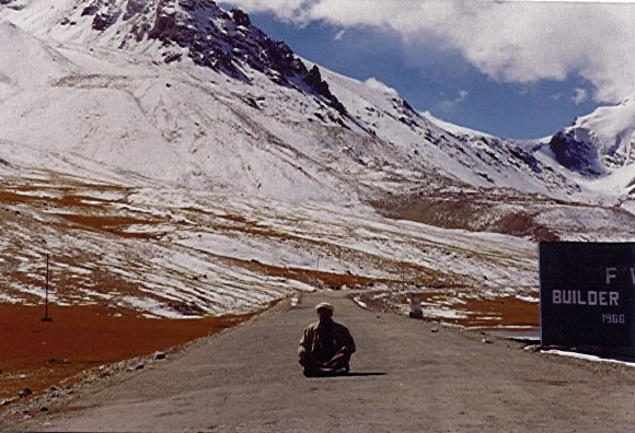 Khunjrab : The only way to keep you warm is to sit on road |
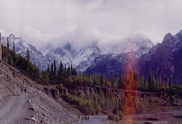
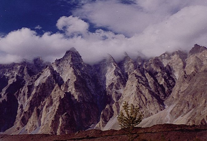 PASSU KOON : On the way to Khunjrab. The best picture , I had taken |
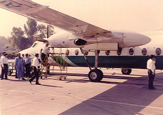 Islamabad to Gilgit/Skurdu : 33 seated Fokker, hard to avail the seats in season |
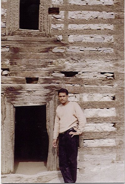 A nice work behind at BALTIT FORT (Gilgit)
|
Way to SUST |
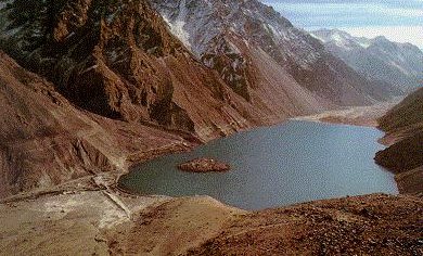 Satpara lake : Surrounded by high glacial mountain (SKURDU) |
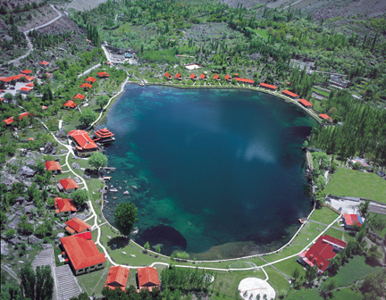 SHANGRILA : Bird eyeview |
 Satpara lake, an island in the middle of its clear water (SKURDU) |
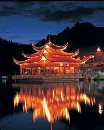
SHANGRILA......Resort in Skardu http://www.shangrilaresorts.com.pk/pages/index.html
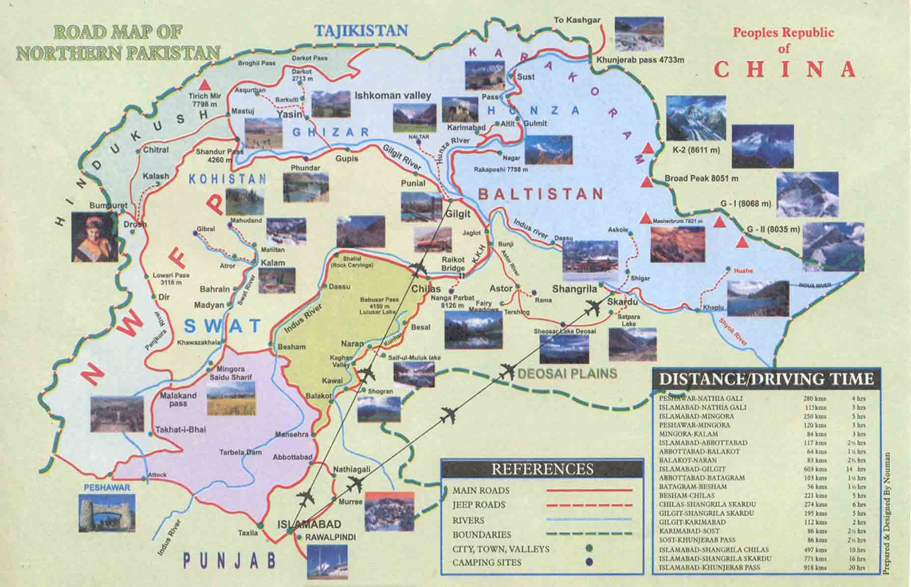
MAP OF NORTHERN PAKISTAN
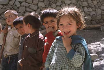
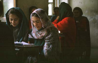
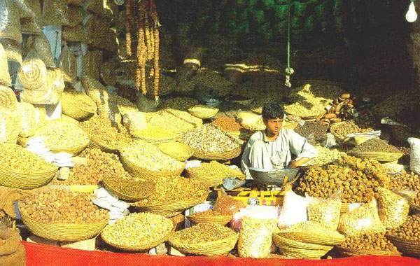
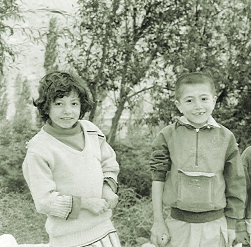
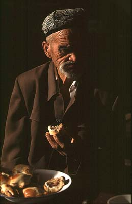
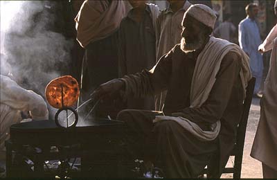
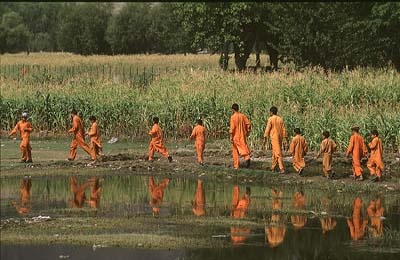
PEOPLE
LIVE THERE


|
|
|
Just imagination , night view of the northern areas |
Sign My Guest Book
Go to my another page : http://www.oocities.org/dade222
Go to the web page of PTDC for the travel in country :
http://www.karakorumexplorers.com.pk/Karakorum.htm
http://www.karakorumexplorers.com.pk/Karakorum.htm Govt. Licence No. 2046 (NEW)
http://www.travel-library.com/asia/pakistan/index.html (Travel Liberary for Pakistran)
http://www.abdn.ac.uk/~src048/hp/pic.html
http://www.members.tripod.com/~PakInfo
PAKISTAN : With the view of others :
http://www.ping.be/travelspot/ (Ayse and Jan's travelspot ) (Text = ***** , Pic = *** )
http://www.oocities.org/~kenghor/silkroad/silkroad.html (Wee Keng Hor) (Text & Pic = ***** )
DETAILS ABOUT AREAS :
The Karakoram Highway
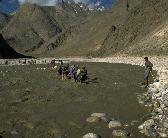
The Karakoram Highway, or KKH, is the greatest wonder of modern Pakistan and one of the most spectacular roads in the world. Connecting Pakistan to China, it twists through three great mountain ranges - the Himalaya, Karakoram and Pamir - following one of the ancient silk routes along the valleys of the Indus, Gilgit and Hunza rivers to the Chinese border at the Khunjerab Pass. It then crosses the high Central Asian plateau before winding down through the Pamirs to Kashgar, at the western edge of the Taklamakan Desert. By this route, Chinese silks, ceramics, lacquer-work, bronze, iron, furs and spices travelled West, while the wool, linen, ivory, gold, silver, precious and semi-precious stones, asbestos and glass of South Asia and the West travelled East.
For much of its 1,284 kms (905 miles), the Karakoram Highway is overshadowed by towering, barren mountains, a high altitude desert enjoying less than 100 millimeters (four inches) of rain a year. In many of the gorges through which it passes, it rides a shelf cut into a sheer cliff face as high as 500 meters (1,600 feet) above the river. The KKH has opened up remote villages where little has changed in hundreds of years, where farmers irrigate tiny terraces to grow small patches of wheat, barely or maize that stand out like emeralds against the grey, stony mountains. The highway is an incredible feat of engineering and an enduring monuments to the 810 Pakistanis and 82 Chinese who died forcing it through what is probably the world's most difficult and unstable terrain. (The unofficial death toll is somewhat higher, coming to nearly one life for each kilometre of road).
The Karakoram and the Himalaya, the newest mountain ranges in the world, began to form some 5 million years ago when the Indian sub-continent drifted northwards and rammed into the Asian land mass. By this time the dinosaurs were already extinct. India is still trundling northwards at the geologically reckless rate of five centimeters (two inches) a year, and the mountains are still growing by about seven millimeters (1/4 of an inch), annually. the KKH runs through the middle of this collision lbelt, where there is an earth tremor, on average, every three minutes.
Karakoram is Turkish for 'crumbling rock', an apt description for the giant, grey, snow-capped slag heaps that tower above the gorges cut between them.
The Indus River flows northwest, dividing the Himalaya from the Karakoram, before being knocked south by the Hindu Kush. the KKH hugs the banks of the Indus for 310 kilometres of its climb north, winding around the foot of Nanaga Parbat, the ninth highest mountain in the world and the western anchor of the Himalaya. The highway then leaves the Indus for the Gilgit, Hunza and Khunjerab rivers to take on the Karakoram Range, which boat 12 of the 30 highest mountains in the world. By the time the road reaches the 4,733 mere (15,528 foot). Khunjerab Pass, it has earned the name of the highest metalled border crossing in the world.
Gilgit
At an elevation of 1453.90 meter lies the Gilgit valley, offers spectacular scenic beauty. It is surrounded by lakes, rivers, glaciers and high mountains ranges. Some of them world's largest peaks, such as Nanga Parbat, 8125 meter and Raka Poshi, 7788 meter are located here. The best season to visit is from May to mid October. The local dialect is Shina, however, Urdu and English are also spoken and understood.
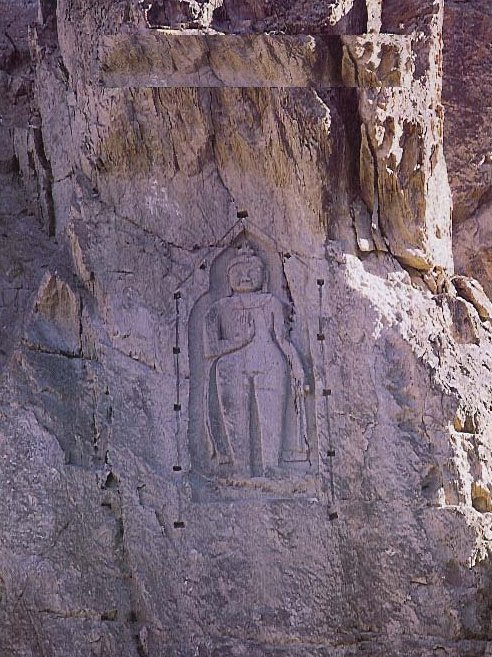
Places of Interest: Buddhist Rock Carvings carved out of the mountain side are worth paying a visit. It is about 10 kms away from Gilgit and the distance is covered in about 20 minutes in a jeep.
The Victory Monument of Taj Mughal was built about 700 years ago and lies at a distance of 11 kms from Gilgit and it takes about 25 minutes by jeep to get there.
Karimabad
Miles and miles of terraced fields and fruit orchards mark Karimabad, the capital of Hunza Valley. It offers a panoramic view of the Rakaposhi, Ultar and Balimo peaks. It is 112 kms from Gilgit and it takes a jeep about 3 hours to cover the distance.
Punial
Sher Qila is the main village of the picturesque Punial valley. The distance is 40 kms and time required to reach there is about 2 hours.
Singal
This spot in the Punial valley offers ideal trout fishing opportunities. It is 56 kms away and takes 3 hours to get there.
Yasin
A valley providing ideal opportunities for hiking and trekking, it lies at distance of 160 kms and the jeep journey requires about 7 hours.
Phandar
This picturesque area has a lake which abounds in trout. It is about 177 kms away and the time required to get there is about 8 hours.
Shandur Pass
This 1250 feet long pass connects Gilgit to Chitral. The pass remains snow-bound during winters. It is 250 kms and 15 hours away by jeep.
Rama
A lake in this region offers an awe-inspiring view of the eastern side of Nanga Parbat, 8126 meters high. It is 120 kms away and takes 6 hours to get there.
For the adventure-loving tourist, hiker, angler, art-lover, mountaineer or polo enthusiast, there are few places in the world that could compare with Gilgit.
Naltar
Naltar is the loveliest fully-day outing from Gilgit. About a two-hour drive away, it is an area of alpine meadows and pine forests 3,000 meters (10,000 feet) above sea level and surrounded by snow-capped mountains. the road up from Nomal climbs steeply through a rocky gorge to emerge on the fertile, high-altitude pastures. Those who wish to stay can choose among the Public Works Department rest-house, the very basic local hotel, or camping. Naltar is the perfect base for gentle walks through the forest or up to Naltar Lake, where the fishing is excellent. The village is also the starting point for more energetic treks across the 4,000 (13,000 foot). Naltar Pass to the Ishkoman Valley, or across the 4,800 meter (15,700 feet). Daintar Pass to Chalt. The two ski-lifts at Naltar are reserved for army use.
Hunza
Hunza has been ruled by the same family known as Mirs of Hunza for 960 years. Hunzakuts are believed to be the descendents of five wandering soldiers of Alexander the Great. The people of Hunza speak Brushuski, an aboriginal language. This preincely state retained its isolated independence for a long time in the remote part of the areas which now from the Northern Areas of Pakistan adjoining the Sinkiang Autonomous Region of China.
During early nineteenth century, Hunza resented Kashmir's attempts to gain control and its rulers periodically expelled Kashmir garrisons, threatended Gilgit, and politicked with the rulers of Kashgar to the north where the Russians were gaining influence. Fearing Russians infiltration into their northern frontiers, the British took over direct political control at Gilgit in 1889. Incesant fratricidal intrigues in Hunza and Nagar made the areas doubly insecure. This, coupled with the Mir of Hunza's consistent intransigence induced the British to march on Hunza in December 1891, where they fought a decisive battle at Nilit, 60 km beyond Diaynor Bridge. After this the British garrisoned Aliabad until 1897 when Hunza became a princely state protected by the Government of British India. After the Pakistan was created in 1947, the people of Hunza also gained liberation and the princely state was merged in Pakistan.
Baltit Fort
The Baltit Fort is a kilometer away from Karimabad. It was built 700 years ago by 300 labourers broght to Hunza in the dowry of the Princess of Baltistan when she married Mir of Hunza. The area is anmed Baltit after those labourers. Over the ceunturesd it has been inhabited by the ruling family of the Hunza State.
Buddhist Rock Carving
The rock carving and inscriptions around Ganesh village give proof of the Buddhist influence in the area. The inscriptions are in four different scripts and the carvings are of human and animals figures.
Batura, Passu, Hopper, Hisper Glacier
Batura Passu glacier is 35 kms from Karimabad while the Hopper and Hisper glaciers are 25 kms away. The journey takes two hours by jeep and ther last two kilometers have to be travelled on foot.
Altit Fort
Altit fort is situated in the village of Altit about three kilometers from Karimbabd. It has been built on a sheer rock cliff that falls 300 metres (1,000 feet) inti the Indus river. The fort is a 100 years older than the Baltit Fort and weas at one time inhabited by the ruling family.
Ultar Peak
The Ultar peak known as the killer mountain is the only un-conquered peak.
Nagar
Nagar, the large kingdom across the river from Hunza, was possibly first settled by people from Baltistan who arrived over the mountains by walking along the Biafo and Hispar glaciers. It was settled again in about the 14th century by Hunzakuts who crossed the river. A man called Borosh from Hunza suposedly founded the first village of Boroshal, and married a Balti girl he found there. The legend says the girl and her grandmother were the sole survivors of a landslide that killed all the early Balti settlers.
Nagar is entered by the jeep road that leaves the KKH just beyond the Ganesh bridge across the Hunza River. The first five kilometres (three miles) of this road are dry and barren, then the road divides. Once branch of crosses the Hispar River on a bridge and climbs up into the fertile villages of central Nagar, where many kilometres of irrigation channels provide pleasant walks through fields and villages right up to the last village of Hoper. You can get here by public transpsort from Aliabad in Hunza, which leaves most days for Nagar, and occasionally continues to Hopar.
The Ruby Mines
The Ruby Mines of Hunza are also nearby. A sales centre is located at Aliabad who sale precious and semi-precious stones and jewellery.
The KKH Beyond Karimabad
The KKH is at its most spectacular between Ganesh and Gulmit. The road rides high on the eastern side of the river, twisting and turning round the barren foot of the Hispar Range, which boasts six peaks over 7,000 metres (23,000 feet). On the opposite bank, villages cling implausibly to the side of the 7,388 metre (24,240 foot) Ultar Mountain. Between the villages, grey screen slithers down to the river, looking in the distance like piles of find cigarette ash. Above, the jagged teeth along the ridge hide the highest snow-covered peaks from view.
The KKH crosses back to the west bank at Shishkot Bridge, from which the view upstream of the serrated ridge of mountains above the river is one of the most photogenic prospects of the entire drive. From here to Tashkurgan in China the people speak Wakhi.
Gulmit
Eight kms (five miles) past the bridge, is a fertile plateau 2,500 metres (8,200 feet) high, with irrigated fields on either side of the road. This is a good place to spend a night or two, marking the halfway point between Gilgit and the Khunjerab Pass. The small museum here belongs to the prince, Raja Bahadur Khan, and is full of interesting ethnic artifacts. And two of the hotels here belong to Mirzada Shah Khan, hero of the 1947 mutiny.
The rock and gravel covered Ghilkin Glacier comes right down to the road about one kilometre (just ovr half a mile) past Gulmit. The road crosses the snout of the glacier at the very edge of the river, then climbs up on to the lateral moraine - a great, grey slag heap. About five kilometeres (three miles) furtehr on, you round a corner to find Passu Glacier straight ahead. It is shining white and deply crevased - just as you would expect a glacier to look. Above the glacier to the left is the jagged line of the Passu and Batua peaks, seven of which are over 7,500 metres (25,000 feet). On the opposite side of the river, which you can cross over a terrifying footbridge, the valley is hemmed in by a half-circle of saw-toothed summits, down the flanks of which slide grey alluvial fans.
Passu is a village of farmers and mountain guides 15 kilometres (nine miles) beyond Gulmit. This is the setting-off point for climbing expeditions up the Batura, Passu, Kurk and Lupgar groups of peaks, and for trekking trips up the Shimshal Valley and Batura Glacier. The Passu Inn, right beside the road, is the meeting place for mountaineers and guides.
The KKH pases through four more villages before reaching the immigration and customs post at Sost, 33 kilometres (21 miles) from Passu. Outgoing traffic must pass through Sost before 11 am. It is a four-or-five hour drive from here to Tashkurgan, and you must allow time for clering Chinese customs and immigration to kilometres before Tashkurgan (moved down from Pirali). The time difference between China and Pakistan is three hours, so it will be around 7 to 8 pm Chinese time before you arrive in Tashkurgan. Incoming traffic is processed until 4 pm Pakistani time, 7 pm Chinese time.
From Sost to Tashkurgan
PTDC and NATCO run daily buses from Sost to Tashkurgan, for Rs. (about US $ 23).
For the first 30 kilometres (19 miles) from Sost, the valley is narrow and barren, the cliff-face shattered into huge cubes and slabs that peel off and tumble down to the road, where they lie like forgotten building blocks belonging tol giant children. The road leaves the Hunza for the Khunjerab River, and there is more of the same, with alluvial fans flowing down every gully, frequently blocking the way.
Khunjerab National Park begins 30 kilometres (19 miles) from Sost. The hills move back from the road, the valley opens out and the Khunjerab River dwindles to a tiny mountain stream with the odd tuft of grass, willow or birch along its banks.
The check-post at Dih consists of six lonely stone houes. The last 30 kilometres (19 miles) to the top of the pass are easier driving, as there is less mountain above and the slopes are gentler. The road follows the banks of the stram before winding up round 12 wide, well-engineered hairpin bends to the top.
The Khunjerab Pass, at 4,733 metres (15,528 feet), is reputedly the highest metalled border crossing in the world. A red sign announces 'China drive right', and a rival green sign says 'Pakistan drive left'. A monument declares that the highway was opened in 1982 and indulges in a bit of hyperbole by saying tht the pass is 16,000 feet (4,875 metres). The Khunjerab is on a continental watrshed. All weater on the Pakistani side flows down to the Indian Ocean, while that on the Chinese side is swallowed by the Taklamakan Desert,the name of which means, if you go in, you don't come out'.
It is 32 kilometres (20 miles) from the top of the pass to the abandoned Chinese border post at Pirali. The scenery is remarkably different on the two sides of the pass. The Pakistani side is vertical world of desert gorges devoid of any sign of human life for the last 30 kilometres (19 miles), except for the road itself. the Chinese side is wide, open and grassy high-altitude plateau with grazing herds of yaks, sheep and goats tended by Tajik herders. Children and dogs romp among round felt tents called yurts. The Tajiks are a smiling and friendly lot, and the women are as happy to be photographed as the men. Even the camels are altogether different animals. Pakistani camels are tall, short-haired, one-humped Bactrains that appear to wear hairy, knee-lenght shorts.
Baltistan
Baltistan, 26,000 square kilometres in area is right below the serrated, jagged and glaciated ramparts of the Karakorams. Once part of Ladkah, it was known as Tibet-i-Khurd - Little Tibet.
Archaeological exploration has proven that it was encompassed by the Silk Trade Route. Rock carvings have been discovered along the road between Gol and Khapulu, and Skardu and Satpara Lake. the trade routes here split in Skardu with one leading to Satpara over the Deosai and Burzil Pass (5000 metres high) into Kashmir and another leading to Gol. At Gol it forks again with one trail leading to Khapulu, the other to Kharmang into Leh.
Skardu
Amidst a landscape of towering mountains, deep gorges, crashing waterfalls and quiet lakes, Skardu, the district headquartes of Baltistan, is situated on the banks of the mighty river Indus, just 8 km (5 miles) above its confluence with the river Shigar. Perched at a height of 2286 metres (7,500 ft), Skardu offers a cool and bracing climate.
On the eastern boundary of the district lies Ladakh, in the west Gilgit, in the south Indian-held Kashmir and to the north is the Chinese provice of Sinkiang.
During the summer, skardu attracts a large number of trekkers and mountaineers from all parts of the world. In fact, the entire region is known as a mountaineers' paradise. Nowhere in the world does one find such a large collection of lofty peaks, including K-2 the world's second highest peak, and huge glaciers like Baltoro, Biafo and Siachen, some of the largest in the world outside the Polar region, as in this 16,283 square km (10,118 square miles) of wonderland.
There are five main valleys in the district Skardu, Shigar, Khaplu, Rondu and Kharmang. All of them produce apricots, peaches, pears and apples in such profusion that this rgion is known as the land of apricots and apples.
Kharfocho Fort
The construction of Kharfocho fort of th King of forts at Skardu has been attributed to the famous ruler of Skardu - Maqpon Bugha (1490 - 1515 AD), the great grand father of Ali Sher Khan Anchan (1560 - 1625 AD) by Hishatullah. But Moghal historains are of the view that the great fort was built by Ali Sher Khan Anchan himself. This view is upheld by European writers such as Cunningham, Foso Marine, G.T. Vagne etc. Some observations about this fort have been made in the Imperial Gazetteer of British India. It states that one of the most famous of the Gralpos (Monarchs of Skardu), Ali Sher Khan, who ruled till the end of the 16th century, conquered Ladakh and built a fort at Skardu.
Mindoq Khar
This palace was built by Gul Khatoon or Mindoq Gialmo on the hill where now stands the Kharfocho fort only. The palace was named after the queen as 'Mindoq Khar' meaning the 'Flower Palace'. The Palace was destroyed by the troops of the Sikh ruler of Kashmir, Maharaja Gulab Singh, when he invaded Skardu in 1840 AD.
Hilal Bagh and Chahar Bagh
Just below the Mindoq Khar or Flower Palace, there was a terraced garden with fountains built in marble. This royal garden covered the areas from Mindoq Khan to the present bazaar at Skardu where the newly constructed road crosses the channel. A palace built in marble with towers also stood in the middle of the garden, above the Polo Ground which is called Ghudi Changra. The palace was destroyed during the great floods in the area after the death of Ali Sher Khan Anchan and a marble Baradari was later constructed at this palace. This royal garden was named Hilal Bagh (Crescent Garden). Another garden was also laid which was named Chhar Bagh on the site where a Girls College stands now. The said garden was laid on the orders of the Queen while her husband was away to Gilgit and then to Chitral. As the mother tongue of the Queen was Persian, she gave Persian name to these gardens.
Buddhist Rock
There is only one surviving Buddhist Rock with rock carvings in the Skardu Valley located on Satpara road. Probably the rock carvings and images of Buddha date back to the period of Great Tibetan Empire. When the Buddhist people of Gandhara migrated and pased through the present northern areas of Pakistan, they settled at some places temporarily and carved drawings of Stupas, scenes of their experiences and images olf Buddha with texts in Kharoshti language. There were a number of such Buddhist rock carvings in the Skardu Valley. Probably those rocks were used either by Ali Sher Khan Anchan as building material or submerged in the Satpara lake. Scholars and researchers like Dr. A.H. Dani from Pakistan and some from other countries have done lot of research work on these rock carvings and have since deciphered the text of the carvings in Kharoshti language.
Satpara Lake
8 km (5 miles) south of Skardu, 20 minutes by jeep, lies the Satpara Lake. Surrounded by high glacial mountains, this lake has an island in the middle of its clear waters, which can be reached by boat. The lake is considered ideal for fishing.
Kachura Lake
About 32 kms (20 miles) from Skardu, 2 hours by jeep, lie the shimmering waters of the Kachura Lake. In the springtime its banks are adorned by a multitude of colourful flowers, while the trees are laden with peach, apricot and apple blossoms. The lake offers great opportunities for trout fishing.
Shigar Valley
The Shigar Valley, 32 kms (20 miles) from Skardu and 2 horus by jeep, is watered by the Shigar River. It forms the gateway to the great mountain peaks of the Karakoram, including Mount K-2. The vlley has an extremely picturesque landscape, and abounds in fruit such as grapes, peches, pears, walnuts and apricots.
Khaplu Valley
This beautiful valley of the Shyok River is 103 kms (64 miles) from Skardu and 6 hours by jeep. There is a sprawling village perched on the slopes of the steep mountains that hem in the river. Many famous mountains, such as Masherbrum, K-6, K-7, Sherpi Kangh, Sia Kangri, Saltoro Kangri etc. are located here.
