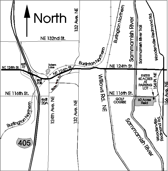
Map to 60 Acres Flying Field
Return to Maps page
Map prints out on 8 1/2 x 11 page if browser text size set to "smallest".
Return to Eagles 34 Home Page

From Interstate 405 going north:
Go North on I-405 past Hwy-520, past Hwy-980. Take Exit 20A (116th St. Exit). Turn right on 116th, then left on 124th Ave. NE. Go north on 124th Ave. NE to NE 124th St. Turn right on NE 124th St. Follow NE 124th St. east over hill. At bottom of hill, turn right onto Willows Road. Go south on Willows road to NE 116th St. Turn left on NE 116th St. Go east on 116th St. past golf course on right. Go over small bridge - WATCH OUT FOR BICYCLES, JOGGERS, and PEDESTRIANS! A difficult-to-see jogging trail crosses the road IMMEDIATELY after the bridge, and the cyclists/joggers/pedestrians don't always look for cars. ESPECIALLY WATCH FOR FAST BICYCLES! They pop up without warning from either side of the road, and are least likely to look for cars! Go past the line of Poplar trees running north-south on the right side of the road. The field on the right east of the Poplar trees is 60 acres. Continue along NE 116th St. to the east side of the field. The entry is a parking lot on the right. Go through the parking lot to the gravel road which leads to the field. Depending on wind direction, parking will be at either the north or south side of the field.