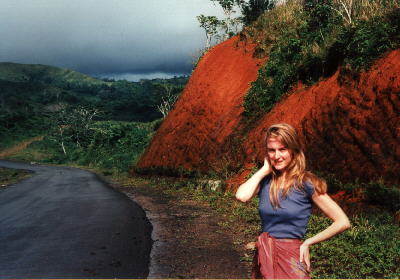
The beauty of the Dominican Republic does not end with the beaches. If you take the time to go to the inner parts of the island you will find wonderful mountain areas, mainly in the northern and western parts of the country. The countries highest points are at the same time the highest points in the caribbean: The Pico Duarte with 3175m and the Pico La Pelona with 3168m. They are both located in the Cordillera Central between Santo Domingo and the Haitian Border. When driving cross country, the mountains are always good for spectacular sights. Vegetation seems to change with every meter you climb. From the sugar cane fields and the green meadows in the lowlands through jungle-like rainforests to nearly european forests you'll find nearly everything. As a european, you will most probably like the climate on the higher areas of the island. When you drive to the waterfalls of Jarabacoa, you'll enjoy driving through wonderful forests soon after you left the Carretera Duarte. But be careful. If you hike down to the waterfalls, you should already be accustomed to the warm climate because you will have to master quite a height difference - first down to the river and then back up again.
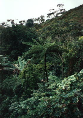
We started for an afternoon tour and decided to drive north from San Pedro de Macoris. The planes between San Pedro and Hato Mayor are mainly sugar fields. In Hato Mayor, we turned right towards El Seybo. This road already touches the outer parts of the Cordillera Oriental. In El Seybo we turned left onto the 107 towards Miches. The next 44 kilometers are pure mountain adventure. You'll climb high into moisty, foggy jungle regions with spectacular sights and phantastic plants. The photo on the left shows a fern tree, probably about four to five meters high. It's much cooler here then down at the coast which you will probably appreciate, if you are european. There are many places where you probably want to stop to take a picture. This area is just beautiful. Most of the way you will be driving on a pretty good road, partly with blacktop, partly not, but always in good condition. Just as you come down to Miches, the last 500 meters are in such bad condition that you'll think your car won't make it. But be assured, with our Toyota Tercel with automatic transmission it was not a problem and so it schould be ok with most standard car. (A 4WD sometimes seems like a nice thing to have though.) One thing I wouldn't do, though, is going on this trip during a tropical rain. I could imagine that this last strech is really bad when the rain makes it wet and slippery.
On our way back, we took the coastal road from Miches, passing the lagoons of ???????. Although this road was shown as a minor road on our map (in fact it looked the same as the track down the mountain) it was in real good condition. This got us back to our normal tour starting point Higüey (pronounced like he gay... sorry, that's what it is). From there to La Romana, you have about 15km of the worst pothole road you've ever seen, well, you probably don't because when we were there in march they were just about to redo the blacktop there so I think this road should be in pretty good condition for the next two or three years.
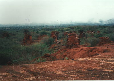
This shot is from the south-wertern region, not far from Pedernales. A huge, well maintained road leades away from the coast, towards the mountains. What you see on this photo is what american companies left over when digging bauxit here. The country built that perfect infrastructure and then the big companies found out that it wouldn't pay off any more to maintain this place, so they withrew. I don't know how contaminated the soil is here. |
||||||||
|
|