DESCRIPTIVE SKETCH
OF VICTORIA
Atlas Page 35
By James Smith
VICTORIA - MOUNTAINS.
An undulating and devious spine, commencing at the eastern boundary of
the colony, near some of the sources of the Snowy River, dipping down into the valley of
the Mitchell, then making its reappearance five and twenty miles to the northward, and
curving round, like a bow, to Kilmore, whence it stretches in a westerly, direction to
Mount Ararat, where it throws out a few spurs and then stops short in face of the massive
ranges which there run from north to south, is the most conspicuous feature of the
mountain scenery of Victoria. Upon the southern slopes rise the numerous rivers which
discharge their waters into the sea, while the northern flanks supply the various
affluents of the Murray. But in no case does the highest peak attain a higher elevation
than six thousand one hundred feet above the level of the sea, although this altitude is
exceeded in two instances by spurs thrown off from the main or Great Dividing Range. These
spurs are of remarkable complexity in the eastern counties of the colony, in some of
which, as for example in Benambra, Tambo, Dargo, the north-western part of Croajingolong,
Bogong, the southern half of Delatite, Wonnangatta, and Evelyn, the area of country
occupied by labyrinthine ranges probably exceeds that of the valleys and lowlands
comprehended within their limits. In many instances the mountains grouped together,
independently of the dorsal range, resemble an octopus in shape.  From a
central eminence between four and five thousand feet in height, as at Mount Baldhead,
Mount Bindi, and Mount Bowen, limbs are thrown out towards all points of the compass,
terminating generally in a bold declivity. Occasionally all isolated range will wriggle,
snake-like, for a distance of thirty or forty miles through an otherwise open country. At
other times a mountain chain will protrude short spurs, or foot hills, at almost regular
intervals like the feet of a caterpillar, to which its irregular contour will offer a
certain fantastic and exaggerated resemblance. Strictly speaking, the Great Dividing Range
is merely a continuation or extension of that which runs down the whole of the Australian
continent from Cape York to Forest Hill, at which point it is deflected to the,
south-westward so as still to maintain, in the direction it assumes, that parallelism to
the coast which it has observed in its previous course. At Mount Baw Baw it appears to
send out a southerly tier of equal magnitude and altitude to that which constitutes its
western extension, and this stretches to the sea-coast and reappears on the island of
Tasmania.
From a
central eminence between four and five thousand feet in height, as at Mount Baldhead,
Mount Bindi, and Mount Bowen, limbs are thrown out towards all points of the compass,
terminating generally in a bold declivity. Occasionally all isolated range will wriggle,
snake-like, for a distance of thirty or forty miles through an otherwise open country. At
other times a mountain chain will protrude short spurs, or foot hills, at almost regular
intervals like the feet of a caterpillar, to which its irregular contour will offer a
certain fantastic and exaggerated resemblance. Strictly speaking, the Great Dividing Range
is merely a continuation or extension of that which runs down the whole of the Australian
continent from Cape York to Forest Hill, at which point it is deflected to the,
south-westward so as still to maintain, in the direction it assumes, that parallelism to
the coast which it has observed in its previous course. At Mount Baw Baw it appears to
send out a southerly tier of equal magnitude and altitude to that which constitutes its
western extension, and this stretches to the sea-coast and reappears on the island of
Tasmania.
Entering the colony at Forest Hill, the Great Dividing Range sweeps
round in a semi-circle to the peak six thousand and twenty-five feet high known as the
Cobberas, whence it pursues a serpentine course, under the name of the Bowen Ranges, until
it reaches its most southerly point in the amphitheatre where the river Mitta Mitta
gathers together the springs which form its source. Southward, a remarkable off-set shoots
out, about ten miles in length, with Notch Hill (over four thousand six hundred feet in
height) —halfway between the main system —and Mount Baldhead (four thousand five
hundred and seven feet) as its points of greatest elevation. From this, as from a
ganglion, radiate in all directions subsidiary ranges which, in their ramifications,
resemble the distribution of the nerves in the human body. The Great Divide, doubling back
to the north, reaches its greatest altitude at Mount Hotham (over four thousand feet),
which is another ganglion, sending forth its plexus to the north. The Barry Mountains,
running almost in a straight line due west, serve as a connecting link between Mount
Hotham and Mount Howitt (over five thousand seven hundred feet), above which the main
range bends round to the south, resuming its westerly course at Mount Selma; and pursues
it thence, with numerous fluctuations, until it dips into a marshy plain a few miles
beyond Ararat, at the western extremity of which, the Grampians, the Serra and Victoria
Ranges, running from north to south, constitute an independent system.
For picturesque variety, the Bogong Range can scarcely be surpassed even
in the Alpine region to which it belongs, teeming as it does with loft peaks and softly
rounded domes, solitary heights which no human foot has trodden from the foundation of the
world, and deep ravines and moist valleys with springs and streams which maintain a
perpetual verdure by, their never-failing water. During the winter months the summits of
the higher mountains are clothed in robes of dazzling snow, stainless as an infant’s
soul, which glitter like helmets and cuirasses of plated silver in the sunlight, and have
a weird, wan beauty that has something spectral and eerie in it when the moon touches them
with a pallid lustre. They impress the mind less perhaps by majesty of form than by
magnitude of substance. A chain seventy miles in length, and culminating In a peak
attaining the elevation of six thousand five hundred and eight feet, sends out lateral
ranges to the eastward from fifteen to twenty miles in extension, numbering its spurs by
hundreds, and giving birth to innumerable water sources, swollen to the dimensions of
rivers directly the snow begins to melt at the beginning of the summer. And if, as has
been said, "loveliness of colour, perfection of form, endlessness of change, and
wonderfulness of structure, are precious to all undiseased human minds," we may find
them all combined in this lonely and lovely district. Under all the vicissitudes of the
season, and in all hours of the day, the colour of the mountains prefers an indisputable
claim upon the admiration. Under some aspects, it is an intense purple, and there is a
suggestion in it of softness and smoothness of texture as if the hills were apparelled in
sumptuous velvet or sheeny plush; at other times the hue is a turquoise blue, variegated
in the shadowy recesses by a deep emerald green. Again, the lofty landscape will be
enveloped in a filmy veil of vapour, very tender in tone, and analogous in tint to the
first reek of a peat fire as it issues in spiral wreaths from the chimney of a highland
shieling when the braes are purple with the changing heather. As to form, the variety is
endless, and the beautiful curves of the flowing lines are charmingly broken in upon and
diversified by sharp peaks, by granitic pinnacles, and by the acute points of broad-based
pyramids. Not only so, but at the very summit of the Bogong Ranges, as is the case also in
the Dargo Ranges which run parallel to them, there are grassy plains of considerable
extent, from four to six thousand feet above the level of the sea, undulating in surface,
and not altogether bare of timber. From these lofty plateaux, the descent into the valleys
beneath is precipitous, heavily timbered in some places and clothed with a thick scrub in
others. The structure of these mountains is full of interest to the geologist. The bedrock
is composed —according to the careful study of the district made by Mr. Alfred W.
Howitt, the explorer, who worthily sustains the good name he has inherited from William
and Mary Howitt —of lower silurian shales and sandstones, with metamorphic schists of
granites. Above these occur the gravels, sands and clays deposited there in the miocene
age, overlying which are beds of lava, constituting the plains previously spoken of, the
highest peaks consisting of palaeozoic rocks. Some of the plateaux are described as
presenting the appearance of having been "paved with five-sided blocks of stone, and
in some of the mountain sides, where landslips have taken place, are acres covered with
jumbled heaps of five-sided logs of basalt." As the thickness of the volcanic outflow
amounts in some places to seven hundred feet, it is reasonably concluded that this could
not have been poured forth in a single stream. Up to the present time no extinct craters
have been discovered in this mountainous region, which has been only partially explored,
and Mr. Howitt believes they will have to be sought for in the country to the north and
north-west of the highlands of Bogong and Dargo. Many of the creeks and gullies draining
the plateaux are represented to be auriferous, but the gold appears to be thinly
distributed over so wide an area as to preclude its being mined except on a large scale.

As the tourist toils laboriously to the summit of one of the more
accessible of these mountains in a secluded portion of the range, amidst the awful silence
of a forest peopled with patriarchal trees, the tourist is oppressed by a feeling of
solitude which has in It something of solemnity. He stands face to face, moreover, with an
antiquity which is almost incalculable. Each of the sylvan giants, which dwarf his own
stature to that of a pigmy, belongs to an epoch so remote, that all dynasties, all
political institutions, all living literatures, and all social organisations, seem to be
things of yesterday in comparison. When these trees were self-sown, our savage ancestors
were clothed in skins, were feeding on roots, were hovelling in caves. For tens of
thousands of times did the sun rise and set, the moon wax and wane, the stars come forth
in glittering myriads after nightfall; and all the beautiful processes of Nature went on,
in their majestic order and regularity, unhelped and unhindered by Man. Silently the young
tree put forth its tender germ; silently the sapling lifted itself upward to the light;
and silently, century after century, the aspiring column rose among its fellows, until,
attaining an altitude of three hundred feet or more, it spread its crown of foliage to die
sun, and received through all the changing seasons the messages uttered, now in soft
murmuring whispers, and now in accents of passionate fury, by the winds. In older, or
should we not say in younger, countries all sorts of human associations are connected with
the mountain and the forest. Each has its history and its legends. The former may be
vaster or more terrible in Europe, in Northern India and in South America but neither the
highest aiguilles of the Alps, nor the sublime heights of the Himalayas, nor the
snowy summits of the Andes, are dissevered from human interest like the unexplored ranges
of Australia. So also with the forests of Europe, and of Asia more particularly. The
cedars of Lebanon carry us back to the days of Solomon; the sacred fig of the Hindoo
village has been the place of refuge and of prayer for generation after generation of the
native worshippers of Brahma; angels are described as having visited Abraham under the
trees in the valley of Mamre; Alexander the Great requested that he might be buried in the
forest of Libya; the fountain of Egeria flowed from a consecrated wood in the Roman
Campagna; it was to the forest of Dodona that the two black doves flew when they forsook
the shrine of the Theban Jupiter; the woods of Britain and Gaul are haunted by memories of
druids and druidesses, and recall the exploits of famous outlaws ; while the genius of
Shakespeare has invested two forests with undying interest by associating them with such
exquisite creations as those which speak to us in "As You Like It" and the
"Midsummer Night’s Dream." But the mountains and woods of Australia have
not been thus consecrated. They belong to the infancy of the world. Their virgin
solitudes, in numberless instances, have never been penetrated by the foot even of the
black man. To plunge into the forest, and to scale the summit of the wooded range, is like
receiving admission into the inner most sanctuary of Nature. She has secluded these
mysterious regions from the human eye ever since the dawn of creation. But for the rustle
of a lizard in the grass; but for the occasional apparition of a bird glancing across the
pillared aisles of the stupendous cathedral which lifts its vaulted roof of foliage so
high overhead; but for the chiming of an unseen spring, fretting and chafing against the
mossy boulders which impede its downward course; and but for a faint and far-off stir
—a sort of muffled music in the air —when the wind plays with the leaves which
loftily over-arch the difficult path, the traveller would be enveloped by absolute
stillness, to which, after a time, he is so accustomed and reconciled that the ear becomes
preternaturally sensitive to sound, and any, violent impact upon it, like the firing of a
gun, occasions almost a feeling of pain.
 But in the winter season all is changed. Instead of
the silence and serenity of the long, calm days of January and February —when the
very air seems to have fallen asleep and the sun flames across a cloudless sky as lustrous
as burnished silver, "shining on, shining on, by, no shadow made tender"; when
the motionless leaves of the trees in the forest appear as if they were ready to crackle
with the heat; and when the plains below shimmer and quiver in the fierce light of the
almost vertical luminary, and a hot haze envelops the distant ranges, chequered in places
by volumes of white smoke arising from bush fires —gloom and tumult invade the
landscape; murmuring runnels are transformed into roaring torrents; voluminous clouds,
sullen and sombre in aspect, drift inland, shrouding the rugged summits of the highest
mountains in an atmosphere of vapour, and investing them with an air of mystery. For days,
and even weeks together, they are completely effaced —blotted out by the opaque
masses of rain-cloud rolling up their massive sides and resembling emanations from the
surface of some vast’ cauldron, or the mists and exhalations which Faust describes as
arising from the deepest abysses of the Brocken. And when the short tempestuous day has
yielded to the night, the scene recalls that so vividly depicted by an English poet:
But in the winter season all is changed. Instead of
the silence and serenity of the long, calm days of January and February —when the
very air seems to have fallen asleep and the sun flames across a cloudless sky as lustrous
as burnished silver, "shining on, shining on, by, no shadow made tender"; when
the motionless leaves of the trees in the forest appear as if they were ready to crackle
with the heat; and when the plains below shimmer and quiver in the fierce light of the
almost vertical luminary, and a hot haze envelops the distant ranges, chequered in places
by volumes of white smoke arising from bush fires —gloom and tumult invade the
landscape; murmuring runnels are transformed into roaring torrents; voluminous clouds,
sullen and sombre in aspect, drift inland, shrouding the rugged summits of the highest
mountains in an atmosphere of vapour, and investing them with an air of mystery. For days,
and even weeks together, they are completely effaced —blotted out by the opaque
masses of rain-cloud rolling up their massive sides and resembling emanations from the
surface of some vast’ cauldron, or the mists and exhalations which Faust describes as
arising from the deepest abysses of the Brocken. And when the short tempestuous day has
yielded to the night, the scene recalls that so vividly depicted by an English poet:
The reeling clouds
Stagger with dizzy poise, as doubting yet
Which master to obey: while rising slow,
Blank, in the leaden-coloured east, the moon
Wears a war circle round her blunted horns.
Seen through the turbid fluctuating air,
The stars obtuse emit a shivering ray;
Or frequent seem to shoot athwart the gloom,
And long behind them trail the whitening blaze.
By night or day, the transitory glimpses afforded of these huge ranges
impress one with a deeper feeling, not only of their bulk and magnitude, but of their
elevation, for they loom through the mist, or reveal themselves with imposing effect when
the clouds are suddenly riven asunder, with an augmentation of their mass attributable to
the vapoury medium which interposes itself between them and the eye of the spectator.
Other transformations occur in the aspect of these ranges after an interval of cold clear
weather, at the same period of the year, when the free selector on the distant plains,
issuing from the door. of his hut in the earl morning, sees the crests of the
far-stretching mass sharply outlined against a steel-blue sky, wearing a robe of spotless
white, woven by the deft and subtle fingers of the frost, during the stillness of the
night, out of the wreaths of vapour which had been drifting along the ridges, when the
darkness fell upon them a few hours before.
A radial line of thirty miles drawn from Mount Bogong would comprehend
within its circumference, with one exception, the whole of the loftiest peaks in Victoria,
as for example Towanga (four thousand one hundred and sixty-one feet), the Buffalo (five
thousand six hundred and forty-five feet), Feathertop (six thousand three hundred and
three feet), Fainter (six thousand one hundred and sixty feet), Hotham (six thousand one
hundred feet), Cope (six thousand and fifteen feet), Wills (five thousand seven hundred
and fifty-eight feet), Tambo (four thousand seven hundred feet), Benambra (four thousand
eight hundred and fifty feet), and the Twins (five thousand five hundred and seventy-five
feet). The exception is Mount Cobberas, which lies about fifty miles, as the crow flies,
due east of Mount Bogong, the monarch of the Victorian mountains, being six thousand five
hundred and eight feet above the sea-level.
The geological formations of this district, as mapped out and explained
by Mr. Reginald A. F. Murray, are few in number and so simple as to render them
intelligible to the non-scientific reader: —"Lower silurian slates, shales and
sandstones, and metamorphic schists and granites form the bed-rock of the whole. This
bed-rock is overlaid in parts by gravels, sands and clays, whose fossil flora indicate
them to be of miocene or middle tertiary age, and, wherever found, these are covered by
varying thicknesses of lava, forming the plateaux or high plains already referred
to"; that is to say, the Bogong and Dargo highlands, consisting of open, undulating
plains and moors, from four to six thousand feet above the sea-level, and smaller ones
which do not attain more than half that elevation. "The highest peaks consist of the
palaeozoic rocks, which are also plainly exposed in all the deeper rivers and creeks that
intersect the plateaux and separate them from one another. These watercourses contain
drifts and gravels of post tertiary age, made up of the materials denuded from the
bed-rock, the middle tertiary beds and the basalts. The geological history of the
district, deduced from the above data, is that in middle tertiary times the beds of the
watercourses were at a far higher relative elevation than those of the present day; that
flows of lava took place which filled in the valleys of the period, and that the present
rivers then commenced to cut their way, and have, during long ages, eroded their valleys
as they now exist, sometimes parallel with and sometimes across the ancient river
beds." There is every reason to believe that the flow of lava from the active
volcanoes of a remote epoch was confined to the narrow valleys which are so characteristic
of this romantic region. These are, in some cases, not more than a mile and rarely more
than two miles wide, measuring from ridge to ridge of the ranges by which they are
flanked. This is the case with the hollow lying between the parallel spurs, that resemble
in shape the prongs of a tuning-fork, thrown out from Mount Cobbler (five thousand three
hundred and forty-two feet), and running in a straight line due north for a distance of
sixteen miles. Each depression is the bed of a creek or river flowing down its centre, and
fed by a hundred tributaries taking their rise in the wooded heights above. Such are the
sources of the streams which empty themselves directly into the Pacific or discharge their
waters into the Gippsland lakes on the one side of the Great Divide, or contribute to
swell the volume of the Murray by means of the Mitta Mitta, the Ovens and the Goulburn, on
the other.
 Another striking bifurcation occurs at Mount St. Bernard, which
is the diverging point of two important ranges, both taking a northerly direction, the
shorter off-set trending somewhat to the westward for eight miles until it reaches
Growler’s Hill, when it again divides and throws out two branches, each of them
terminating about twelve miles from its starting point. The other and longer arm is about
thirty-five miles in length, with diverging spurs innumerable on both sides. Its most
conspicuous peaks and pinnacles are Mount Hotham and Mount Feathertop. The latter derives
its appellation from the resemblance which its outline presents —as seen from the
lofty plateaux known as the Baw Baw, Precipice and Horsehair Plains —to the graceful
curve of an ostrich feather. These tablelands have been partially explored by adventurous
gold-seekers, who have discovered the precious metal in payable quantities among the
gravels which seem to have formed the beds of ancient rivers flowing in some instances, a
thousand feet above the level of the streams which are now, marked on the map.
Another striking bifurcation occurs at Mount St. Bernard, which
is the diverging point of two important ranges, both taking a northerly direction, the
shorter off-set trending somewhat to the westward for eight miles until it reaches
Growler’s Hill, when it again divides and throws out two branches, each of them
terminating about twelve miles from its starting point. The other and longer arm is about
thirty-five miles in length, with diverging spurs innumerable on both sides. Its most
conspicuous peaks and pinnacles are Mount Hotham and Mount Feathertop. The latter derives
its appellation from the resemblance which its outline presents —as seen from the
lofty plateaux known as the Baw Baw, Precipice and Horsehair Plains —to the graceful
curve of an ostrich feather. These tablelands have been partially explored by adventurous
gold-seekers, who have discovered the precious metal in payable quantities among the
gravels which seem to have formed the beds of ancient rivers flowing in some instances, a
thousand feet above the level of the streams which are now, marked on the map.
Mr. Alfred W. Howitt, after a careful and prolonged investigation of the
geological structure of North Gippsland, has been led to make the following statement:
—"That the general land surface of Victoria probably stood in miocene times some
eight hundred feet lower in respect to the sea-level than it now does, and as the
elevation and depression of the land seems to have been, on the whole, equal over large
tracts in Southern Australia, we may conclude that the miocene Dargo flowed at least two
thousand feet above the sea-level. This view would indicate a much warmer climate, and
would agree with conclusions as to temperature to be drawn from the marine fauna of the
miocene limestones of Bairnsdale."
Mount Feathertop is one of a cluster of eight peaks, three of them
unnamed, none of which is less than five thousand eight hundred feet above the sea-level,
nor more than five miles distant from the centre of the Bogong High Plains; but it is
extremely probable that other eminences quite as lofty as the highest of these remain
undiscovered in this intricate labyrinth of mountainous country, so much of which awaits
thorough exploration.
 Next in importance to this network of ranges, which covers the
greater part of an area one hundred and sixteen miles long and one hundred and twenty
miles broad, those in the counties of Evelyn, Anglesey and Mornington, are entitled to
take rank, although none of them attain the elevation of the mountains previously referred
to. Strictly speaking, they form part of one system, and are laterals thrown off from the,
Great Divide; Mount St. Leonard, Mount Monda, Mount Juliet and Mount Baw Baw being the
most prominent of the culminating points in this region, which, so far as the county of
Evelyn is concerned, contains a much smaller proportion of level country than of densely
timbered mountain chains dipping abruptly down, into narrow valleys, affording barely
space enough for a brawling stream to groove a channel. Here and there, however, a
cup-like hollow may be found, with room sufficient for the formation of an Alpine village,
one thousand five hundred or two thousand feet above the level of the sea, " remote,
unfriended, melancholy, slow," with the purple mountains folding it in their cold
embrace, and a purling, brook of the purest water gliding past cottage gardens which never
lose their verdure. A wayside inn with its broad verandah, where the local gossips gather
after the labours of the day are over; a wheelwright’s shop, where the roaring of the
forge is a pleasant thing to listen to, and the red glare of the flames is comforting to
look at on a chilly winter evening; a general store with a highly miscellaneous stock of
merchandise; a State school of limited dimensions, a dozen or two of weatherboard
cottages, form the constituents of this isolated hamlet; but it is linked with the larger
life and the restless activities of the metropolis, seventy or eighty miles distant, by a
daily coach, the morning, departure and evening arrival of which occasion a momentary
ripple upon the otherwise stagnant mill-pond of the monotonous lives led by these secluded
folk: after which gentle excitement the place relapses into its habitual repose.
Next in importance to this network of ranges, which covers the
greater part of an area one hundred and sixteen miles long and one hundred and twenty
miles broad, those in the counties of Evelyn, Anglesey and Mornington, are entitled to
take rank, although none of them attain the elevation of the mountains previously referred
to. Strictly speaking, they form part of one system, and are laterals thrown off from the,
Great Divide; Mount St. Leonard, Mount Monda, Mount Juliet and Mount Baw Baw being the
most prominent of the culminating points in this region, which, so far as the county of
Evelyn is concerned, contains a much smaller proportion of level country than of densely
timbered mountain chains dipping abruptly down, into narrow valleys, affording barely
space enough for a brawling stream to groove a channel. Here and there, however, a
cup-like hollow may be found, with room sufficient for the formation of an Alpine village,
one thousand five hundred or two thousand feet above the level of the sea, " remote,
unfriended, melancholy, slow," with the purple mountains folding it in their cold
embrace, and a purling, brook of the purest water gliding past cottage gardens which never
lose their verdure. A wayside inn with its broad verandah, where the local gossips gather
after the labours of the day are over; a wheelwright’s shop, where the roaring of the
forge is a pleasant thing to listen to, and the red glare of the flames is comforting to
look at on a chilly winter evening; a general store with a highly miscellaneous stock of
merchandise; a State school of limited dimensions, a dozen or two of weatherboard
cottages, form the constituents of this isolated hamlet; but it is linked with the larger
life and the restless activities of the metropolis, seventy or eighty miles distant, by a
daily coach, the morning, departure and evening arrival of which occasion a momentary
ripple upon the otherwise stagnant mill-pond of the monotonous lives led by these secluded
folk: after which gentle excitement the place relapses into its habitual repose.
A curious feature of the Great Dividing Range is that, due north of Port
Phillip Bay, it recedes inland, where its course bears a general resemblance to the
curvature of that inlet. The general altitude of the mountains diminishes as they approach
the west, and Mount Macedon, although so conspicuous by its height and bulk, does not
attain a greater eminence than three thousand three hundred and twenty-four feet. Sixteen
miles to the westward of it, the range throws off a northern spur, about twenty-five miles
in length, terminating just beyond Sandhurst. On each side of the main range are numerous
detached hills, some of them between two thousand four hundred and two thousand five
hundred feet above the sea-level, and their complete isolation —as in the cases of
Mounts Blackwood, Franklin, Warrenheip and Buninyong —gives them an imposing
character. Beyond Lexton, where —the range begins to be known as the Pyrenees; the
hills have combined to form it beautiful amphitheatre, triangular in shape, and less than
a mile across in its widest part. The Sugarloaf forms its apex, and in the green hollow of
this romantic spot the waters of the Avoca take their rise, and find an outlet to the
north. Near Ararat, the Pyrenees, after making a sharp bend to the north-west and an
equally abrupt detour to the south-west, branch off into two arms, and then come to an
end. One of these is known as the Black Range, and the other reaches an altitude of two
thousand and twenty feet at Mount Ararat.
Little more than a mile from the farthest outpost of the southern limit,
and separated from it by a marsh, lies the most easterly spur of the Grampians, or Serra
Range, in the midst of which the rivers Wannon, Glenelg, and Wimmera take their rise.
There is one main range, upwards of fifty miles in length and forty in breadth, with four
subsidiary ranges, all having a meridional direction, and attaining their greatest
elevation in Mount William, three thousand eight hundred and twenty-seven feet above the
sea-level. The sedimentary rocks of which they are composed are estimated to cover an area
of one thousand two hundred and twenty miles; and these rocks for seven hundred and eighty
miles are one vast, mass of freestone of the purest quality. Something like fifteen
hundred feet of it is exposed in natural section; for, on the eastern face of the range,
there are majestic cliffs and massive escarpments rising as high as three thousand two
hundred feet in one place above the level of the sea. This one would almost expect to find
flowing at their base. From it indeed they were originally upheaved. But now they lift
themselves above billows of foliage, and overlook a pastoral landscape freshened by
winding streams, and populous with flocks and herds; while, in one secluded nook, a
waterfall leaps rejoicingly down from a ledge of rock a hundred feet high to join the
Wimmera in the northern plains.
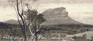
Thirty miles to the north-east of Mount Zero, which marks the
termination of the Grampians in a northerly direction, there rises abruptly from the dead
level of an extensive plain abounding in miniature lakes, both salt and fresh —these
lying sometimes almost side by side —a curiously fantastic mass of rock, one thousand
one hundred and seventy-six feet in height, which has received the name of Mount Arapiles.
In its horizontal laminations and vertical fissures, it resembles the stupendous
foundation walls of some vast edifice planned and commenced by Titans and then abandoned,
leaving Nature to adorn the ruin, according to her gracious wont, by crowning its summit
with forest trees and weaving a robe of foliage about its feet. A little to the northward
of it, surmounting a wooded mound is another columnar rock, but of very much smaller
dimensions, with a cleft-crest, whence it has derived the appellation of the Mitre Rock.
Near by is a salt-water pool which has received the name of Mitre Lake, and it stands
midway, between two sheets of water, Lake Natimuk and St. Mary’s Lake, both of which
are fresh.
 Northward of the Grampians and Mount Arapiles, the
country slopes gradually downward to the Murray, with scarcely a hill to break the
monotonous level of the landscape, and the mallee scrub commences within about seven miles
from the Mitre Rock. In the sandy soil of the district, the trees, from which it takes
its’ name, thrive amidst the most discouraging circumstances, covering the ground so
thickly in places as to form a perfect jungle, interweaving their sombre foliage overhead
and having their stems interlaced at times by a species of wild vine, or liana, as supple
as cordage when it is twining round them, and as rigid as a wire cable when it has got
them well within its grip. Lowan, in which Mount Arapiles is situated, takes, its name
from a native bird, also variously entitled the brush turkey, the mallee pheasant, and the
mallee hen, the Megapodus Tumulus of naturalists. It is somewhat larger than a
good-sized fowl, and it lays its eggs, which are disproportionally large, in an artificial
mound constructed by the co-operation of many pairs of birds, by whom they are annually
enlarged and repaired. Some of these tumuli are fifteen feet high with a like
circumference; but a large one when measured was found to be no less than fifty yards
round its base. They are, entered by a funnel-like cavity at the top, and the eggs are
laid six feet below the surface, each hen depositing one in a cavity twenty inches from
its neighbours, and then covering it with soil and carefully smoothing over the surface.
The eggs are placed vertically, are laid during the night at intervals of several days,
and are about the size of those of a goose. They are hatched by the heat of the soil in
which they are placed; but the mallee hen is so shy, and at the same time so vigilant,
that it is difficult to say whether the parent birds assist their young in escaping from
the grave in which the eggs have been buried.
Northward of the Grampians and Mount Arapiles, the
country slopes gradually downward to the Murray, with scarcely a hill to break the
monotonous level of the landscape, and the mallee scrub commences within about seven miles
from the Mitre Rock. In the sandy soil of the district, the trees, from which it takes
its’ name, thrive amidst the most discouraging circumstances, covering the ground so
thickly in places as to form a perfect jungle, interweaving their sombre foliage overhead
and having their stems interlaced at times by a species of wild vine, or liana, as supple
as cordage when it is twining round them, and as rigid as a wire cable when it has got
them well within its grip. Lowan, in which Mount Arapiles is situated, takes, its name
from a native bird, also variously entitled the brush turkey, the mallee pheasant, and the
mallee hen, the Megapodus Tumulus of naturalists. It is somewhat larger than a
good-sized fowl, and it lays its eggs, which are disproportionally large, in an artificial
mound constructed by the co-operation of many pairs of birds, by whom they are annually
enlarged and repaired. Some of these tumuli are fifteen feet high with a like
circumference; but a large one when measured was found to be no less than fifty yards
round its base. They are, entered by a funnel-like cavity at the top, and the eggs are
laid six feet below the surface, each hen depositing one in a cavity twenty inches from
its neighbours, and then covering it with soil and carefully smoothing over the surface.
The eggs are placed vertically, are laid during the night at intervals of several days,
and are about the size of those of a goose. They are hatched by the heat of the soil in
which they are placed; but the mallee hen is so shy, and at the same time so vigilant,
that it is difficult to say whether the parent birds assist their young in escaping from
the grave in which the eggs have been buried.cont...
click here to return to main page