DESCRIPTIVE SKETCH
OF VICTORIA
Atlas Page 51
By James Smith
THE EAST 3...
With its sylvan surroundings, Euroa is one of the pleasantest places on
this part of the northeastern line of railway. A stream, which has received the name of
the Seven Creeks, from its combining the waters of as many brooks that take their rise
among the neighbouring ranges, doubles back upon itself so often as to form a succession
of little promontories and peninsulas and as its banks are overhung by noble trees, and
its course obstructed in many places by fallen trunks, it presents, at almost every bend,
a charming motif for the landscape painter. At the back of the town, and only a few
miles to the southeast of the old coach road to the border, Mount Balmattum uplifts its
shaggy bulk, clothed with forests to the very summit; while somewhat to the eastward, an
unnamed range, resembling a horse-shoe in form, constitutes a strikingly picturesque
background to the landscape.
The coach road from Euroa to Mansfield passes through a winding valley
watered by the Seven Creeks, and the bottom lands on either side are covered with trees
that have been ringed; this gives the scene an air of desolation, which is only relieved
by the spring tresses of the weeping willows that have been planted by the water’s
side, and by the bright blossoms of the orchard trees encircling the rude habitations of
the free-selectors. 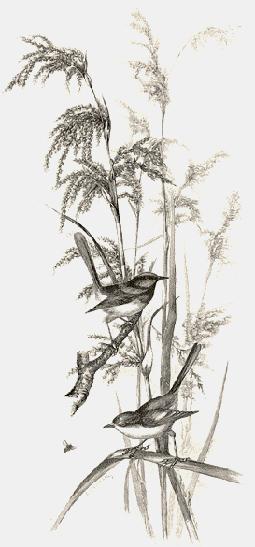 The lofty ranges flanking the valley are of
granitic formation, and masses of that stone protrude from the surface of the slopes in
huge bosses, dolmens, cromlechs, cleft cones that resemble mitres, and gigantic ledges and
tables that might be readily mistaken for Druidical altar stones. After a while the broad
bush track, in which much of the indigenous timber is still standing, rises and falls over
a succession of foot-hills skirting a valley dotted with fat cattle and densely wooded in
places. Presently there looms in sight a mountain, something like a truncated pyramid in
shape, bearing the native name of Gooram Gooram Gong, and clothed with timber from base to
ridge. Here the road begins to ascend the sinuous course of a narrow gorge, through which
a stream comes foaming down with passionate impetuosity over a series of granite ledges,
rising higher and higher as they curve backward for a distance of half a mile or more, so
as to present a series of rapids and cascades. The banks are matted with tangled fern and
bracken, the sombre tints of which serve to heighten by contrast the brightness of the
golden blossoms of the wattle that shed a shower of delicate perfume on the pure cool air.
When the oddly named Watchbox Creek has been passed, the country becomes wilder in
character, and the road-climbs the shoulder of the Big Hill. A deep ravine yawns upon the
right hand side of the ascent, with a mountain runnel making a pleasant melody of its own
in the dim recesses far below; while, above the moist and shadowy fern-gullies which
conceal it from view, vast cubes of granite, embedded in the precipitous slopes, are
completely overlaid with a delicate tapestry of green and russet mosses speckled with
white and yellow lichens. As soon as the road has crossed the ridge, about one thousand
six hundred feet above the sea-level, the geological formation of the country changes
abruptly to sandstone, and a gradual descent leads down to the village of Merton, fringing
the banks of a creek of the same name, and then, by way of Brankett, to Doon, whose
"banks and braes" bloom as "fresh and fair" as those of its Scottish
prototype. The valley hereabouts is not more than half a mile wide, and the rolling owns,
which form its boundary on either side, fall into plaits and folds like the skirts of so
many voluminous robes arranged by an old Greek sculptor to exhibit graceful lines and.
strongly accentuated lights and shadows. These undulating tracts offer a succession of
lovely pictures to the eye, with here and there the purple crests of the Strathbogie
Ranges peering above the softly-rounded summits on the left. Beyond Maindample, the hills
flow down into, a broader valley, where the dreary uniformity of dog-leg fences is
pleasantly broken, in places, by blackberry hedges, and Mansfield is eventually reached at
the end of a long straight approach.
The lofty ranges flanking the valley are of
granitic formation, and masses of that stone protrude from the surface of the slopes in
huge bosses, dolmens, cromlechs, cleft cones that resemble mitres, and gigantic ledges and
tables that might be readily mistaken for Druidical altar stones. After a while the broad
bush track, in which much of the indigenous timber is still standing, rises and falls over
a succession of foot-hills skirting a valley dotted with fat cattle and densely wooded in
places. Presently there looms in sight a mountain, something like a truncated pyramid in
shape, bearing the native name of Gooram Gooram Gong, and clothed with timber from base to
ridge. Here the road begins to ascend the sinuous course of a narrow gorge, through which
a stream comes foaming down with passionate impetuosity over a series of granite ledges,
rising higher and higher as they curve backward for a distance of half a mile or more, so
as to present a series of rapids and cascades. The banks are matted with tangled fern and
bracken, the sombre tints of which serve to heighten by contrast the brightness of the
golden blossoms of the wattle that shed a shower of delicate perfume on the pure cool air.
When the oddly named Watchbox Creek has been passed, the country becomes wilder in
character, and the road-climbs the shoulder of the Big Hill. A deep ravine yawns upon the
right hand side of the ascent, with a mountain runnel making a pleasant melody of its own
in the dim recesses far below; while, above the moist and shadowy fern-gullies which
conceal it from view, vast cubes of granite, embedded in the precipitous slopes, are
completely overlaid with a delicate tapestry of green and russet mosses speckled with
white and yellow lichens. As soon as the road has crossed the ridge, about one thousand
six hundred feet above the sea-level, the geological formation of the country changes
abruptly to sandstone, and a gradual descent leads down to the village of Merton, fringing
the banks of a creek of the same name, and then, by way of Brankett, to Doon, whose
"banks and braes" bloom as "fresh and fair" as those of its Scottish
prototype. The valley hereabouts is not more than half a mile wide, and the rolling owns,
which form its boundary on either side, fall into plaits and folds like the skirts of so
many voluminous robes arranged by an old Greek sculptor to exhibit graceful lines and.
strongly accentuated lights and shadows. These undulating tracts offer a succession of
lovely pictures to the eye, with here and there the purple crests of the Strathbogie
Ranges peering above the softly-rounded summits on the left. Beyond Maindample, the hills
flow down into, a broader valley, where the dreary uniformity of dog-leg fences is
pleasantly broken, in places, by blackberry hedges, and Mansfield is eventually reached at
the end of a long straight approach.
The town is cruciform in plan, two streets, each three chains wide,
crossing each other at right angles, their point of intersection being marked by a marble
monument, erected by public subscription, to the memory of Michael Kennedy, Thomas
Lonigan, and Michael Scanlan, who were murdered by the Kelly gang, as described in a
previous page. The street running east and west has been planted with elm, pine, and gum
trees, and will at some future date form a handsome boulevard. In the southern arm of the
transverse thoroughfare are the shire hall, the public hospital, a State school, the
public gardens, and two churches. Its broad perspective is terminated by the undulating
outline of a group of lightly- timbered hills; in one of these, about half a mile from its
base, is a cave, reported to have been a hiding place of the Kellys; a number of wild
goats now make it their lair. It is about one hundred and fifty feet deep and nine feet
high just beyond the entrance, while the roof is composed of cemented gravel largely
intermixed with sea-shells, arranged in horizontal courses, and showing the gradual
upheaval to which all this portion of the Australian continent must have been subjected
during the lapse of incalculable ages. Looking northward, the prospect is closed in by the
Blue Ranges, stretching away to the westward, and by an almost isolated and flat-topped
hill which has received the name of the Haystack. Against the western sky a saddle-backed
eminence with two cones locally known as the Paps constitutes a striking figure at sunset
when thrown into strong relief by bars of crimson and orange, or by a smooth expanse of
cloudless amber or delicate primrose; while, in the east, Mount Warrambat, the fissures
indenting its summit still white with snow, and Mount Buller, the top of which glitters
with its fleecy burden like a mirror of burnished silver, offer grander outlines and more
majestic proportions to the view.
Nearer Mansfield, in the same direction and within an easy walk of the
town, a remarkable freak of nature invites examination. It has received the appropriate
name of Battery Hill, for its level summit and a number of terraces upon its slope are as
smooth and regular in their formation as if they had been executed by human labour, under
the direction of a military engineer, to serve as platforms for the reception of heavy
ordnance to be employed in shelling the town, which lies about three miles distant from
these singular earthworks.
The county of Delatite, of ‘Which Mansfield may be considered the chef-lieu,
is separated from that of Moira by the north eastern railway, which follows the boundary
line from Avenel to Wangaratta, the intervening stations not previously noticed being
those of Violet Town, Baddaginnie, Benalla, and Glenrowan. Of these, the only place of
importance is Benalla, which is pleasantly situated on the Broken River, and is one of the
oldest, most prosperous and progressive settlements in this part of Victoria. Its
vineyards cover four hundred and fifty acres, and the wines of the district justly bear a
high reputation.  There are something like forty
thousand acres under cultivation for cereals, and an equal area of the pasture land in the
neighbourhood has been laid down with English grasses, which appear to be peculiarly well
adapted to the soil and climate; large quantities of excellent stock are profitably raised
here for the Melbourne and local markets.
There are something like forty
thousand acres under cultivation for cereals, and an equal area of the pasture land in the
neighbourhood has been laid down with English grasses, which appear to be peculiarly well
adapted to the soil and climate; large quantities of excellent stock are profitably raised
here for the Melbourne and local markets.
Glenrowan, which has acquired a certain notoriety in connection with the
tragic incidents already narrated, lies in a gap of the range, which, commencing at Mount
Keilawarra, runs down in a southerly direction for fifty Miles, throws out two long
lateral spurs, and then abruptly ceases. Ten miles farther on, the train halts at
Wangaratta, lying at the junction of the Ovens and King Rivers, and in the immediate
vicinity of the alluvial flats known as the Oxley Plains. The town is the manufacturing
and commercial centre of a splendid agricultural and horticultural district, and its
flour-mills, foundries, breweries, and tannery find plenty of employment in supplying the
wants of a populous neighbourhood; while its four churches, public hospital, court-house,
town hall, banks, public library, and racecourse, combine to show that it is what
Americans would call "a live town." Four miles from Wangaratta a line branches
off to Beechworth, and at the Springs another line diverges to Rutherglen and Wahgunyah;
but the trunk railway pursues its course to Wodonga at a short distance from the Murray,
which is here bridged so as to unite the two railway lines connecting the capital of New
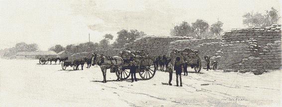
South Wales with that of Victoria. Numerous sawmills have been established at Wodonga,
which lies upon a creek of the same name, and large quantities of timber are brought down
for their use from the sylvan regions watered by the Mitta Mitta and the Upper Murray.
This was, in November, 1824, the crossing place of Hume and Hovell, who effected the
transit by means of a rude punt constructed of wattle saplings with a tarpaulin stretched
over it. A little lower down the river, just beyond the hamlet of Haines, is the historic
spot where Major Mitchell crossed the Murray in October, 1836, after having traversed the
whole of the country —which he named Australia Felix —from Portland to
Mount Ochtertyre, on the south side of the river. Many of the towns on its banks exist but
in name, the only places of real importance being Wahgunyah and Yarrawonga the former is
united by a bridge to Corowa, on the opposite side of the Murray, and has a good
background of agricultural and pastoral country. Yarrawonga, which is the terminus of a
branch line of railway from Benalla, is the county town of a shire of that name covering
an area of upwards of eight hundred square miles, and, although it is scarcely twelve
years old, it has already attained the civic development which would have been the work of
half a century in older countries. The place is in daily communication, by means of a
coach, with Numurkah, the present terminus of a loop-line which joins the northeastern
railway at Mangalore. Some idea may be formed of the progress of agriculture in the
surrounding country from the fact that since the year 1875 upwards of six hundred thousand
acres of land have been entirely cleared of timber in the county of Moira, and that from
Numurkah alone no less than three hundred thousand bags of wheat are annually forwarded by
railway to Melbourne. Even as late as the middle of September the station is encumbered by
two huge stacks of grain sacks to the number of five or six thousand, with no other
shelter from the weather than such as can be afforded by tarpaulins stretched over them.
Numurkah itself is more compact and substantial than most rural towns, and if its
prosperity is to be gauged by its annual expenditure on fermented liquors —an amount
estimated by an expert at forty-five thousand pounds sterling per annum —it must be
flourishing in the extreme.
Proceeding southward, the line passes through a perfectly level country
until it reaches Seymour. In fact, the whole of the country westward of the one hundred
and forty-sixth meridian is one vast plain; a solitary eminence, Mount Major, which rises
to a height of one thousand two hundred and fifty feet, near Cashel, being the only
exception to the rule. 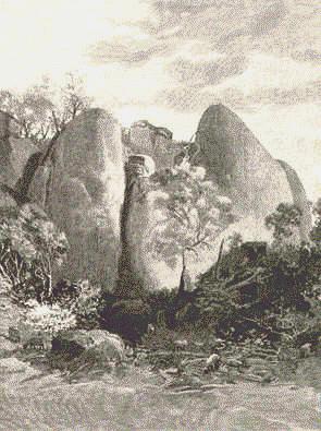 The country was originally thickly timbered, and
millions of ringed trees still remain to attest the richness of the soil in which they are
rooted. But not an acre of land, apart from a limited number of government reserves,
remains unalienated, and the shire town of Shepparton, twenty miles south of Numurkah, is
the centre of one of the most densely-settled and fertile agricultural districts of the
colony, extending forty miles to the westward, sixty miles to the eastward, fifty miles to
the northward, and the same distance to the southward. The average production is something
like twenty-five to thirty-five bushels of wheat to the acre, and the pasture land,
watered by, five rivers, and creeks innumerable, is capable in many instances of carrying
from two to three sheep to the acre, and is let, in some cases, at from six to seven
shillings per acre for grazing purposes. Twenty years ago a single tenement marked the
site of the future township; to-day it is a thriving place, containing seven places of
worship, a handsome town hall, four banks, a shire hall, flour-mills, a brewery, sawmills,
an agricultural, horticultural, and pastoral society, and a number of streets two chains
wide planted with elm, pine and pimento trees. There is a Queen’s Park of four acres
in the centre of the town, and a reserve of one hundred acres for a botanical garden on
the banks of the Goulburn. A beautiful combination of wood and water lends a
picturesqueness to Shepparton, of which the flatness of the surrounding country would
otherwise deprive it. The river coils around it in voluminous folds, its flood-waters
forming, in certain seasons, numerous bayous, lagoons, and inlets which inherit the
serpentine propensities of the parent stream; and the banks of all these are margined by
red-gum and box-trees of stately growth and abundant foliage, happily protected from
destruction by special reservation.
The country was originally thickly timbered, and
millions of ringed trees still remain to attest the richness of the soil in which they are
rooted. But not an acre of land, apart from a limited number of government reserves,
remains unalienated, and the shire town of Shepparton, twenty miles south of Numurkah, is
the centre of one of the most densely-settled and fertile agricultural districts of the
colony, extending forty miles to the westward, sixty miles to the eastward, fifty miles to
the northward, and the same distance to the southward. The average production is something
like twenty-five to thirty-five bushels of wheat to the acre, and the pasture land,
watered by, five rivers, and creeks innumerable, is capable in many instances of carrying
from two to three sheep to the acre, and is let, in some cases, at from six to seven
shillings per acre for grazing purposes. Twenty years ago a single tenement marked the
site of the future township; to-day it is a thriving place, containing seven places of
worship, a handsome town hall, four banks, a shire hall, flour-mills, a brewery, sawmills,
an agricultural, horticultural, and pastoral society, and a number of streets two chains
wide planted with elm, pine and pimento trees. There is a Queen’s Park of four acres
in the centre of the town, and a reserve of one hundred acres for a botanical garden on
the banks of the Goulburn. A beautiful combination of wood and water lends a
picturesqueness to Shepparton, of which the flatness of the surrounding country would
otherwise deprive it. The river coils around it in voluminous folds, its flood-waters
forming, in certain seasons, numerous bayous, lagoons, and inlets which inherit the
serpentine propensities of the parent stream; and the banks of all these are margined by
red-gum and box-trees of stately growth and abundant foliage, happily protected from
destruction by special reservation.
From Shepparton to Moroopna the country is as level as the fens of
Lincolnshire or the marshes of Holland; but its flatness is relieved by frequent glimpses
of the Goulburn, sinuous in its course, and always flowing underneath a lofty arcade of
living trees. On the way to Arcadia, the river is crossed twice in its erratic career, and
in every direction may be seen large areas of land which have been brought under
cultivation —wheatfields of forty and fifty acres each —with every here and
there the weather-board and zinc-roofed cottage of the free-selector; with a herd of kine
grazing in the home-paddock, and perhaps a score or two of sheep nibbling the succulent
grasses which have grown up in the pastures and which rapidly develop their quality
wherever the trees have been killed by ringing.
Arcadia must have been so named in humorous affirmation of its utter
unlikeness to its Greek namesake, for there are no rugged mountains or gloomy defiles, the
soil is the reverse of sterile, the climate is anything but harsh, and there are no bears
or wolves to affright the settlers in the district; but it undoubtedly resembles the
imaginary Arcadia described by Sannazaro in his prose poem, with its "delightful
plain" covered with verdure, and its majestic trees amidst which an imaginative
visitor might be pardoned for expecting to hear "the murmur of a happy Pan."
There is no change in the character of the country between Arcadia and Murchison, a busy
town on the banks of the Goulburn, surrounded by a large area of agricultural land; nor is
it until the train approaches Mangalore that the level line of the eastern horizon is
broken by a low range of hills tracing its flowing outline against the sky.
At Seymour, the up train from Nurmurkah may be quitted for the down
train to the Beechworth junction, which passes Euroa and Benalla, described in a preceding
page. The branch line to Beechworth lies through the little villages of Terrawingee and
Everton, in each of which the current of existence seems to creep along as leisurely as a
Dutch canal through a flat and spongy marsh. But, by way of compensation, the situation of
both is exceedingly salubrious, and the surrounding scenery is full of a wild
picturesqueness peculiarly Australian.
Should the latter part of the journey be made at the close of the
afternoon or the beginning of the evening, there may be witnessed some magnificent sunset
effects, heightened in the splendour of their colour by the sombre tints of the
far-stretching aisles of living forest giants that frame with their leafy arms the
evanescent glories of the west, where bars of purple cloud are drawn across a lustrous
expanse of the purest amber which changes first to a glowing orange, next to a fiery red,
then to a pale primrose, and finally fades away through a soft green into a cold gray,
while the purple bars assume the colour of indigo, and the brief twilight is superseded by
the spectral gloom and mysterious indistinctness of night.
Beechworth is one thousand seven hundred and seventy-five feet above
sea-level, and its railway, branching from the Sydney line at Wangaratta, climbs one
thousand feet in the last ten miles. The granite hills upon which it is perched, and which
fill the whole landscape when viewed from any considerable elevation, fold one upon
another until their outlines are lost in the haze of the horizon. As they are clothed with
primeval forest from their rounded crests to the deep ravines that intersect them
—the Greyish tint of the eucalyptus being everywhere mixed with the bright green of
the stalwart Murray pines —the guide-book statement that "the scenery around the
township is unsurpassed" is one that is seldom challenged. From the One-tree Hill,
from Feely’s Rock, from Ingram’s Rock, from the head of the Reid’s Creek
waterfall, dashing four hundred feet down from its narrow gorge to the historic valley of
the Woolshed, the prospect is as charming as heart can desire and much more charming than
pen can describe, especially towards evening, when the distant ranges take, with the
colours of the sunset, a tender bloom that is like the down on ripe fruit in autumn. On
the last-named lofty stand-point, the outcropping boulders —some of them of immense
size —are embroidered with moss and lichen, and fringed with ferns, of which between
thirty, and forty varieties have been collected in the district; and at the proper season
the thin scrub breaks out into flowers —ericas, orchids, boronias, the purple
kennedya and wild clematis, and a multitude more —the gum trees are feathered with
delicate red leaves, and the ever-lovely wattle lights up gray rock and green sward as
only wattle can. With these, looking in the direction of the town, the orchard colours
blend or contrast, but as soon as the spectator turns in an opposite direction he has an
immediate sense of being alone in the primitive wilderness. There is not so much as a
bird’s note to be heard, and it requires a keen eye to discover the signs of human
habitation. A wreath of smoke here, that might easily be a little blue mist amongst the
trees; a tiny clearing there, a fair-sized farm, perhaps, but a mere speck in the rolling
sea of scrub; a bridge spanning a watercourse like a strand of a spider’s web a
faintly-speckled, blurred patch in the lap of the more distant hills indicating a
neighbouring village: these are all. It is easy to pass them over, and to imagine oneself
in a world where no man has ever set his foot.
 It is, however, very hard to imagine, in such a vast
solitude, where nature is so strong and looks as if she had never been interfered with,
that not so very long ago there were twenty thousand diggers camped around, and as wild a
set as any, to be met with in the pages of Bret Harte. The place where they worked and
played —from the May Day Hills, as the original Beechworth was called, to Sebastopol
and El Dorado —this very Reid’s Creek valley, which, from the head of the falls,
looks as green and quiet as an old grave, is a kind of hallowed ground here, within
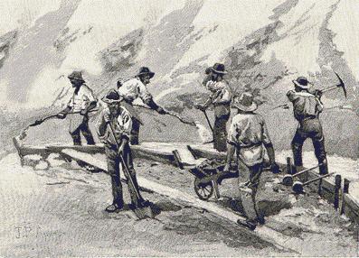
fourteen years, ending June, 1866, between three and four million ounces of gold were
extracted from the soil; here, the miners, having chosen one of their number to represent
them in parliament, subscribed the necessary two thousand pounds’ qualification in
two minutes, and, when he was elected, shod his horse with gold that he might ride in
befitting triumph and splendour up the stony heights to Beechworth; here they lit their
pipes with bank-notes and played skittles with uncorked champagne —freight charged on
goods from Melbourne being at that time sixty pounds a ton —and now there is not a
trace of them left. Nature has obliterated all signs of pick and shovel from that part of
the once famous goldfield which is visible from the point of view named.
It is, however, very hard to imagine, in such a vast
solitude, where nature is so strong and looks as if she had never been interfered with,
that not so very long ago there were twenty thousand diggers camped around, and as wild a
set as any, to be met with in the pages of Bret Harte. The place where they worked and
played —from the May Day Hills, as the original Beechworth was called, to Sebastopol
and El Dorado —this very Reid’s Creek valley, which, from the head of the falls,
looks as green and quiet as an old grave, is a kind of hallowed ground here, within
fourteen years, ending June, 1866, between three and four million ounces of gold were
extracted from the soil; here, the miners, having chosen one of their number to represent
them in parliament, subscribed the necessary two thousand pounds’ qualification in
two minutes, and, when he was elected, shod his horse with gold that he might ride in
befitting triumph and splendour up the stony heights to Beechworth; here they lit their
pipes with bank-notes and played skittles with uncorked champagne —freight charged on
goods from Melbourne being at that time sixty pounds a ton —and now there is not a
trace of them left. Nature has obliterated all signs of pick and shovel from that part of
the once famous goldfield which is visible from the point of view named.
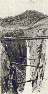
The "good old times" are gone. Mining now —sluicing and
quartz-reefing —is carried on with the usual difficulty, and the usual varying
success. . Large sums of money have been spent on various works, the most important of
which is a tunnel bored through the solid granite of the hill on which the town stands;
and this was made by the Rocky Mountain sluicing company to provide a fall for their waste
water; and the spirit of enterprise is still active. But it is a humdrum industry in these
days compared with what it was in those exciting times. The face of nature is not much
marred by its operations. Many of the "races" are seen by the highway traveller
only, as rills by the roadside, overgrown with ferns, or as rapids flowing down a narrow
ravine; the flumes are few and unobtrusive, and no hideous poppet-heads disfigure the
landscape. Beechworth was born of the Ovens rush about thirty-five years ago, and calls
itself a mining town still, but it has ceased to rely upon its gold-yield for its
prosperity and its good name. Its strong points now are its important government
institutions, its virtues as a sanatorium —known even in England, whence consumptive
patients have been sent to its dry and bracing air —and its attractions as a centre
of beautiful scenery easily accessible from Melbourne.
 It is delightfully situated
on its breezy hill, of which the English-looking square tower of the Episcopalian Church
marks the highest point, surrounded by a gully, and beyond that by more hills, amongst
which the great Buffalo rises head and shoulders above the rest, crowned, for more than
half the year, with a glittering diadem of snow. The hard white streets are neither sloppy
in wet weather nor dusty in dry; their side-paths are shaded with English trees; the
substantial public buildings are mostly built of the white granite quarried in the
neighbourhood; the comfortable, trim houses and gardens show scarcely a trace of neglect
or squalor, and an exquisite cleanliness and brightness seem to characterise everything in
this rare and stainless atmosphere. These things lend a charm to Beechworth that is
wanting in many other country towns, and its principal edifices are grouped in and around
it with harmonious effect, the most central being the county gaol —the grimness of
which is softened, to those outside it, by the shadow of a close girdle of elm trees
—and the most conspicuous the lunatic asylum, which displays its white facade, seven
hundred and sixty feet in length, on a neighbouring hillside.
It is delightfully situated
on its breezy hill, of which the English-looking square tower of the Episcopalian Church
marks the highest point, surrounded by a gully, and beyond that by more hills, amongst
which the great Buffalo rises head and shoulders above the rest, crowned, for more than
half the year, with a glittering diadem of snow. The hard white streets are neither sloppy
in wet weather nor dusty in dry; their side-paths are shaded with English trees; the
substantial public buildings are mostly built of the white granite quarried in the
neighbourhood; the comfortable, trim houses and gardens show scarcely a trace of neglect
or squalor, and an exquisite cleanliness and brightness seem to characterise everything in
this rare and stainless atmosphere. These things lend a charm to Beechworth that is
wanting in many other country towns, and its principal edifices are grouped in and around
it with harmonious effect, the most central being the county gaol —the grimness of
which is softened, to those outside it, by the shadow of a close girdle of elm trees
—and the most conspicuous the lunatic asylum, which displays its white facade, seven
hundred and sixty feet in length, on a neighbouring hillside.
The drives out of Beechworth, as might be expected from the nature of
the country, are all picturesque. The road to Stanley, six miles away, makes an ascent of
seven hundred feet before reaching the brow of the hollow in which nestles the little
hamlet; it is planted with English trees, and wears the same neat and self-respecting air
that characterises its more important neighbour. Six miles farther up, the summit of Mount
Stanley, three thousand four hundred and forty-four feet high, commands a far-spreading
outlook over a billowy expanse of wooded hills rolling to the horizon on every side; the
vision irresistibly suggesting to the imagination the heaving bosom of the ocean as seen
from the deck of some steam leviathan. There are the Blue Alps, which become white in
winter, the Strathbogie and the Dividing Ranges, the valleys of the Ovens and the King, of
the Snowy Creek and the Mitta Mitta, combining to present an impressive panorama of the
mountain country, in which such small things as towns are invisible.
To Yackandandah, fifteen miles from Beechworth, the road is down hill
for the most part, and the deep descent of the first and last few miles will not be
forgotten by anyone who has made it on a fine Jay; especially memorable is that turn in
the gap from which the valley, wherein the little place lies amid its vineyards and
hawthorn hedges, suddenly opens out at one’s feel, closed by a great blue mountain at
the other end. The road to Myrtleford and Bright, again, is extremely picturesque. Down
the steep and winding Buckland Gap, overhung with its ferny banks and peppermint gum
trees, it is romantic indeed, dappled with sun and shade like a woodland path in England.
Beyond Bright, beyond Harrietville, up in the Alpine regions, where the snow is over a
man’s head in winter, the beauty of this hill-country reaches its majestic
culmination. Standing here, on Mount Hotham or the Razorback, or on Feathertop, or on the
lower Mount St. Bernard, above the "Hospice," the highest habitation in
Victoria, the spectator looks out upon the widest sea of all, where the larger mountain
waves are between six and seven thousand feet high, and the vastness of the prospect is
such as words could not adequately describe.  The lonely heights
are unvisited in winter, as are Alpine heights elsewhere, the passes being "closed in
the regular Alpine fashion. It snows in Beechworth a little —on June 6th, 1887, there
were five feet of it upon the ground —and it snows in Stanley more; but here the snow
falls and lies for nine months of the year, and night after night the "Hospice"
is buried in it, so that the inmates have to dig their way to daylight in the morning.
"On the Dargo track" the casual traveller perishes in the whirling storm and the
treacherous drift, and the mailman in his snowshoes is apt to lose his way, because all
his guide-poles are covered. But in summer the Alps are accessible in every direction, and
their wild peaks and precipices, their deep valleys and gorges, their thousand rills and
waterfalls, their stately forests —where the solemn silence is invaded only by the
sound of the woodman’s axe or his cross-cut saw, mutilating the trunk of a
many-centuried tree —their lights and shadows, their sunrises and sunsets are joys
for ever to the lover of nature, who, in seeking them, is not afraid to rough it a little.
And this paradise of the picturesque in Victoria is only a dozen hours’ distant from
Melbourne. A crescent-shaped line drawn in an easterly and southerly direction from
Beechworth to Marysville, by way of Mount Selwyn, would bisect a tract of country as
mountainous and as beautiful as many parts of Switzerland, comprehending virgin solitudes
hitherto unpenetrated by human foot, and forest sanctuaries which have witnessed the
procession of incalculable centuries, and secluded valleys known only to the bell-bird and
paroquet, and secret springs and hidden streams diffusing a perpetual freshness and
maintaining, generation after generation, a perennial verdure without a human witness of
their silent beneficence.
The lonely heights
are unvisited in winter, as are Alpine heights elsewhere, the passes being "closed in
the regular Alpine fashion. It snows in Beechworth a little —on June 6th, 1887, there
were five feet of it upon the ground —and it snows in Stanley more; but here the snow
falls and lies for nine months of the year, and night after night the "Hospice"
is buried in it, so that the inmates have to dig their way to daylight in the morning.
"On the Dargo track" the casual traveller perishes in the whirling storm and the
treacherous drift, and the mailman in his snowshoes is apt to lose his way, because all
his guide-poles are covered. But in summer the Alps are accessible in every direction, and
their wild peaks and precipices, their deep valleys and gorges, their thousand rills and
waterfalls, their stately forests —where the solemn silence is invaded only by the
sound of the woodman’s axe or his cross-cut saw, mutilating the trunk of a
many-centuried tree —their lights and shadows, their sunrises and sunsets are joys
for ever to the lover of nature, who, in seeking them, is not afraid to rough it a little.
And this paradise of the picturesque in Victoria is only a dozen hours’ distant from
Melbourne. A crescent-shaped line drawn in an easterly and southerly direction from
Beechworth to Marysville, by way of Mount Selwyn, would bisect a tract of country as
mountainous and as beautiful as many parts of Switzerland, comprehending virgin solitudes
hitherto unpenetrated by human foot, and forest sanctuaries which have witnessed the
procession of incalculable centuries, and secluded valleys known only to the bell-bird and
paroquet, and secret springs and hidden streams diffusing a perpetual freshness and
maintaining, generation after generation, a perennial verdure without a human witness of
their silent beneficence.
The colony, of Victoria, it will be apparent from what has gone before,
comprises four distinct regions, in each of which the scenery possesses characteristics
special to itself and differentiating it from all the rest. The first and largest of these
divisions, which constitutes the north-western portion of the colony, extends from the
South Australian boundary on the west to the river Goulburn on the east, and from the
Murray on the north to within thirty miles of the thirty-seventh parallel of latitude on
the south. It consists for the most part of extensive plains, in which the rainfall does
not average so much as ten inches per annum in the westerly portion, and varies from ten
to fifteen inches in the country lying between the Wimmera and the Campaspe Rivers. It is
mainly pastoral country, and of second and third-rate quality. Salt lakes, sand hills, and
large tracts of mallee scrub and saltbush render this region uninviting to the eye; and
specially favourable terms have had to be offered to settlers to induce them to reclaim
the mallee country. A few isolated hills of no great altitude break the monotony of the
plains, and between the Loddon and the Goulburn the country changes, and this leads us to
the next great division.
 The second region, which is substantially the north-eastern
quarter of the colony, may be described as being bounded by the Goulburn on the west, by
the Murray on the north, by the boundary of the colony on the east, and by the watershed
of the Great Dividing Range on the south. The southern portion of this district
constitutes the Alpine region of Victoria; the streams nearly all flow to the north,
draining into the Murray, and the warm exposure gives to agriculture a stimulating summer
and a rapid development of vegetation in all die rich bottom lands. The district
comprehends a maze of mountain ranges possessing most of the features of the lower
Pyrenees, but nowhere high enough to reach the limit of perpetual snow, and everywhere
giving birth to perennial springs and streams, and enfolding valleys remarkable for their
fertility and beauty. Clothed, as a general rule, with forests to their very summits, but
lifting up, in places, imposing cliffs of bare granite, these ranges offer a succession of
majestic forms and a mass of splendid colour to the admiration of the artist. Their slopes
are furrowed by tiny cataracts which maintain a perpetual freshness and verdure in the
shadowy cloisters with which Nature has overarched them, employing for that purpose the
dark pillars and curving fronds of the moisture-loving tree-ferns, the aromatic shrubs
which abound in such localities filling the air with perfume, and rising like incense to
the spirit of the scene.
The second region, which is substantially the north-eastern
quarter of the colony, may be described as being bounded by the Goulburn on the west, by
the Murray on the north, by the boundary of the colony on the east, and by the watershed
of the Great Dividing Range on the south. The southern portion of this district
constitutes the Alpine region of Victoria; the streams nearly all flow to the north,
draining into the Murray, and the warm exposure gives to agriculture a stimulating summer
and a rapid development of vegetation in all die rich bottom lands. The district
comprehends a maze of mountain ranges possessing most of the features of the lower
Pyrenees, but nowhere high enough to reach the limit of perpetual snow, and everywhere
giving birth to perennial springs and streams, and enfolding valleys remarkable for their
fertility and beauty. Clothed, as a general rule, with forests to their very summits, but
lifting up, in places, imposing cliffs of bare granite, these ranges offer a succession of
majestic forms and a mass of splendid colour to the admiration of the artist. Their slopes
are furrowed by tiny cataracts which maintain a perpetual freshness and verdure in the
shadowy cloisters with which Nature has overarched them, employing for that purpose the
dark pillars and curving fronds of the moisture-loving tree-ferns, the aromatic shrubs
which abound in such localities filling the air with perfume, and rising like incense to
the spirit of the scene.
The third of the great divisions of the colony is the area lying south
of the watershed of the Great Dividing Range, with the boundary of New South Wales on its
north-east, the Ninety-mile Beach and the ocean for its south-east boundary, and the Baw
Baw Ranges for its western limit. This district, which is the southeast corner of the
colony, and includes the fertile province of Gippsland, may be called the Lombardy of
Victoria. Its grassy plains are watered by numerous rivers which take their rise in the
mountains to the north; its lakes and inlets teem with fish; its climate is cooler and
more genial than that of the country lying on the other side of the Great Divide, for its
slopes face to the south; and its coast scenery in the neighbourhood of Wilson’s
Promontory is as romantic in its grandeur as the environs of Lake Tyers are tender in
their sylvan beauty and peaceful seclusion.
The fourth region embraces the whole of the western district lying
between the Baw Baw Ranges on the east and the South Australian boundary on the west, the
main divide of the colony on the north, and the ocean on the south. It includes Melbourne,
Ballarat, Geelong, Hamilton, and Portland, and may be likened, in many respects, to
Tuscany, not less fair and not less fertile, with the river Hopkins for its Arno, Lake
Corangamite for its Thrasymene, the Mount Otway Ranges for its Apennines, and the shores
of Portland Bay for its Riviera. I t comprehends the greater part of the
territory to which Sir Thomas Mitchell, in the ardour of his first discovery, gave the
name of Australia Felix, and which, upon closer acquaintance, has proved itself
worthy of the title. Within its limits were all the first settlements from which have
radiated the exploration and occupation which have made Victoria what it is.
t comprehends the greater part of the
territory to which Sir Thomas Mitchell, in the ardour of his first discovery, gave the
name of Australia Felix, and which, upon closer acquaintance, has proved itself
worthy of the title. Within its limits were all the first settlements from which have
radiated the exploration and occupation which have made Victoria what it is.
Upon the diversified landscape scenery of all these regions time may be
expected to bestow the consecration and the charm which that of older countries derives
from history, poetry and legend, thus linking the majesty and loveliness of nature with
human interests, affections, aspirations, and achievements; so that what are virgin
solitudes to-day will be hallowed in the eyes of future generations by the vanished
presence, and sanctified by the beneficent lives, of men and women who will have
distinguished themselves by their genius, their greatness, or their goodness, and with
hundreds of localities that are now unnamed or unnoticed will be associated —"Images
and precious thoughts that cannot die, and cannot be destroyed."
click here to return to main page