

The plan after Puerto Vallarta was to head back to La Paz and spend another Year cruising in the Sea of Cortez. However, we had become familiar with the notion that cruising plans seem to be somewhat evanescent, typically described as being written in sand or Jello. John was asked, and agreed to help out an ex-colleague with a research project they had worked on together, thereby committing to several monthly trips back to San Diego. We still planned to cruise but modified those plans to include stays in Marinas where Trick would be well protected during the hurricane season. San Carlos and Guaymas are only a couple of days sailing from Bahia Los Angeles.
The journey back to La Paz started out somewhat inauspiciously with almost no wind and what little there was, coming from the direction of La Paz. We motored out to Isla Isabella and anchored overnight to check the propeller and figure out why we were making such poor speed. The propeller was fine so we figured that our (GPS) speed was being affected by a Southerly current. You can see how calm the sea was during this trip. It took us three and a half days of continuous motoring to return to La Paz where we had arranged to meet up with friends Paul and Rebecca and spend a week with them cruising the local islands.

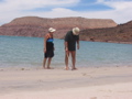
Here they are wandering the beach at Ballandra on the mainland just North of La Paz. It is almost inconceivable that such a wonderful spot so close to a large city would be so deserted. Perhaps because there are so many similar places close by.
It was then time for a trip back to San Diego. Our radar proved to be irreparable and there were a few other boat items that we needed to pick up. Most are much cheaper in the US. For example, a gallon of epoxy in the US retails for about $90 whereas it costs $120 in Mexico. Other things, such as aluminum propane tanks and stainless rail fittings we found to be cheaper in Mexico.

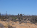
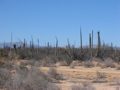

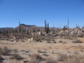
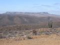
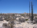
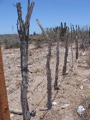
We had chosen to try out the bus in one of our previous trips back to the US. It was a fascinating trip, although Patricia found the 19-hour journey from Loreto a little tiring as she doesn't sleep well while traveling. This time we decided to rent a car to ease the logistics of getting heavy goods back from the US. A 2-week rental cost about the same as air travel but we wanted to turn it into a mini-vacation and spend some time exploring the interior of Baja. If you walk into a car rental operation in Mexico, you are likely to be charged $70 per day for a rental with insurance. Book the same car over the internet and the price may be only half of that. We're getting used to haggling over prices, but it still seems a little strange, especially for car rentals at such places as Hertz and Avis. Baja is a wild and desolate country with about 2 million people spread out over an area as big as the US state of California and the desert scenery was like nothing we'd ever seen before. Not least because of the scale of it, spending the best part of some days in the wilderness between as we drove from one town to another. The pictures here are from the area around Catavina, a small town surrounded by National Park.
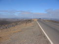
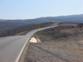


Parts of Baja are quite mountainous and many of the roads we travelled went along the peaks of mountains. The same used to be true in England where modern roads followed ancient pathways across the moors. The reasoning was that height afforded good vantage points to keep a wary eye out for brigands and the like. I wonder if this was the same in Baja. Although we didn't take photographs, some areas of Baja were under intensive cultivation with acres and acres of land under cover to retain moisture and protect from the intense sun. It still seems odd to have the sun so high in the sky that you are always standing on your own shadow.

Despite the apparent remoteness, there were people and signs of habitation everywhere. The dry desert probably preserves everything for long periods of time, so its hard to know how old things are, but it was interesting to note how people made use of the local resources. Another 'preserved' item in some areas of the desert seemed to be garbage, particularly black polythene which the farmers used to supplement the fencing around their fields, perhaps to help protect crops from winds which presumably sweep across the flat desert areas. It was interesting to see that even plastic seemed to break up into tiny pieces and become integrated into the local soil.


It took us 3 days to drive up to Los Angeles, staying in Mulege (Las Brisas del Mar hotel on the road to the lighthouse) and and a motel in Catavina for around $35 per night. We had enjoyed staying at Las Brisas on our previous road trip (the name means Sea Breeze Hotel). We even revisited El Patron - a restaurant on the beach which had great food. Las Brisas had air conditioning but we were shocked to find that we had no water on the morning of our departure. No-one was around to help until we were set to leave at around 9:30. The proprietor was most apologetic and discovered that the water (delivered by truck, 2000 liters at a time) had been turned off. Perhaps this was usual in the quiet season we visited to preserve it in the event of a leak. No-one remembered that the hotel had guests that night. Catavina was a spectacular area but the motel we stayed at was an adventure. The room was very sparsely furnished, without even a mirror in the bathroom. there was no air conditioning, but the altitude meant that the heat wasn't too bad. It wouldn't have helped too much anyway since this remote area isn't on the power grid. Like many towns in Baja, people were left to generate their own electricity, and this hotel only ran theirs between 7:30 pm and 11 pm.
We took a little longer on our trip South. Thankfully we had no problems getting through customs at the border and spent our first night in a motel in the tiny town of Santo Thomas. This was in the heart of an agricultural region, including wineries and the local restaurant served excellent locally produced food such as lamb and quail. The pictures here are of San Ignacio. First the 'yurt' in which we spent the night at the San Ignacio Springs bed and breakfast. This was the most expensive of our nights at $80 but was extremely comfortable with a magnificent cooked breakfast and unending supplies of food. San Ignacio mission on the right was one of the many old and attractive missions which dot the Baja peninsula. We also stayed at a hotel in the center of Ciudad Constitucion and enjoyed wandering the local streets sampling the delicious food from the small kiosks which lined some streets.


The picture on the left is looking across Bahia Coyote and its islands in Conception. The area around Loreto had been a favorite while we were sailing and seemed equally attractive from the road. The two pictures on the right are of Juncalito and the islands of Carmen and Danzante, where we spent so much time the previous Summer. The mountainous terrain around Loretto and for a few miles South of Puerto Escondido was spectacular. The only problem, as with much of the Gulf of California, is that the scale is so vast that it is hard to convey with pictures.
Trick's Summer cruising plans had slowly washed away over the few weeks since arriving back in La Paz. The problem was that all of the safer marinas, especially in the Northern part of the Gulf of California were full and unable to take any reservations. That meant the possibility of leaving Trick at anchor while we went back to California. There was still the possibility of turning up in a marina and finding a vacant slip, but that wasn't really compatible with our need to book flights and be in San Diego at predictable times. Reluctantly, we decided to shelve plans for cruising and head back to the mainland to the only safe Marinas that were able to offer us slips. Despite our nervousness about being far enough South to be well within the Summer hurricane belt, we chose Marina Mazatlan on the recommendation of friends who suggested it was a very safe hurricane hole.