![]()
![]()
|
|
|
|
Approach Photos
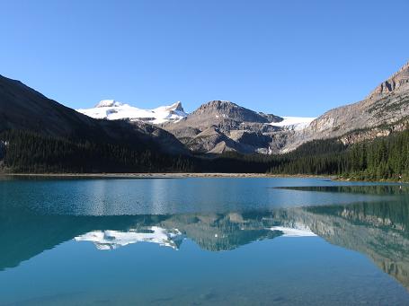
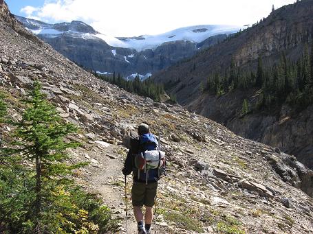
Bow Lake and the start of the climb
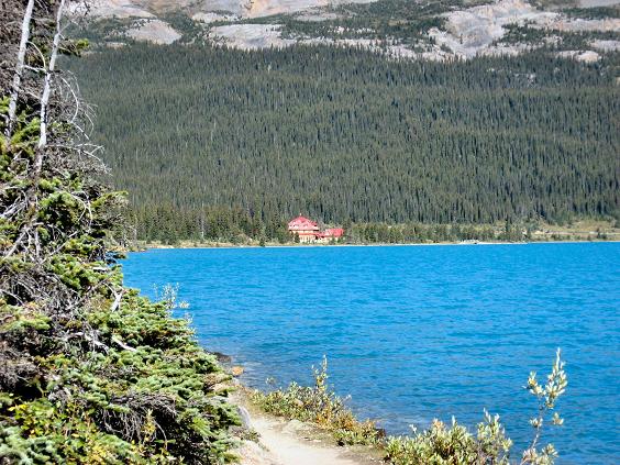
Looking back at Num-Ti-Jah lodge as you hike around Bow Lake
Looking back after you cross the chock stone after 1 hour of hiking
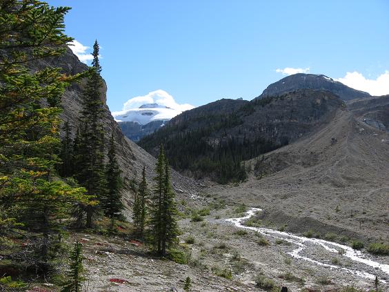
Shortly after the chock stone you go left up this valley towards Bow Hut
Heading up the valley
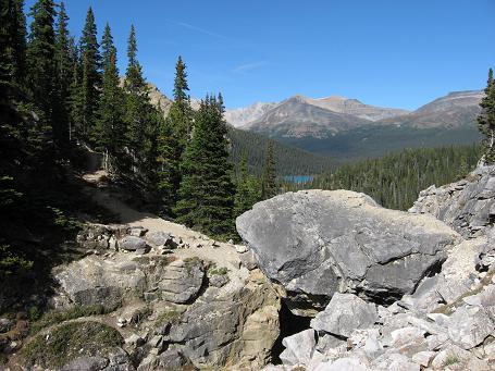
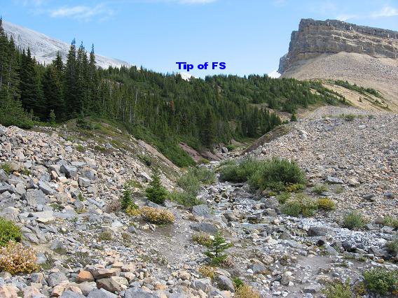
Just past this section of trail is the left turn up the creek
Left turn up this creek, you can see the false summit in the distance peeking above the trees
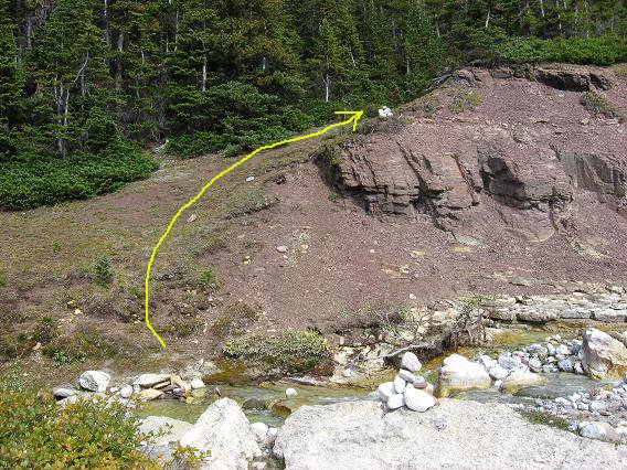
Just a minute or two up the creek you head left on the climbers trail
Once above the trees Bow Hut can be seen looking back to the west Route Photos
A view of the glacial moraine route, head right to the glacier edge then back left to directly below the false summit
Here's a view of the glacier edge as you traverse along it back to your left to a good bivy spot
A good bivy spot directly below the false summit
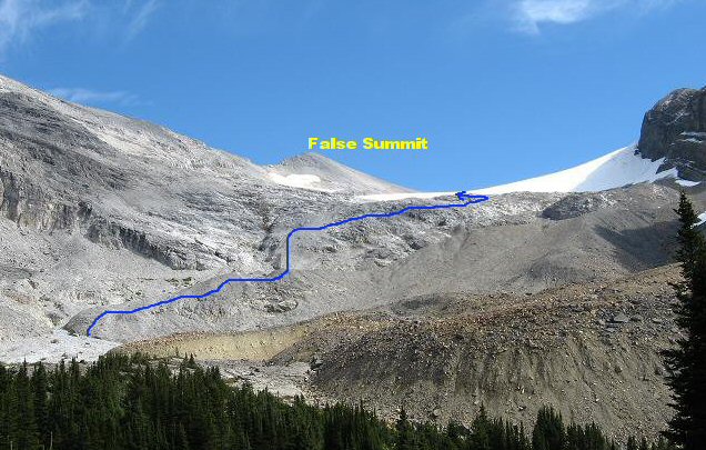
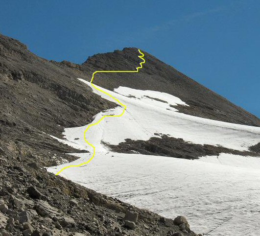
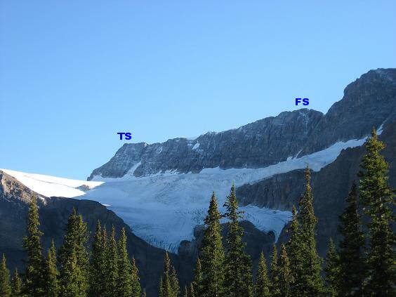
Approximate route only up the glacier and the false summit
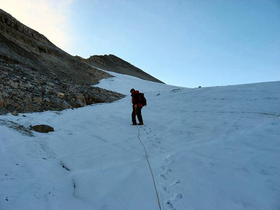
Cramponing up the glacier
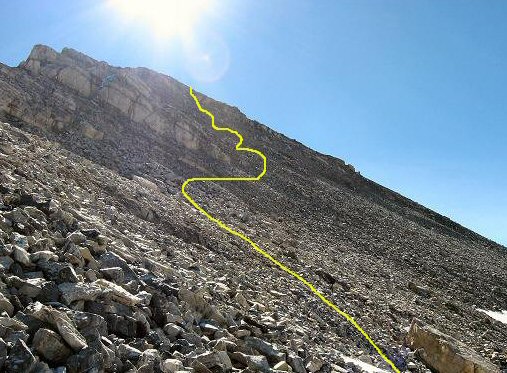
Approximate route only up the loose rocks to gain the false summit
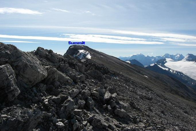
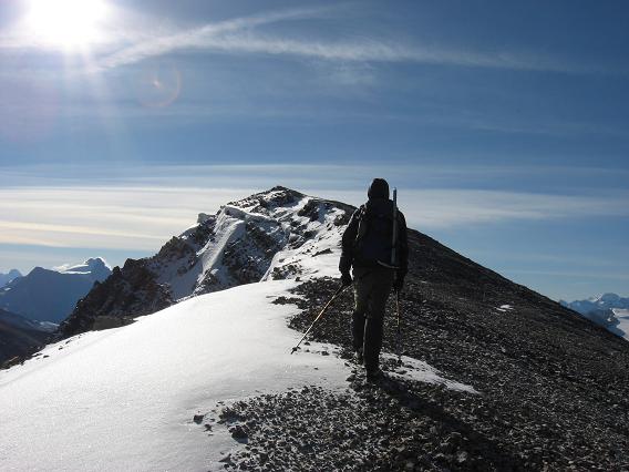
The long but enjoyable ridge walk!
Almost there, just past the high point in the picture is the summit Summit Photos
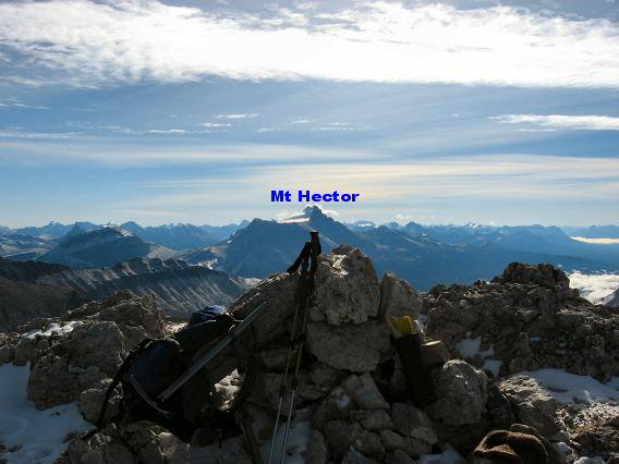
Summit at last, no identifiable entries in the register for 2007, perhaps some couldn't get open the frozen summit container, Al warmed it up in his jacket and we signed in, we did note Granticulus's entry from our attempt last fall
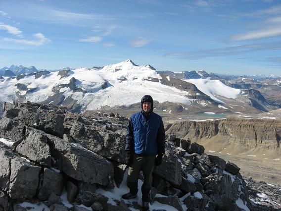
Summit photo looking southwest with Mt. Balfour in the background
From highway 93 a different look of the true summit and false summit Crowfoot Mountain Mountaineering: Class 3 with Route Finding and Glacier Crossing, Crampons, Ice Axe, and Rope necessary, Mountaineering training or going with a person with adequate mountaineering experience is required Altitude: 3,050 meters / 10,006 ft Elevation Gain: 3,570 ft, approx 10 km one way 20 km return Start Time: if late August or early September 6-8 am start allows margin of safety or take your headlamp just in case Ascent Time: 5 to 6 hours, 10-12 hours return Highlights This alpine climb is probably one of the most beautiful and scenic outings you can experience if you are fortunate enough to get a clear crisp day in late August or early September. It would be only a scramble but for the 30-40 minutes to climb the glacier. The views on the upper part of Crowfoot Mountain and the nice ridge walk are quite spectacular as Bow Hut and the Wapta Icefield is to the west and Mt Hector is to the southeast. Getting There The parking lot for the route to Crowfoot Mountain is located at the Bow Summit area which is around 44 km north of Lake Louise on highway 93. This road is the famous Icefield Parkway which goes all the way to Jasper. Once you reach the Bow Summit area turn left down the road for Num-Ti-Jah lodge. There is a day parking area and washrooms only 50 yards from the lodge. Camping If you want to get an early start Mosquito Creek Hostel is only a few kilometers back down the road towards Lake Louise. Lake Louise also has a Hostel and campground. Route Description From the parking lot walk past Num-Ti-Jah lodge and take the trail that goes counter clockwise around Bow Lake. Just under an hour walking around the lake brings you to some steps up a steep hill, head up these steps to a trail junction left goes to Bow Hut and right goes to Bow Falls. Take the left to Bow Hut and you have to climb over a large chock stone that goes across the fast moving water coming down the gorge from Bow Falls (see photo of the chock stone). You’ve covered about 3.6km to this point. From here the trail after a few minutes heads left up the valley towards Bow Hut. As you hike up this valley the long ridge of Crowfoot Mountain is on your left and the Wapta Icefield is on your right. Basically follow the trail up the valley for approx 2.5 km until you arrive at the creek flowing from your left into the valley. This is the drainage for the Crowfoot glacier. Take a left here up the creek and then after just a couple of minutes you will see the cairn to head left from the creek up a small climbers trail. This narrow almost overgrown trail will take you through the trees left of the creek to bypass a bit of steep gorge area. From here the views open up and you see the glacial moraine, the Crowfoot glacier and the false summit directly above. The true summit is not in view until you actually gain the false summit. As you approach the glacial moraine head up the mounds on the right side of the creek then follow this hilly moraine until it gradually curves a bit right. Follow it right up to the edge of the glacier then follow the terrain at the glacier’s edge as it curves back around towards the left. The far left of the upper moraine is where you can bivy if that is your plan or if you are doing the climb all in one day it is the spot where you can access the glacier to climb directly up to the false summit. See some of the photos with approximate route drawn on them. From the left at the creek it is approximately 2.3 km to the false summit. From the false summit walking on the ridge to the true summit it is approximately 1.6 km. As you are now directly below the false summit hike up along the glacier until you reach an obvious spot to don your crampons and rope up in order to climb directly up to the rocky slope below the false summit. Once at the rocky slope you will find that it is quite steep and loose (quite a bit of hands down climbing). The best route is directly up to the rocky ledges then traverse and angle up to the top from here picking your way up the most stable terrain that you can find. Once on top of the false summit you will see the long but enjoyable ridge walk that awaits you. |