
![]()
![]()
![]()
![]()
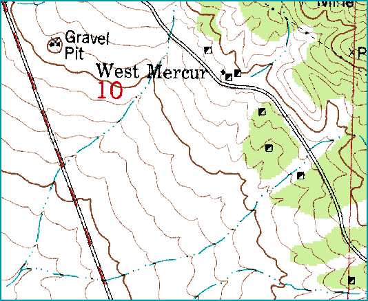
Map of West Dip
USGS 7.5 Minute Series Map "Ophir, Utah 1993"
Brief History of West Dip
There is, at least to my knowledge, not much written about West Dip. West Dip was also known as West Mercur, for the town was an outgrowth of the town of Mercur. It was settled in 1895 and contained a school, a church, and several other buildings.
In 1898 a mill was constructed, called the Daisy, which was upgraded in 1910 to use electrical machinery but was destroyed by fire in 1917. The mines around West Dip were shallow and were soon played out. But as long as Mercur (just a few miles away) was bustling with activity West Dip could feel secure in its continued existence. West Dip served as a rest stop for people and freight on their way to Mercur, and many miners lived in West Dip because they "preferred it to the high elevation of Mercur (Thompson, 20)." Unfortunately Mercur's existence wasn't all that secure and when Mercur was abandoned so was West Dip.
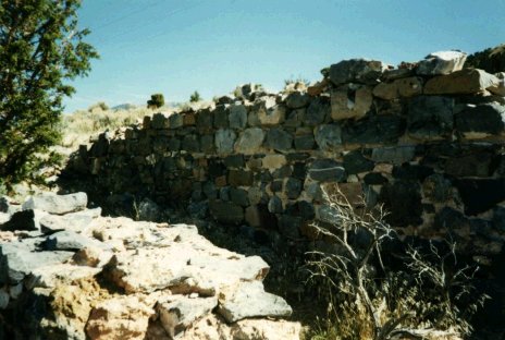
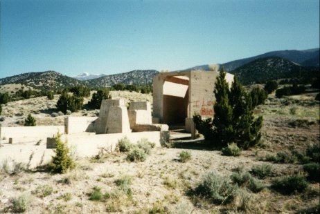
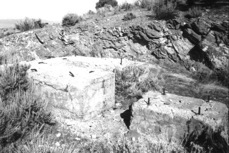
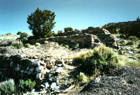
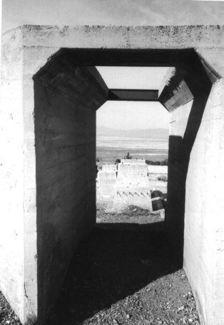
There are several rock and brick foundations in the area of West Dip. There is also a large concrete complex, probably some sort of mill or smelter, which is worth checking out. There are also a lot of verticle shafts around that aren't fenced off so watch your step (at least this was the case in 1995-1996). Measures may have been taken to secure and fence these potential hazards by the Abandoned Mine Reclamation Program. (If anyone has information on this please let me know, just send me an e-mail.)
Sources:
Carr, Stephen L. The Historical Guide to Utah Ghost Towns (page 28).
Thompson, George A. Some Dreams Die: Utah's Ghost Towns and Lost Treasures (page 20).
Pictures
Click on the thumbnail for larger photo.
All photos copyright (c) Chad Carter 2000.
All photos copyright (c) Chad Carter 2000.
All photos copyright (c) Chad Carter 2000.
All photos copyright (c) Chad Carter 2000.

Utah Ghost Towns and Mining Camps
All photos and graphics (unless noted otherwise)
copyright (c) Chad Carter 2000.
Created in 800X600 resolution.