
In case you were wondering, these maps were made by taking the downloadable map of Weyerth, cutting a peice of it, blowing that up to fill a page, printing it, tracing it onto graph paper, colouring it and scanning it.
By a freaky coincidence, the scale on these maps works out to be 8 boxes is 125 miles. The typical Norse drakkar or longship could cover about 125 miles in a day. So 8 boxes is a day's sail. Cool, neh?
Savaxia Archipelago
This map shows the island archipelago referred to by most of Weyerth as "Savaxen."
Of course, those who live on the islands know that the name "Savaxen" only applies to the
largest island in the group; on the rare occasions that they need to refer to all of the
islands they say "Savaxia." But since every island is it's own little kingdom, there's
not much call to reference the whole archipelago.
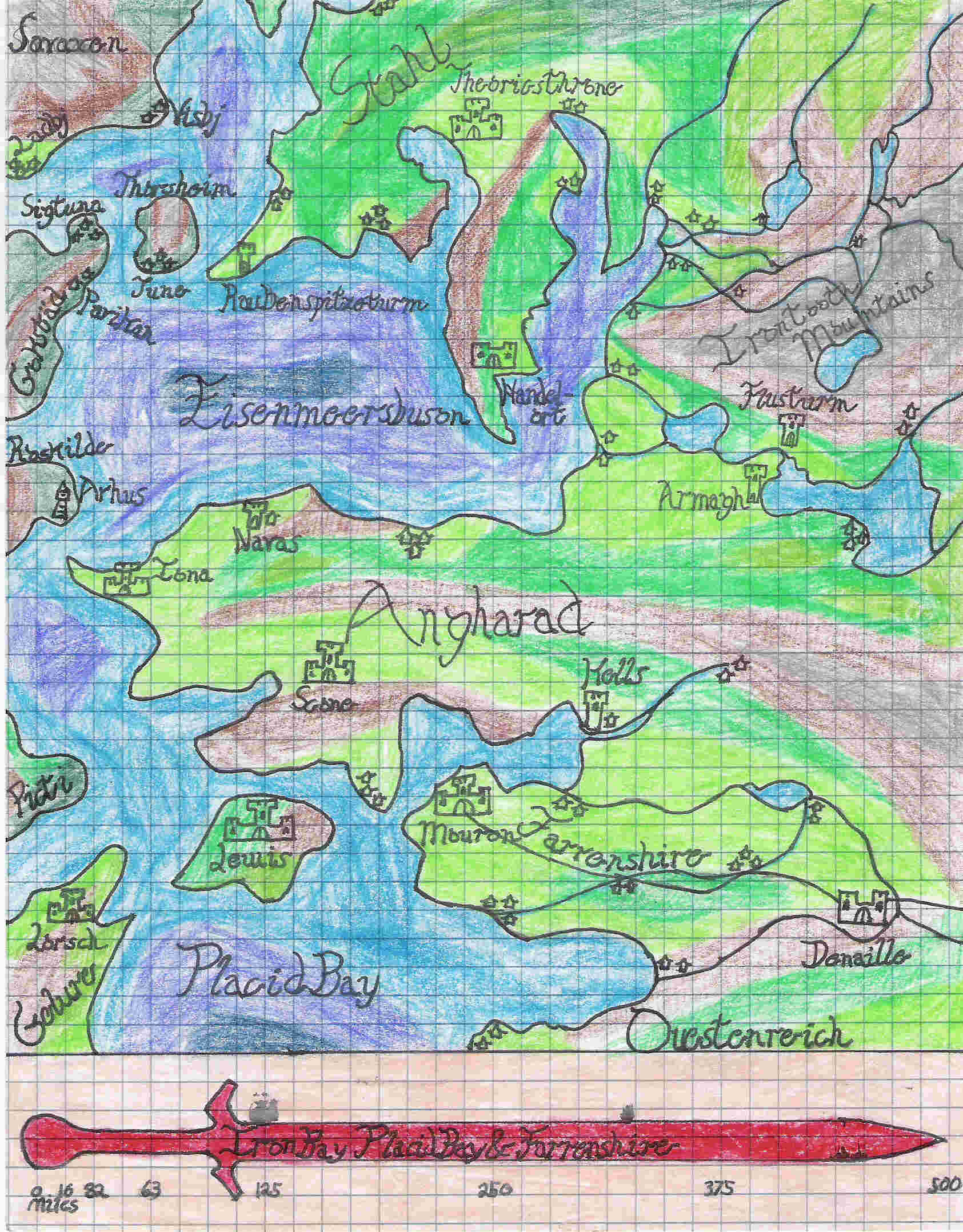
Iron Bay
This map shows the Iron Bay (or Eisenmeersbuson, in Stahlne), the bay between Stahl
and Angharad. A not uncommon destination for Savaxen ships on viking cruises, the Iron Bay
also has Handleort. Technically part of Stahl, Handleort is a free city and a major trading
port. Traditional feuds are always set aside in Handleort, even to the point of allowing
Angharad ships in to trade and recruit troops - while that country was at war with Stahl.
Mail me: vagabondelf@yahoo.ca
index.html