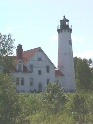

For hundreds of years, Algonquin Indians gathered on the banks of the St. Mary's River, to hold councils, to raise families, to travel down the rapids, to eat fish. They knew of few waters anywhere on the continent so abundantly supplied with fish as the river which flowed from Lake Superior to Lake Huron.
Today, thousands of Americans annually stand on these same banks and marvel at this U.P. attraction -- the Soo Locks.
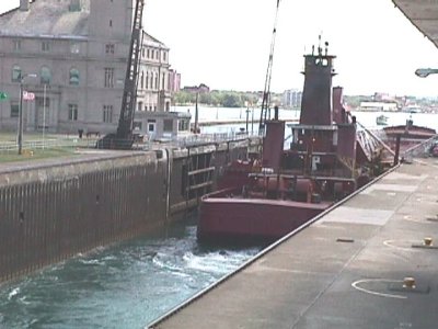
The first lock at the Sault Canal open to navigation in 1855. It's opening marked the beginning of America's great steel making industry. At only a mile long, the Sault Canal has become the greatrest waterway in the world. In the eight months per year it is open for operation it handles more freight than the Panama, Suez and Kiel Canals combined in an entire year.
Over 100 big lade steamers pass through these locks daily, carrying iron ore from the mines of Michigan, Minnesota, Wisconsin, and Canada. Wheat and other grains are also transported from western fields to lower lake ports, and on return trips coal as well as autos, machinery, furniture and other manufactured goods to Lake Superior ports.
Chippewa has a land area of 1,651 square miles. It has 294 miles of shoreline on the Great Lakes and connecting waters. It holds claim to 169 inland lakes and 800 miles of streams. For some fine fishing check out, Munuscong Bay, where big muskies are caught; Potogannissing Bay, for pike and bass, and Whitefish Bay on Lake Superior to catch a Lake Superior Trout.
The broken shoreline of the mainland and the county's many islands provide refuge for migrating ducks and geese. Chippewa has become a favorite for wildfowl hunters. If you are after big game, a large number of bear and deer inhabit the counties forested areas.
Etienne Brule, a young French secretary and interpreter of Champlain, is credited with being the first white man to come upon the Sault Rapids in 1618.
Brule named the falls "Sault de Gaston" in honor of the younger brothre of Louis XIII of France. It was later named "Le Sault de Sainte Marie" by Father Jacques Marquette a famous Jesuit explorer. The famous Indian agent and first postmaster of the town shortened the name to it's present form of Sault Ste. Marie.
A long list of explorers, fur traders and missionaries followed Brule, Jean Nicolet in 1634, the Jesuits Jogues and Raymbault in 1641, Marquette in 1668 and Peter Radisson.
Many flags have flown over the region, French, British, and American. When the French feared the English would lay claim to their fur trade, St. Lusson in 1671 took possession of all the western country in behalf of his king, Louis XIV of France. Following the capture of Quebec, the British in 1762 seized the fort which had beem erected at Sai;t Ste/ ,aroe bu tje :pios de Gardeur in 1750.
The Treaty of Paris in 1783 gave the newly formed United States all lands in the vicinity south of the Great Lakes but the British did not laeave the Upper Peninsula for several years. They remained until after the War of 1812.
Lewis Cass, then governor of the Territory of Michigan, came to the Sault in 1820 to raise the American flag and haul down the British. This action caused bitterness among the Indians, but there was no fighting. A government military post was established near the falls in 1822 to protect American rights.
The need for a lock was recongnized by a Canadian fur company and one was built in 1797. This small lock was destroyed in the War of 1812. It was not until 1855 that the first of the modern day locks was opened.