
This area is part of the village. It was surrounded by a wall of timber that fortified the whole area.

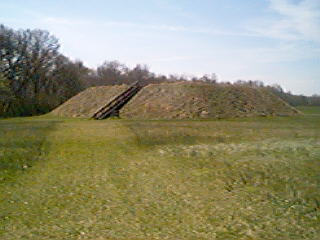
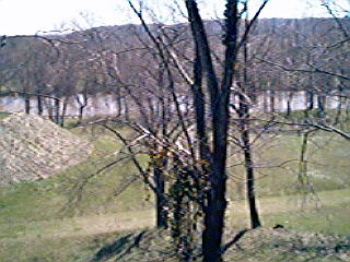
Actually this area has three mounds. Two of the mounds are about the same size, but one is a lot bigger. I am standing on the larger one looking down on one of the smaller mounds. To the right is the other smaller mound. Directly behind this mound is the Etowah River. When the water is down you can still see the fish trap that was made by the tribe. It is a line of rocks that form a "V" in the river and cause fish to be trapped. It is very interesting..
This picture was taken a few feet to the right of the last picture. The village chief had a great veiw don't you think??

Maybe this picture can give you an idea of how tall the first mound is.

I would love to know what it was like to live here along the banks of the Etowah River when this village was alive. The only way I ever will know is in my dreams. The inhabitants are long gone from here. All that remains is the telltale signs of their existence. The indian spirit still lives here along these banks. If you don't believe me, take a walk by this river sometime....you may just find it..
Join me next week for another Georgian Adventure!! Till then, go outside, it's a great place to be....


