
The coastal regions are defined by their rainforests,
mountains and, of course, the Pacific Ocean. The South Coast is the most
populous area of the province, Vancouver being the largest city. One of the most
attractive cities you'll ever see, Vancouver is home to Canada's largest urban
park, Stanley Park.
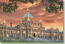
Victoria, on Vancouver Island, is the capital of the province
and the 2nd largest city. Southern Vancouver Island is generally
regarded as the garden capital of the province as well. Victoria has a
distinctly British feeling, wouldn't it be grand if the members of the
legislature would show a little more British style decorum as well? LOL

The Rocky Mountains cut through the northern half of the
province from southeast to northwest and the continental divide forms the
southern half of our (eastern) border with Alberta. Northeast of the Rockies is
the Peace River Region, the terrain there is flat and lends itself to wheat
farming. In this region you'll find the town of Dawson Creek (no relation
whatsoever to the tv show) home to "Mile 0" of the Alaska Highway.
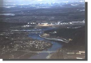
On the southwest side of the divide is the Central Interior,
anchored by the city of Prince George, the largest city in northern BC. Prince
George started out as Fort George, a Northwest Company outpost founded in 1807
by Simon Fraser. The city lies at the confluence of the Fraser and Nechako
Rivers on the heavily forested Nechako Plateau. Prince George is home to 3 pulp
mills, numerous sawmills and a whole mess of loggers. It's also a good place to
be from!
South of Prince George you'll find the Cariboo-Chilcotin and
Thompson regions, ranching and logging are mainstays there. Barkerville, near
Quesnel, was the site of The Cariboo Gold Rush of 1862 and has been restored as
a Provincial Park.
Further south, the Thompson River region, named for David
Thompson, an early explorer, is centered by the city of Kamloops. I'm trying to
think of something nice to say about Kamloops, other than (and because) I have
some nice relatives there...LOL. Seriously, though, Kamloops is a thriving city
that offers many recreational and cultural opportunities.

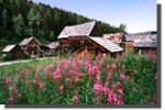
The southeastern part of the province is famous for its
cordilleran terrain. Here you'll find Yoho, Kootenay, Glacier and Mount
Revelstoke National Parks. This area is a must see for any visitor to BC, the
scenery is some of the most spectacular anywhere. It's a great place to camp,
hike or just sit around, sip your favourite beverage and ogle the mountains.
Speaking of your favourite beverage, the town of Creston, in the Kootenays is
home to the Columbia Brewing Company, makers of Kokanee Beer. In winter, as
almost anywhere in BC, there are numerous ski resorts, large and small for those
of you who enjoy sliding downhill with boards strapped to your feet. There are
no large cities in southeastern BC but many picturesque towns such as Revelstoke,
Cranbrook, Castlegar and Nelson all with their own interesting features and
histories.
Shuswap Lake, east of Kamloops is a giant with 1000 km of
shoreline. The region is a recreation magnet. It's also home to the Adams River,
where every 4 years you can see the spectacle of one of the largest sockeye
salmon runs anywhere. It's quite phenomenal...the river is solid red with
millions of spawning fishes. Just up the road from Sicamous you'll find
Craigellachie, the site where the last spike was driven into the Canadian
Pacific Railway in 1885. The promise of this railway was a deciding factor in
British Columbia joining Canada.
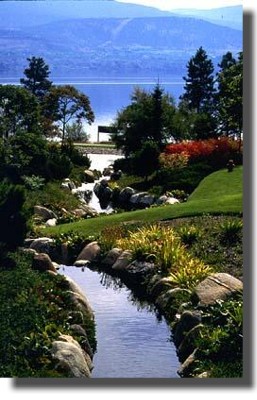
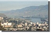
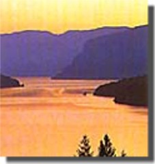
I live in the Okanagan Valley, in south-central BC. The
Okanagan is, at its southern end, the only hot desert in Canada. The valley is
dominated by 70-mile long Okanagan Lake, which drains into the Columbia River
system in Washington State. Our major industries are tourism, fruit production
and (O, shock and wonder!) forestry. We have a thriving wine producing industry
as well and I encourage you to try any wine from the Okanagan. Kelowna, a city
of about 100,000 is the largest city in the valley...and my hometown.