Crater Lake
This was to be one of the last hikes I did this summer. Ever since I found out about this lake, I have always wanted to go back to it. Crater Lake is a walk in the park for those in good physical shape, but it is 7.8 miles back to the lake. There is only around 2000 feet of elevation gain over the entire hike, so the trail is never real steep. Nancy and I started out at the Monarch Lake trailhead at around 7:00 a.m. The first 1.5 miles went really quick as it was over level ground. This brought us to the junction of the Southside Trail, which is the trail that continues around Monarch Lake. Continue following the trail to the left, this takes you another 1.7 miles to Shelter Rock Campground. This unique area has several large boulders laying in a valley and many campsites strewed about. There is only one problem: The Forest Service has now closed this area for an experimental revegetation area, thus, camping is no longer allowed. After another 0.1 mile, you meet with the junction of the Buchanan Pass trail. Continue on the Cascade trail for another 1.2 miles to Cascade Falls.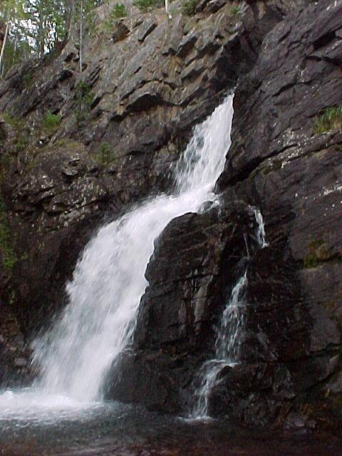 This is the first of many large waterfalls along the hike,
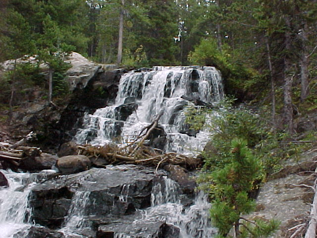 and it is well worth taking all the subsidiary trails to explore the falls. Here the trail steepens as it makes the ascent to the top of the falls and continues back through the valley and around the base of Mount Achonee. This is the peak on the right side of the trail. The trail becomes more and more faint as it switchbacks and follows the valley around the base of the peak. Once the peak is directly above you, looking behind it you can see Lone Eagle Peak on the front of the ridge that contains Crater Lake. This is a stunning peak, one rising about 1100 feet above the rim of the lake. The remainder of the hike continues south towards this mountain. The trail is very confusing in some places, and sometimes there may be as many as 4 different trails leaving from a junction. Around all the falls leading to the lake, this is not a concern as they all eventually get back to the main trail. After the 4 waterfalls you see, it becomes more difficult to find the right trail. Keep a southernly direction and you should be alright. After about 7.5 miles the trail drops and crosses a small stream, then switchbacks up a hill to the north shore of little Mirror Lake. This lake is much smaller than Crater Lake, yet interesting due to the greenish color of the water. Continue on the trail along the east side of Mirror Lake for a short distance to the northern shore line of Crater Lake. Upon first glance, Crater doesn't appear all that large, but be sure to explore around the shore to reveal all the little bays that the trees hide.
 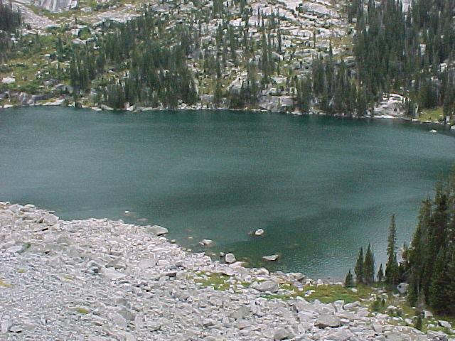 The are numerous campsites available at the lake, but be sure to check with the Ranger Station at Monarch Lake to obtain a permit for backpacking if you are going between June 1st and September 15th. The total time getting back to the lake was a little over 3 hours, but considering we took the wrong trail about 3 times, it would have been about 3 hours if we knew the correct trail.
Along with me on the hike: Nancy
Total Round Trip Time: 7 hours