|
ĀSAFEPLACE Climb-A-Thon 2001 |
|
ĀSAFEPLACE Climb-A-Thon 2001 |
At 9:30A.M. on Monday, June 18, 2001, nine climbers stood atop the 14,411 foot summit of Mount Rainier, where the temperature was ten degrees and winds were gusting over 60 mile per hour. This year, this team of climbers raised nearly $7,000 for Safeplace, in support of survivors of domestic and sexual violence by scaling Mount Rainier.Ā
The Climb-A-Thon, founded by George Sharrett in 1993, is a community-based special event in which local volunteers climb the mountain to support Safeplace, the only rape relief program and women's shelter in Thurston County, WA. Each climber collects donations for Safeplace, and then attempts to summit Mount Rainier, measuring him or herself against the snow, wind, ice, weather, and altitude of the 14,411-foot peak.
Again this year, I became the designated "Expedition Photographer", with the ultimate goal to produce another Safeplace Climb-A-Thon commemorative calendar.Ā Kevin Hauser was to help me, but became ill during the first day of ascent.Ā Under trying conditions for me, even though the weather was relatively perfect under Rainier's standards, I took approximately 80 photos.Ā From these, I have been able to pull 12 shots for each month of the calendar, along with 12 images of the actual climbers.
Calendar sales are expected to start in early October.Ā If you are interested in purchasing a calendar for $20,Ā or in making a donation to SAFEPLACE, Kevin Hauser has created an easy-to-use form on his website, www.hausers.com.
Click on an image for a full page printable version.
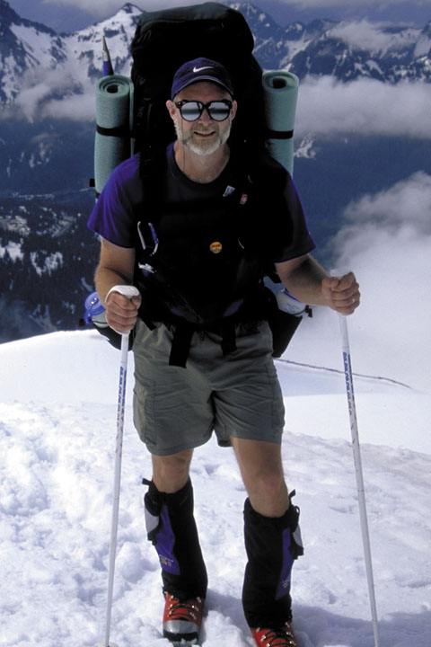
| That's me,Ā John Hayes |
 |
|
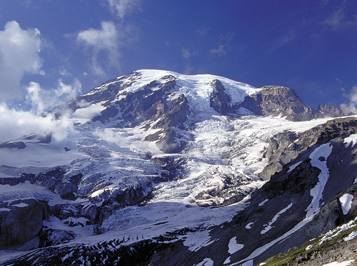
Mount Rainier - the route The route carried us across the flanks of the Nisqually Glacier, west to the Wilson Glacier.Ā Then up the "Turtle" to the Kautz Ice Wall, and finally up the Kautz Glacier to Columbia Crest and the summit.Ā |
| Paul Przbylowicz, Climb Leader |  |
|
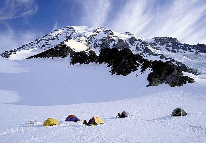
Camp 1 On the Wilson Glacier, we set up camp and practiced "self arrest" on the snow field just behind camp. |
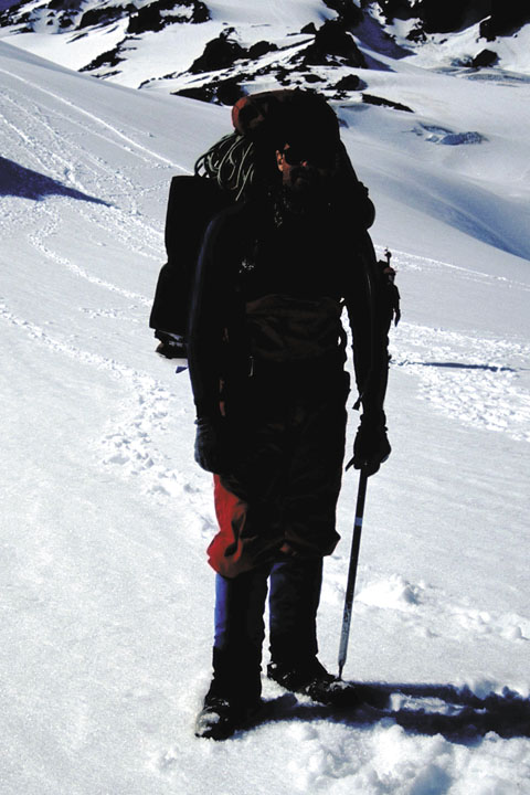
| George Sharrett, Rope Team Leader |
 |
 |
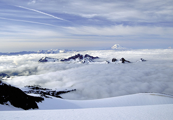
Sunset on the Tatoosh From Camp 1, the evening sunset with Mount Adams in the background. Ā |
| Tim Gregg, Rope Team Leader |
 |
 |
Another Sunset Shot of the Tatoosh |
| Molly Goodman | 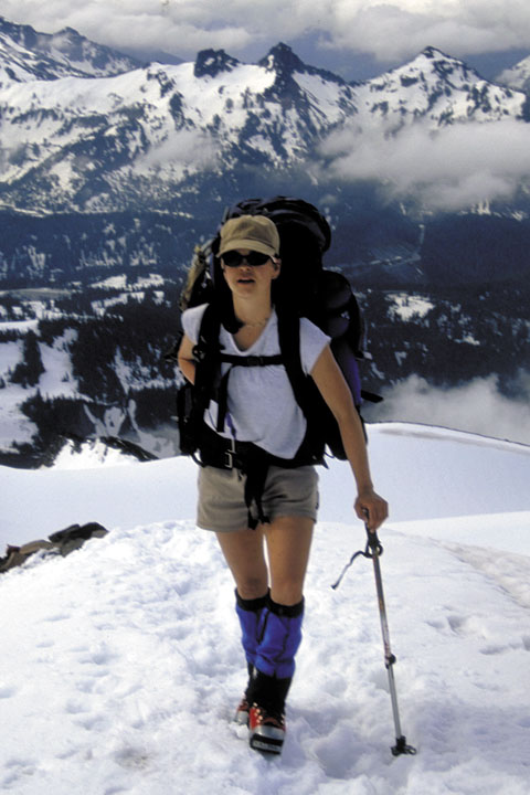 |
|
Above the Clouds The Tatoosh, with the Goat Rocks and Mt. Adams beyond. |
| Brian Kerr |  |
|
Ascending the Turtle This is a long "hog's back" ridge leading from the Wilson Glacier up to the Kautz Ice Wall.Ā This climb of 3000 feet took all of the second day. |
| Lisa Zolman | 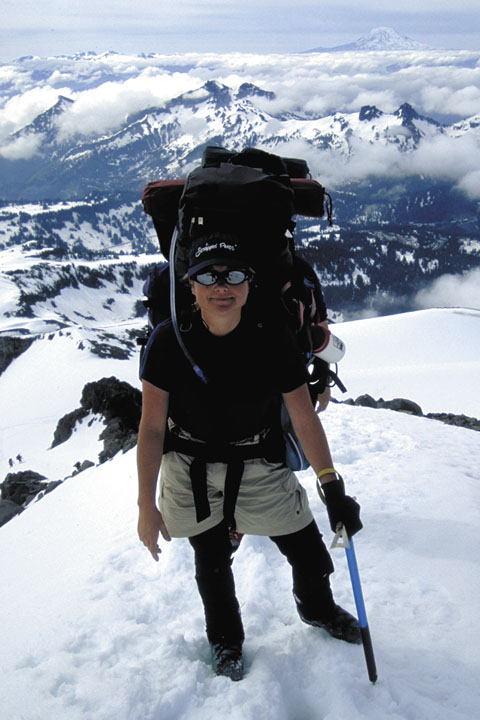 |
 |
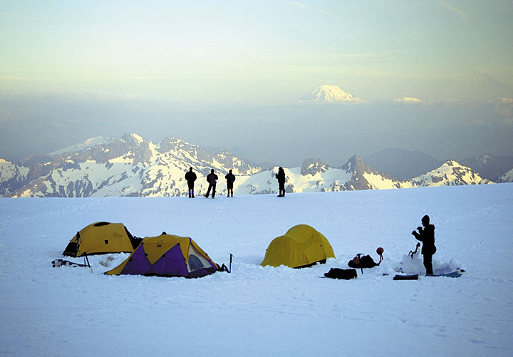
Camp 2 Camp 2 was established just below Camp Hazard below the Kautz Ice Wall.Ā There were exactly enough leveled tent spots for our group. |
| Rama Lash |  |
 |
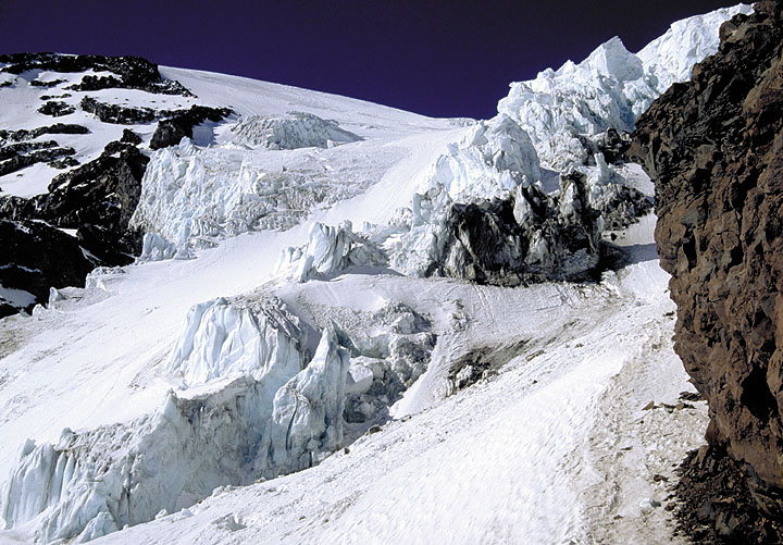
The Kautz Ice Wall Formidable at 300 feet thick and probably a 1/4 mile wide, this wall of ice is dangerous during daylight hours.Ā For this reason, we had to start our summit bid at midnightĀ |
| George Sharrett | 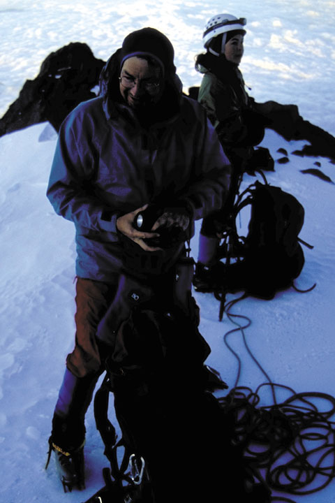 |
 |
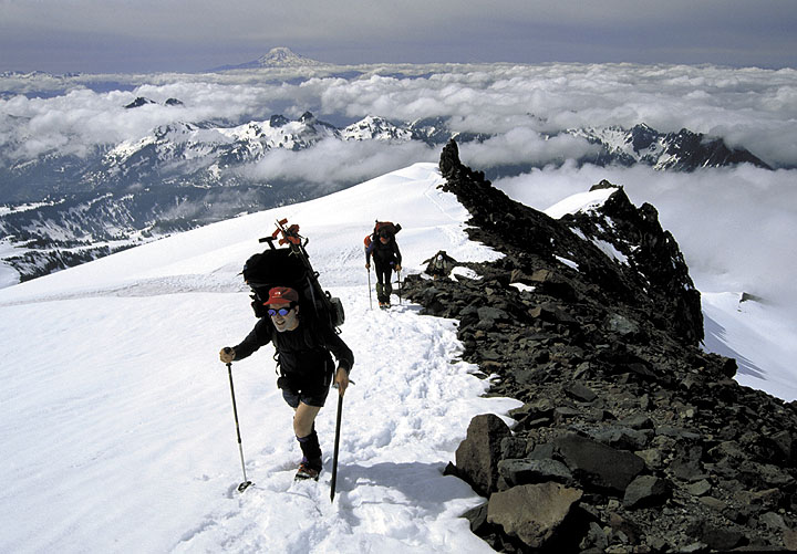
Summit Route In order to overcome the Kautz Ice Wall, we had to skirt to the left, and then make a 1000 foot ascent of the 60 degree slope in the dark with headlamps. |
| Doug Ruth | 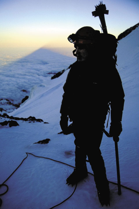 |
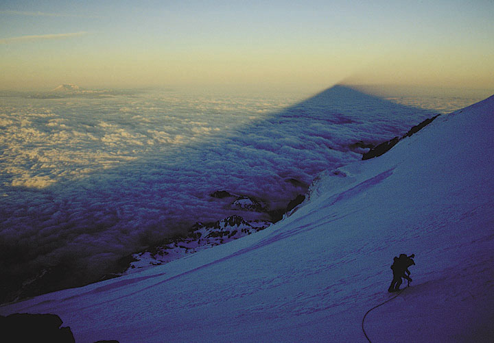 |
Rainier's Shadow Once the 1000' ascent was made, we came up onto a small ramp where we could rest and observe the sunrise.Ā Here, Rainier's shadow is cast across the top of the clouds towards the western horizon. |
| Paul Przbylowicz |  |
 |
Sunrise At 13,000 feet, we enjoyed one of the most spectacular sunrises I have ever experienced. |
| Molly Goodman | 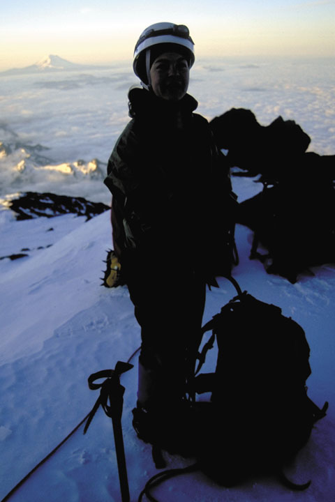 |
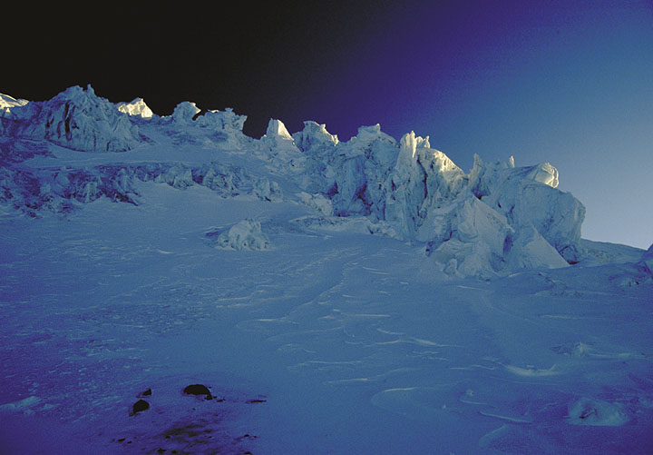 |
Ice Pinnacles Again, during the sunrise, this shot was taken looking up the mountain towards the sunrise, casting darkness to light across the backside of 100 foot tall ice pinnacles.ĀĀ |
| Ā | Ā |  |
Gearing up for final summit bid On the calendar, this image is titled "On Top of the World", as it give the sensation of being on the summit.Ā Actually, it is the location of our rest stop at 13,000 feet.Ā We still had 1400 feet to go. |
| Ā | Ā | Ā | No summit photo Sorry, I just couldn't get any summit photos.Ā It was 10 degrees, and with 60 mph winds, I was not about to pull off my gloves to take photos.Ā Some shots were taken inside the ice caves, where we took haven from the winds before starting our ascent.Ā If you need proof, I have the slides. |
 Ā
Ā