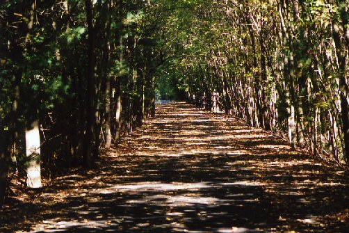
The trail continued to be pleasant for about 5 miles to the vicinity of Avon. The prettiest area was near the Nod Wildlife Preseve where there were a few good distant views.
A short distance south of Rt. 44 in Avon there is a section where the route follows roads for about a mile through an office park area. It is marked Bike Route signs, but sometimes we didn't see these but instead saw arrows on the road. It's important to have the map of this section (map4) to follow the roads. These roads are busy but have good shoulders.
North of this Avon for the next two miles, the trail was not as pretty. There was one section near a commercial area that wasn't pleasant. About 7 miles north of the starting point at Stratton Brook Rd. in Simsbury, the trail comes to and end with a sign "End of Trail". Here the route again follows roads for over a mile, but there are no signs pointing the way to this route. Here it is necessary, the have the trail map 4. We heard that this section will be under construction in 2005.
After this one mile detour, the trail continues north for another 5 miles, but we decided to return to the southern end and the bicycle along the Farmington River Trail.