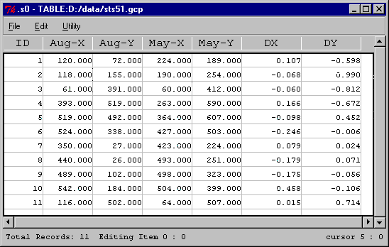
Geocorrection. Space shuttle imagery STS51B-038-0095 and STS51F-035-0011 were taken in a three-month interval over the same agriculture plain of Columbia River. An overlay display of the May and August imagery will be helpful to detect crop changes in the time interval. Coordinates of eleven control points were located from these two imagery using an XBit image GUI, view, and then output to a table widget of XBit. An XBit command calcgeocalc was then invoked from the table widget to calculate a second-order polynomial that maps a pixel coordinates from the August image to the May image. Finally, command rimage georef was performed to georeference the image of May to the image of August. The following scripts may be used:
calc geocalc -data controlPointList -order 2 -file polynormial
rimage georef -in inputImage -outoutputImage -par polynormal

view, a Tcl GUI for image analysis
table, a Tcl GUI for tabular data analysis
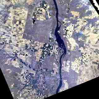
A georeferenced image of May
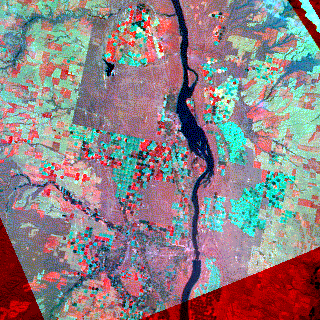
A color composite using imagery of May and August
Red: May(r), Green: Aug(g), Blue: Aug(b)