Dale woke up at 3:00 am and started driving north toward Whale Pass. The weather was overcast and drizzly all day. We were on gravel roads most of the day. The unpaved roads looked pretty good, but because the roads were so windy and narrow you couldn't go more than 30 mph. It was easy to loose traction on the curves. We saw a sign for the Rough-It General Store. We decided to take this road even though it was overgrown with bushes. After 2-3 miles he decided he didn't want to continue, which meant he had to back up all the way.
![]()
 Dale wanted to explore the north part of this island where there were two caves which have recently been opened to the public. These caves were only discovered in 1988 by studying aerial photographs. Logging had exposed some of the smaller pits in the area giving experts reason to believe there might be even more. We took Big Salt Road (Hwy 929) to Control Lake Junction. Here you turn left on Road 20 (Prince of Wales Road). After about 40 miles turn right on FR 27. Signs about 3-4 miles down the road direct you to the trailhead for the Cavern Lake Trail. A short trail leads to a deck where you can view the mouth of the Cavern Lake Cave, North America's third deepest cave. A stream comes out of this cave and flows into nearby Cavern Lake.
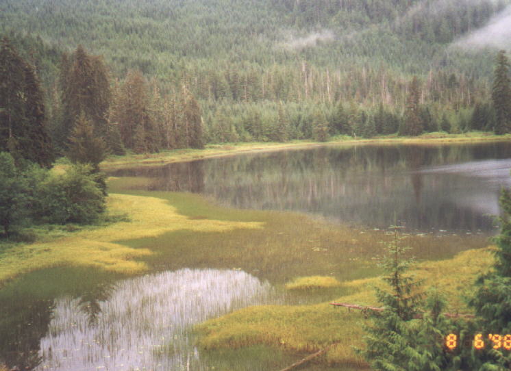
 We followed this stream to the entrance of the cave before turning back. Going back to the FR 20/27 junction and continuing north on FR20 will take you to the El Capitan Cave. This cave is approximately 600 feet deep, the deepest in North America. Bear, seal, deer and human remains have been found here, dating as far back as 41,000 years. Free two hour guided tours are offered Thursday thru Sunday at 8am (except Thursdays), 10 am, 1 pm and 3 pm. To arrange a tour in advance you can contact the Thorne Bay Ranger Station, phone 907-828-3304. We got there around 7:00 am on a Thursday and decided not to wait around another three hours for the first tour, which did not start until 10:00 am since it was a Thursday. There is steep stairway (over 370 steps) to get to the mouth of the cave. Dale and Jacob went into the cave. You can enter the first 150 feet at any time. Beyond that is a gate that can only be accessed by a guide.
Going back south we stopped near the bridge crossing Red Creek. We saw a wooden structure down by the water. Dale and Jacob walked down to the creek to explore what looked to be a very large abandoned barge buildt out of whole logs. They found some fish guts down there. 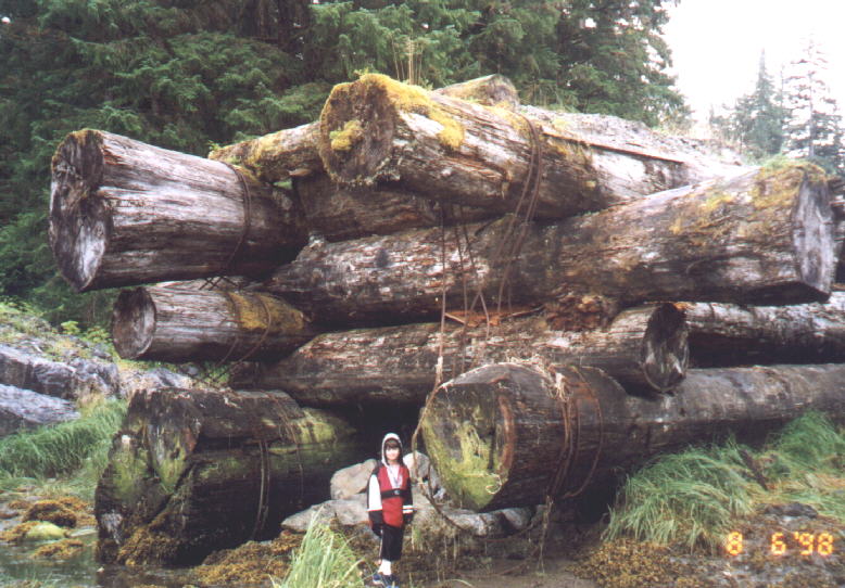
 A mile down the road we saw a black bear. We stopped at Naukati, a small community. Dale found free coffee at the Nahkati Connection. We headed east toward Coffman Cove. About 10 miles before getting there we saw another black bear. Coffman Cove was featured on 20/20 a few years ago and shortly afterwards they were barraged with people wanting to move there. It is the newest town on the island, incorporated in 1989. It was a small community with lots of new or newly buildt homes of modest size. We stopped at the Riggin Shack. It was a shack and it didn't look open but it was. We bought a picture, some coffee and some snacks. We drove past Luck Lake and stopped at Sandy Beach. This was a large beach in a cove with a picnic shelter near the parking area. This was one of the few beaches we saw in southeast Alaska with real waves. There were lots of logs on this pebbly (not sandy) beach.
We continued south and stopped at Thorne Bay for fastfood at Someplace to Go. This was another small communitiy. We took FR 2030 to the Salt Chuck Mine Trailhead. 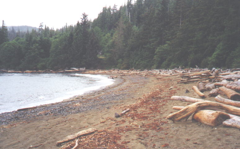
 This trail was about a mile long and went through a rainforest. There was lots of dead wood, streams and rocks to climb over. The trail came out at a cove where there was a sandy beach. To reach the old mining ruins you had to cross a stream. There was a lot of debris and buildings left behind when this mine was closed. Dale saw a paw print that belonged to either a bear or wolf. On the way back to Craig we stopped at the Eagle's Mest Campground. This campground was still under construction.
We got into Craig around 6:00 pm. We were hoping to find a hotel room for the night. Most of the rooms in town were $90-115 a night. 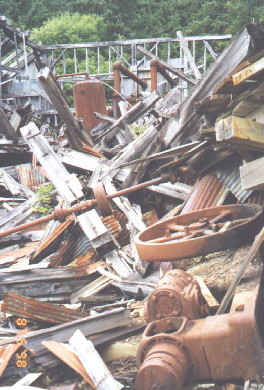
 Someone told us to go to the bar tender at Ruth Ann's, a bar and restaurant. We got a room at a hotel up the street by the same name for $90. It was a nice room done with Victorian style furnishings. We back to Ruth Ann's for dinner, which was a mistake. We had no idea their food would be so expensive until we sat down. Their cheapest meals were salads for $20. The three of us barely made it out of there on $50. We went to bed early knowing we had to be up early to catch the ferry.
300 miles today
4200 miles total
Someone told us to go to the bar tender at Ruth Ann's, a bar and restaurant. We got a room at a hotel up the street by the same name for $90. It was a nice room done with Victorian style furnishings. We back to Ruth Ann's for dinner, which was a mistake. We had no idea their food would be so expensive until we sat down. Their cheapest meals were salads for $20. The three of us barely made it out of there on $50. We went to bed early knowing we had to be up early to catch the ferry.
300 miles today
4200 miles total