Name: Siri Island, Jazireye Siri in Persian.
Province: Hormozgân , southern Iran
Island Population: 550
Transportation: Boats from Bandare Lenge
and Qešm island.
Map: Click here
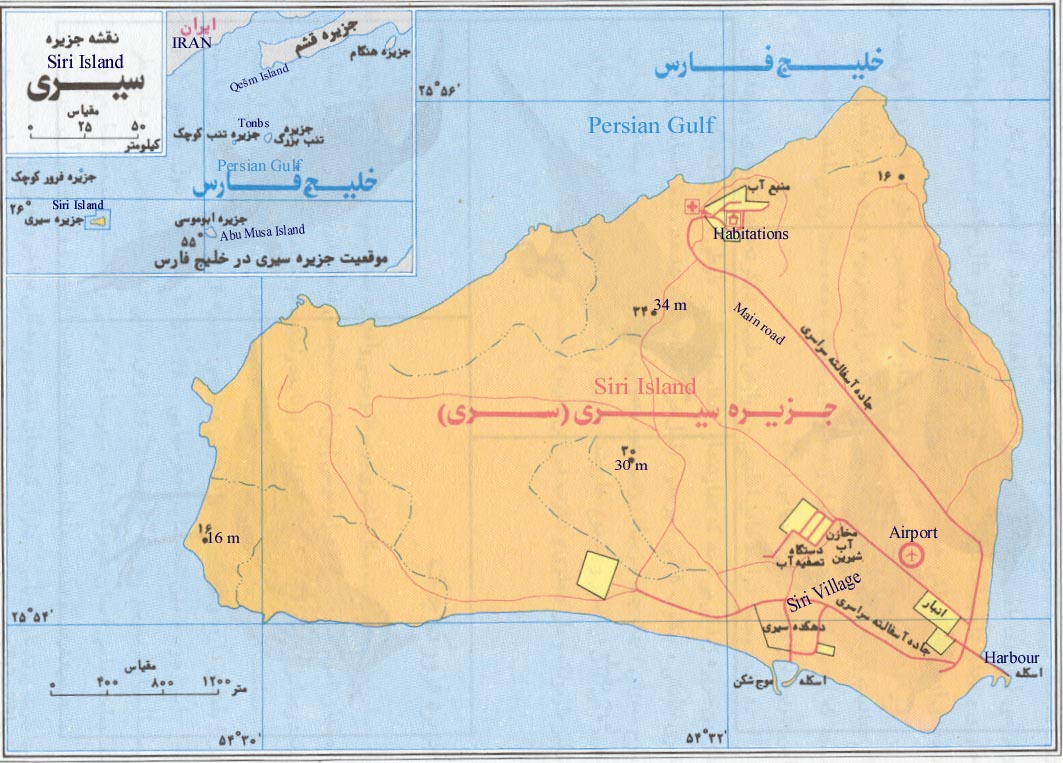

The Siri island is situated 76 km from Bandare Lenge and 50 km eastern Abu Musa island, in the
Persian Gulf. This island is located between latitudes 25- 56' and 25- 53' N. and longitudes 54- 33' and 54- 29' E and is one of six islands in Abu Mus â Island Group (Hormozg ân province) in Iran.
This island covers an area of 17.3 sq kms. The highest point on the island is 33m above the sea. Like the other islands in the Persian Gulf enjoys warm and humid climate.
There is roads around a part of the island. There is although local airport, a lighthouse, oil industry, fishing industry, post & telephone office, sport facilities, a Care Center, a cooperative store, a primary school, power station, a mosque etc on this island.
