

iRiphabliki
wase Transkei
Republic
of Transkei
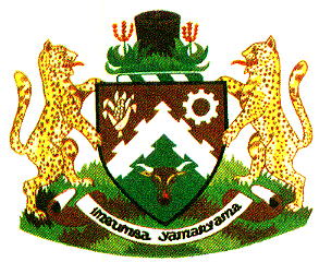
The arms of Transkei, registered by the State Herald in Pretoria and published in the South African Government Gazette on 25 September 1970, may be blazoned:
Arms: Per chevron ochre and vert, a chevron dove-tailed between in chief dexter a mealie head and sinister a cogwheel argent, and in base a bull’s head caboshed proper.
Crest: On a mount vert a wicker basket between two aloes proper.
Supporters: Two leopards proper.
Motto: Imbumba yamanyama.
Arms explained:
The colours are unusual – besides the arms of Transkei and of the University of Transkei, I know of only one other instance where ochre is used in heraldry, namely the arms of Australia’s Northern Territory. However, the choice is deliberate and appropriate.
Ochre, known in isiXhosa as ibovu, is the traditional colour of the amaXhosa and is used for marking the face – both for special markings on the face alone or on face and body, and for a general facial cover to protect from the sun.
Ochre is used especially by newly circumcised young men to mark the fact that they have recently passed from boyhood to the status of amadoda (men). For a period following their attendance at circumcision school (during which time he had been known as an inqwetha), a new indoda (man) wears ochre-coloured clay over his whole face except for openings left around his eyes, nostrils and mouth.
The clay available in Pondoland, called umcuko, is white in colour, so that colour is equally important.
Where clay is used for other kinds of decoration, all sorts of colourants are nowadays used (often make-up), but the traditional ochre and white used are clay.
Green is the colour of the hills of Transkei.
The colours of green, white and ochre also appeared in the Transkeian flag.
It is not especially apparent why the shield division is in the form of a chevron, or why the chevron is dove-tailed. However, since the chevron points upwards, it is perhaps intended to be an encouragement to aim high.
The mealie head symbolises the traditional agriculture of the Transkeian peoples. Mealie (Afrikaans mielie) is the usual South African name for maize (Zea mays), which is the grain crop most widely grown in Southern Africa. Although this plant has its origin in the Americas, it was brought to Africa by the Portuguese and was widely planted by Bantu-speaking groups in South Africa before the arrival of white settlers. In Xhosa society, the cultivation of crops is women’s work, so it is significant that this symbol appears in the prime position.
The cogwheel represents industry – the dream that manufacturing industry would flourish in an independent Transkei. It did to a limited extent, for the 18 years of Transkei’s “independence”, but that came to an end when the South African subsidies that had enabled it were withdrawn. And even during that period it was not the mainstay of the Transkeian economy, or consistently productive.
The bull’s head (also referred to as an ox head) not only points to animal husbandry as an important occupation among the rural populations of the Xhosa-speaking tribes but also underlines the significance of cattle-keeping in their traditional culture. It is also said to symbolise the development of society. The term caboshed means that the head faces forward and shows no sign of a severed neck.
The basket in the crest is used for grain storage; it symbolises the prudence of saving some of the crop to provide for lean times. This artefact is unique to the Southern Nguni.
The aloes are typical flora of Transkei. It is not stated what species they are, but they are most likely Aloe ferox, which is a striking species distributed from the Western Cape to KwaZulu-Natal and occurring as far inland from the Transkeian coast as Lesotho. Another species of aloe, A reynoldsii, is found only in Transkei, but it has yellow flowers, the inflorescences are more bushed, and the leaves have yellow spots. A ferox also appears in the arms of the Eastern Cape Province.
The crest also includes grass, which repeats the element of green (for the rolling hills) from the base of the shield.
The leopards (Leo pardus) also represent chiefly authority: it is traditional in Southern Africa that only chiefs may hunt leopard, and only chiefs or those deserving of special favour may wear leopard skin. Leopards were used for supporters by Ciskei and Bophuthatswana as well.
The motto, Imbumba yamanyama, means “Unity is strength” – it is a translation into Xhosa of the motto of South Africa (in its 1910 arms).
Peoples, languages and history:
The name Transkei indicates that it is the home of people living on the “far side” – away from Cape Town – of the Kei or Nciba River.
The Transkeian peoples are chiefly abeNguni, although Sotho-speaking groups are found along the Drakensberg foothills. The written language of these southern Nguni is isiXhosa (see Ciskei for an explanation of this).
The first entry of Nguni-speakers into the Transkeian region has been estimated at 1300; before that the region was inhabited by the aboriginal Bushmen,[1] who were hunter-gatherers, and the closely related Khoikhoi,[2] who were cattle-keepers. The precise relationship between the Nguni who settled the Transkeian region and the Khoikhoi whom they replaced is not known, but it is known that the abeNguni arrived in Southern Africa cattle-less and acquired cattle, and a cattle-related culture and language, from the Khoikhoi.
The Southern Nguni also display a strong strain of Khoisan ancestry: blood serum testing reveals that while all Bantu-speaking groups are of Negro (West African) origin, the Southern Nguni or Xhosa-speaking tribes display the highest proportion of Khoisan descent, approximating 60%. Only one other Bantu-speaking group, the Tswana-speaking Bakgalakgadi of Botswana, have Khoisan ancestry at this high level.
The Transkeian peoples first came under British rule in 1879, when Fingoland (including the mission settlements of Butterworth and Idutywa) was annexed to the Cape Colony. (For further information on the amaMfengu or Fingo people, see Ciskei.) Griqualand East, which would later for a time be part of the Transkeian Territories but was the home of the Griqua[3] of Adam Kok III, was annexed at the same time.
On 10 November 1882 the municipality of Umtata came into being on the right (western) bank of the Mthatha River. The municipality’s proclamation was quite sudden, since a military post had been established there only a few months before. But already it was apparent that this was an ideal neutral position between the abeThembu and the amaMpondo. The respective chiefs of these two warring tribes had in fact already acknowledged this fact as long ago as 1869 by granting colonists privileges to settle along the river banks. The town became the seat of a magistracy and the centre of administrative control over the territory.
In 1884, the Cape and Natal simultaneously annexed the strategically important estuary of Port St Johns. Natal later gave way, and the territory became part of the Cape.
Between 1884 and ’86, the Cape also annexed Galekaland (Willowvale district; the land of the Gcaleka Xhosa; see Ciskei), Bomvanaland (the land of the amaBomvana) and Tembuland (Kentani district; the territory occupied by the abeThembu when they first came into contact with the British).
Also annexed (but not treated as part of Transkei until 1975) was Emigrant Tembuland (initially called Tambookieland, and later named Glen Grey after Governor Sir George Grey). This district was set aside for abeThembu loyal to the regent Nonesi from 1852 onwards, and after unsuccessful attempts had been made to persuade them to move further east (to make way for white settlement), the district was annexed in the 1880s.
All of these annexations involved land west of the Mthatha River.
In 1887, the Cape Parliament passed a Bill creating two parliamentary seats in Transkei, but with tribal tenure excluded as qualification for franchise. The Bill was approved by the High Commissioner and the Colonial Office on the grounds that the exclusion was not explicitly racial.
In 1894 Pondoland (home of the amaMpondo and the related amaMpondomise) was annexed to the Cape Colony. This comprised West Pondoland, lying between the Mthatha and Mzimvubu rivers; and East Pondoland, between the (upper) Mzimvubu and (upper) Mtamvuna rivers. The territory between the lower Mzimvubu and lower Mtamvuna rivers had already been annexed by Natal in 1866 as Alfred County.
Annexation in each of the districts of Transkei was followed by the appointment of magistrates or “agents” for the territories annexed. The chief magistrate at Umtata had authority over 27 magisterial districts.
In 1894 the Cape Parliament passed the Glen Grey Act, which provided for a system of native councils. The first were the district councils of Butterworth, Idutywa, Nqamakwe and Tsomo (all created in 1895). These four councils were united in the Transkei General Council, which sat at Butterworth. In 1899 Kentani (as it was then spelt; it has since been corrected to Centane) became part of the system, and in 1903 the seven districts of Tembuland and Griqualand East were also joined (Griqualand East under the name of Emboland).
A further change in 1903 was that the overarching body was now called the Transkeian Territories General Council.
In 1911 the council system, in modified form, was extended to the districts of Libode, Ngqeleni and Port St Johns, collectively known as Western Pondoland, and the body so formed being known as the Pondoland General Council. In 1927 the districts of Eastern Pondoland (Bizana, Flagstaff, Lusikisiki and Tabankulu) adopted the system and were included under the jurisdiction of the Pondoland General Council.
From 1 January 1931 the Transkeian Territories General Council and the Pondoland General Council were amalgamated to form the United Transkeian Territories General Council. This council was convened annually by the chief magistrate of the Transkeian Territories (who was also its chairman) at Umtata.
The general council (popularly known as the Bunga) had an executive committee of four magistrates and four black members of the Bunga.
The Bunga’s procedure was more or less parliamentary in form, but it was based on Western methods. African law and custom had no place in it.
When in 1951 the Bantu Authorities Act was passed, it did not apply to Transkei, because the council system was already functioning there. However in November 1955 a committee of the Bunga recommended that “Bantu authorities” as envisaged in the Act should replace the council system. This became effective under Proclamation No 180 of 1956, which provided for the dissolution of the General Council and its 26 district councils and for the establishment of a territorial authority and regional, district and tribal or community authorities.
The Promotion of Bantu Self-government Act of 1959 provided for the development of self-governing national units, commonly called homelands, and for the appointment of a commissioner-general for each unit.
It should have been self-evident to the South African Government at this stage that two separate “national” units for the Southern Nguni were illogical, especially since they separated the principal branches of the Xhosa tribe and also divided the amaMfengu in two. However, Transkei and Ciskei continued their separate existence.
Own Constitution:
In 1963 the South African Parliament passed the Transkei Constitution Act.
The Transkeian constitution was drawn up by a committee of the Territorial Authority (which was, like its successor, known as the Bunga, and occupied the same building in Umtata). This constitution provided for a Transkeian flag, to be flown side by side with that of South Africa, a national anthem (Nkosi Sikelel’ iAfrika) and for Xhosa, English and Afrikaans to be the official languages. Transkeian citizens would remain nationals of South Africa.
In 1975 the Territorial Authority accepted an offer of “independence” from South Africa.
Close ties between the abeThembu of the Glen Grey district (the Emigrant Tembu) and the rest of the Thembu people (in Transkei) led to the transfer of both Glen Grey and Herschel to Transkei in December 1975. However, large numbers of tribesmen from both Herschel and Glen Grey refused to be incorporated into Transkei, and accepted transfer to the Queenstown district.
White landowners in Transkei were bought out during this period, with the aim of ensuring that Transkei would become an exclusively black state.
Griqualand East was, however, not included in the planned independent Transkei, and arrangements were made for its transfer to Natal, since Transkei would cut it off from the Cape Province.
A full list of the indigenous peoples in Transkei can now be given: Gcaleka, Ngqika (both of these branches of the Xhosa people), Thembu, Jumba, Mfengu, Bomvana, Khonjwayo, Qwathi, Mpondomise, Bhele, Mpondo, Ngutyana, Zizi, Tshangase, Nci, Xesibe, Bhaca, Ntlangwini and Hlubi (all of the above Nguni-speaking or of Nguni origin); as well as Tlokwa, Kwena and other indeterminate Sotho-speakers in the Drakensberg foothills.
“Independent” state:
Transkei took its “independence” on 26 October 1976 – the first South African homeland state to do so.
This independent status was, however, not recognised by any country outside South Africa, and the best international recogition Transkei or any of the other three “independent” states received was the listing of their postage stamps in the Stanley Gibbons catalogue.
Throughout its existence Transkei relied heavily on subsidies from South Africa, and the four “independent” states exploited the South African Government’s anxiety by inflating their budgets with salaries for excess staff and exorbitant expenditure on the leadership and their projects.
Like the other three “independent” homeland states, it ceased to exist on 27 April 1994. Transkei now became part of the Eastern Cape Province.
