|
|
|
| introduction | ||
|
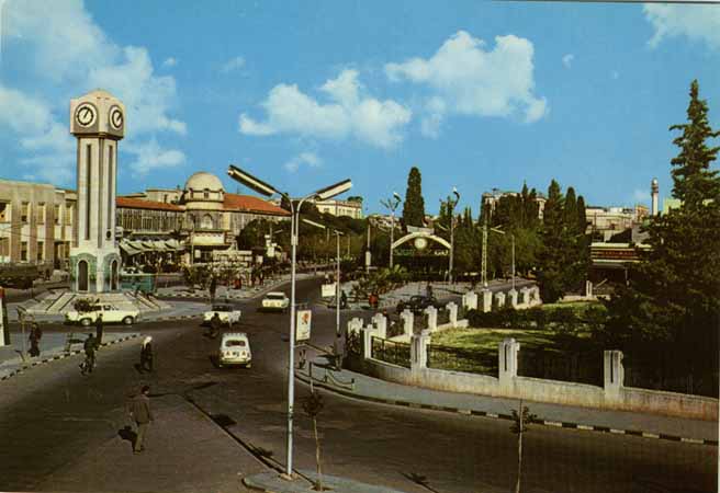
Homs or
Hims is the third important city in Syria and it is
strategically located at the fertile Orontes River (Naher al-Aassi, - Assi means Rebel, since the river runs northwards) Valley in the centre of Syria, between Damascus (162 Km South) and Aleppo (193 Km north). It is very close to the coast (Tartus, 96 Km West) and is not far from Hama (47 Km) to the north and Palmyra (155 Km) to the southeast.Homs is the only natural gateway from the Mediterranean coast to the interior. (Homs Location Map) |
||
| Government |
|
|
| Business | ||
| Industry |
History |
|
| Trade |
Homs
is an ancient city dating back to the year 2300 B.C and
was known in Roman times as Emesa,
which contained a great temple to the sun god El Gebal (Aramaic; Latin: Elagabalus; Greek: Heliogabalus). Emesa was ruled by a line of priest-kings throughout the Roman Empire, and two of its nobility rose to become emperor, Elagabalus and Severus Alexande who ruled Rome from 193 to 211. Four Homs women became Roman Empresses -Julia Domma, Julia Maesa, Julia Mammea and Julia Soemia. Aurelian (reigned AD 270-275) made the town his headquarters and there defeated Queen Zenobia of Palmyra. Emesa's fortunes were always tied with the trade city of Palmyra. As long as Palmyra flourished so did Emesa. When Zenobia was defeated at Palmyra in about 272 AD, Emesa declined. Only the remains of one citadel built above a rocky hill south of the city with two gates and a wall remained intact. The two gates are: Bab Sham (Damascus) and the Bab Palmyra. Homs was the third station on the “Silk Road” after Doura Europos and Palmyra. |
|
| Computer | ||
| Arts & Literature |
|
|
|
Christianity
was established in Emesa early on, as 3rd to 7th century. Catacombs were found
in houses in the eastern quarter, where quite a large population of Christians still live. After Arab conquest, it is said that 500 of the prophet's companions came and settled here. Homs became important, again but by the 18th century Homs had sunk into a state of weakness.Homs was taken in 636 by the Muslims, who renamed it Homs, and the city's large Christian element was eliminated during the rebellion of 855. Hims later (1516) passed into Ottoman hands, where it remained, except for a brief period of Egyptian control in the 1830s, until the creation of Syria after World War I. |
|
|
| The word " Homs " derives from a Canaanite root that means shyness. |
|
|
| Attractions and historical building | ||
| The prime attractions and most important historical building in the city of Homs are: | ||
|
-
The
Khaled
Ibn Al-Walid Mosque (take the name of the Arab Moslim leader Khaled
Bin Al-Walid who lived in Homs for the last seven years of his life), this building is distinguished by its metal dome which reflects sunshine. It is also famous for its two high minarets and narrow galleries built with black and white stones in a horizontal manner. |
||
|
|
||
| The
Kaneesat Um Zunnar Church which was named after a piece of cloth said to
have belonged to the Virgin Mary that was found underneath the alter during renovations in the 1950's. |
||
| -
Another church in the area is Kaneesat Mar Elian Church which also had
discovered beautiful wall paintings and mosaic in the 1970's during renovations. It also contains Arab and Greek scripts dating back to the twelfth century AD and even as far back as the sixth century. |
||
| The ruins of the underground monastery and chapel of the Syrian Aramain Church. | ||
| Other attractions include the Citadel,Homs Old gates, Al Nouri Mosque (or Great Mosque), the ancient souks | ||
|
Between
Homs and Tartus,
the
Krak
Des Chevaliers
(Qalaat
al-Hossn)
(Qalaat al-Hosn) is the most
important castle of the middle ages. It is located 65 km west of Homs and reaches a summit of 750 meters above sea level. The castle controls a strategic passage called the Homs gap in the Orontes Valley. The castle was erected covers an area of 3 hectares and has 13 towers containing a number of halls, stores, passages, stables and bridges. |
||
| The
Qattina
Lake which is 15 kilometers from Homs; it has rainwater dam used in
agriculture. Which dates back to the 2nd millennium B.C. Close to this lake is the archaeological hill called Tal al-Nabi Mando (Qadesh), where a historic battle took place between the Hittites and the Egyptians in the thirteenth century B.C |
||
|
In the Homs museum, there are many archaeological artifacts dating back to the
ancient Syrian, Greek, Roman, Byzantine and Arab eras. |
||
| Other
places of interest around Homs, include al-Rastan, Meshta al-Helu
(Resort Town), Mar Jourjous (Monastery of St. George), Wadi al-Nasara (collection of Christian villages surrounding Qalaat al-Hosn), Tal- Mishrefeh and Lake Qattina. |
||
| Economy | ||
|
Homs
governorate is the largest in Syria (43,630 sq.km.). Its central location and
size made it the third governorate in agriculture, trade and industry. |
||
|
Homs
is distinguished from other Syrian governorates in its important strategic
location. It is in the middle of Syria, on a hill of approximately 508m height above sea level. |
||
|
Homs is situated in a fertile agricultural region that produces wheat, corn
(maize), millet, cotton, fruits, and vegetables. The city has thus become a thriving agricultural market centre; its local handicrafts, which include jewelry, belts, and cloaks, are also well-known. In addition, Hims has an oil refinery opened in 1959, an agricultural research station, fertilizer and vegetable-oil plants, a sugar refinery, and a university (1979). The hub of an important road and rail network, it is the central link between the interior cities and the Mediterranean coast. A shrine and mosque erected in 1908 honours the Arab general and conqueror Khaled ibn al-Walid, known as "the Sword of Islam," who died there in 642. Hims contains a medieval citadel with remains of older foundations. |
||
| Main References: The Syrian, Britannica, Encarta and Columbia encyclopedias | ||
| information from homs online site | ||