|
The
following is a collection of free key sites which I regularly consult in order to make the
surf forecasts as accurate as possible
A big thank you must go out to Ric Harwood whose web pages are a
wealth of information, and intially provided me with all the relevant data sites needed to
start the my own personal forecasts many moons ago.
Key Sites
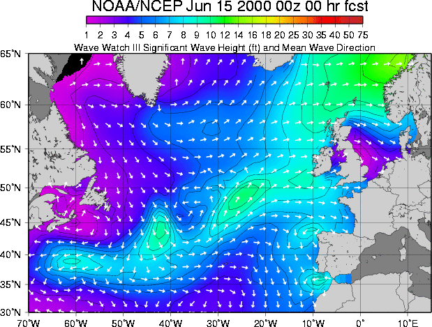 |
NOAA/NCEP WAVEWATCH III Plots - Wave Height and Direction Excellent
charts ploting wave height and mean swell direction. Colour cordinated for easy
understanding. Courtesy of Scripps Research
For a 144 hour animated forecast check here |
| |
|
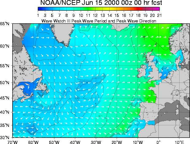 |
NOAA/NCEP WAVEWATCH III Plots - Peak Wave Period and Direction Excellent
charts ploting wave period and direction. Colour cordinated for easy understanding.
Courtesy of Scripps
Research
For a 144 hour animated forecast check here |
| |
|
 |
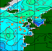
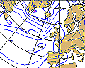
Supplied by FNMOC the WX map
provides an excellent graphical model for approx. +144 hours. Cover significant wave
height (?coloured contours), and surface winds (winds barbs). NOTE:
Graphic to the left not the correct one - whoops!) For 6 day forecast check all
times |
| |
|
 |
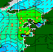
Provided by FNMOC, the Hs plot shows wave height in metres (coloured
contours), the direction of the swell (red arrows), and the direction and speed of the
wind (wind barbs). Forecast for : 0h | 6h | 12h | 18h | 24h | 30h | 36h | 42h | 48h | 54h | 60h | 66h | 72h |
| |
|
 |
Again provided by FNMOC, the Tp plot shows peak wave period (coloured
contours) and direction of the peak wave period (red arrows). Forecast for
0h | 6h | 12h | 18h | 24h | 30h | 36h | 42h | 48h | 54h | 60h | 66h | 72h, also
includes an animation.
|
| |
|
 |
Supplied by Top Karten,
the NOAA AVN wind forecast chart is nice and easy to read. The wind direction is
shown with wind barbs, the barbs point into the wind and each 'feather' is 10 knots,
(5m/s) half a feather is 5 knots.
t+00h
| t+12h | t+24h | t+36h | t+48h | t+60h | t+72h
|
| |
|
 |
Supplied by the European Centre for Medium
range Weather Forecasting (ECMWF), these charts are excellent sources with prediction
for 3 - 6 days ahead. Check it here |
| |
|
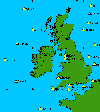
| UK Wave
Buoy Information |
|
All the latest information regarding UK wave buoyscan be found at: Wave Buoy Information
For this site you need to know the number of the buoy your after. This will be made
available for all UK buoys on this site early next week.
N.B. All credit for finding this link goes to Mark
Smith.
|
Other Sites
There are loads more sites out there which are
not included above. Rather than list every one, I'd prefer to point you in the direction
of two sites which contain them all.
The only two I can really recommend are the site run by Ric Harwood and
the site run by Stormsurf.
|
|


