
THE GASQUET PAGE


What springs to mind when someone mentions "Northern California"? Is it Sacramento? San Francisco? Maybe even Redding or Eureka? Well hold on to your hats, and get ready to take a trip to the real Northern California. Welcome to
Gasquet, California,
located on the pristeen Smith River, and within a stone's throw of the Oregon border. Prepare yourself for a journey into the best kept secret of the Pacific Northwest.
The region surrounding the Smith River has long been valued for it's botanical diversity,
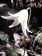
 trillium
 calypso orchid

 pitcher plant
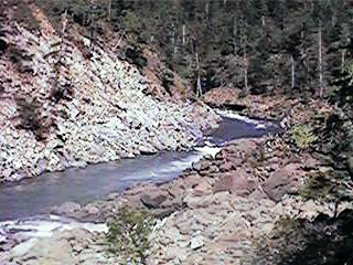
geologic and aquatic beauty,

and recreational opportunities.
Camping
Hiking
Kayaking
Redwood Nat. Park
National Forests
National Rec. Area
Ranger Station

Members of the Gasquet community treasure this uniqueness,
and have chosen to create homes, establish businesses and raise their families in this utopian environment.
Want to learn more about Gasquet?
Visit the above links, or try out a few of these below:
The Smith River
History
Native American History
Weather Report
Map
Now here!
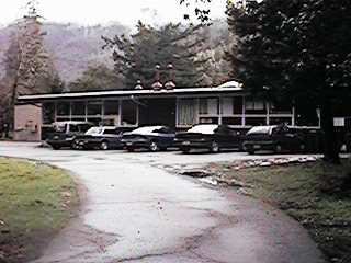
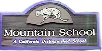
The Mountain School Home Page
Created by 5th and 6th grade students
at Mountain School.
 Gasquet Mysteries
Created by the students of grades 3 and 4 at Mountain School
COMING SOON: History of Del Norte County by students of grades 2,3 and 4 at Mountain SchoolYou can search Amazon.com for books on Northern California.
PLEASE COME BACK AND VISIT OUR UPDATED PAGE IN THE NEAR FUTURE!


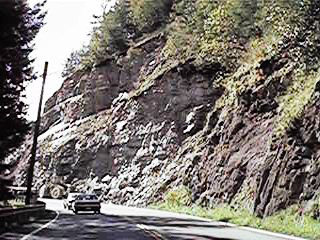
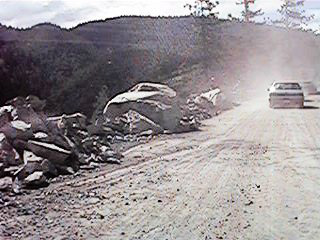
Motorists queue up as word spreads that one way traffic will be restored around noon on Wednesday. Lines of waiting cars and truck snake through the the redwood parks of the Smith River National Recreation Area.
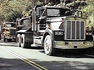
Parked dump trucks wait along the shoulder, allowing one way traffic to pass through the canyon.
Portions of previous slides can be seen just outside of the active slide area.
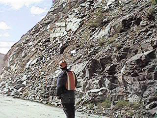
A lone Caltrans worker stands in the cleared lane, supervising the passing of traffic.
A car travels precariously along the cleared ledge, hovering between rubble piles estimated as high as 80 feet, and a sharp drop down into the Smith River Canyon. Note how large the boulder is in comparison to the car!
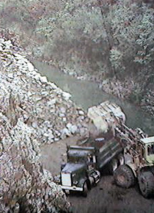
In this photograph from the front page of Tuesday's Triplicate, large earthmoving equipment tries to reclaim Highway 199 from mounds of talis and debris.
This page hosted by
Free Home Page
NEW Gasquet Mysteries
Home Divorced Parents Sarah Amanda Vacations With the Girls Family Photo Album
Gasquet Poetry Resume Mountain School

You are visitor number

Copyrighted 1999 by Susan Buchert sugebu@hotmail.com.
Susan's World Updated January 9, 1999

Or, click on the envelope in the above "Geoguide" to leave a message!
[ Previous 5 Sites | Previous | Next | Next 5 Sites | Random Site | List Sites ]
You are visitor number