
|
|
|
|
|
|
|
|
|
|
|
|
|
|
|
|
Hike: Mount 'Alava Trail on Tutuila, American Samoa |
Time Started: 9:45 AM |
Party: Mike Wong & Alex Okihara | |
Summary:
Parking on the side of the road of Fagasa Pass, I was disappointed to find that the hiking trail to the 1610-foot summit of Mount 'Alava was actually a wide unpaved road. The road is used by 4x4 vehicles to reach the antenna station at the top. Along the way to the top, there weren't many good views due to the thick vegetation on the sides of the broad ridge. The trail, about 6 miles round trip, is fairly easy. There are no steep and treacherous areas.
When we reached the end of the trail, however, we were rewarded with a superb view of Pago Pago Bay. Lying just before us was Matafao Peak (elev. 2142), the highest peak on the island of Tutuila. To our left lay Mt. Pioa, which is commonly called the Rainmaker because of all the rain that falls there. We could also see the steep cliffs along Fagasa Bay and Massacre Bay.
The total round trip took about 3 and a half hours.
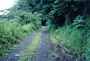
 This is the start of the trail. The trail is actually an unpaved road used by 4x4s.
 This is basically what the trail looked like for the entire trip. There weren't many
good views because of all the tall trees on both sides of the road.
This is basically what the trail looked like for the entire trip. There weren't many
good views because of all the tall trees on both sides of the road.
 I believe that this is Fagasa Valley. This shot was taken near the start of the
trail before the view was obstructed by tall trees.
I believe that this is Fagasa Valley. This shot was taken near the start of the
trail before the view was obstructed by tall trees.
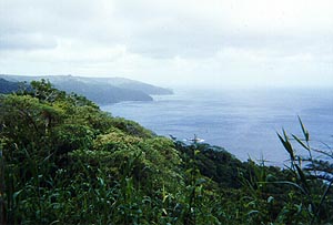 Occasionally, we were able to get a nice view of what lay to the left of the trail while
we going up. Here is a view of the steep cliffs along Fagasa Bay and Massacre Bay.
Occasionally, we were able to get a nice view of what lay to the left of the trail while
we going up. Here is a view of the steep cliffs along Fagasa Bay and Massacre Bay.
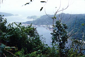 On the right side of the trail, we were able to see parts of Pago Pago Bay.
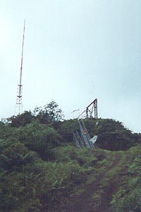 Finally, about 2 and a half hours later, we reached the top of Mount 'Alava marked by
several huge antennas. The stairs lead up to a plywood platform which offers an
excellent view of Pago Pago Bay.
Finally, about 2 and a half hours later, we reached the top of Mount 'Alava marked by
several huge antennas. The stairs lead up to a plywood platform which offers an
excellent view of Pago Pago Bay.
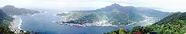 At the top of the stairs, we were treated to a panoramic view of Pago Pago Bay.
(Click on photo to see larger image)
At the top of the stairs, we were treated to a panoramic view of Pago Pago Bay.
(Click on photo to see larger image)