
Page 2 - Thumbnail images and descriptions
Click the thumbnail photo to see the larger image:
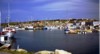
 Burgeo is located on the south coast of Newfoundland and has a large, usually tranquil harbour. Here the homes crowd around the sea and their residents enjoy a fantastic view looking towards the south.
 This is a view, looking south, of the ferry dock and parking area in Burgeo. Some of the numerous rocky islands just outside the harbour can be seen in the distance.
 The serenity of an early Sunday morning is only slightly broken by a solitary individual moving about Burgeo harbour in his dory.
 Bay de Verde is a community at the tip of the Baccalieu Trail and looks out on Conception Bay. This view is from the highway just before entering the town.
 The very high cliffs near Bay de Verde look down into the vast expanse of Conception Bay. This was taken near Lower Island Cove.
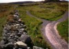 A national historic site, the very old stone fences in Grates Cove stretch across the northern landscape.
 A bright summer day shines on the fishing fleet in Old Perlican near the tip of the Baccalieu Trail.
 The unique community of Trinity has many older residences that have been carefully restored. This one is now an inn, many others are picturesque B&Bs.
 The Cabot monument, located beside the sea in Bonavista, commemorates the explorer's discovery of Newfoundland in 1497.
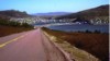 The quaint and picturesque town of Lawn is located on the Burin Peninsula. This is the view that greets visitors approaching from the south-west.
 Another community on the Burin coast is St. Lawrence. This monument in the town centre pays tribute to the heorism of its residents whose bravery has been shown in both mining disasters and shipwrecks.
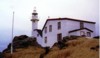 A very pretty community along the Northern Peninsula is Rocky Harbour. Just north of there is a poplular tourist attraction and viewing area, the Lobster Cove Lighthouse.
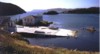
 Now retired after many years on the sea these two fishing boats peer out over the water and the community of Placentia, along the Irish Loop and south-west of St. John's.
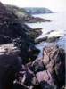 This photo gives some indication why Newfoundland is called The Rock. This coastline is along the west coast of the Avalon peninsula near St. Bride's and the Cape St. Mary's Bird Sanctuary.
 L'Anse aux Meadows at the tip of the Northern Peninsula is the only authenticated Viking settlement in North America. Here modern day Vikings in period costumes greet visitors.
 Another view of the sod huts at L'Anse aux Meadows. From here and on clear days it's possible to see the shores of Labrador just across the water.
 This historical site promises to be a busy spot in 2000 when the 1000th anniversary of the Viking landings is celebrated.
 Traveling north from Botwood the highway ends in this beautiful community named Leading Tickles
 The rugged and rocky scenery is everywhere along the north shore of Newfoundland. Leading Tickles offers some of the best.
 Like so many communities on Notre Dame Bay, Leading Tickles has a protected harbour where the houses seem to compete for the best view. Evidence of the once dominant fishing industry persist everywhere.
Back to Home Page
Page 3 of Thumbnails & Descriptions
 Burgeo is located on the south coast of Newfoundland and has a large, usually tranquil harbour. Here the homes crowd around the sea and their residents enjoy a fantastic view looking towards the south.
 This is a view, looking south, of the ferry dock and parking area in Burgeo. Some of the numerous rocky islands just outside the harbour can be seen in the distance.
 The serenity of an early Sunday morning is only slightly broken by a solitary individual moving about Burgeo harbour in his dory.
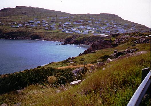 Bay de Verde is a community at the tip of the Baccalieu Trail and looks out on Conception Bay. This view is from the highway just before entering the town.
 The very high cliffs near Bay de Verde look down into the vast expanse of Conception Bay. This was taken near Lower Island Cove.
 A national historic site, the very old stone fences in Grates Cove stretch across the northern landscape.
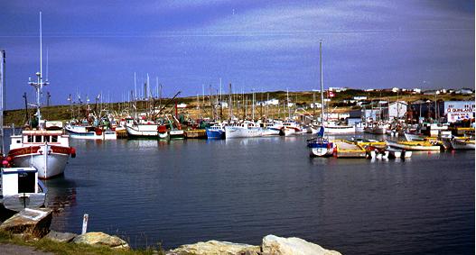 A bright summer day shines on the fishing fleet in Old Perlican near the tip of the Baccalieu Trail.
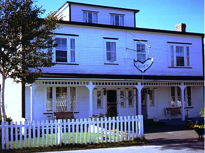 The unique community of Trinity has many older residences that have been carefully restored. This one is now an inn, many others are picturesque B&Bs.
 The Cabot monument, located beside the sea in Bonavista, commemorates the explorer's discovery of Newfoundland in 1497.
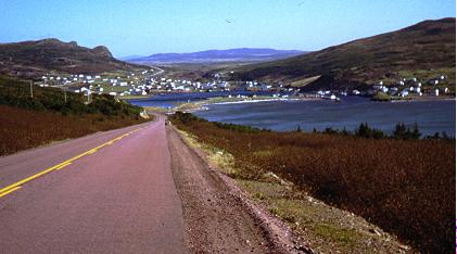 The quaint and picturesque town of Lawn is located on the Burin Peninsula. This is the view that greets visitors approaching from the south-west.
 Another community on the Burin coast is St. Lawrence. This monument in the town centre pays tribute to the heorism of its residents whose bravery has been shown in both mining disasters and shipwrecks.
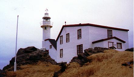 A very pretty community along the Northern Peninsula is Rocky Harbour. Just north of there is a poplular tourist attraction and viewing area, the Lobster Cove Lighthouse.
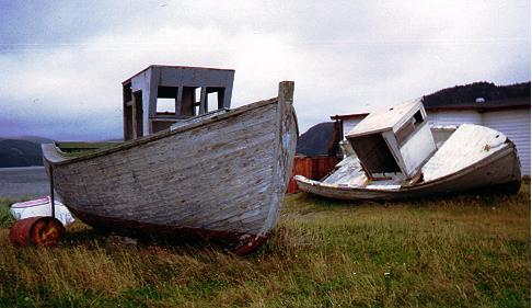 Now retired after many years on the sea these two fishing boats peer out over the water and the community of Placentia, along the Irish Loop and south-west of St. John's.
 This photo gives some indication why Newfoundland is called The Rock. This coastline is along the west coast of the Avalon peninsula near St. Bride's and the Cape St. Mary's Bird Sanctuary.
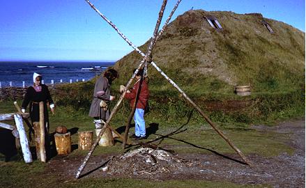 L'Anse aux Meadows at the tip of the Northern Peninsula is the only authenticated Viking settlement in North America. Here modern day Vikings in period costumes greet visitors.
 Another view of the sod huts at L'Anse aux Meadows. From here and on clear days it's possible to see the shores of Labrador just across the water.
 This historical site promises to be a busy spot in 2000 when the 1000th anniversary of the Viking landings is celebrated.
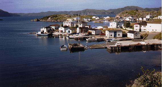 Traveling north from Botwood the highway ends in this beautiful community named Leading Tickles
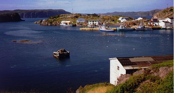 The rugged and rocky scenery is everywhere along the north shore of Newfoundland. Leading Tickles offers some of the best.
 Like so many communities on Notre Dame Bay, Leading Tickles has a protected harbour where the houses seem to compete for the best view. Evidence of the once dominant fishing industry persist everywhere.