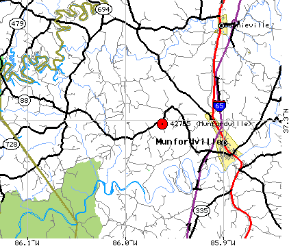
This is a road map of the location of the Polston/Poston Cemetery. From I-65 in Munfordville, Kentucky, take Hwy. 31-W south to Hwy. 88 West. Go 7 miles West on Hwy 88 about 1 mile past the Kessinger community. The cemetery is about 1 mile west of the Kessinger-Macon Road and about 1/2 mile west of Waddell Road; but about 1/4 mile before coming to the John Logsdon Road. The cemetery is located on the left side of Hwy. 88 on the first curve after passing Waddell Road. Turn off Hwy. 88 West at a farm house drive on the curve and the cemetery is located about 1/4 mile from Hwy 88 on a hill.