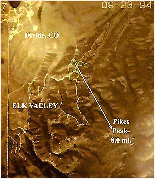
This is my Colorado Land from 30,000 Feet (MSL):
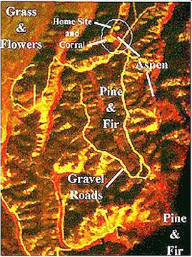
This National Aerial Photography Program (NAPP) image was secured from the USGS, as was the next one, taken 11 September 1990 and shown in False Color IR. In false color, one can detect coniferous vs. deciduous trees, stressed vegetation, and variations in surface geology (say dirt vs. rock formations).
The bright red areas are healthy low growth and deciduous trees -- in this case, wild flowers, grasses, and Aspens! The Chocolate areas are a mix of coniferous trees -- mostly Ponderosa Pine on the western and southern slopes, and Colorado Blue Spruce and Douglas Fir on the Eastern and Northern slopes. Below, is a USGS Color Contour Map of the region.

More will be added to this page, as I complete my Remote Sensing Projects.
Link to Another Earthwatch (Inc.)


 ... Looking For the Abyss...
.
.