Home Previous Next
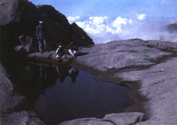
 surface. The ice melted less than 10,000 years ago and many signs of the glaciation can still be seen on the Summit Plateau. Glacial striations, usually less than an inch deep, and the larger glacial grooves were cut by rocks underlying the glacier as the ice moved slowly downwards. Post-glacial weathering has rounded and smoothed these and other features such as the frost-shattered block-field of Low's Peak, and the bands or dykes of different types of rocks that run across the granite. Exfoliation, (layers of rock peeled off parallel to the surface), can also be seen. This is caused by the alternate expansion and shrinkage of the rock as it heats up during the day and cools down at night. Today only occasionally does ice form in the pool below the summit where the early climbers made further sacrafices to the spirits of the mountain. |
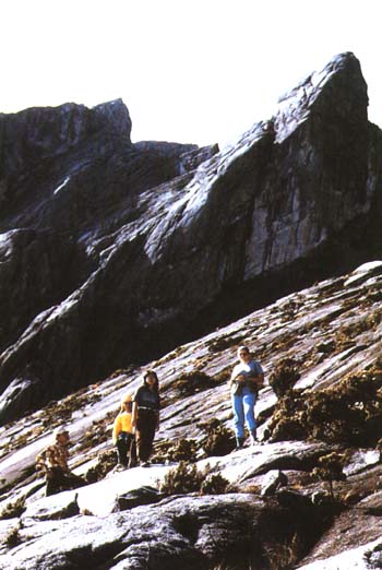
 Any plants on the Plateau are reduced to clinging to cracks in the rocks, as the force of the water rushing down the slopes after rain washes away any soil that may be forming, making it impossible for most plants to live there. Near the top of the Summit Plateau and at the base of Lows Peak a re a few small sunken patches of sand which support grasses and sedges. In the crevices the most common flowering plants are the stunted Heath Rhododendron and Leptospermum, maturing, flowering and fruiting when only a few inches high. Few birds are seen up here but there are magnificent views, especially of the awesome cliffs of Low's Gully, a 1 1/4 km (1 mile) deep cleft that divides the east and west arms of the mountain. Most people climb to the summit in time to see the sunrise and dawn creep slowly over the land, illuminating the coast-line west and north and the dim ranges of hills to the south. In good weather almost all of Sabah can be seen before the clouds come up (usually around 9.00 or 10.00 am) and it is time to begin the descent. 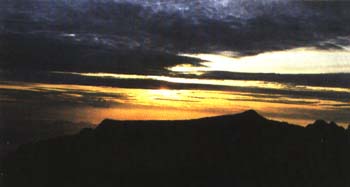 |