![]()
These remains are [like fragments of a shipwreck] that after the Revolution of so many Years and Governments have escaped the Teeth of Time and (which is more dangerous) the Hands of mistaken Zeale. So that the retriving of these forgotten Things from Oblivion in some sort resembles the Art of the Conjurer. A conjurer, who makes those walke and appeare that have layen in their graves many hundreds of yeares: and to represent as it were to the eie, the places, Customes and Fashions, that were of old Times. - John Aubrey mid-Seventeenth Century (Ashmore 1996).
Caveat: The following artistic reconstructions were made for general educational purposes and were only designed to give an approximation of shapes. For extremely precise visualization purposes (e.g. for academic publications) I might have approached the 3D modeling process differently using AutoCAD with its 8 decimal place precision. I might have then represented the archaeologically excavated remains in one color and the reconstructed remains in another so that the viewer knew which sections of the model were based on the site plans and which parts were reconstructed. Unfortunately this is a relatively time consuming and expensive process which is not necessarily aesthetically pleasing and not really necessary for a general purpose 3D model so long as it is clear to the viewer that these are artistic reconstructions and only partly based on site plans and archaeologically recovered material. Needless to say, "virtual reality" (an oxymoron) can never capture the complexity of the real objects. Its advantage is in reconstructing past objects and artifacts that now only exist as ruins.
Click below to view a Quicktime Movie (863K .mov) of a 3D model of Stonehenge, reconstructed as it might have appeared around 2000 BC at the summer solstice sunrise. This Quicktime movie may take awhile to load if you have a slow modem connection. You may also want to download it to your computer before playing it. After the movie plays you should be able to see more details of the reconstruction by manually pushing the control bar at the bottom of your Quicktime Viewer forward and back. Please note that if you download any Quicktime movie and it will not open for you, it is probably because in the transmission over telephone lines some little part of the file got lost somewhere. Usually a second attempt at downloading the file will make it work. There is nothing wrong with any of the files on this end but sometimes a modem problem or some static on a phone line can cause a loss of a little bit of a file which can make it not open.
Large format still renderings of individual frames from the movie: Still Image 1 (42K) Image 2 (20K) Image 3 (33K) Image 4 (25K) Image 5 (27K)
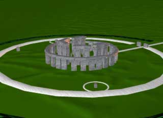
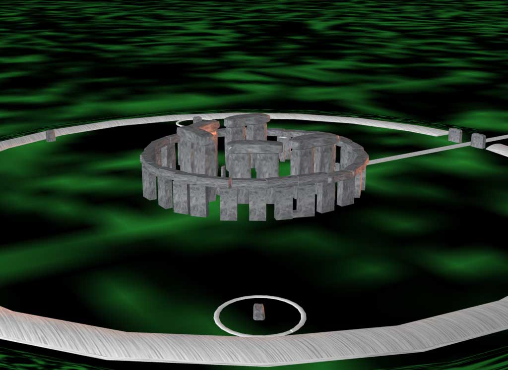
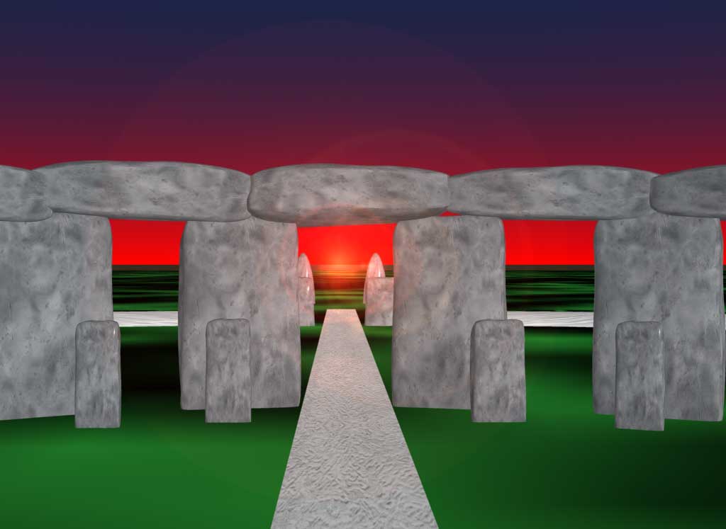
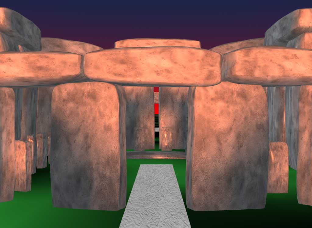
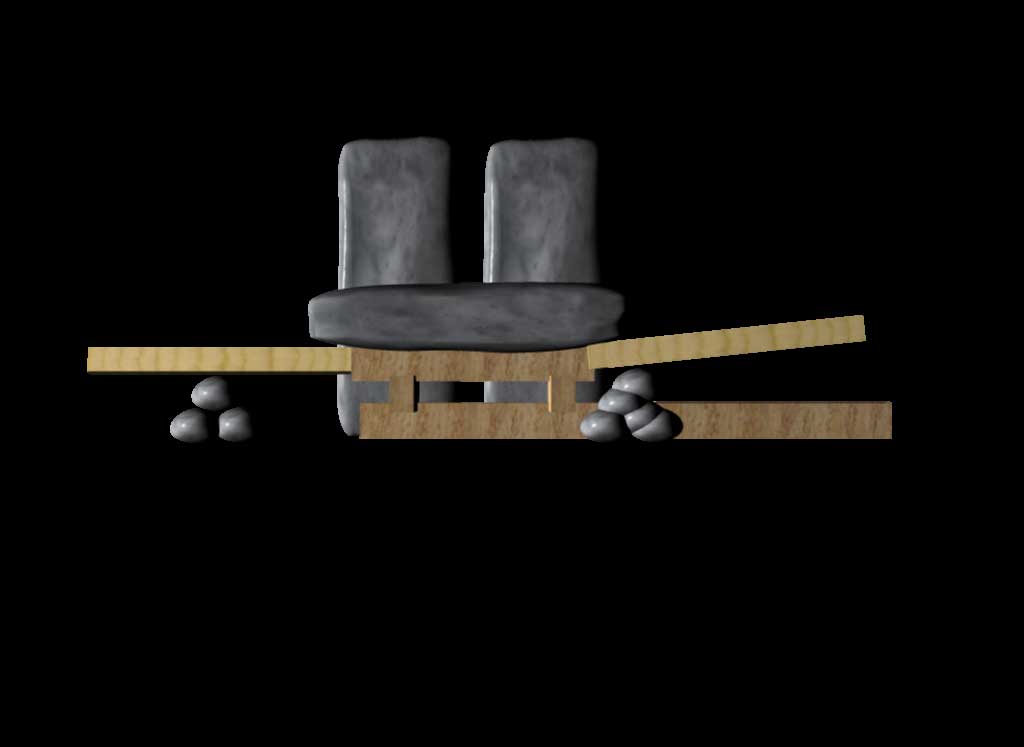
Stonehenge stands in the central part of southern England (in the county of Wiltshire) in a rolling chalk landscape known as Salisbury Plain. It is about a 1 1/2 to 2 hour drive west of London. The stone lintels atop the uprights and the rectilinear shaping of the stones sets this site apart from other stone circles in Britain and Ireland. The outer circle, composed of Sarsen sandstone, is about 100 feet in diameter with uprights that are about 13'6' x 7' x 3'9", with a space between stones of about 3'6". The lintels and uprights were put together using mortice and tenon joints. The 5 inner sarsen trilithons are in a horseshoe shape facing northeast towards the summer solstice sunrise. The tallest trilithon is about 22' above ground and 8' below ground. There is an outer "bluestone" circle and an inner bluestone horseshoe. Most of the outer bluestones are about 6'6" tall, 3'3" to 4'6" wide, and 2'6" thick. The inner bluestones rise from 6' to about 8' getting taller, like the sarsen trilithons, as they trend towards the southwest. Stonehenge went through many construction phases between 3100 BC and 1100 BC. This reconstruction is of Stonehenge IIIc from about c.1550 to c. 1100 BC. (Source: Christophers Chippendale's book Stonehenge Complete revised edition 1994:10-15; Thames and Hudson, Inc.:New York).

They might have raised the lintels with levers or they might have buried the trilithons in dirt and pulled the lintels up some sort of ramp with a sledge.
Large format still renderings of individual frames from the movie: Still Image 1 (42K)
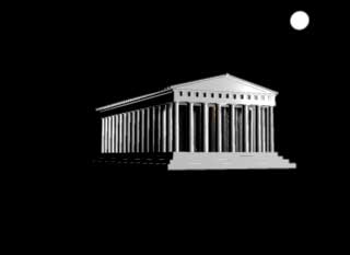
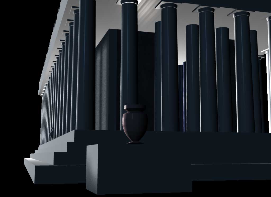
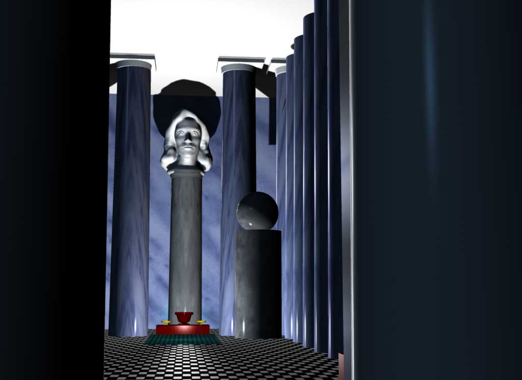
A "Parthenon-like" Greek temple. Although there are no drawings of the original interior of the Parthenon, the statue of Athena Parthenos by Phidias was described as being made of ivory and gold. She stood upright and wore a three crested helmet with full military gear. The front of the real Parthenon would have had the Elgin Marbles and probably did not have some of the interior features I have added. Pausanias in his Description of Greece stated: "As you enter the temple that they name the Parthenon, all the sculptures you see on what is called the pediment refer to the birth of Athena, those on the rear pediment represent the contest for the land between Athena and Poseidon. The statue itself is made of ivory and gold. On the middle of her helmet is placed a likeness of the Sphinx . . . and on either side of the helmet are griffins in relief.. . . The gold which the griffins guard . . . comes out of the earth;. . . griffins are beasts like lions, but with the beak and wings of an eagle.. . . The statue of Athena is upright, with a tunic reaching to the feet, and on her breast the head of Medusa is worked in ivory. She holds a statue of Victory about four cubits high, and in the other hand a spear; at her feet lies a shield and near the spear is a serpent. This serpent would be Erichthonius. On the pedestal is the birth of Pandora in relief. Hesiod and others have sung how this Pandora was the first woman; before Pandora was born there was as yet no womankind. The only portrait statue I remember seeing here is one of the emperor Hadrian, and at the entrance one of Iphicrates,1 who accomplished many remarkable achievements" (Source: The Perseus Project website).
Large format still renderings of individual frames from the movie: Still Image 1 (42K) Image 2 (20K) Image 3 (33K) Parachuting in(large 1.4MB Movie File).

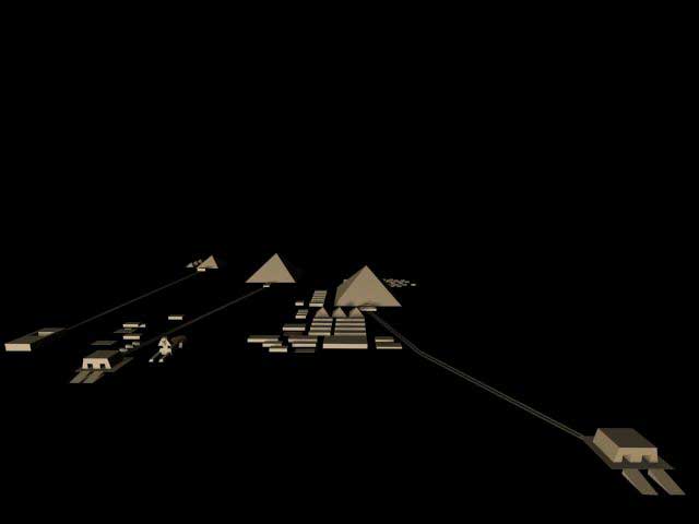
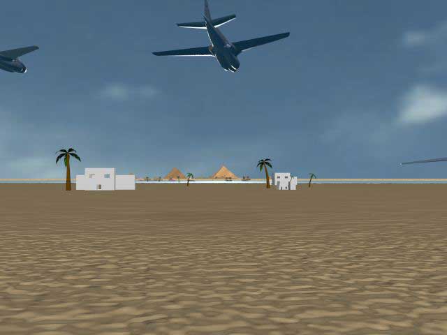
Large format still renderings: Original model of the Giza Plateau (7.35K) Image 1 (17K) Image 2 (18K) Image 3 (29K)

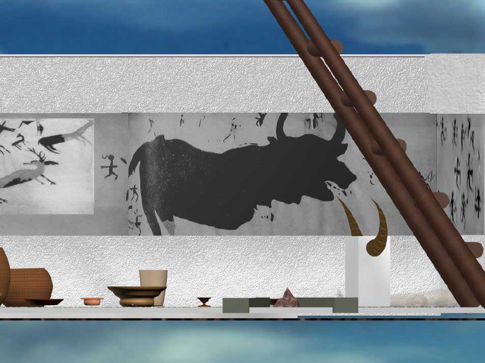
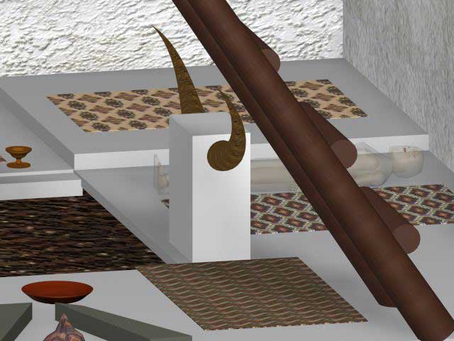
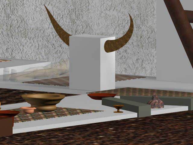
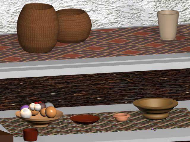
Catalhoyuk in Turkey is the earlest town archaeologists know of and was inhabited c. 6100 BC. This 32 acre town was home to perhaps 6,000 people. The houses were made of mud brick with terraced roofs connected by ladders. Doorways were cut into small second stories. The dead were buried below the floors and below the sleeping area. "Goddess" figurines, the earliest landscape art (c. 6200 BC), and the world's earliest wall frescoes were found by James Mellart when he excavated a small part of the town in the early 1960's. The site is currently being excavated by a team of archaeologists led by Ian Hodder. Dr. Orrin Shane of the Science Museum of Minnesota is overseeing the public presentation of the excavation results. The cutaway view of a room pictured above is called the "Hunting Shrine." There were fascinating and lively murals in the room showing harlequin figures, and other figures running (or dancing), holding bows or lassoes, with spotted leopard skin "bowtie" sashes around their waists. There was also a well done mural of a large bull. Local food for the people of Catalhoyuk included deer, hare, duck, goose, peas, roasted wheat, juniper berries, apples, pears, shelled almonds, and hackberry wine. (Source: Dora Jane Hamblin's Time-Life book The First Cities1973:42-65).
Still images (rendered) of:
Catalhoyuk and volcano(the earliest town)
Catalhoyuk outside(exterior view 1)
Catalhoyuk(exterior view 2)
Catalhoyuk room(closeup of the bull fresco)
Interior of a room at Catalhoyuk(closeup 1: Bull horns)
Interior of a room at Catalhoyuk (closeup 2)
Interior of a room at Catalhoyuk(closeup 3: Baskets and Pottery)


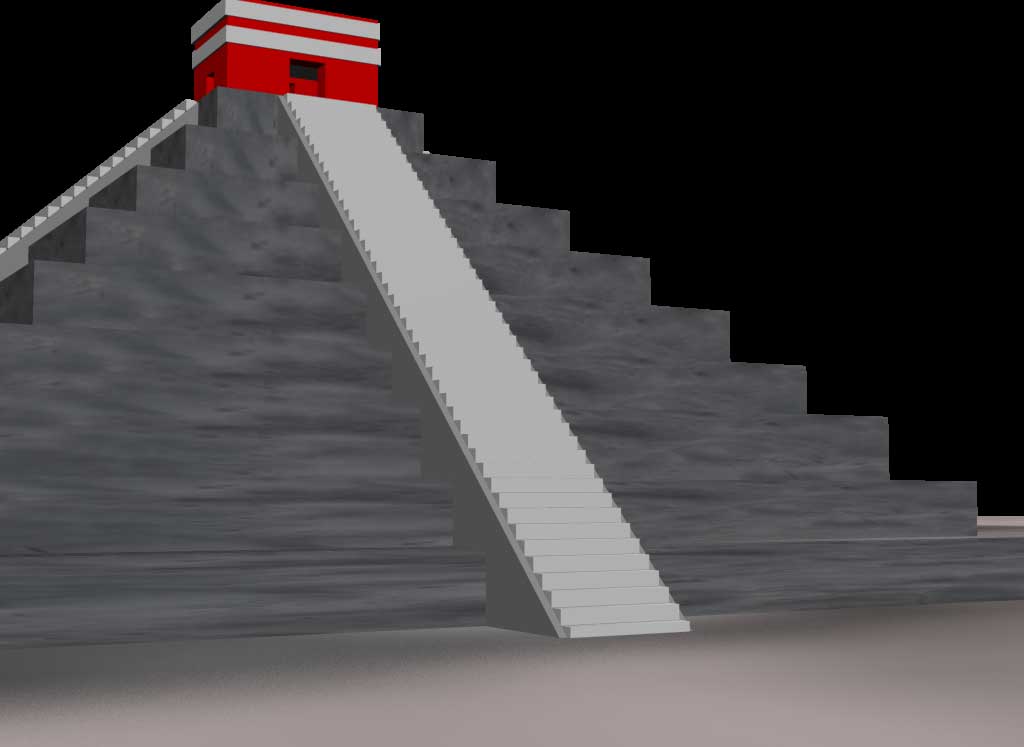
Chichen Itza, in the northern Yucatan of Mexico is a vast archaeological site. El Castillo is a Maya temple 79 ft. high that on the Spring equinox (or March 21st after about 4:30 P.M.) is thronged with tens of thousands of visitors who come to watch the appearance of the feathered serpent Kukulcan. The rays of the setting sun shine across the northwestern corner of the temple and cast an undulating shadow along the balustrade of the northern staircase, eventually touching the snake's head at the foot of the balustrade. Snakes are a symbol of renewal to the Maya because they shed and regrow their skins. The Classic Maya period was from AD 250 to AD 900. Chichen Itza was important during Post-classic times and was abandoned in the thirteenth century (Sources: Andrew L. Slayman, July/August 1996 Archaeology magazine, vol.49 No. 4:56-60; Brian Fagan People of the Earth 1995:507-508).
Large format still renderings of individual frames from the movie: Still Image 1 (38K) Image 2 (28K) Image 3 (25K)
Large format still rendering from the movie Image 1
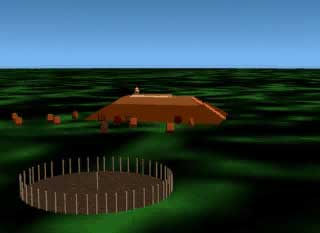
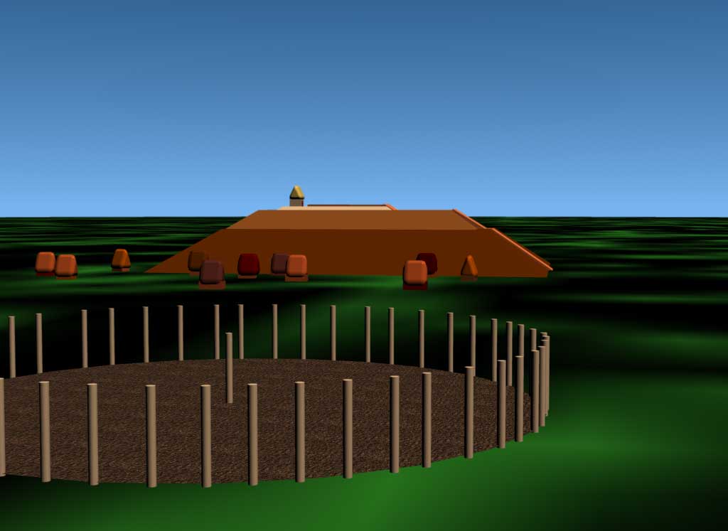
Cahokia Mounds, Illinois, a few miles east of St. Louis, Missouri, was the largest ancient city north of Mexico. Monks Mound was an enormous dirt mound 100 feet high surrounded by thatched houses and next to a large open plaza. Nearby was Cahokia's famous "Woodhenge" with probable astronomical alignments. Excavations revealed that Woodhenge was rebuilt with cedar posts several times by the "Mississippian" culture. The entire site was over 5 square miles and 2000 acres of this had residences for perhaps 30,000 people (Source:Brian Fagan, Ancient North America 2nd Ed., 1995:438 Thames and Hudson).

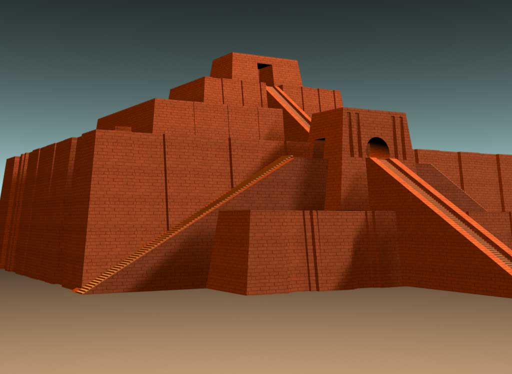
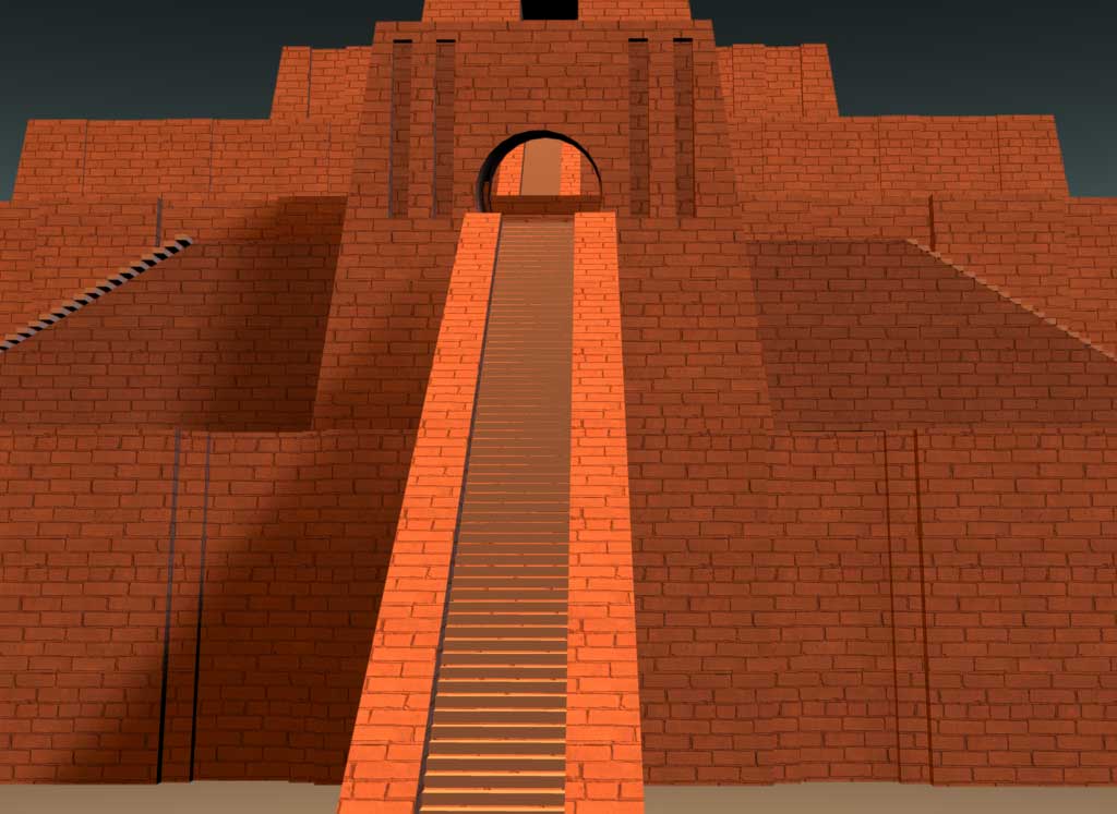
Ur was one of the early cities of Sumer (Mesopotamia - now modern Iraq). In 2100 BC King Ur-Nammu built the ziggurat with a casing of fired bricks set into bitumen or tar (A thousand years later the kings of Babylon would build a different ziggurat called the Tower of Babel). The mud brick core was interlaced with cables and reed mats. The ziggurat of Ur was dedicated to Nanna, the moon god. The ziggurat covers 30,000 square feet. The base, which survives, is 200' x 150' x 50'. This religious center had three tiers which rose 70' over surrounding homes, shrines, a storehouse, and courtyards (Source: Hamblin 1973:108-109; Hammond et al. 1986:15,22-23)).
Large format still renderings of individual frames from the movie: Still Image 1 (42K) Image 2 (20K) Image 3 (33K)

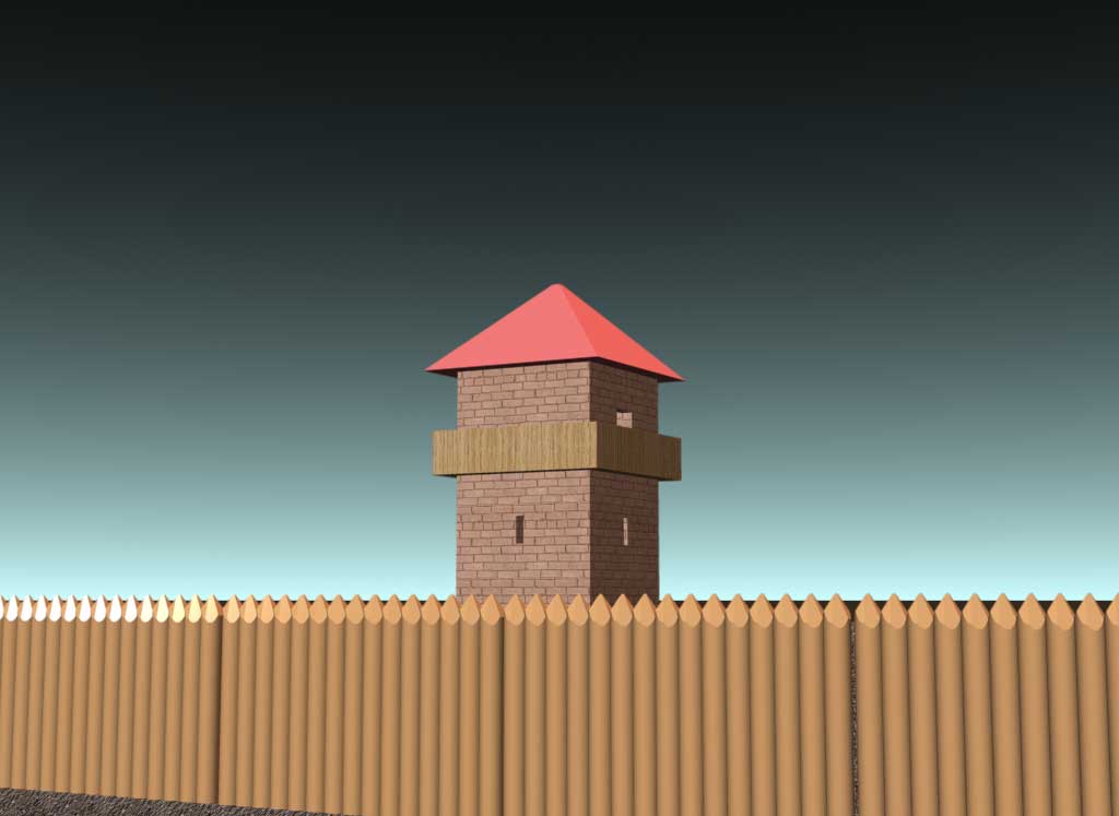
The Roman Limes was the Roman border fortification on the frontier with Germany. This reconstruction shows a typical part of the Forward limes in the late second century. The central section of the Forward limes ran in a straight line for 81 kilometers. In that section the limes watchtowers were 400 to 600 meters apart. The limes was composed of a wooden palisade, a ditch, and wooden watch towers which were eventually replaced with stone (Source: Anthony King, Roman Gaul and Germany 1990:168-169 U of CA Press)
Large format still renderings of individual frames from the movie: Still Image 1 (42K) Image 2 (20K) Image 3 (33K)

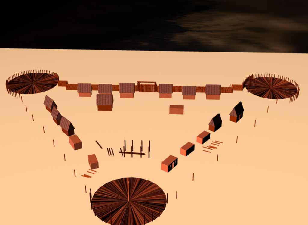
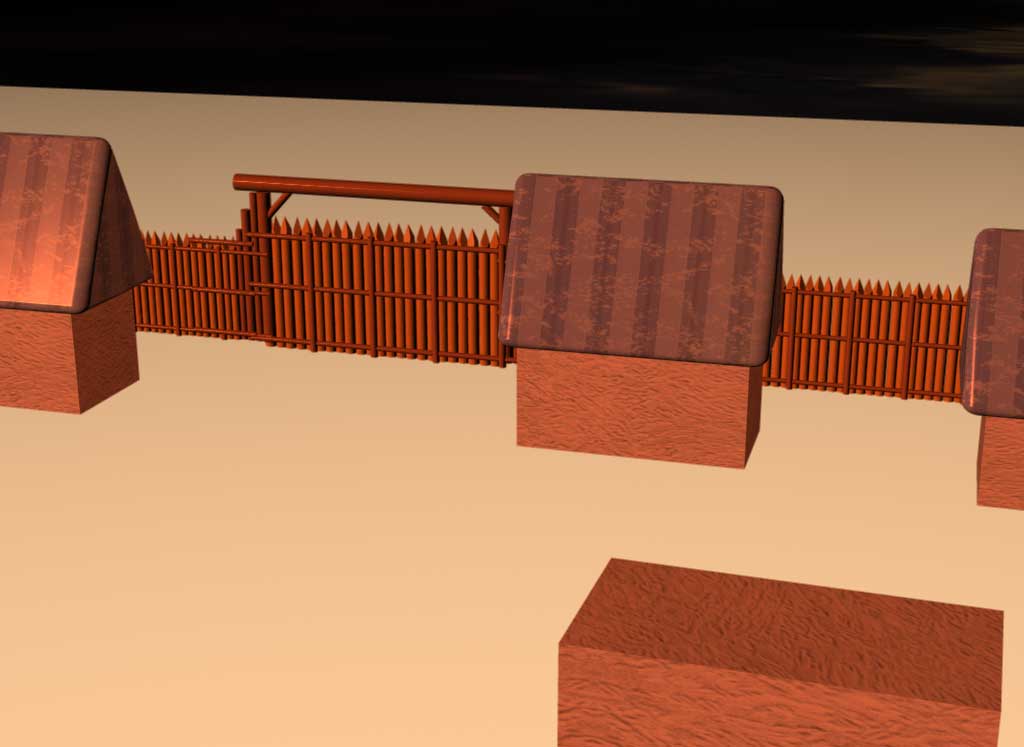
This reconstruction is intended to show the general layout of the James Fort as it was being built at Jamestown, Virginia during the summer of 1607. The English colonists were very concerned about the possibility of an attack by the Spanish and Native Americans living along the James River. They built the fort on Jamestown Island near the entrance to the James River. About three miles downstream, and visible from James Island, was Point Comfort, Hog Island which was used to give advance warning of approaching ships. Hog Island had a clear view to the mouth of the James River and also blocked the view of approaching ships of Jamestown Island. A 20 foot blockhouse was built on Hog Island sometime before 1609 from which ship masts could be seen 16 miles away. James Fort was rediscoverd in 1994 and more than 160,000 artifacts have been recovered including armor, arms, ammunition, coins, pottery, and political tokens. James Fort is a good example of what can be learned through historical archaeology. The fort was destroyed by fire in 1608 (Sources: J. C. Harrington and John L. Cotter, and William M. Kelso and Nicholas M. Luccketti, Archaeology, March/April, 1998, pp. 56-63).
Large format still renderings of individual frames from the movie: Still Image 1 (42K) Image 2 (20K) Image 3 (33K)

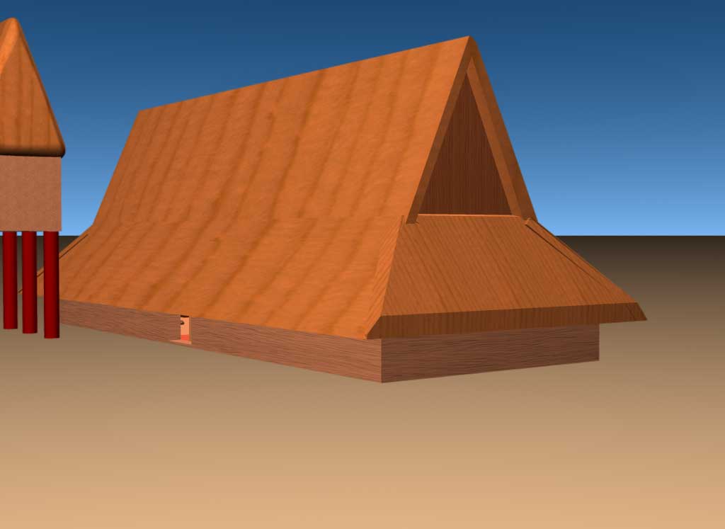
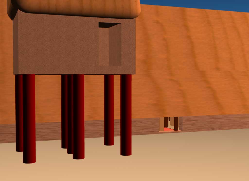
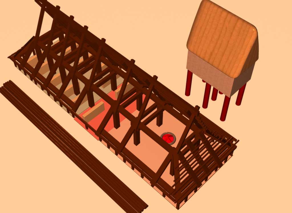
This animation shows a reconstruction and "exploded" view of the byre or three aisled hall house at Feddersen Wierde, Germany from the fifth century AD. This 82 ft. structure was not only a human habitation with a hearth but also had stalls for cattle on the opposite end of the building. The hall house was constructed of timber posts, planks, and wattle walls. This kind of iron age structure was brought to Britain by the Anglo-Saxons. The milder climate in Britain did not require keeping the cattle indoors.
Large format still renderings of individual frames from the movie: Still Image 1 (28K) Image 2 (16K) Image 2 (16K)

Hadrian's Wall was begun on the orders of the Roman emperor Hadrian who visited Britain in AD 122. This monumental barrier crossed northern England near the latitude of the Solway Firth and was the first of two attempts at constructing a walled frontier (The second was Antoine's Wall built later in Scotland). In the east, the stone wall was 3 meters thick and 4 meters high. Every 1000 paces there was a garrison milecastle and in between there were two evenly spaced turrets. Hadrian's wall was considered a springboard and a line of final defense rather than a static border (Source: Stewart Ross, Ancient Scotland 1998:94-100, Barnes & Noble Books: New York).

A quick trip up a DNA molecule. DNA is the only self-reproducing molecule and in some sense is what "life" is. When heated the molecule splits apart and gathers more chemical base pairs allowing one molecule to turn into two. The sequence of chemicals composing the DNA molecule are our "genes."


Large formatted still Image 1, and Image 2.
Clonmacnoise was a famous early Christian monastery on the Shannon River in County Offaly, near the center of Ireland. St. Kieran (or Ciaran) founded the abbey in AD 548. This reconstruction shows MacCarthy's Roundtower which is 56 ft. tall and one of two that are still standing today. By the 9th century AD Clonmacnoise was a monastic city of great learning (Encyclopedia Brittannica 1971,Vol. 5, pg. 939). The Annals of Clonmacnoise make several direct references to Ceallaghan (Callaghan) of Cashel, the 10th century King of the Irish province of Munster [i.e. the southwestern quarter of Ireland] from whom the family name of Callahan and MacCarthy is derived.

Large format still Image 1


"A tradition of wheel-thrown pottery, distributed around Kent, Essex, Hertfordshire and Bedfordshire, and named after two cemetaries in Kent dating to the first century BC. The complex dates from c. 60 BC and has Continental parallels in Normandy, Picardy and Champagne, extending into Belgium. The tradition reached Britain with the so called Belgic invasion of the first century BC and may also be loosely termed Belgic ware, though this is an unacceptably broad label" (Alex Gibson and Ann Woods, Prehistoric Pottery for the Archaeologist, 2nd Ed., 1997 Leicester University Press: London and Washington pp.90-93).


Landscape 2, Landscape 3, Landscape 4, Landscape 5


This reconstruction shows the general movements of the Roman military and the placement of Hadrian's Wall and the Antonine wall. This animation does not show the fort system throughout the country or the towns.

(This old building used to house the Anthropology Department and is now being renovated into a state of the art internet facility)

This reconstruction is of the Roman fort at Balmuildy, Lanarkshire, Scotland right on the Antonine Wall and near the River Kelvin. The central building was Headquarters. The other large square building next to the wall was the Commandant's residence. The Headquarters building was flanked on both sides by Granaries shown in green and closer to the wall were two narrow Workshops shown in purple. There were two other narrow workshops on the south side of headquarters shown in white. The 6 Barracks were the gray, blue and yellow buildings. The Antonine Wall is the long wall (which is the North side of the fort facing the river and the "barbarians"). (Source: Graham and Anna Ritchie, Scotland Archaeology and Early History 1991, Edinburgh University Press: Edinburgh, p.130).
![]()
 Links to other sites on the Web
© 2000 Kevin L. Callahan call0031@tc.umn.edu
You are visitor number
Website start date: 2/19/2000
|
|
This Archaeology on the Net Web Ring site is owned by Kevin L. Callahan. |
|||||
| Join | Previous | Next | Next 5 Sites | Random Site | List Sites | |
