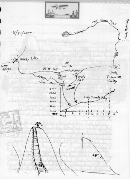
Here is the trail map and graph of elevation gain (4800 ft) by Tanming, reproduced in my travel journal from the trail book with some embellishments from me.
The trail begins at the Happy Isles Trailhead in the Valley near Curry Village where we'd stayed the night before. On the way up, we took the Mist Trail and on the way down, the John Muir Trail.