If the previous trail map didn't mean anything to you (it didn't to me), we luckily have a photo of the trail map, taken from Glacier Point.
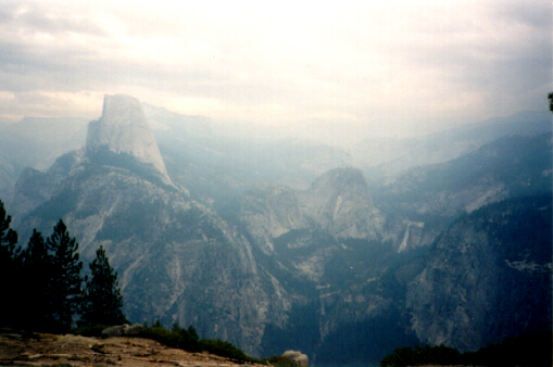
Here's what the landscape looks like.
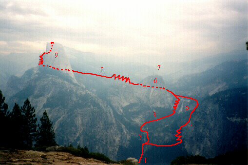
Here's the same photo with the trail map superimposed over it.
1. Happy Isles trailhead (somewhere down there)Dotted lines indicate that the trail meanders behind the rocks.
2. Vernal Fall
3. Mist Trail
4. John Muir Trail
5. Nevada Fall
6. Liberty Cap
7. Little Yosemite Valley (somewhere behind there)
8. Half Dome Trail
9. Half Dome