
The East Mojave is a vast expanse of desert and juniper forest south-east of Baker, California. Recently it was re-designated the Mojave National Preserve.
It is one of the most geologically rich areas of the desert, with many volcanic features. The impressive Cima Lava Dome, home to the densest forest of Joshua Trees known to exist, is flanked by the Providence and New York mountain ranges. Also in the area are the massive Kelso Dunes, volcanic cinder cones, numerous abandoned mining operations and the Mitchell Caverns State Park, featuring guided tours. The Cinder Cones area also features a small lava tube (cavern) which is open for unguided exploration.
An interesting political juxtaposition exists here, with cattle ranchers and miners pitted against preservationists. Currently, mining and ranching are permitted on parts of the Preserve, but when the properties' leases are up the land will be returned to nature.

Many who are loyal to the Preserve would like to see the beautiful Kelso Depot, now vacant, developed into the official visitors' center. This would be ideal, as the Depot is within 40 miles of most of the major features of the Preserve. I believe that this is indeed the official plan now.
The pictures you will see on this page were taken on two occasions:
a camping trip in November, 1996 and a "field trip" with the Sierra Club
over Valentine's Day weekend, 1998. In the latter, we were based at the
Zzyzx Desert Studies Center.
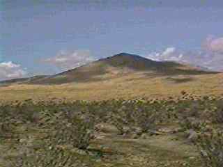
According to geologists, some of the cones may have been active as little as 1,000 years ago. The majority of the activity, however, occurred .5-2 million years ago.
Many of the cones are visible from Kelbaker Road, which extends south from Baker from I-15 to I-40 through the small railroad town of Kelso.
However, if you turn off to the east on Aiken Mine Road, you can get a far better view of the features.
Here is a view of a lava flow with a cinder cone in the distance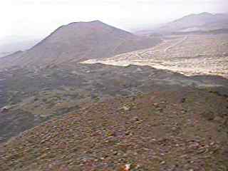
This was taken from the top of another cone during an El Niño storm on our Valentine's Weekend excursion. (what a Valentine's date!) According to our geologist, Brian Elliott, the flow was created when the cone in the foreground "blew out," like a mini Mt. St. Helens. Indeed, the cone has a huge U shape. This flow forever changed and at one time dammed the course of the dry riverbed which can be seen as a light area along the edge of the flow.
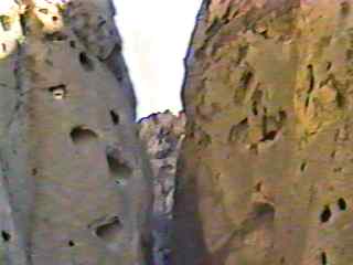
The next day, we visited a lava tube in the area. A lava tube is a cavern formed when a lava flow slows and the top layer cools off and "crusts over". Molten lava continues to flow below, and when the source of the lava disappears, what is in the channel drains away and leaves a cavern. Though small, the cavern is extermely well preserved and events occurring millenia ago look as if they could have happened last year.
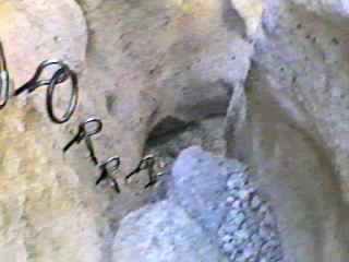
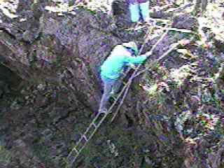 Entry to the tube is
by a flimsy ladder
Entry to the tube is
by a flimsy ladder
Then you actually enter the cavern
After crawling about 20 feet you emerge into the main grotto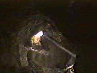
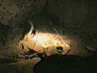
A few "skylights" illuminate the grotto enough so flashlights aren't needed except for close-up viewing
 Skeleton of an unfortunate
rabbit who fell in the cave
Skeleton of an unfortunate
rabbit who fell in the cave
Weird "stalactites" formed when cooling lava dripped from the top of
the cave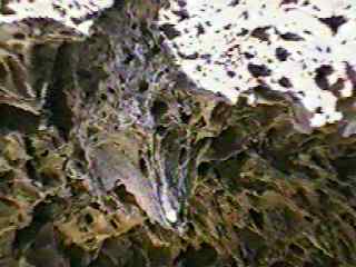
A phone booth in the middle of nowhere. And it works! 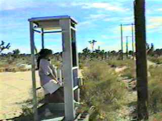
A few minutes later some cattle ranchers pulled up to use the phone. They live in the area and said it is the only one for miles around.
(Update 9/26/99) This phone, now unofficially known as the "Mojave Phone
Booth," has become quite an international celebrity lately, with the help
of Godfrey Daniels.
I have a little bragging right of my own, though: as far as I know, this
is the first picture of the phone ever published on the Internet.
The dunes were formed mainly with sand from the Mojave River and are between 10,000-20,000 years in the making. The piling up is caused by a confluence of shifting winds in this area.
They are considered "booming dunes" - when the sand is dry and you cause a small "avalanche," a low booming sound can be heard. This is due to the microcrystalline structure of the sand grains. Unfortunately, our visit was the day after an El Niño storm so we heard no booms.
View at the beginning, near the parking area. Our goal is the peak in the distance.
The snow-capped Providence Mountains loom to the east 
 The wind left many cool
patterns in the sand
The wind left many cool
patterns in the sand
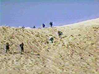 We trudge towards the
saddle, ready for the final ascent
We trudge towards the
saddle, ready for the final ascent
Replace sand with snow, and it could be Everest! 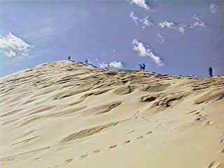
At the top, Brian lectures us on the dunes' origin 
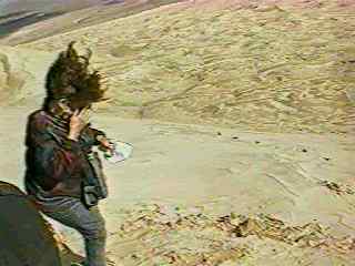 Is it ever windy!!
This guy doesn't mind, though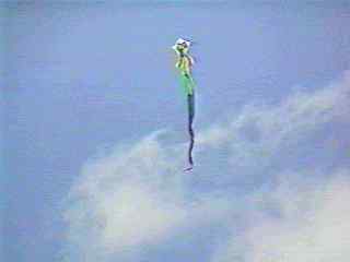
 View from the top
Going down is the fun part! Mari has a great system 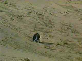
Afterwards, we visited the nearby Vulcan Mine in the Prov. Mtns.

What a big hole in the ground!! It's one of Brian's favorite places
to visit as it still contains a rich variety of minerals, including magnetite,
limonite, hematite and pyrite (a.k.a. "fool's gold".) It was mined extensively
by Kaiser Steel in the forties.
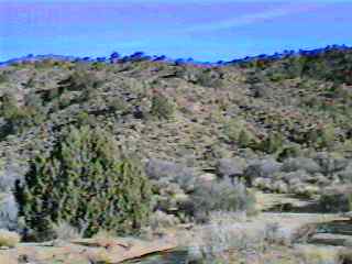
Mid-Hills Area
We looked around this area when on our '96 camping trip, and plan to explore it more soon.
The area is fascinating and features rapidly-changing vegetation. In a quarter-mile one can go from typical high-desert scrub to a full-blown pinyon-juniper forest. Here is a scene that's kind of in the middle.
Sunrise over the Mid-Hills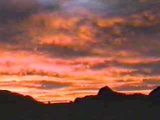
 The Hole-in-the-Wall
area from a distance
The Hole-in-the-Wall
area from a distance
 The
"Ring Trail" which ventures into the heart of the formation
The
"Ring Trail" which ventures into the heart of the formation
Mari tries her hand at the Ring Trail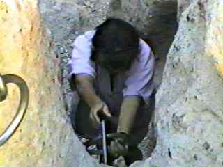
Our campsite. We enjoy "primitive" camping away from the
crowds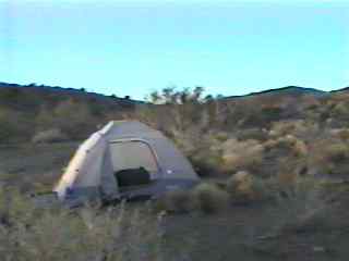
A beautiful "sun dog" near sunset. The actual sun is off to the left of the frame

While exploring the Mid-Hills area, we came across this fantastically-preserved miner's cabin, owned by the late Jim Winkler. (Actually, he wasn't a miner - I was told later that he was a Needles-area butcher who built and transported the cabin there as a base-station for hunting and getaway trips.)

The sign above the door proclaims, "Take what you need - leave what
you can."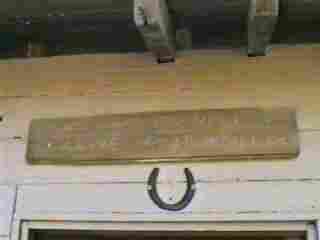
Inside there are many amenities - a bunk bed, a pot-bellied stove,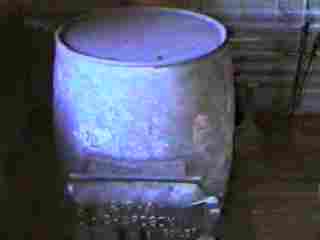
 a fully-stocked pantry,
and a table.
a fully-stocked pantry,
and a table.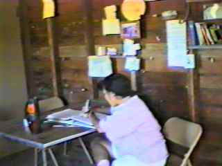
Some of the trinkets posted on the wall:
 Mr. Winkler's portrait,
his death certificate and funeral announcement,
Mr. Winkler's portrait,
his death certificate and funeral announcement,
some works of art and a plea to preserve the sanctity of the cabin.


Mr. Winkler's grave marker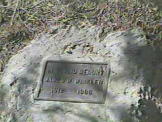
 The outhouse, behind
the cabin (NO DOOR!!)
The outhouse, behind
the cabin (NO DOOR!!)
But with no one else around for miles, who cares?
Nearby the cabin was a small mine tunnel. I ventured inside but it ended
about 50 feet into the mountain.
 A very rare cave column
(where a stalactite and stalagmite have merged)
A very rare cave column
(where a stalactite and stalagmite have merged)
An even rarer cave shield, believed by many to be the finest in the world. It actually grew upwards, appearing to defy gravity!

Cave coral  and
cave curtains
and
cave curtains 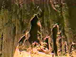
If caves intrigue you at all, this is a "must see." If you have a choice,
the late afternoon (3:00 or so) tour is the best as the mid-day tour attracts
the most people (as we found out the hard way.) The guide said that he
describes the features in much more detail when a smaller crowd is present.
Update 9/26/99: We went on another outing last Feb., where we hiked Caruthers Canyon. I will post pictures of this outing when I get a chance. Also, we made 2 trips to the Red Rock Canyon area in the West Mojave. So much video, so little time...
Also, the Mojave Phone Booth is waiting for our imminent return... and
I can't wait to answer it!