The Sahyadris and Google Earth
View the Sahyadris like never before! This truly space-age technology is amazing in its realism. Simply follow the steps given below and you will soon be immersed in this amazing adventure!

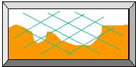
GPS Tracks from this website have been superposed on a satellite photo of Harishchandragad from Google Earth (shown above) by Dr. Aditya Ponkshe.
Google Earth is a free software provided by Google that combines GPS data with satellite imagery in three-dimensions. The results are truly breathtaking ... especially for hikers like you and me. You can view many hiking areas in the Sahyadris as realistic three-dimensional images right on your own computer! You can check out existing routes, locate various Sahyadri forts and other landmarks and even plan out new routes! All you need to do are to follow the instructions below:
STEP 1:
First you need to obtain the GPS coordinates of Sahyadri peaks and landmarks. These are to be used as input into the Google Earth software. These data are available on this website in the form of the Sahyadri GPS Database. Download and save this database on your computer before continuing with the rest of the instructions.
Click here to access the Sahyadri GPS Database
STEP 2:
This step involves the download of the Google Earth software. This is available for free at the website shown below. When you click on that link, the Google Earth home page will appear in a new window. Select the Google Earth free version for download. If you encounter a message saying Google Earth will not work if you don't have a high speed internet connection, ignore it. It will work with even a slower dial-up phone modem, except that it takes much longer (but we hikers can be very patient). However, ensure that your computer speed is above the minimum MHz specified on the website. I know for a fact that it won't work on slower PCs.
Click here to access the Google Earth home page
STEP 3:
Follow the instructions on the Google Earth home page and install the software on your computer. Then make sure you are connected to the Internet and then launch the Google Earth software.
STEP 4:
From the Sahyadri GPS database, select the GPS coordinates of the peak or region of interest. Then enter the GPS coordinates of that location into the input box in the top left corner of the Google Earth screen. Use the arrow/zoom/tilt keys at the bottom of the window to view your site of interest. There are a lot more features (such as flying from one location to another) which you can discover for yourself by playing with the software.
Useful Tips
You can use Google Earth WITHOUT being connected to the Internet too! This is because Google Earth stores all the places you visited on your computer while you are connected to the Internet. The more you tour the Sahyadris on Google Earth, the larger will be the library on your PC. Of course, the first time you use Google Earth, you must be connected to the Internet.
The single most easily observable man-made landmark is the Mumbai-Pune expressway. You can use this landmark to orient yourself before zooming in to relevant sites.
Natural landmarks such as rivers and lakes show up prominently. These can be used as guides for finding other locations in the vicinity.
When you move the cursor on the Google Earth screen, the GPS coordinates that correspond to that particular point will be displayed. This feature is very useful for finding GPS coordinates of various locations.
GPS coordinates of other landmarks (such as hiking trail start/end points, road junctions, temples, railway stations, etc) can be obtained from the GPS map collection on the home page. You can enter the GPS coordinates of these locations into the Google Earth software and get some very interesting views.
|