|
Date: |
Sunday 3 September 2005 |
|
Location: |
Arkwright Opencast Coal Site & Duckmanton Rail Cutting |
|
Leader: |
John Aram |
|
Author: |
David Dunn |
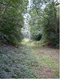
Seven of us, including leader John Aram, met in the entrance to the Arkwright Opencast Coal Site, this was my first OUGS meeting but I soon felt like one of the family, so much so that within 5 minutes I found that I been delegated to prepare this record of the day’s activities. The original intention had been to visit the Opencast Coal Site but this is now being restored and it had not proved possible to obtain access and instead we were to spend the morning looking at the Duckmanton Railway Cutting. The weather forecast said that early morning mist in the Vale of York and Trent Valley would soon clear to give a warm day with hazy sunshine; in the event it was cold, I was glad of my fleece but wished I had worn long trousers and was glad to get into the shelter of the cutting and out of the wind.
Duckmanton Railway Cutting is the International Stratotype for the boundary between the Lower Coal Measures (Westphalian A) and the Middle Coal Measures (Westphalian B), the boundary being the Clay Cross Marine Band, which here dips at some 20 degrees to the east. The band also is exposed in Germany and in Pennsylvania. The beds exposed at Duckmanton are successions of shale, siltstone, sandstone and coal. Because of the importance of the site no hammering or collecting is permitted; never the less we found much of interest in the scree, mostly bivalves including one slab covered with a number of extremely well preserved Dunbarella. Also found were plant remains usually Cordaites, one of the sources of the coal. Someone had left, in a prominent position, a good example of cone-in-cone compaction which John explained to us. We examined the coals, including Flockton Seam and I now know what a seatearth is. In the sandstone and shale beds were numerous iron nodules, these were previously quarried and used to produce cannonballs at a foundry which was in what is now the opencast area; indeed, it is suggested that the iron was the initial mineral of interest and attention only turned to the coal when wood for smelting became scarce.
The history of Arkwight Town which claims to be the smallest town in England (some 200 houses) was explained by John. The town was originally situated to the east of the colliery and across the Sutton Scarsdale road from it; but, in 1989, methane was detected in the houses and the decision taken to move the town, lock, stock and miners’ welfare across to the north side of the A632. The total cost was over £40M and the area left was never actually worked in the Opencast due to its proximity to the road.
 |
 |
| Duckmanton Cutting looking west. Photo © Don Cameron | The Oilman statue at Dukes Wood. Photo © Don Cameron |
 |
 |
| One of the Coal seams exposed in the cutting. Photo © Don Cameron | Cone-in-cone structures. Photo © Don Cameron |
We returned to the cars and drove up the escarpment passing Bolsover Castle and Town (pronounced ’Bowser’ according to some old miners John had met on his recce) to the Poulter Country Park at Langwith, where John had found an idyllic place for our picnic lunch. The park was previously part of Langwith Colliery, and there was evidence of quarrying, the Permian Magnesian Limestone being cut back as rough terraces which, as the sun was now out, provided excellent seating for our stop.
After lunch it was on to the Duke’s Wood Nature Trail and Oil Museum. Here we were able to examine a small museum of the Nottinghamshire oilfield and of war time memorabilia. Older readers will remember HMS Amethyst which was trapped in the Yangtze between Nanking and Shanghai and repeatedly shelled by the communists during their take over of China. The ship was trapped and under fire for over three months, what I had not realised was that a flying boat delivered crew replacements for those killed, supplies, etc.; the museum curator was part of the flying boat crew, who later had a career in RAF Bomb disposal. We speculated that may have been why he was employed on the first Seismic surveys post war where blasting was used down hole!
We then watched a forty minute film of the development of the oil field. Following some exploration in WW1 and production from a small well at Hardstoft, near Tibshelf, the area was part of a large scale onshore exploration programme by D’Arcy Exploration, a subsidiary of Anglo-Iranian Oil Co Ltd (later BP) which led to two prospects, at Formby, Lancs, and here, at Eakring. Although oil was found in Eakring by 1939, not enough production was taking place to make up losses due to U-boat warfare. In 1943 US oil men were brought across to be billeted at Kelham Hall Monastery whilst opening up the field to produce 1.4 million barrels of oil by 1945. The film was a bit “Yanks help out plucky Brits” but was still well worth seeing.
The oil is present within the Millstone Grit series, being found in the pores of the rock, and to reach it one must drill through the Triassic Keuper Marls (Mercia Mudstone Group), the whole of the Permian and the Coal Measures. At one time there were about 170 nodding donkeys in this Nottinghamshire field and some 1200 men were employed. Gradually the wells became less productive and that at Duke’s Wood shut down in 1965. Sympathetic restoration and transfer to a nature reserve has allowed some traces of the efforts here to remind us of them.
After enjoying delicious scones (made by the curator’s wife) we explored the site, trying to avoid standing on the very numerous froglets. Visible were nodding donkeys, well heads and a rather idealised statue of a US oil man.
A fascinating day, our thanks to John for leading us in his usual erudite manner and to Tracy and Don for making the arrangements.
Access: Duckmanton Rail Cutting is on B6425, about 100yds from junction with A632, and some 3 miles east of Chesterfield. Access is strictly by permit from Derbyshire Wildlife Trust.
Duke’s Wood is between Eakring and Kirklington and about 4 miles north of Southwell. The site, which is run by Nottinghamshire Wildlife Trust, is always open but the museum tends to be open at weekends only. If you intend to visit a telephone call to the curator Kevin Topham on 01623 882 446 would be advisable since it would be a pity to arrive, find it closed and miss the scones.
For further information on the day’s sites: -
References: Measured sections at Duckmanton Railway CuttingVarious North West Branch Members. 1985. OUGS Journal, Vol. 6 No 1,
www.wildlifetrusts.org; www.derbyshirewildlifetrust.org.uk; www.wildlifetrust.org.uk/nottinghamshire describe the nature reserves.
http://perso.libertysurf.co.uk/neil.bridgewater/Adelphi.htm discusses the ironmaking at Duckmanton.
www.dukeswoodoilmuseum.co.uk, and www.bolsover.gov.uk/index.asp?sessionx=MX4wfjEzfjUxfjB%2BMA for information on the Eakring field and the Uk’s first oilwell at Hardstoft.
Neil Turner of Wollaton Hall Museum, Nottingham, attended the trip and has kindly provided a list of the plant fossils likely to be seen on the scree slopes. There are plenty loose blocks to fossick about in, so please do not hammer the outcrops.
Duckmanton - Plant fossils seen on the trip: -
1. what could have been part of a cordaite leaf, scientific name: Cordaites sp.
Cordaites grew up to 30m tall, with long, strap - shaped leaves arranged in a spiral, amongst which were primitive cones. Some cordaites developed stilt roots similar to those of the mangroves that grow today in coastal swamps. They appeared in the early Carboniferous, about 325 million years ago but by the mid - Permian they had been replaced by their presumed descendants, the conifers.
2. What looked like part of the bark or stem impression of the giant clubmoss Sigillaria sp. This was a tree - sized clubmoss with a simple stem.
3. What could have been vaguely preserved, isolated, pinnules of seed fern fronds. These were just parts of a whole seed fern frond where the whole frond had been broken up and the parts scattered. I wasn't able to say which genus because they were fragmented and weren't that well preserved.
4. Part of a stem of the giant horsetail Calamites sp. showing longitudinal ridges and a transverse line at a node. The giant horsetail Calamites grew up to 16m high.