|
Directions(all distances approximate)
From the intersection of Route 30 (Lincoln Highway) and Route 896 (Hartman Bridge Road) located east of Lancaster, follow Route 896 south to Strasburg. Turn right onto Route 741 (Miller Street), and follow for 1-1/4 miles, passing Strasburg Pike (on the right). Route 741 bends to the right (becoming Village Road) where Penn Grant Road meets it on the left. The Strasburg Mennonite Church is located on the left just past this point.
Map courtesy of MapQuest
|
Photos of Plot Locations
Figure 1a. From the back corner of the Church nearest the cemetery, the Kendig family plot is easily identified by the tallest monument (just left of center in the photo).
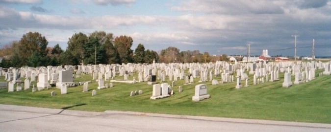
Figure 1b. From the first driveway intersection in the cemetery, the tall, spire-like monument is easily identifiable.
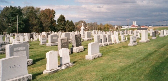
Figure 1c. Individual burial plot locations are marked by rectangular stones arranged in two rows on either side of the tall monument (eight on the nearer side in the photo, five on the farther side).
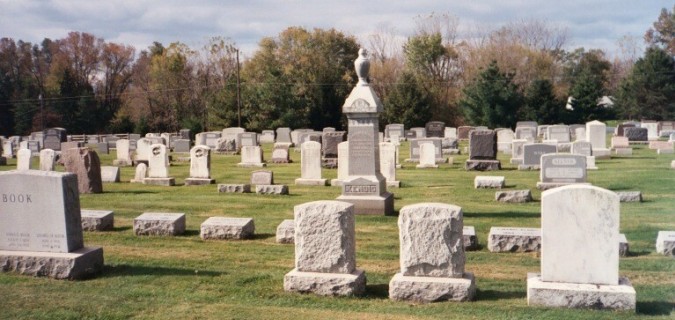
Figure 1d. Closer view of the tall monument, dedicated in memory to Christian H. Kendig and his wife Anna Rutt (Witmer) Kendig.
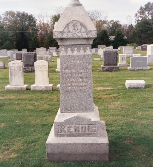
Figure 1e. On the side fatherest from the church are markers for Witmer J. and Rebecca (Kinports) Kendig, and thier son John Leslie Kendig (right to left in the photo).
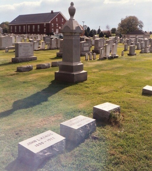
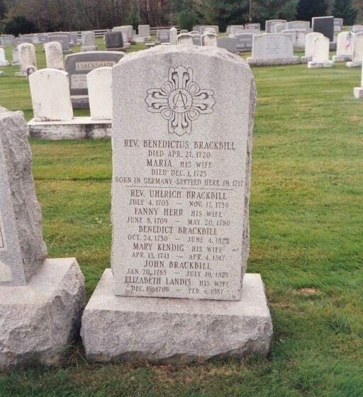
Figure 2a. At the first driveway intersection in the cemetery, the marker for Rev. Benedict Brackbill can be seen to the left (the taller stone in the center of the photo that is leaning slightly backwards).
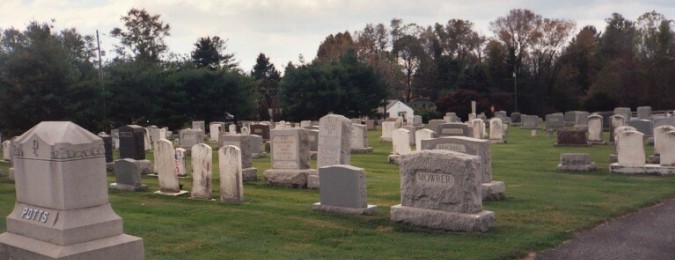
Figure 2b. Closer view of the stone marker that was erected generations after his death by the Brackbill family in honor of Rev. Benedictus Brackbill and his descendents.