THE
WESTERN GHATS
Geomorphology and climate of the Western
Ghats
The landscape of the Southern Indian tectonic
shield is believed to have evolved through a slow geomorphic process
(Radhakrishna 1993), which arose as a result of the movement of the
peninsular region into the rest of the Asian mainland and the resulting
geologic transformations. Volcanic activity over a period of 120 - 130
million years resulted in the formation of the present day Western
Ghats (Daniels 2001b). Along
with this, the peninsula also experienced an eastward tilt which
changed
the pattern of drainage. In many cases, like the river Sharavati and
Kali
in Uttara Kannada, the western faulting led to 'river capture' and
diversion of the easterly drainage to the west (Radhakrishna, 1991).
The Western
Ghats, which arose from these activities, presently forms a continuous
chain
of small to medium sized mountain ranges running along the western
coast
of Southern India. Recent work by Valdiya (2001) also indicates that
there
have been active neotectonic movements along the NNW-SSE leading to the
formation of faults and fractures. Among other geologic changes, this
has resulted in changes in the flow character of all rivers and streams
that flow to
the west and descend across the western margins of the Western Ghats.
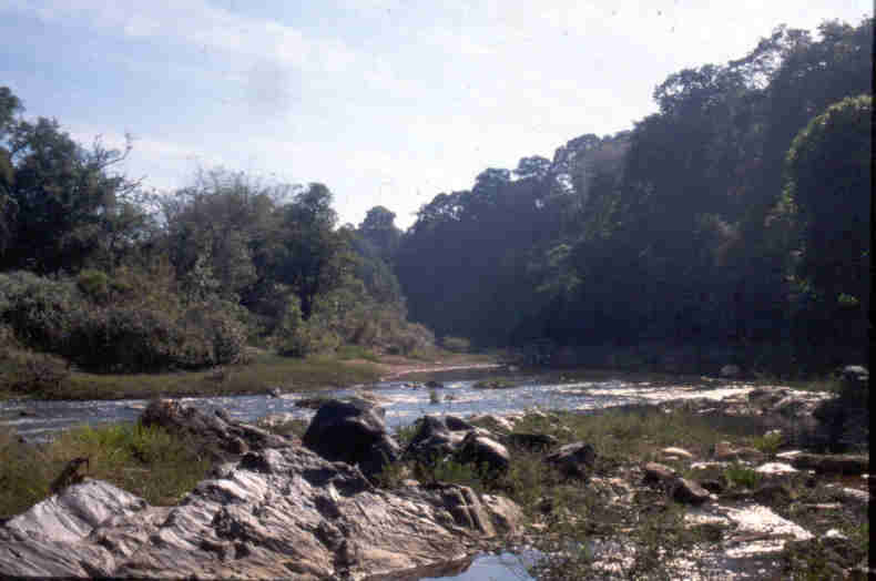
There
are abrupt drops as water falls through gorges and cascades of rivers
flow
along the upper reaches of the Western Ghats. Rivers show anastomosing
patterns in the sinuosity of meandering in the upstream stretches. It
has also lead to the formation of stream ponds as the rivers flow
through these faults. For instance, in Uttara Kannada, we find the
ponding of the river Bedti
at the study sites of Ramanguli and Hoskambi.
The Western Ghats is a forested tract of relatively
smooth, but very old, mountain ranges bordering the South Western
coastline of India, starting from Central Maharashtra to the southern
tip of Kerala. The Western Ghats, along with another range of smaller
mountains - the Eastern Ghats, form a substantial percentage
(approximately 10%) of the forested area of the Indian Subcontinent.
It runs rather continuously north- south between 8
and 210 N latitudes. It covers a distance of approximately 1600 km-
being interrupted just once by the 30 km wide Palghat Gap at around 11
N. The narrow coastal strip that separates the hill chain from the
Arabian sea in the west varies in width from 30 to 60 km being the
narrowest between 14 and 15 N. Hills are generally of elevations
between 600 and 1000 m. However there are higher hills of 1000- 2000 m
between 8 and 13 N and
18- 19 N. Peaks over 2000 m are found only in the Nilgiris, Palanis and
Anaimalais. The Nilgiris and Palanis are spurs from the main hill
chain,
which extend the Western Ghats eastwards to approximately 78 E. Annual
rainfall on the Western Ghats averages 2500 mm. Rainfall as high as
7600
mm in localities such as Agumbe between 13 and 14 N is not uncommon.
The Western Ghats receives much of their rain from the southwest
monsoon.
Hence the wettest season generally lies between June and October. The
rainy
season in the southern latitude is however often prolonged locally due
to
pre-monsoon and winter showers. Thus the dry periods in parts of the
Western
Ghats south of 13 N are the shortest (2- 5 months) while in the north
it
varies from 5 to 8 months. Mean temperature ranges between 20 and 24 C.
However,
it frequently shoots beyond 30 C during April- May (summer) and
sometimes
falls to 0 C during winter in the higher hills. The Western Ghats
harbours
approximately 38 east flowing and 27 west flowing major rivers. The
west
flowing rivers originate in the Western Ghats and drain into the
Arabian
Sea while the East fowing ones merge into the three major river
systems-
Cauvery, Krishna or Godavari- before they drain into the Bat of Bengal.
Soil
The soil mainly consists of
the derivatives of the ancient metamorphic rocks in India, rich in iron
and manganese (Pascal 1988). There are exposed lateritic rocks along
the coastal hills
which appear black and are barren and mostly unfit for plant growth.
Some
granitic rocks are also present towards the southern parts of the
district. One distinct feature of this region is the formation of
limestone pannicles in the forests of Yanna. These are a unique feature
for the Western Ghats; they are, however, common in the forests of
South - East Asia.
Biogeography
An early attempt to classify the various
vegetation types of the Western Ghats was done by Champion in 1936 and
was later revised and enlarged by Champion and Seth in 1968.
Nagendra and Gadgil (1998) have identified 11 landscape elements (LSE)
or vegetation mosaics, including some anthropogenic kinds,
characteristic of the Western Ghats.
Because of its African origin, much of the flora
and fauna of the Western Ghats are shared with Africa, Madagascar and
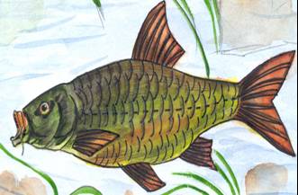
also South America. Amongst fishes, some species of catfish (Clarias),
some Cyprinids (Puntius, Labeo, Rasbora and Barilius) as well as genera
like Notopterus and Mastacembelus are common to both India and Africa.
There are also similarities between the biodiversity of this region
with the East - Himalayan region. This is found to be true of some
species of fishes, mammals as well as birds (Hora 1949).
On a broader scale of the Western Ghats, studies on the biodiversity
of this region have shown that the overall species diversity here is
high. In fact, it has been counted as one of the world’s 18
biodiversity “hotspots”. There is also a high level of endemicity in a
number of taxa in this region - with nearly 2000 species of higher
plants, 87 species of amphibians, 89 species of reptiles, 15 species of
birds and 12 species of mammals (Daniels, 1997). There are around 218
species of primary and secondary freshwater fishes in the Western
Ghats. 53% of all fish species (116 species in 51 genera)
in the Western Ghats are endemic (Talwar and Jhingran 1991, Jayaram
1999,
Menon 1999, Daniels 2001a). Furthermore, freshwater fishes of the
Western Ghats have a high economic value – they are caught extensively
for food as well as ornamental purposes (in aquaria).
230 species of woody plants and 480 species of birds have been
recorded in the Uttara Kannada district. There is a distinct gradient
in species richness of plants in Uttara Kannada. The plant species
densities increase both from east to west as well as north to south.
This gradient of plant species richness coincides with the rainfall
gradient. A similar trend in bird species diversity is also observed,
but for birds, species diversity increases with decreasing rainfall,
with the maximum diversity being found in the intermediate rainfall
zone (Daniels 1989). Diversity patterns of reptiles and amphibians have
also been studied by Daniels (1991). The central Western Ghats are
rather
rich in butterfly species. While 249 species are known from the state
of
Goa, the Uttara Kannada district alone is known to harbour 300 species
(Gaonkar,
1996). Species richness data for fish and aquatic invertebrates have,
however,
not been documented in the recent times. A number of species have been
introduced into the waters of this region, most of which are in the
reservoir areas
of dams. Many have naturalised in the streams, ponds and tanks of the
region. Species like Oreochromis mossambics, Gambusia officinis,
Poecilia reticulata etc. are exotic species which are originally from
Africa and South America. Species like Rohu, Catla, Mrigal (carps which
are from the northern parts of India) have been introduced recently,
mostly for commercial purposes.
Figure 1: Map of Southern Western India showing latitudinal divisions.
Map adapted from Samant et al. (1996).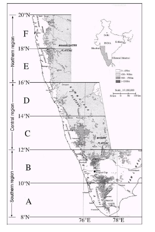
References:
Daniels, R J R (1989). A conservation strategy
for the birds of the Uttara Kannada district. PhD Thesis: Indian
Institute of Science, Bangalore. pp238.
Daniels, R J R (1991). The problem of conserving amphibians in the
Western Ghats, India. Curr. Sci., 60(11): 630-632.
Daniels, R. J. R. (1997). Taxonomic uncertainties and conservation
assessment of the Western Ghats. Curr. Sci. 73 ( 2): 169- 170.
Daniels, R. J. R. (2001a). Endemic fishes of the Western Ghats and the
Satpura Hypothesis. Curr. Sci., 81 (3):240-244.
Daniels, R. J. R. (2001b). A Report on the National
biodiversity Strategy and Action plan- the Western Ghats Ecoregion:
Submitted to the Ministry
of Environment and Forest, India. pp 129.
Gaonkar, H. (1996) Butterflies of Western Ghats, India including Sri
Lanka: a biodiversity assessment of a threatened mountain system.
Unpublished Report submitted to Centre for Ecological Sciences, IISc,
Bangalore.
Hora, S L (1949) Satpura Hypothesis of the Distribution of the Malayan
Fauna and Flora to Peninsular India. Proc. Nat. Inst. Sci. India,
15(8):309-314.
Nagendra, H and Gadgil, M (1998) Linking regional landscape scales for
assessing biodiversity: a case study from the Western Ghats. Curr.
Sci.,
75(3):264-271.
Pascal, J P (1988). Wet evergreen forests of the Western Ghats of
India. Pondicherry: Institut Francaise.
Radhakrishna, B P (1991) An excursion into the past - 'the
Deccan volcanic episode'. Curr. Sci., 61 (9&10):641-647.
Radhakrishna, B P (1993) Neogene uplift and geomorphic
rejuvenation of the Indian Peninsula. Curr. Sci., 64 (11&12)
:787-793.
Samant, J. S. Ajit Kumar, C.R., Thomas, R. and Biju, C. R.
(1996). Ecology of hill streams of the Western Ghats with special
reference to fish community. Annual (draft) submitted to Bombay Natural
History Society.
Valdiya, K. S. (2001). Tectonic resurgence of the Mysore
plateau and surrounding regions in cratonic Southern India. Curr. Sci.,
81 (8): 1068-1089).
Back to Main Page