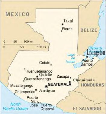
Guatemala is the northern-most country of Central America.
Guatemala Borders: To the north and west by Mexico, on the east by Belize and the
Caribbean Sea, on the southeast by Honduras and El Salvador, and on the
southwest by the Pacific Ocean.
Guatemalan Geographic Coordinates are: 15 30 N, 90 15 W
Total area: 108,890 sq km; water area: 460 sq km,
land area:: 108,430 sq km.
Comparative area: Slightly smaller than Tennessee.