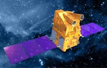
The twelfth in the Indian Remote Sensing (IRS) satellite series, CARTOSAT-2 is an advanced remote sensing satellite capable of providing scene-specific spot imagery. It will join the other six IRS satellites which are in service -- IRS-1C, IRS-1D, OCEANSAT-1, Technology Experimental Satellite (TES), RESOURCESAT-1 and CARTOSAT-1. It carries a Panchromatic camera (PAN) to provide imageries with a spatial resolution of better than one metre and a swath of 9.6 km. The satellite can be steered up to 45 deg along as well as across the track. The data from the satellite will be used for cartographic applications at cadastral level, urban and rural infrastructure development and management, as well as applications in Land Information System (LIS) and Geographical Information System (GIS).
Soon after its separation from the DLA, the two solar arrays of CARTOSAT-2 were automatically deployed to generate the electrical power for the satellite. The satellite health is being continuously monitored from the Spacecraft Control Centre of ISTRAC at Bangalore with the help of its network of stations at Bangalore, Lucknow, Mauritius, Bearslake in Russia, Biak in Indonesia, as well as support from Svalbard ground station in Sweden for the initial phase of the CARTOSAT-2 mission. Further operations on the satellite like orbit trimming, checking out the various subsystems and, finally, switching on the cameras will be carried out in the coming days.
With ISRO Satellite Centre (ISAC), Bangalore, as the lead Centre, CARTOSAT-2 was realised with major contributions from Space Applications Centre (SAC), Ahmedabad, LPSC at Bangalore, and IISU, Thiruvananthapuram. ISTRAC is responsible for initial and in-orbit operation of CARTOSAT-2. The National Remote Sensing Agency (NRSA), Hyderabad receives and processes the data from CARTOSAT-2.