Route 5 starts in Oxford from St Ebbes Street and heads south, crossing the river Thames by the footbridge near Grandpont. From Oxford railway station, cross the new footbridge to the car park and follow the marked cycle path to Osney Road then Speedwell St. Prepare to turn right at the pedestrian crossing on Speedwell Street into Gas St, rejoining Route 5.

The route follows the narrow river path for about half a mile before turning right through the meadow to a new cycle path alongside the railway. After about a mile, you reach Sandford Lane, at the southern edge of Kennington. Turn right under the railway bridge and left at the T-junction. From Kennington to Radley the route follows the road. A shared-use segregated path has been built alongside the road, but is not yet signposted as such.

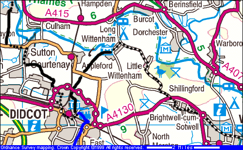
Map images produced from the Ordnance Survey Get-a-map service. Image reproduced with kind permission of Ordnance Survey and Multi Media Mapping.
On entering Radley the signed route turns left, following the quiet road through the village, passing the station, shops and a pub. Radley station is served by hourly trains to Oxford and Didcot, most of which continue to London.
On leaving Radley the route turns left down Thrupp Lane, passing a farm and gravel works. Thrupp Lane bends sharply right, then the route turns left and leads to the course of the former railway line to Abingdon.
A new surfaced path has now been built along the old railway (May 2001) which continues through Barton Fields which is a water meadow, and Abbey Meadow, an elegant riverside park with outdoor swimming pool and tennis courts. From the park the route follows the road past the Abingdon Guildhall under a medieval archway.

The NCN route leaves Sutton Courtenay via Hobbyhorse Lane, a left turn that is also signed for the Catholic Church. The lane leads to a byway and then a new cycle path across the landscaped meadows that cover the landfill site. This path goes around Didcot Power Station to Didcot's Northern Perimiter Road. Cross the perimiter road into Southmead industrial estate, turn left at the first T-junction, right at the second, and then cross the road to a shared-use path to the right of the road. If you reach the Asda warehouse you have gone too far! The cycle path becomes a lane that passes the sewage works and joins Basil Hill Road.
An alternative route from Sutton Courtenay to Didcot is to follow the shared-use commuter route through Milton Park industrial estate. This uses a pavement through the site and then along Milton Road, next to the railway line. The path ends at a roundabout on the Perimiter Road: cross this to Basil Hill Road, directly opposite.
Basil Hill Road passes the entrance to Didcot Parkway's
long stay carpark and then joins Station Road
at a roundabout. Turn left to reach the railway station
main entrance and to continue along the NCN. To reach the town centre go
straight across the roundabout and up Foxhall Road, then turn left at the
next roundabout. To continue along Route 5 go past the station, then turn
left under Cow Lane bridge (controlled by
traffic lights). This is the start of the route to Long
Wittenham and Wallingford.