The Bohemian Alps of Nebraska is the name given to part of the range of uplands which runs in a line 50 - 60 miles west of and roughly parallel to the Missouri river.

The Bohemian Alps of Nebraska is the name given to part of the range of uplands which runs in a line 50 - 60 miles west of and roughly parallel to the Missouri river. |

|
| Copyright Ray Sterner, John Hopkins University Applied Physics Laboratory Color Landform Atlas of the United States |
Czech immigration to the U.S. reached its height in the decades 1860 - 1910 and had two main causes.
Firstly, the immigrants wished to escape the arbitrary autocracy of the Hapsburg regime which, in the 1850s, had sought to eradicate the Czech language and culture.
Secondly, Czech culture always has held learning in high esteem and the small farms of the Bohemian plateau did not allow for the scope of the advances in agronomy taking place there.
By 1910 about 90,000 Czechs lived in Nebraska, one out of every eight in the U.S.
Most lived on farms or small towns in the eastern part of the state (like most everyone else).
The area most famous for Czech settlement is the middle course of the Big Blue river, i.e. Wilber (the Czech Capital of Nebraska), Crete, and the surrounding farmsteads.
Most of the others resided in that range of uplands describing a gentle curve from Verdigre in the north to Table Rock in the south, but most especially in that area immediately south of the Platte river (shown in the infrared satellite image below).
 |
|
| From the Consortium for the Application of Space Data to Education at UNL |
So, if you are in Butler or Saunders county between north-south lines drawn through Dwight and Weston (about 30 miles north to south and 15 from east to west), you're in the Bohemian Alps.
It is this area that contains the most closely spaced group of towns with relatively high proportions of people of Czech descent.
These towns are -
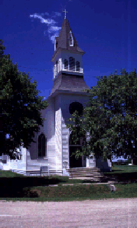
Most all of these towns have fine old churches dating from around the turn of the century. |
 |
Butler and Saunders counties maintain websites about their histories. In Wahoo, one may visit the Saunders County Historical Museum.
The Bohemian Alps has many places for outdoor recreation:
 |
This highway map of the general area is from Mapquest. You may view six 1874-1898 maps from the NEGenWeb page, or one from the 1895 U.S. Atlas page. |
This page is very much a work in progress. This summer I'll be posting some photos of the Bohemian Alps so check back and hit reload.