|
Paul
and Ivor Going Feral 2 Part
2 Tully Falls National Park QLD to
Laura QLD |
|
|
|
Written by Paul Jones |
Written by
Ivor Morton
|
|
|
Thurs. 25 April 2008. We were treated very well with dinner and breakfast prepared by Maria and although I was eager to get on our way it made me feel sad to see them both standing there waving and to know that Ivor will almost certainly not see his old mate again.
On the way we stoped and and visited the “Millstream Falls” . The terrain around hear, has been formed by lava flows which the river has shaped and moulded to the present contours. As soon as we got there we booked a tour
for 3.00 pm the same afternoon. Our guides name was Stephen and arrived with one of the “Undara’s Centre’s” small buses and we left about 3.30 pm. He drove us around the village of tents lodges and Caravan Park and talked about the railway carriages that they had acquired and off their history. They are now used for accommodation and administration blocks. Then we were driven about 12 kilometres to where there were two sections of the Laver Tunnels intact. See the following web site. ( http://undara.com.au/lava-tubes/tunnels-to-a-wildlife-underworld/ )
On returning to camp at 5.30 we had heard earlier from the tour guide that there was a sing along starting at 8.00 o’clock. I did a bit of typing in the computer. Ivor tried out the swimming pool and then I got some tea, we had bought a roasted chook yester day so I cooked some vegetables and reheated the chook in the cast iron frying pan. At 8.0 pm we went over to the area were there was some entertainment about to happen there were already a dozen or so people there, and it was not long before a man of about 25 years appeared with guitar and lit the fire. He was very good and soon got the audience participating in the songs. Half way through the evening he was about to do Waltzing Matilda he got Ivor up to play the swagman. Ivor was in his element and hammed it up excessively. A young girl of about 20 was the sheep and Ivor had great fun stuffing her in the tucker bag, which in this case was a chair, she took it in good cheer and the audience gave them all a good clap and cheer at the end of the performance. Later Ivor managed to recite one of his poems successfully, it was a good evening and enjoyed by all. |
Drive
to Lava Tunnels through Mt Garnet. Road closed for Anzac day march. Undara a
treat, Had tour and a swim. Campfire fun. People next to us with a brand new
Jayco offroader and three young boys. Took me back a long time. |
|
|
Sat 26 April 2008. I slept well until around four in the morning, at which time I woke up filling very sore and tight around the centre of the chest. I am hoping that it is just because when we went to look at the Lava Tunnels I took the new Shalale with me to help me get down and back the three hundred steps, and leaning on it has made my chest sore. I got up about six and went and had a long hot shower but it did not help much, when I got back to the tent Ivor was up and starting breakfast. So I did a bit more typing on the laptop. After eating and packing up we left “Undara” at 9.30 am. It was a great experience and one of the highlights of the trip so far. Heading for Atherton, but we decided to get off the beaten
track and cut across the range, the first town we set out for was Irvinebank.
The road in places was pretty rough and at one creek crossing there was a 450
mm drop where the recent rains had eaten into the creek bank. But there was
evidence of vehicles going through so we followed without too much grief! We pulled up on top of the range and boiled the Billy on the one burner spare stove. We had just got settled when a red four drive one toner came up the track. He pulled up and said good day and we talked with for fifteen minuets or so. He had been in the district for forty years and had worked on a station until his health failed, he has bad gout and arthritis and can do very little with one hand and arm. He is now on a pension, but is a member of the local bush fire brigade and still has ties with the station he used too work for as the Ute he was driving belonged (“in his words)”To the station”. He was in fact going out to check on a fire that had been burning for a couple of days. His name was Steve. We asked him how long the road we were using had been there he said a hundred years and had been put in for the tin exploration and mining, there were still operating tin mines there was so much tin in the area that the streams were unsafe to drink from because of the naturally accruing arsenic was in the water. He confirmed that we were on the right road to Irvinebank. “Motormouth” has been very confused and most of the time has no idea where we are, every now and then she pipes up and confirms that we are on the right path. We left Steve at a gate which he said to leave open as he was going off on one track to check the fire and then would be coming back to check it on the road that we were taking and I must say that less than a kilometre from the gate on our road the fire had got into some thick grass and blackboys and was going strong it had not jumped the road at that stage but was flaring and as we drove past the you could feel the head radiating through the glass. The country was mountainous and as we got closer “Irvenebank” the road was steep and winding in and out of the mountain range with numerous creeks most still had water running. At Irvinebank we stopped and had a short chat with a retired man who said he liked to restore engines of all types. It was only a small town and I did not see any shops, though there could have been, we saw about 30 houses . I think that in the past it must have been a tin town.
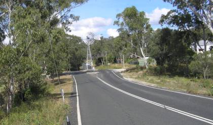
Going through Watsonville there was a rather large windmill installed in the middle of the road on a traffic island one lane on each side. It was obviously not operational all though it was complete with blades a gearbox etc. more for affect I think.
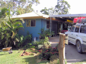
John took us through his garden and wild area which is
main part of there block, as they, that is both (John and Eda) are avid Bird
watchers, John is a carpenter and Eda is a Botanist with the National parks,
But is over seas at this time. They even have a sizeable dam at the bottom of
the block to encourage wild life- it was a good experience and John looked
after us well. We stayed the two nights and did a circuit of Lake Tinaroo
which took us around five hours and we saw rain forest and exotic pine
plantations historic sites including I used the time also while we were at John’s to recharge the batteries in the Land Cruiser and also computer and camera batteries, and transfer Photos and videos to the USB hard drive. |
Went
via back roads to Atherton, Irvine bank to Watsonville with a windmill in the
middle of main road. Went through dry rough country, meeting `Steve’ who gave
us some info on the local area. Water poisoned from tin mining whilst some
small scale mining still going on. Through to Herberton, lovely green rolling
downs and then Atherton. Turned at Tolga for Kairi where postmaster would not
give us directions to John’s home. Soon thereafter a bit of a diversion.
Great welcome, pretty property with lots of birds and Dog, `Tevi’. John a
great host. Planned next day’s tour. I
THINK WE HAVE LOST A DAY HERE. |
|
|
Mon 28 April 2008. After a good breakfast we headed off for Mareeba where we
took on gas (that is gas not petrol as the Cruiser is duel fuel) – then to
Mossman where we did our shopping. When we left we were fully stocked with
provisions. We stopped off at Mossman Gorge where there was a terrific Swimming hole in which their were dozens of good sized fish swimming around, and did not seem at all perturbed when Ivor striped down to his underpants and when in to cool of- there was a couple of canoeists there also. After leaving there we called into several beaches including “Wonga Beach”, all the beaches are lovely along the coast in this area, this is all part of the drive through the costal part of the Daintree River. I believe that Sir Joh Bjelke-Petersen bashed this road through with a lot of opposition from environmentalists, we took the car ferry across the Daintree and not far from this was a tourist centre that obviously catered for the rich and famous as they were offering a hour or so guided tour along board walks and look outs for the small sum of which for the two of us would have cost three hundred and ninety dollars, far to much for budget travellers. After a lovely day we spent the night at the Cape Tribulation Caravan Park Not far from were we are camped there is a large army type tent and next to it is a small two man tent. We found out the large tent was occupied by a woman, who was studying the local wild pig population. She was known locally as the `pig lady’ and the smaller one by her helper also known locally as the `slave.’ |
Away
through lush country to Mareeba. Got gas and then on our way to the coast and
Mossman. Huge shopping area and very touristy. Gorge with lots of people and
fish in ponds, had a splash in the water and then on to the ferry and further
up through the Daintree. Expensive tourist stops, very commercial but a nice
camping spot at Cape Tribulation. |
|
|
Tue 29 April 2008. Another pleasant if not warm day driving through rain
forests and calling into the odd beach, stopping for lunch at a very pleasant
fast flowing creek to have lunch on the way to Cooktown the road being in the
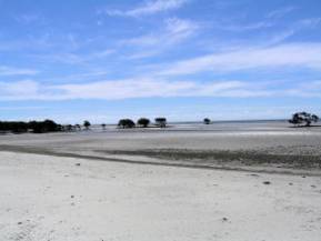
main rough unsealed with steep grades winding up and down through the green
lush forest. We did stop and have a look at “Donovan’s Beach”. The tide was out so far the water was not visible at all only the sand with Mangrove clumps here and there. An hour or so back on the road we came upon a lone shop where we were glad to have a break and an ice cream, very enjoyable. The road improved as we got towards Helen Vale. The weather getting more hot and humid as we progress.
Below is a segment copied from - www.epa.qld.gov.au web site. Black Mountain’s structure resulted from slow geological processes. Some 260 million years ago, a mass of molten rock (magma) slowly solidified deep below the Earth’s surface, forming a body of hard granite rock. As softer land surfaces above eroded away, the sparsely fractured top of this granite was gradually exposed. Weathering and chemical decomposition removed loose material along weak fractures extending downward through the rock. More resistant rock remained as large rectangular blocks, their corners becoming progressively rounded into boulders. The solid granite core of the mountain now lies beneath the jumbled cover of boulders. The granite rock is actually a light grey colour and composed of mineral such as feldspar, mica and hornblende. Black Mountain’s distinctive dark appearance is due to a film of microscopic blue-green algae growing on the exposed surfaces. Grey patches and boulder fractures indicate ongoing rock disintegration, a process accelerated dramatically when cold rain hits rock, sometimes with explosive results.
|
Coastal camp, smell of sand and salt, mangroves and decaying vegetation. Pig Lady and lean to tents, many nationalities on site. Tide out, sand as far as we could see. Slower trip up towards Bloomfield, Joh’s road, he was a vandal. Rough twisty attractive it was good to see the country in a less developed way. Pushed on to Cooktown. Found camping grounds and settled in. The Black Mountain was amazing. Local lady Ricki gave us some advice on places to go. |
|
|
Wed 30th.
April 2008 (Entry By Ivor) The day was a bit cloudy with quite a breeze.
We packed up the camp as we intended to stay at Finch Bay a local free
campsite suggested to us by Ricki a young local who had come for a holiday 6
years ago and stayed. As it was a Wednesday Paul wanted to check the place
for its suitability for his sked. The locals helped us with our work, wallabies
tried to get into all our bags whilst the Scrub Turkeys were ever watchful
for a spilt bag or crust of bread. Found our way to Finch Bay through a very
narrow bush track, it would be a long backing trip for someone. It was a good
place, the crocodile notice was prominent, there were however a few spots a
bit away that looked safe to us, and after all, Ricki had said that there had
been no sightings for years. (False sense of security?) We planned to be back
later in the afternoon. Exploring, we went to the visitor’s center
first, an excellent display of local flora and fauna, snakes, artifacts,
paintings, photos, stories, books and directions to all the places of
interest. I found a book that I thought Dee would like and posted it to her. On to Cook’s ` Grassy Head’, where we could
see the reefs in the clear water and the strong currents coming from the
river mouth. I thought of trying to bring a sinking ship to a safe beaching
spot and admired Cook’s seamanship. On to the town, where we bought supplies,
some boxes to make packing easier, filled the gas bottle, fruit, groceries,
sandwiches and milky drinks for lunch, had it picnic style on the riverbank.
We went out to the Airdrome, looked at the old cemetery with its various
nationality areas. Back to town to fill the vehicle with gas, I
paid with my card and went back to my seat. Minutes later we wanted something
else and I found my wallet missing. I checked under the seat, lifted floor
mats, checked all the car (And My) pockets. Paul helped me look. It had gone.
The fuel station was busy but they went through their video surveillance
records, they saw me going to the vehicle and leaning into it. No wallet!
Paul had booked the car in for a service and whilst this was going on I went
to the police station to report the loss and also the Post Office, no reports
of the wallet anywhere. We went back to the camping ground we had stayed at
the previous evening because I wanted to be where I could cancel my credit
cards and go through all the rigmarole necessary. I phoned Dee and warned her
that we would probably have all sorts of hold ups. Paul was setting up his antennas for the
evening contact and I decided to check the car one last time. Moved the
seats, pulled out all the carpets and there stuck into a crease beside the
console and some upholstery was the wallet. Joy and rapture for me, I phoned
Dee and she was greatly relieved, I could see that Paul looked easier, but no
one had the feeling of relief that I had! The evening was blustery with squalls and
Paul’s sked was not all he wanted, but I slept like log all through the
night. Camped same park as
last night |
|
|
|
Thurs 1 May 2008. Last Night very windy at times and a little rain all would be calm then for ten minuets the wind would gust at about 60 KMH-n and then dead calm again, the green grocer when we were getting some vegetables later said had been in Cooktown for two years and liked it fine except for the wind, so I the gusts we experienced was not unusual. After going to all the places that we previously reported Ivor’s wallet lost including police and post office- and paying the girl at the shop for the flavoured milk that she replaced, and I later found in the car, we slipped quietly out of town with the hope that the town would soon forget that we had ever been there.
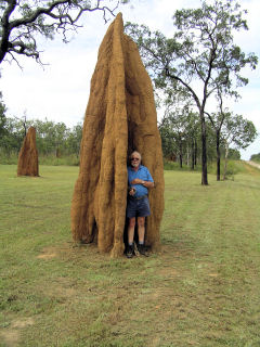
As we left the area it reverted to the lightly wooded grassland, large anthills started to appear with ever increasing frequency The road varied from reasonable to rough with frequent wash outs for which one had to be forever vigilant. One peculiar wash out showered the evidence of skid marks and a 450 mm drop with wheel marks running over the edge and continuing a meter along the bottom of the washout, the back wheels must have only just been on solid road and I guess the driver would have managed to back out OK but it must have been quite a shock to all concerned. When we got to lake Emma camping ground we found a notice and a box to put the $4.50 per person, but no forms and what’s more no camping area that was evident- we drove in around for 3 or 4 kilometres till we came to lake Emma. There were a small number of cattle around a the lake and nothing else we drove back from the lake There could be man eating cockatiels any up in this area. We found a spot with minimum grass and set up camp, it turned out quite good but in firs five minuets I caught a grass tick drying to burrow into my arm and it took quite a bit of effort to dislodge the little blighter We did a bit of work to repair the rope tags on the tent with a kit that we bought in Cooktown with a little success. Will try and finish the job another day. |
Away early, heading for Litchfield Nat Park. Road not open as yet, back track. Old Laura. Camped at Lake Emma, very peaceful but some cattle. Lots of insects, Northern Kooka, channel bill and butcher bird. Galahs and corellas. Early to bed. |
|
|
Fri 2 May 2008. After being chased to bed by the hordes of insects rather early we had a good nights sleep and were on the road around 9.00 am. Varying conditions and we travelled about 60 Kilometres
per hour, which gave me time to We came across a very healthy mob of wild pigs could have been 20 or more from old boar, sows and piglets. They did not stick around and went tearing of and disappeared into the long grass. We also Saw and photographed a small goanna who obligingly
posed for us. When we reached the old Laura historic
homestead. It looked as thought it had veranda where the Three posts were new- but
in caricature of the house- unfortunately the main building was shut of with
heavy mesh, which stopped entrance to the top section, never the less it was
very interesting- and we spent one hour looking around. After leaving we
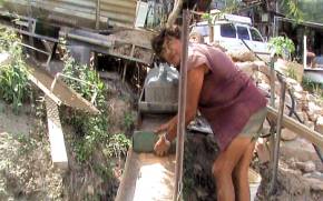
turned north intending to find our way We went and had a look at the crossing and were going to turn back and then walk down when a Ute came from the opposite site and we could see that although you could not see the concrete and the edge where the water was running over was about a meter drop. There was only about 450 mm of water and as long as you kept about 600 mm from the edge you could get across all right, driving across was a bit scary but we got to the other side alright only to find a closed gate with a sign stating road closed, which was all right as we did not want to go that way any way, so we had to drive back over the weir again. After leaving we turned north again only to reach the New Laura Ranger Station only to find the road was still closed so we had to back track some 70 kilometres back towards The historic homestead old Laura, and got onto the Peninsula Road before we could start North again. About 4.30 pm Ivor spotted a disused gravel pit and we camped there mostly out of site from the passing traffic. Insects started to annoy us after dark and the Mossies arrived, and ferocious they were too. But good clean camp and no grass to speak of. As it got dark the hordes of insects became attracted by the light and were making it impossible to use the computer. In desperation I tried the head lamp that Maria had given me, the normal blue Leds attract them and what was worse they would fly into my eyes and mouth, I then tried the red Leds the lamp is also equipped with and to my surprise the insects appeared not to be able to see the red light, though they were still attracted to the screen of the computer but by putting the portable fluorescent lamp some way away, which attracted most of them I was able to do a fair bit of typing before I went to bed about 10 am. |
Lots
of early birds and roo at morning. Got to Kalpower crossing on the Normandy
river, had a boil up and a shower and then on to Laura road. Cattle in park
and large number of pigs. Bypassed Laura and on to Han River. Speeding ute
threw stones and damaged windscreen.
Camped in gravel pit, bit rough but O K. |
|
|
Sat May 3rd 2008. Up with the sun, which up here is about 7.00 am We were on the road by 9.00 am. The road conditions were
about the same as yester day rough some recently graded and some hilly
country. The whole of the day was spent on the Peninsula Development Road
there were numerous of culverts, some had a trickle of water but most were
dry. When we reached Coen we stopped at the local store and a very pleasant and well-spoken aboriginal girl served us we bought sandwich and flavoured milk and had it on the veranda of the shop where there were tables and chairs for that purpose. Ivor asked the girl what we should see before we left Coen, she told us to look at the gold mine and bottle house before we left. On the way Ivor rang Deirdre. I tried Maria several times but got no answer. We followed a hand painted sign for 2 kilometres and came
to a gate that said enter at your own risk, on going through we came on a
hole heap of rather run down machinery. A fellow, Charlie was his name was
working on what turned to be a sluice; He was a sixty one year old Maltese
though he looked like an aboriginal at first glance with his very dark tan. He was quite a character and had not worked his mine for some years due to bad back and heart trouble he now only worked it as a hobby. He was on an invalid pension, the house was a homemade affair made out of local rock painted blue between the rocks. The inside blue and out side browns and reeds and other colours. The roof was of poles with ply covering, and the windows are made of bottles. He had constructed a very nice camping ground and told us some of the tall stories he tells the tourists, such as a filled in a mineshaft, which he has placed a cross on. When a tourists asks him what it is for he tells them that his wife fell in there collapsing the shaft on the way down, and it was two much trouble to dig her out so he placed the cross there. He mixes a bit of gold dust with some gravel for the tourists and if they are reluctant to participate he gives the dish to the youngest girl and says here you have a go for free, he has already made sure that the dish contains some gold grains and when the others see the gold he said they soon all want a go. He was telling us about the time that he went across the ferry (which we will have to pay about $80 for) because of his dark suntan when the aboriginal man asked him for the money he said. “What, I am a local, are you charging black men to cross now and they let me cross for free. He was married once but they split up along time ago and his wife went back to Malta with the kids, a very colourful character and rogue, but a loveable one. After leaving the mine we headed for Archer River Road House 70 Kilometres away. On nearing our destination a four wheel drive with a boat and trailer passed us at least 100 kilometres per hour showering us with stones, three hit the wind screen, resulting in a circular crack about one hundred millimetres in diameter and a large chip with radial cracks. I was very annoyed because normally if two approaching vehicles slow down while passing, this situation can be largely avoided. Archer has very good camping amenities and although there was no Mobile Telephone signal there were a couple of public phones there which I intend to use on my Home Card to ring Maria tonight. |
Road to Cohen was
very mixed, rough, bitumen, good gravel Badly
corrugated. Cohen a nice little town, did a bit of shopping and it was
suggested that we go to see `Charles’ Place’. A wild Maltese who has an old
gold mine as a tourist attraction. He salts a heap of ore and lets the first
person try panning for free and then charges for further dishes to pan. Has a
great house with lots of odds and ends, huge DVD collection. Went on to
Archer River campsite and had a good clean up and aired bedding etc. Went to
roadhouse for a beer and phoned Dee. All well at home. |
|
|
Sun 4 May 2008. At last managed to contact Maria last night via Phone. She had a bit of bad luck; she went all the way from “Morisset” to “Maitland” to photograph statures only to find both her camera batteries were flat. I did tell her when I gave her the camera that she can use dry cells, and I have mentioned since, but I better remember to tell her again. We got a slow start. Ivor had done the washing yesterday when we arrived and it took a couple of hours to dry, however we got away at about 10 am and after filling our water bottles we were rolling again. A hundred yards down the road we crossed the Archer River. We could have camped there if we had known, there were tents poked in every were the river is very wide but is mostly sand banks, it was a lovely place, and I guess the campers knew what the were doing, the water was only shallow, so crocs weren’t the trouble and as long as there were no unseasonable storms to wash them all away it looked fine. As we continued the road was on the whole good to rough,
there were lots of dips to accommodate small waterways, some had a trickle of
water but most were dry. We stopped for lunch at the Wenlock River and driving down the riverbank, we had a very pleasant break beneath the trees accompanied by two brush turkeys, looking for a hand out. The Morton Telegraph Station is also against to the river at this point, and has full camping facilities, we drove in and had a look and it would have been a nice place camp but being only 1.30 pm we pushed on planning to stop at a bush camp in the “Eliot Twin Falls” camp at the north end of the “Heathlands Resource Reserve”. As we proceeded the land changed to lightly wooded grass land, to heavily timbered (not a great lot of large trees) to rain forest and then dry rainforest to light scrub and sand patches in the road thought the “Heathlands Resource Reserve” then back to bush. We turned of the Telegraph road and travelled 9 kilometres along the old telegraph road. To start with it was badly washed out but improved, as we got closer to the bush camp. For 4.50 a night it was clean with septic toilets and tap water. Ivor went for a swim at the falls. I have not been there yet as I had to set up the gear for my 80 meter Sked. But I will go down tomorrow before we leave. Hoping to get to the Cape tomorrow. Signals were weak I could Just hear both Ralph and Dave but Dave could only hear a few words from me; Ralph got most of what I was saying though. I gathered that they went up to my place and got the repeaters going again, hope it works OK until I get home again, in around two months. I saw my first blue coloured King fisher to day it was a
bit smaller than a Regular Kookaburra but very similar except for the bright
patches of blue. |
Filed up and on way to Twin Falls. Once on Old
Telegraph Road things were rough, but only needed care. The Twin Falls
campsite was good with mostly family groups, mostly schoolteachers from Bamaga.
The wives were the teachers and the men dependents. One confessed that the
family `Ate a lot of fish.’ Hot and sultry, Paul’s sked was very poor. |
|
|
Mon 5 May 2008. I was awake this morning before Ivor and although he got to bed 8.00 am; he seemed to be loath to wake up. The trip is starting to tell on him I think. After we were all packed up we took our towels and because
Ivor had seen the twin falls yesterday he headed of on a different track
towards another small falls called the Saucepan. I continued to the twin
falls. Both places were part of the Eliot River. A fast flowing, pristine
river. When I got to the Twin falls the sheer beauty confounded me, the water just fell into a vee shaped fissure in the rock bed and because the two sides are apposed to each I figure that is why the fall got the name Twin Falls. There however was no place that was safe to have a wash, so I headed off for the Saucepan, which Ivor went to. It took about fifteen minuets of quick walking to get there I did not pass Ivor on the way and when I got there was no sign of Ivor or any clothes so I though that he must be waiting for me back at the car, so I stripped of and had a good bath in the shallow water that was running over a relatively flat large area of rock, before it reached the edge and fell a couple of meters into a deep clear pool before it travelled on a few hundred meters to the Twin falls. The water must have been 24 or 25 degrees and it was wonderful just to lay on the rock with about six inches of fast flowing water swirling around me. I had a good wash and felt much refreshed as the temperature of the day was already reaching thirty degrees C. Every day for the last week has reached the high thirties and the humidity has been very high as well. When I got back to the cruiser there was know sight of Ivor, and after about a quarter of an hour I started to get concerned especially as I had mentioned to Ivor that I did not want to leave the fridge running for more than half an hour because I had been using the batteries on the amateur radio and also the computer last night. I sounded the horn every few minutes. I sounded it again just as Ivor arrived. Ivor explained to me what had happened. He said that he had gone to the twin falls after he had a wash at the saucepan and I don’t know why I did not see him and then he was talking to some campers. Anyway alls well that ends well and we were soon on our way once again headed at long last to Cape York or the Tip, as it is locally known. Once we retraced our steps back along the Old Telegraph
road, and we actually saw one of the old galvanized pipe pole with single
insulator on top bent over but other wise intact. Which gave the whole thing
that little bit of authenticity. We were back on the Bamaga Road. At first the
road was good and all weather gravel but as we proceeded along it got
increasingly sandier, care had to be taken especially on corners. The country
changed as well some times it was sparsely treed with grass and then changed
to rain forest and then to more costal small shrubs and trees and then back
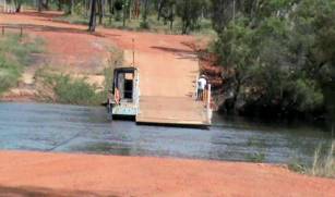
again, it certainly was anything but boring. When we got to the Jardine River Ferry there was a small shop on this side of the river with petrol and diesel pumps we called in and paid our eighty eight dollars for the ferry ride to the other side which if you had three barges you could make a floating bridge. I was told the aboriginal people had put a dozer into that old crossing which was an alternative, so as to force people to use the ferry. I don’t know whether this is true or not though. We also bought a couple of soft drinks and had a bit of a rest when we got to the other side. The road improved from then and became a well graded and fast highway and we arrived at Bamaga just after midday and had a drive around. The black people here are in the majority I. would have seen thirty black people to one white. We got fuel at $1.90 per litre and some bread and milk, also directions and headed for the Tip. From the tent shop we took the right fork, and it was not long before the road narrowed to one car width only, the country was manly Rain forest with one or two patches of open eucalypt.
When we were a couple of kilometres from our destination a four wheel vehicle with signs all over it passed and was gone before we could see what it was all about. We soon found out when we came upon a fairly stocky character wearing a small backpack and a variety of other apparel came into sight. It turned out that his name was Michael Mitchell, who had just started out on a walk to raise money for the Cancer Council. The walk had just started from Cape York and is planned to finish at “Wilson’s Promontory” Victoria on the 27 of June 2009. We wished him good luck and continued on our way. We arrived at about 3pm- we had reached the end of the
road that we had been following since we left the Blue Mountains a month ago!
It just stopped with a track leading down to the beach. There were two
four-wheel drives parked under the trees,
the occupants not in sight.- Is that it? We Boiled the Billy and had a
bit to eat. While we were relaxing two four wheel 1 ton trucks full of
indigenous people drove past and onto the beach. There were two men in the
front of each and in the back of each were about a dozen boys all of about 12
0r 13 years old. They drove onto the beach and about one kilometres west
along the beach. The tide was out exposing about 700 meters of sand, they
drove there trucks about half that distance and most of the stayed on the
sand and it would seem that a boy or two was waist deep in the water. We were
very curious to what was going on. Speculated that may be the men were
teaching the boys to fish or maybe to catch Cray Fish. After finishing our
cup of tea we set of following a path up the rock outcrop and then followed
some rock piles up and We thought we were there several times, when at the other side of a dip there was a particularly large pile of rocks, but on arriving there was another dip and a pill of rocks- but at last we looked down and there a few meters above the sea was a little notice, and after climbing down the last few meters! There we were, and we new it because the notice read “You are standing on the most northern tip of Australia”. We had made it but although it was exhilarating- there was also a touch of anticlimax about it. At least the good have been a band and welcoming committee.
When we got back we set up camp some 15 yards further back from the beach that the warning on crocodile sign was set reasoning that the crocodiles would know not to come any further than the sign. |
On
to the old telegraph road and then back to main road. Occasional steel
telegraph post and some huge towers. On to Jardine river and the ferry, $88-00.
Into Bamaga and several Aboriginal towns. Found it a bit depressing, though
some houses had as many as 10 cars outside. Petrol and then on to road to the
tip. Stopped at Crock Tent (Locksley) given a local map and then to the tip.
Met Cancer walker and then to beach near tip. Possible sighting of a Palm
Parrot. Sulphur Crested in numbers. Two utes full of Murris about 12
youngsters about 12, Drove far out onto the beach and seemed to be some sort
of fishing expedition. All looked tired and sandy when they returned four
hours later. Did the walk to the tip, put stones on the huge Cairns, right to
sign at tip and saw the oceans meet. Quite dramatic. Walked back around
shoreline, quite a bit of flotsam. Glad to have done trip but would suggest
thinking carefully about doing it. Showery night and could only see washy
clouds. Saw several large ships well out to sea. |
|
|
Tues 6th may 2008 It rained spasmodically during the night accompanied by
strong gusts of wind, and still was over cast when we poked our heads out at
6.45 am- however we got up and was just preparing breakfast when the vehicle
that we saw with the walker arrived with Michael at the wheel arrived.
Just before we left a small bus pulled in there was a women whose name was Jody driving and half a dozen female passages. The driver came from the loyalty beach caravan park and she was taking the ladies who were from Thursday Island on a day tour of the top end. After they left here they were going to “Somerset”. We headed of in that direction too after we finished our walk. The drive was through dense rain forest with some tricky washouts to negotiate we saw the tourist busses tracks but decided to turn off towards “Chandagoo Point”. As we neared the “Chandagoo Point” the road became very
sandy and the vegetation became costal scrub. We broke clear of this to high
a grassy plateau with the whole of the Pacific Ocean in front of us the wind
was so intense that it was hard to open the car door against it, and on
getting out we had a job to stand in the one place. When we got to the fork in the road we turned right to “Somerset Beach”, some of the tracks were challenging with deep washouts across and sometimes in the middle of the track. Once when I did not have the middle diff locked the wheel came off the ground spinning and going no were, but as soon as I engaged the centre diff lock it immediately gained traction and walked out effortlessly, I find the automatic transmission a lot better that manual so far as instead of slipping the clutch or letting the wheel spin you can apply just enough power to do the job. There is no sign of chipping or any other damage to the tyres We did not stop at “Somerset Beach” or the monument to the first homestead but deciding to look closer on the way continued on to “Fly point”. It was similar to “Chandagoo Point” but with a view of “Albany Island” across a sea channel it is a large Island covered in thick forest one could see the entire length, just.
The canons were from some shipwreck and mounted at the gate to the homestead. It is said that the family recovered 750 kilograms of silver Spanish dollars from a shipwreck and used part of it to make the tableware. Across the road was a monument, there was no inscription on it but I believe that one or more members of the Jardine Family are buried there. On the same side of the road there is the remains of what I believe is a fishing lodge the construction being corrugated iron and timber width an addition at the rear of steel framed building corrugated iron covered. Just up the road less that half a kilometre we stoped and set up camp at “Somerset Beach” it was not the best place to camp, there was quite a lot of rubbish around.
|
Showery night, sat
under trees writing cards, mini bus of tourists from Thursday Island. Cancer
walker returned as they had trouble with the video. Drove to Somerset and
beaches on east side. Very strong winds, Somerset badly time worn, some
tracks very cut up, mossies and itchies. Camped near local beach. Remains of
Luxury tourist resort, disbanded after fir, still has quite a good bush
walkway. Paul has lost his knife and we will go back and look to-morrow. |
|
|
Wed 7th May 2008.
I asked him about the old caravan that we had seen at “Somerset Beach”. He said he did not know much but up till a month ago an old fellow was living in it and he though that he might have got a job care taking an Island. We asked him whether there was any drinking water there; he told us that the first creek down the road was were they got their water from. He was an extremely helpful. Ivor bought some crocodile hatpins for his grand kids and I found a tea shirt that I thought Maria might like before we set out again to explore the west side of the tip. We drove up to “Punsand Bay” but weren’t too impressed with the camping resort there. We did not have look at the beach but continued past and went north another couple of kilometres along very sandy tracks until we came to rather a large corrugated iron building. As we approached a young woman came out and told us in a pleasant American accent that we were on private property. There was a rather large boat sitting out in the bay and I noticed an empty Champaign bottle sitting on a table on the rear veranda, however we apologised and withdrew. We then headed for a camping spot south of the “Punsand Bay Camping Area”, we turning off the track and heading towards to were we thought the free camping area should be, but after only a few hundred yards we came to tree fallen across the track and as neither of us had though to bring an axe on the trip we had to turn back. We decided to go to Bamaga and camp at the camping ground at “Loyalty Beach” the one that the woman conducting a tour, told us about when we met her the group of women she was with at “The Point”.
We got there around three in the afternoon, there was no one at the office, but there was a sign that said pick you home and I will come and see you later, which is exactly what we did. The park and amenities are clean and well presented, the fee as I understand it is ten dollars for an unpowered site. It was Sked night but after erecting all the gear and trying for quite a while there was no sign of boys back home. I guess that the distance is just too great. I gave Dave a ring on the mobile to let him know I could not hear anything. Dave said they had been calling but could not hear me ether. He also said that the ATV repeater was still working. So that was good news. Ivor found out from Deirdre that the “Centre link” has sent new application papers for them to fill out and Deirdre is in a bit of a tizz as what she is supposed to do with them, so tomorrow we will be staying here so that Ivor can go to Centre Link at Bamaga. |
Returned to tip camp but no knife drove through various roads to see
sights. Back to Crock Tent, got more info. Mareeba Library has Jardine book.
Drove on to see other beaches. Lizards fighting and numerous birds. Camp
Punsand but could not find place for camping. One place with American telling
us that this was private property. Back to Bamaga and Loyalty Beach. No
MasterCard, left at Archer River roadhouse. Paul’s sked night and phoning.
Dee having trouble with pension application. Will see Centrelink to-morrow. |
|
|
Thur 8 may 2008 We spent the whole of the day here, Ivor has been trying to resolve the problem with his claim with “Centre Link”, the whole of the staff in “Centre Link” here are local aboriginals and we found the fellow we were dealing with very helpful as he tried to solve the problem, but of course the “Centre Link” in “Springwood” would not co-operate at all. Ivor has filled out what he could and sent the forms down to Deirdre to see what she can do with them. I am starting to get a bit concerned with Ivor’s health he sleeps ten hours per day but is not coping with the humidly very well. The only time so far that he has tested his sugar level it was 8, which he said his doctor told him was not a worry. We did have a chat and I suggested to him that if he felt the trip was getting to much for him we could cut it short and head towards home quicker. I think that has relived his mind as I think he may have not wanted say anything because he new I wanted to do the whole three months. |
Day at Bamaga, Centrelink, sandals, posting and talking. Had an
enjoyable evening talking to Renate and Damien and playing soccer with their
three youngsters. Lovely family, Damien has lost a leg in an industrial
accident, walks with a crutch and rides a bicycle and is GOING TO THE TIP.
Have made arrangements to go to Thursday Island to-morrow. |
|
|
Fri 9 May 2008 Yesterday Ivor having resolved his issues with “Centre Link” at least as much as it is possible at this time we decided to go on a ferry trip to Thursday Island, and for this reason for the first time I was up first at 5.45 am and dug Ivor out at 6.00 am. We had to be at the Seisia Jetty by 7.30 am So after having a hurried breakfast and cleaning up after we duly got there about 7.15 am.
Just to be on the safe side we both took two seasickness pills a short time before boarding the ferry No trouble getting on
board just saw the skipper and paid by credit card. On the way over we were
lucky that it was smooth enough to sit on the open deck behind the bridge-
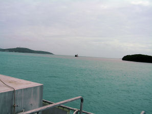
and We left Seisia at 8.0
am and had soon passed ”Possession Island” on our right and going “Thursday Island” is one of the smallest of the group of the Bass Strait Islands, but it is the centre of activity. There are two very
big custom frigates as well as two Police patrol boats stationed there. Most
of the productive jobs on the Island are held down by the indigenous people
and the whole of the place looks rather prosperous, with plenty of cars and
other vehicles running around. We spent the time till we had to board the ferry at 2.15 pm, looking around the wharf and main town area, we called into the “Cab Titui Cultural Centre”, and spent some time there. There was some great art and a room with life sized photos of local prominent people with comments on there life and deeds, there was a gift shop and there we met Evelyn Burnett, who explained the story in a large print from a local artist the copy they had cost $5000.00 and it was print no five the story centred around the discovery of the Dugong. This fellow discovered that the meat was good to eat. He cooked some and dried some in the sun. Some people from another clan wanted to get some of his meat so they got inside dog skins. The fellow with the Dugong meat would give them some. This went on for a long time until some members of his clan said, “These people are tricking you, there are people inside the dogs that you are feeding”- so he cut of one of the dog’s heads and sure enough there was a man inside the dog, so he killed them. When the members of the clan that the people in the dogs skins belonged to found out, they all went and attacked the man with Dugong meat. To escape he turned into a willy-wag-tail and landed on one of his enemies heads another member tried hitting the willy-wag-tail with he club but the little bird was to quick and he missed killing the man. The willy-wag-tail kept doing this until all of the men were dead. This is only a sketchy interpretation of the story of the print, and of what I can remember of what the girl Evelyn was telling Ivor and me. There are no traditional paintings for the “Torres Strait Island” People. All stories and culture was passed by month from one generation to the next but each Island had there own markings that would decorate the drums, spears, and other war weapons- also Ceremonial masks. These pattens are used in the artists of the “Torres Strait” as a background to their paintings. There are also conventional artists. I saw a painting of an Island man crawling into the sea with blood running from his head and I asked the man that seemed to be in charge was it representing a story. Now I can’t, remember the mythical mans name but the story goes like this. This man had a house set back a fair way from the beach. Some strangers came from another island and said “can we build our houses hear. The man said yes but down on the beach, so they did then at night this man sang the water in and it drowned the all people. He then cut of there heads. The people on the other island heard that he had murdered their brothers so they came over and beat him up. The painting I saw was of this man trying to escape and the only way was the sea. The end of the story was that they caught him and cut off his head and threw his body into the sea. From what I understand the warriors of old times used to cut the heads off the enemy and keep the sculls as trophies. Ivor asked Evelyn did the tribes practise cannibalism, and she said they did but it was not part of their normal behaviour but more a ritual thing. We found the centre very interesting it has only been open for a short time. We went to a shop after this and got something to eat, and then back to a park near the wharf there we waited for the ferry departure. When the ferry departed at 2.30 pm we went back on the same open deck but as soon as we were under way, it became quite obvious that the wind had picked up and we would get soaked to the skin if we stayed there. So we climbed down the stairs and went into passenger section where there were rows of seats, the only draw back was that you had to stand up to see anything although there were computer generated screens showing the position of the ferry. The return to “Seisia” was quite rough, but I found the whole experience worth the couple of hundred dollars that we spent on it. Ivor got half a dozed cans of beer to pay back the shout, that the man from the caravan park gave him last night- consequently he did not have any tea. I did not indulged although Ivor was kind enough to buy a couple of cans off scotch and dry especially for me. I wanted to have a meal and also to do some writing, and if I had had a drink I would not have felt like doing either |
Up early to go to Thursday Island. Paul shouted me. At the wharf
there were many people waiting for friends who were coming over from the
island and many more going over. Lots of goods unloaded and a large box that
the hospital carrier said he would have to come back for. It had this way up
signs and could have only been a body. There were locals catching fish, a big
cruiser taking on water, kids riding bicycles and the `Straits Magic’
checking us all aboard. Bit bouncy but good trip. At T I there were two large
coastguard boats at the wharf and people meeting visitors, suddenly they were
all gone, and we walked up to the town. I tried to get a post card for Dee
but they were all of wartime memorabilia. Went to a pearl shop, a young
Philippi no Lass very much tarted up tried to sell us pearls, then paintings and
in the end wooden objects. Nothing to my taste. Wandered to see if we could
get a cup of coffee but had no luck. Asked a mother’s group and they
suggested one place and it was dreadful. Went to the Island cultural centre,
a wonderful display and history tale. Curator told us some stories and the
arts officer told us more. There was a young peoples display on, I thought it
marvellous. Found they had a Café and asked what was for lunch but the girl
behind the counter said `No lunch, Cook piss off.’ On ship back there were
two teenage boys hunched over on the front seat, they looked as thought they
were masturbating but they were texting messages. Back home I played ball
with Jasmin, Lukas and Nadia whilst having a beer with Renata and Damien. I
find them lovely people and the youngsters a delight. |
|
|
Sat the 10 May 2008. Today was spent retracing our steps south, and over the Jardine Ferry. We pulled into the “Bramwell Road House” for Fuel, but when we discovered that they wanted $2.25 per Ltr. we only got thirty just to make sure that we had enough to get to Weipa. We both considered that it was a rip-off considering even at Bamaga and Seisina it was around $1.95. This is the first time on the entire trip that petrol has exceeded $2.
Having stoped the Land Cruiser the Bird dutifully posed while I shot some video. We camped about two kilometres north of “Morson Telegraph Station” alongside a gravel pit. The road in was overgrown with small plants and made a good place to pitch the tent, a very pleasant spot indeed. I was travelling a bit faster than normal around 90 Kph for the first part of the run and failed to adjust quickly enough when the road condition deteriorated and hit a couple of washout a little hard, it was raining quite hard at the time and the water lubricated the gutters to which the luggage racks were attached and that combined with the sudden breaking caused the luggage bars move forward and the whole load with them about 400 millimetres. After tightening down the luggage bars, we decided to leave fixing them until we camped for the night which we did, with out too much trouble. |
Heading to Weipa, good-bye to our new friends, a bit lost going out
but soon on our way. Raining as we crossed the punt. Soon saw Roos and quite
a bit of wild life. Bustard, Eagle and lots of parrots. On road we were
chased by a ute that was going at top speed and he passed us on a narrow
creek crossing, rather alarming. Petrol at Bramston Junction $2.50 ltr. ( A
real rip off) We found our roof racks loose and changed their positions.
Found a good roadside camp. |
|
|
|
|
|
 We were now going to make our way
to “Undara Volcanic National Park” to see the Lava Tunnels.
We were now going to make our way
to “Undara Volcanic National Park” to see the Lava Tunnels.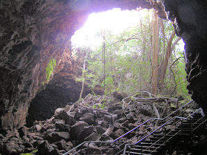 We saw two tunnels both were well
presented with steps and board walks both entrances where were the roof had
collapsed and in these the were two giant figs, one at least was a Moreton
Bay fig and had sent its roots at least 100 meters into the caves.
We saw two tunnels both were well
presented with steps and board walks both entrances where were the roof had
collapsed and in these the were two giant figs, one at least was a Moreton
Bay fig and had sent its roots at least 100 meters into the caves.
 Then through Herberton with
pastoral undulating country and on to Atherton where we fuelled up and got to
Kairi but had trouble finding the exact location off Ivor’s friend John.
First tried to ring him and no answer. We were told that the shop owner would
know and he said to Ivor that He did but would not tell us for Security
reasons. Ivor rang John again this time he answered and gave Ivor directions
with which we manage to get miles of track. Ivor rang again and got new
directions, this time we but the name of the street into Motermouth and she
exonerated herself by taking us straight there, we found John working on his
reticulation system. He stopped work and greeted us warmly and he and Ivor
wet the whistle with a couple of cold ones. I did not feel like beer so John
made me a cup of tea, which went down very well.
Then through Herberton with
pastoral undulating country and on to Atherton where we fuelled up and got to
Kairi but had trouble finding the exact location off Ivor’s friend John.
First tried to ring him and no answer. We were told that the shop owner would
know and he said to Ivor that He did but would not tell us for Security
reasons. Ivor rang John again this time he answered and gave Ivor directions
with which we manage to get miles of track. Ivor rang again and got new
directions, this time we but the name of the street into Motermouth and she
exonerated herself by taking us straight there, we found John working on his
reticulation system. He stopped work and greeted us warmly and he and Ivor
wet the whistle with a couple of cold ones. I did not feel like beer so John
made me a cup of tea, which went down very well.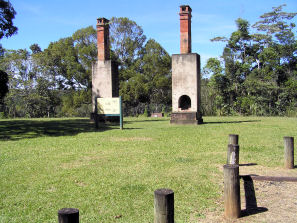 Two chimneys that were the
remains of a family home. They had a sawmill in the area. The sawmill was
moved to a new location were it is still operating to day.
Two chimneys that were the
remains of a family home. They had a sawmill in the area. The sawmill was
moved to a new location were it is still operating to day.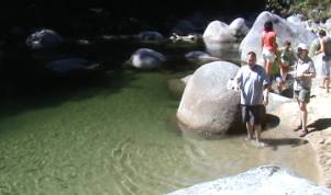
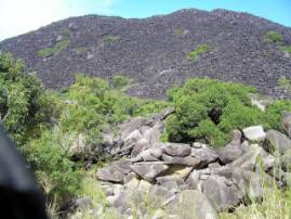 We saw a very strange formation
in the distance which was a very dark black colour and on getting there we
discovered that it was called Black Mountain and the reason was that the
whole lot was actually collapsing upon its self over many thousand of years.
The whole thing was covered with these black boulders many meters across and
no vegetation could get a hold, I have never seen anything like it before
We saw a very strange formation
in the distance which was a very dark black colour and on getting there we
discovered that it was called Black Mountain and the reason was that the
whole lot was actually collapsing upon its self over many thousand of years.
The whole thing was covered with these black boulders many meters across and
no vegetation could get a hold, I have never seen anything like it before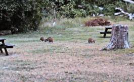 When we reached Cooktown we
called into the local Caravan Park only to find that there was no one there
in the house and office, however there was a sign that said to pick a spot
and fix up the details later which is what we did. We found some beautiful
rather large trees and although Ivor doesn’t seem to worry I am a bit
paranoid of camping under trees because I’m afraid that they will ether fall
on the tent or a branch will, so we camped out of range of them. When we set
up camp Ivor not feeling the best had a bit of a sleep after which he felt a
bit better.
When we reached Cooktown we
called into the local Caravan Park only to find that there was no one there
in the house and office, however there was a sign that said to pick a spot
and fix up the details later which is what we did. We found some beautiful
rather large trees and although Ivor doesn’t seem to worry I am a bit
paranoid of camping under trees because I’m afraid that they will ether fall
on the tent or a branch will, so we camped out of range of them. When we set
up camp Ivor not feeling the best had a bit of a sleep after which he felt a
bit better.
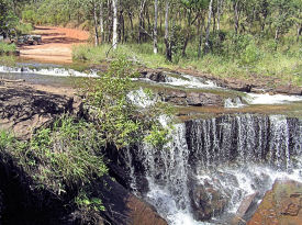 Soon after leaving Cooktown the
Rain forest gave way to lightly wooded grass land until we reached Isabella
Fall about 5 kilometres into the National park which is 40 Kilometres North
West of Cooktown. Despite my warning about Crocodiles Ivor striped off and
had a very pleasant ducking in the Cool Clear Waters and then emerged much
refreshed with all limbs attached. The foliage around the falls was much like
rain forest- The falls themselves were quite impressive and though small if
compared to some of there more famous cousins, the river was say, 20 meters
in width and the quantity of the water was indeed a very well worth sight
indeed.
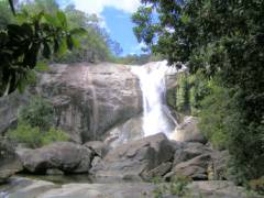
Soon after leaving Cooktown the
Rain forest gave way to lightly wooded grass land until we reached Isabella
Fall about 5 kilometres into the National park which is 40 Kilometres North
West of Cooktown. Despite my warning about Crocodiles Ivor striped off and
had a very pleasant ducking in the Cool Clear Waters and then emerged much
refreshed with all limbs attached. The foliage around the falls was much like
rain forest- The falls themselves were quite impressive and though small if
compared to some of there more famous cousins, the river was say, 20 meters
in width and the quantity of the water was indeed a very well worth sight
indeed.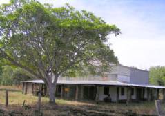 spot the washouts Etc
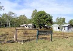
 The anthills increased in size
and the colour reflected the soil that supported them, some reaching 5 meters
or more in height.
The anthills increased in size
and the colour reflected the soil that supported them, some reaching 5 meters
or more in height.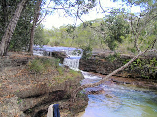
 The first sign of anything as we
drove along was a building on the right side of the track, all deserted and
already the rain forest was taking back what was rightfully it own. We
learned later that Reg
The first sign of anything as we
drove along was a building on the right side of the track, all deserted and
already the rain forest was taking back what was rightfully it own. We
learned later that Reg  along the top of a ridge. Wind
was blowing a treat and at times it was hard to keep upright, but the view
was stunning. Pacific ocean on the right and the Arafura Sea on the left
there were stone piles all the way some of them quite big and we worked out
every body adds a rock to commemorate there visit.
along the top of a ridge. Wind
was blowing a treat and at times it was hard to keep upright, but the view
was stunning. Pacific ocean on the right and the Arafura Sea on the left
there were stone piles all the way some of them quite big and we worked out
every body adds a rock to commemorate there visit. After savouring the moment for a
while we started back but took a lower track. And came out behind the
mangroves on the beach. No crocodilians spotted so far.
After savouring the moment for a
while we started back but took a lower track. And came out behind the
mangroves on the beach. No crocodilians spotted so far. We were surprised at this arrival
but Michael told us what happened. He had got as far as the tent shop as
planned. His uncle who is driving the support vehicle, took some video at the
sign on the point, explaining what the walk was all about, the trouble was he
was using a camera that he was unfamiliar with, and when he thought the
camera was recording it was off and when he thought the camera was off it was
on. Consequently there was a lot of video of feet and ground and nothing
else.
We were surprised at this arrival
but Michael told us what happened. He had got as far as the tent shop as
planned. His uncle who is driving the support vehicle, took some video at the
sign on the point, explaining what the walk was all about, the trouble was he
was using a camera that he was unfamiliar with, and when he thought the
camera was recording it was off and when he thought the camera was off it was
on. Consequently there was a lot of video of feet and ground and nothing
else.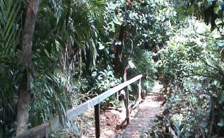 We did not get going until after
12 noon as Ivor was writing post cards and I was writing in here. Before we
left we went for a walk along a board walk and tracks that had been part of
the now defunct tourist resort- it would take very little to repair this
attraction but already we were the only ones that new it was there- the
signage is gone and the entrance is over grown, a pity as it is a great walk.
We did not get going until after
12 noon as Ivor was writing post cards and I was writing in here. Before we
left we went for a walk along a board walk and tracks that had been part of
the now defunct tourist resort- it would take very little to repair this
attraction but already we were the only ones that new it was there- the
signage is gone and the entrance is over grown, a pity as it is a great walk.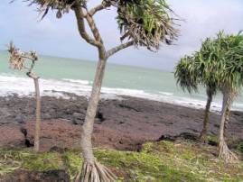 There were Pandanus Palms along
the seaward fringe and the rock looked like lava flow but very porous and red
brown in colour. On the right there stretched a curved beach in pristine
condition. There was a coastal track going north to Fly Point, but the bit of
it we could see was deeply rutted sand and with the LPG tank under the back
of the vehicle so we decided that discretion was the better part of valour
and decided to return by the track we came in by.
There were Pandanus Palms along
the seaward fringe and the rock looked like lava flow but very porous and red
brown in colour. On the right there stretched a curved beach in pristine
condition. There was a coastal track going north to Fly Point, but the bit of
it we could see was deeply rutted sand and with the LPG tank under the back
of the vehicle so we decided that discretion was the better part of valour
and decided to return by the track we came in by.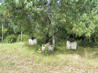 On the way back to “Somerset
Beach” we stoped at the old canons that were mounted in the front of the now
gone “Somerset Homestead” which the Jardine family built in 1864 on the first
cattle station in the area the homestead was also used as a refuge for
shipwrecked sailors. For more information go to net page
On the way back to “Somerset
Beach” we stoped at the old canons that were mounted in the front of the now
gone “Somerset Homestead” which the Jardine family built in 1864 on the first
cattle station in the area the homestead was also used as a refuge for
shipwrecked sailors. For more information go to net page 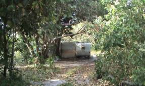 There was an old caravan with a
large annex built out of corrugated iron and looked like it had recently been
occupied but no sign of any body there while we were there.
There was an old caravan with a
large annex built out of corrugated iron and looked like it had recently been
occupied but no sign of any body there while we were there.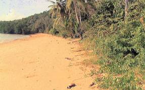 washing) in the bush shower but
had a good wash down, Ivor used the other half in a bucket and also had a
good wash as well, it made a difference to how we felt. It had been a very
hot and sticky day.
washing) in the bush shower but
had a good wash down, Ivor used the other half in a bucket and also had a
good wash as well, it made a difference to how we felt. It had been a very
hot and sticky day.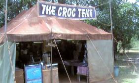 To day after getting going we
decided to look at the west coast of Australia which was only about 59
kilometres at this point of our travels, so we went back to the “Crock Tent”
and a had a chat with the young bloke that runs it with his wife and dog named
Popeye.
To day after getting going we
decided to look at the west coast of Australia which was only about 59
kilometres at this point of our travels, so we went back to the “Crock Tent”
and a had a chat with the young bloke that runs it with his wife and dog named
Popeye.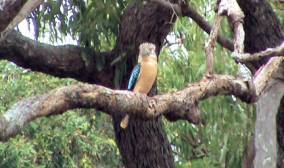 On the way back I spotted a
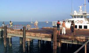 The large cruiser that I had seen
up the coast was moored at the dock, I asked the skipper had he been moored
near “Punsand Bay” on Wednesday, Which he confirmed, but he did not have any
connection with the fishing lodge, they had just picked her up from Sydney.
The large cruiser that I had seen
up the coast was moored at the dock, I asked the skipper had he been moored
near “Punsand Bay” on Wednesday, Which he confirmed, but he did not have any
connection with the fishing lodge, they had just picked her up from Sydney.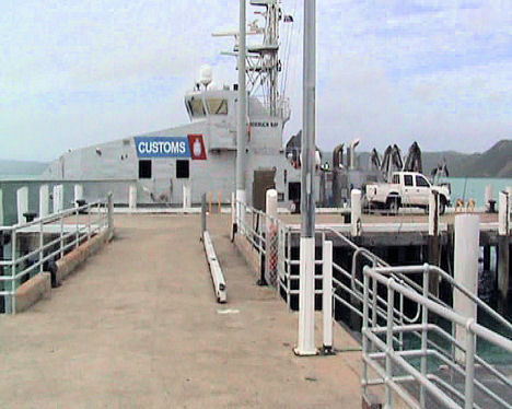 although it was a dull day and
slightly misty we got some good photos, and video of the islands we passed on
the way to “Thursday Island”. The young fellow who was the skippers mate and
crew combined was very helpful and as soon as we were under way he brought
out a nautical chart and spent at least fifteen minuets explaining the island
names and the channel we were following and why, The waters here are very
prone to submerged rocks and reefs in fact there is only one main shipping
channel through the “Torres Strait”, ships passing through have to take on a
pilot. He said there were eight pilots employed full time.
although it was a dull day and
slightly misty we got some good photos, and video of the islands we passed on
the way to “Thursday Island”. The young fellow who was the skippers mate and
crew combined was very helpful and as soon as we were under way he brought
out a nautical chart and spent at least fifteen minuets explaining the island
names and the channel we were following and why, The waters here are very
prone to submerged rocks and reefs in fact there is only one main shipping
channel through the “Torres Strait”, ships passing through have to take on a
pilot. He said there were eight pilots employed full time.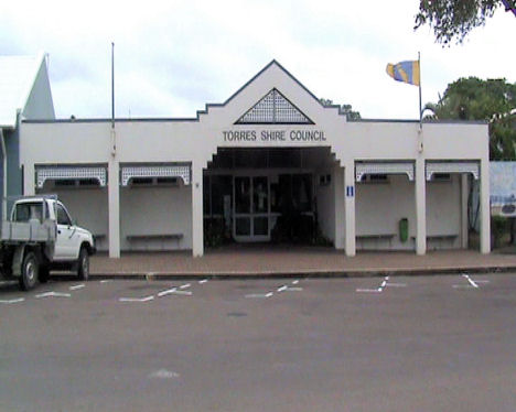 between
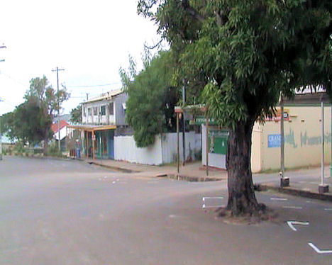
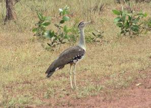 We were cruising along – when we
saw a large bird up-a-head, so we slowed down and Managed to get quite close.
Ivor informed me that it was a Bustard.
We were cruising along – when we
saw a large bird up-a-head, so we slowed down and Managed to get quite close.
Ivor informed me that it was a Bustard.